Kettleness Sand

Beach in Yorkshire Scarborough

England

Kettleness Sand

Runswick Bay Sailing Club Next to Calais Beck.
Runswick Bay Sailing Club Credit: Ian Rob

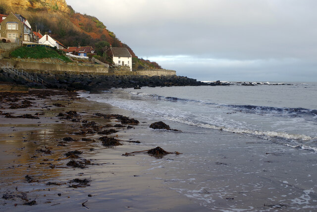
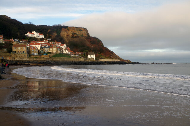
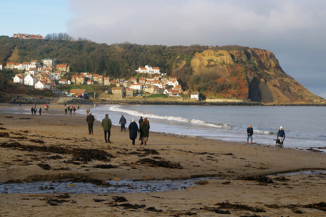
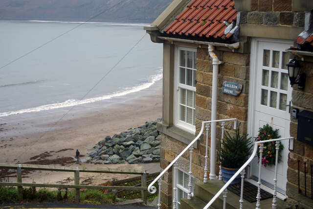
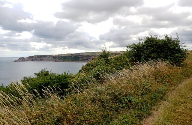
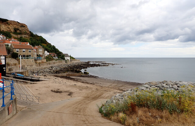
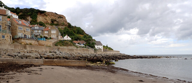
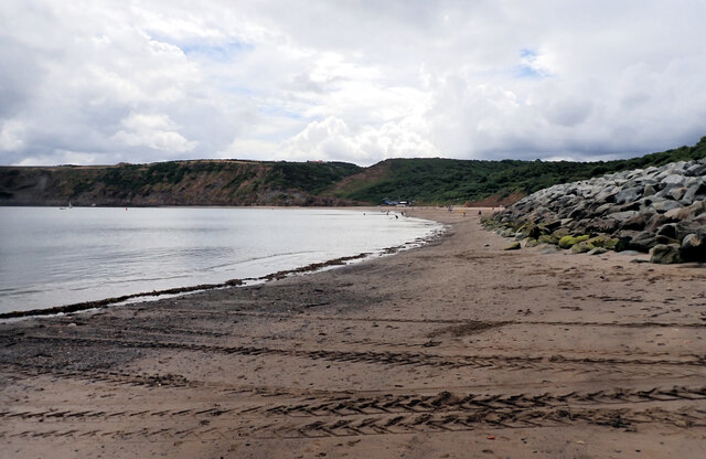
Kettleness Sand is a picturesque beach located on the eastern coast of Yorkshire, England. Situated near the village of Kettleness, this sandy beach offers visitors stunning views of the North Sea and the rugged cliffs that surround it.

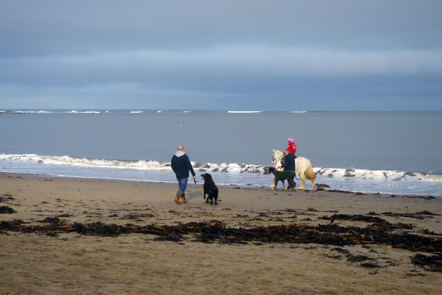
The beach is known for its soft golden sand, which stretches for approximately 2 miles. It is a popular destination for locals and tourists alike, especially during the summer months when the weather is warm and inviting. The sand is well-maintained and cleaned regularly, providing a comfortable and clean environment for beachgoers.

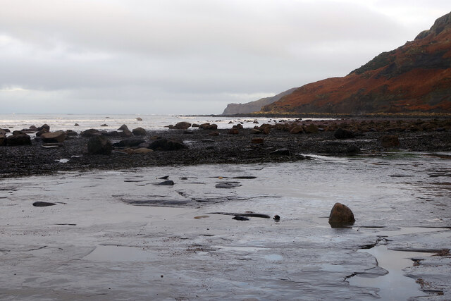
Kettleness Sand is also known for its unique geological formations. The cliffs that flank the beach are composed of layers of shale and sandstone, which have been eroded over time by the sea, creating fascinating rock formations and caves that can be explored at low tide. These geological features make the beach a favorite spot for geologists and fossil enthusiasts, as it is rich in fossils from the Jurassic period.

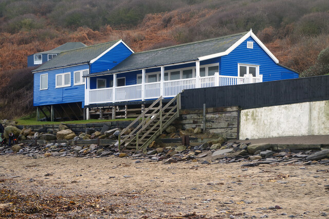
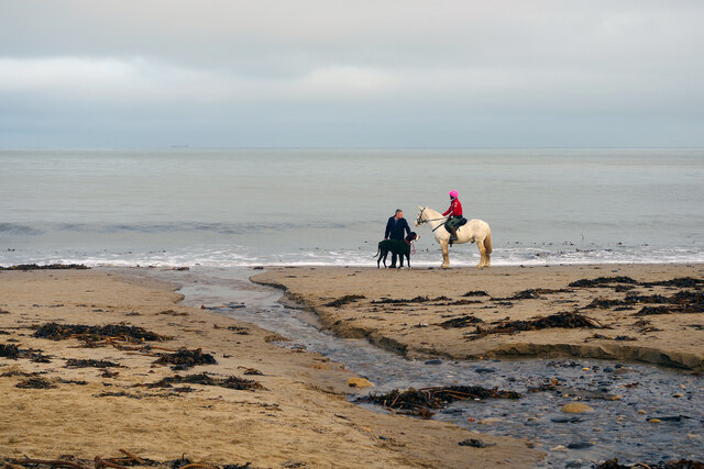
The beach is easily accessible, with a car park located nearby, providing convenient parking for visitors. Facilities such as toilets and a café are also available, ensuring that visitors have everything they need for a pleasant day at the beach. Additionally, the beach is dog-friendly, allowing pet owners to enjoy a stroll along the shoreline with their four-legged companions.

Overall, Kettleness Sand is a beautiful and diverse beach that offers visitors the opportunity to relax on its sandy shores, explore its unique geological formations, and soak up the stunning coastal scenery that Yorkshire has to offer.

If you have any feedback on the listing, please let us know in the comments section below.

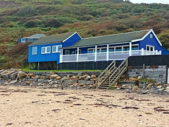
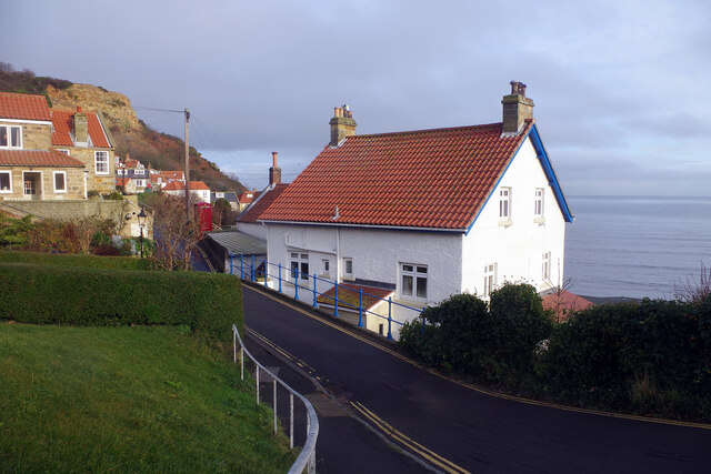
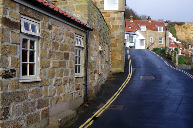
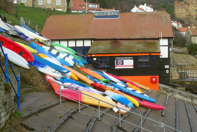
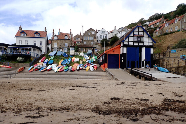
Kettleness Sand Images

Images are sourced within 2km of 54.530828/-0.72025414 or Grid Reference NZ8215. Thanks to Geograph Open Source API. All images are credited.

Runswick Bay Sailing Club Next to Calais Beck.
Runswick Bay Sailing Club
Next to Calais Beck.
Runswick Bay A former fishing village, now very much a holiday destination (many of the properties here are holiday lets), the village at Runswick Bay huddles around the north end of the beach. It was in fact relocated to this site in 1682 after the original village was destroyed in a landslip. This is one of the best-loved locations on the Yorkshire coast.
Runswick Bay
A former fishing village, now very much a holiday destination (many of the properties here are holiday lets), the village at Runswick Bay huddles around the north end of the beach. It was in fact relocated to this site in 1682 after the original village was destroyed in a landslip. This is one of the best-loved locations on the Yorkshire coast.
Runswick Bay This narrow lane passes through the lower village above the beach. The Royal Hotel, actually the village pub, is just ahead on the left (but out of shot).
Runswick Bay
This narrow lane passes through the lower village above the beach. The Royal Hotel, actually the village pub, is just ahead on the left (but out of shot).
Runswick Bay: Kayaks and Rescue Boat Station A number of colourful kayaks are stored here just above the beach and behind them is the Runswick Bay Rescue Boat Station. This inshore facility operates independently of the RNLI and was established in 1982 after the lifeboat was moved to Staithes.
Runswick Bay: Kayaks and Rescue Boat Station
A number of colourful kayaks are stored here just above the beach and behind them is the Runswick Bay Rescue Boat Station. This inshore facility operates independently of the RNLI and was established in 1982 after the lifeboat was moved to Staithes.
Runswick Bay Showing the north end of the beach where the village tumbles down to the sea.
Runswick Bay
Showing the north end of the beach where the village tumbles down to the sea.
Runswick Bay Beach The tide is out making it easy to walk the full length of the beach. Runswick Bay village can be seen in the background.
Runswick Bay Beach
The tide is out making it easy to walk the full length of the beach. Runswick Bay village can be seen in the background.
Runswick Bay Beach and Sailing Club Runswick Bay Sailing Club was formed in 1953, becoming the Beach and Sailing Club in 1998. This is the clubhouse, at the back of the beach about half a mile from the village.
Runswick Bay Beach and Sailing Club
Runswick Bay Sailing Club was formed in 1953, becoming the Beach and Sailing Club in 1998. This is the clubhouse, at the back of the beach about half a mile from the village.
Runswick Bay Beach The water in the foreground comes from the Calais Beck which empties into Runswick Bay here. To the right of that a small horse and a very large dog enjoy themselves on the sand.
Runswick Bay Beach
The water in the foreground comes from the Calais Beck which empties into Runswick Bay here. To the right of that a small horse and a very large dog enjoy themselves on the sand.
Runswick Bay Beach Horses, dogs and people are out and about just after Christmas on this fine beach.
Runswick Bay Beach
Horses, dogs and people are out and about just after Christmas on this fine beach.
Runswick Bay Beach Runswick Bay was named by the Sunday Times as its beach of the year for 2020, describing it as close to perfection. Plenty of people are blowing the Christmas cobwebs off in this view taken the day after Boxing Day. In the background is Runswick Bay village.
Runswick Bay Beach
Runswick Bay was named by the Sunday Times as its beach of the year for 2020, describing it as close to perfection. Plenty of people are blowing the Christmas cobwebs off in this view taken the day after Boxing Day. In the background is Runswick Bay village.
Runswick Bay Beach The sand runs out towards the south-eastern end of the beach, giving way to flat rocks as the coastline heads round towards Kettle Ness.
Runswick Bay Beach
The sand runs out towards the south-eastern end of the beach, giving way to flat rocks as the coastline heads round towards Kettle Ness.
Runswick Bay Light is rapidly fading on a December afternoon but the glow of the street lamp opposite the Royal Hotel seems comforting. The building below the road is the Rescue Boat Station.
Runswick Bay
Light is rapidly fading on a December afternoon but the glow of the street lamp opposite the Royal Hotel seems comforting. The building below the road is the Rescue Boat Station.
Galleon House, Runswick Bay Galleon House is used as a holiday cottage occupying an enviable position adjacent to the Royal Hotel pub and with a panoramic sea view.
Galleon House, Runswick Bay
Galleon House is used as a holiday cottage occupying an enviable position adjacent to the Royal Hotel pub and with a panoramic sea view.
Runswick Bay seen from The Cleveland Way The Cleveland Way runs 110 miles (177 km) between Helmsley and the Brigg at Filey, skirting the North York Moors National Park. Its highest point is at Urra Moor, 1,489 ft (454 m).
Runswick Bay seen from The Cleveland Way
The Cleveland Way runs 110 miles (177 km) between Helmsley and the Brigg at Filey, skirting the North York Moors National Park. Its highest point is at Urra Moor, 1,489 ft (454 m).
Slipway, Runswick Bay
Runswick Bay
Runswick Bay
Runswick Bay
Runswick Bay
Cafe, kayaks and lifeboat station, Runswick Bay
Show me another place!

Kettleness Sand is located at Grid Ref: NZ8215 (Lat: 54.530828, Lng: -0.72025414)

Division: North Riding

Administrative County: North Yorkshire

District: Scarborough

Police Authority: North Yorkshire

What 3 Words

///heartache.pining.curry. Near Whitby, North Yorkshire

Related Wikis

Kettleness

Kettleness, is a hamlet in the Scarborough District of North Yorkshire, England. The settlement only consists of half-a-dozen houses, but up until the...

Kettleness railway station

Kettleness was a railway station on the Whitby, Redcar and Middlesbrough Union Railway from 1883 to 1958 serving the remote village of Kettleness. The...
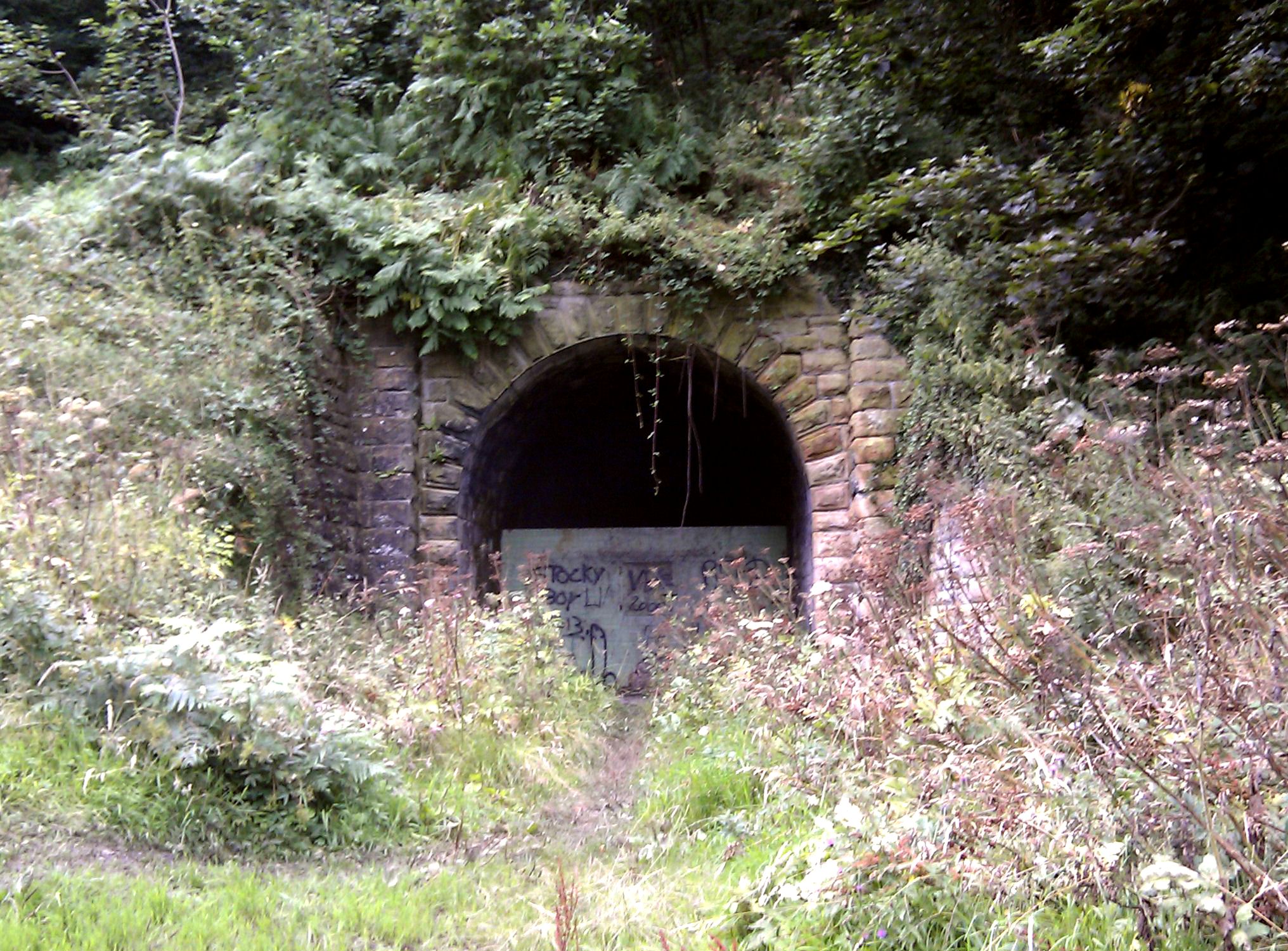
Sandsend Tunnel

Sandsend Tunnel is a tunnel on the former Whitby, Redcar and Middlesbrough Union Railway that was opened in 1883 and closed in 1958. The rail line that...

Goldsborough, Scarborough

Goldsborough is a small hamlet in the civil parish of Lythe, North Yorkshire, England within the North York Moors National Park. It is situated a few miles...

Hob Holes

The Hob Holes are caves in the cliffs of Runswick Bay, Scarborough, England which resulted from mining for jet – fossilised wood which is valuable as a...

Runswick Bay Lifeboat Station

Runswick Bay Lifeboat Station was a Royal National Lifeboat Institution (RNLI) lifeboat station located in Runswick Bay in North Yorkshire, England. The...

RAF Goldsborough

Royal Air Force Goldsborough or more simply RAF Goldsborough is a former Royal Air Force station located in North Yorkshire, England. == History == It...

Runswick Bay

Runswick Bay is a bay in the Scarborough Borough of North Yorkshire, England. It is also the name of a village located on the western edge of the bay...

Nearby Amenities

Located within 500m of 54.530828,-0.72025414
Source: PGS
Lat/Long: 54.5337737/-0.7147798
Source: PGS
Lat/Long: 54.5344211/-0.7157239
Source: PGS
Lat/Long: 54.5343063/-0.7164299
Source: PGS
Lat/Long: 54.5330974/-0.7163049
Source: PGS
Lat/Long: 54.5325785/-0.7163248
Source: PGS
Lat/Long: 54.5322266/-0.7162765
Source: PGS
Lat/Long: 54.5319604/-0.7173166
Source: PGS
Lat/Long: 54.5309543/-0.7185472
Source: PGS
Lat/Long: 54.5302792/-0.7198534
Source: PGS
Lat/Long: 54.5302004/-0.7219102
Source: PGS
Lat/Long: 54.5304114/-0.7228007
Source: PGS
Lat/Long: 54.5305182/-0.7242501
Source: PGS
Lat/Long: 54.5305634/-0.7251015
Source: PGS
Lat/Long: 54.5306362/-0.7259378
Source: PGS
Lat/Long: 54.5305366/-0.7271394
Kettleness
Place: hamlet
Wikidata: Q23799287
Wikipedia: en:Kettleness
Lat/Long: 54.5291571/-0.7175133
Post Box
Collection Times: Mo-Fr 16:00; Sa 11:15
Post Box Type: lamp
Ref: YO21 23
Royal Cypher: EIIR
Royal Cypher Wikidata: Q33102113
Source: survey
Lat/Long: 54.5289506/-0.7167048
Barrier: stile
Source: GPS
Lat/Long: 54.5291637/-0.7234028
Bench
Lat/Long: 54.5292134/-0.7182867
Bench
Backrest: yes
Lat/Long: 54.5294591/-0.7176572
Bench
Backrest: yes
Lat/Long: 54.52947/-0.717684
Hiking: yes
Information: guidepost
Source: GPS
Tourism: information
Lat/Long: 54.5292/-0.717971
Hiking: yes
Information: guidepost
Source: GPS
Tourism: information
Lat/Long: 54.5279774/-0.7203555
Kettleness
Historic Railway: station
Railway: site
Wikidata: Q6395551
Wikipedia: en:Kettleness railway station
Lat/Long: 54.5282103/-0.716926
The data included in this document is from www.openstreetmap.org. The data is made available under ODbL.

Have you been to Kettleness Sand?

Leave your review of Kettleness Sand below (or comments, questions and feedback).