Ayre of Atler

Beach in Shetland

Scotland

Ayre of Atler

Wind turbine Wind turbine installation
Wind turbine Credit: Mat Tuck

Ayre of Atler, located in Shetland, Scotland, is a beautiful beach renowned for its untouched natural beauty and stunning coastal landscape. Stretching over a mile long, Ayre of Atler offers a pristine sandy shoreline, flanked by sand dunes and grassy banks, creating a picturesque setting for visitors to enjoy.

The beach is situated along the east coast of the Shetland mainland, surrounded by rugged cliffs and rolling hills, providing a sense of seclusion and tranquility. It offers breathtaking views of the North Sea, with clear waters shimmering under the sunlight. The beach is also a popular spot for birdwatching enthusiasts, as it attracts a variety of seabirds and waders.

Ayre of Atler is a haven for nature lovers, with its diverse ecosystem supporting a rich array of flora and fauna. Visitors can explore the sand dunes, which are home to unique plant species such as sea rocket and sea bindweed. The beach also provides a habitat for seals and otters, often spotted basking on the rocks or playing in the shallows.

The beach is easily accessible by foot, with a car park located nearby, making it an ideal destination for a peaceful stroll or a family picnic. Ayre of Atler offers a serene and unspoiled environment, allowing visitors to connect with nature and enjoy the tranquility of one of Shetland's hidden gems.

If you have any feedback on the listing, please let us know in the comments section below.

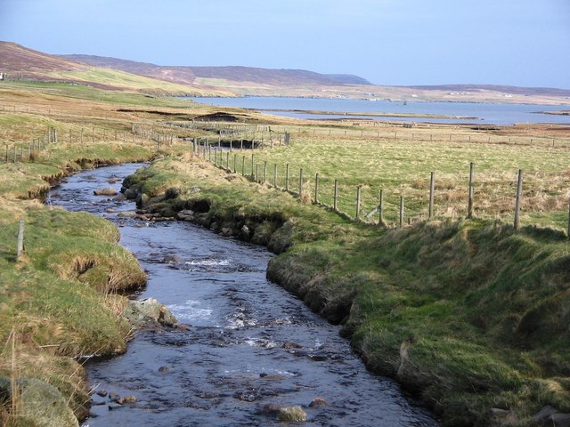
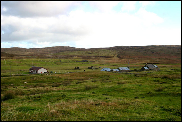
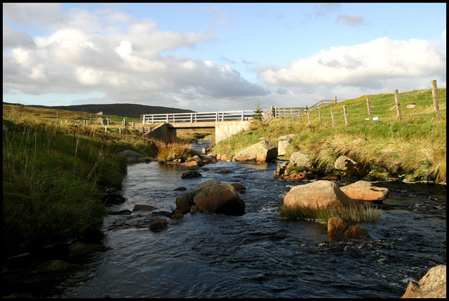
Ayre of Atler Images

Images are sourced within 2km of 60.330733/-1.1744816 or Grid Reference HU4561. Thanks to Geograph Open Source API. All images are credited.

Wind turbine Wind turbine installation
Wind turbine
Wind turbine installation
Ayre of Atler View across to the pier
Ayre of Atler
View across to the pier
The head of Dury Voe, North Nesting, at high tide
High tide at the head of Dury Voe, North Nesting
Trowie Crossing sign, North Nesting Trowies are the peerie folk (little people) of Shetland folklore.
Trowie Crossing sign, North Nesting
Trowies are the peerie folk (little people) of Shetland folklore.
Peatslide on the slopes of Riven Hill Taken from the Whalsay ferry.
Peatslide on the slopes of Riven Hill
Taken from the Whalsay ferry.
Fish farm in Loura Voe, Dury Voe Taken from the Whalsay ferry (photographer grid reference taken from GPS).
Fish farm in Loura Voe, Dury Voe
Taken from the Whalsay ferry (photographer grid reference taken from GPS).
Burn of Grunnafirth, Shetland Looking north and downstream along the Burn of Grunnafirth out to Ayre of Dury beyond.
Burn of Grunnafirth, Shetland
Looking north and downstream along the Burn of Grunnafirth out to Ayre of Dury beyond.
Houses at Lower House Croft House at Lower House, old buildings to right and new dwelling left
Houses at Lower House
Croft House at Lower House, old buildings to right and new dwelling left
Derelict House Old croft now disused
Derelict House
Old croft now disused
Fern Croft "Access road" to the croft at Fern
Fern Croft
"Access road" to the croft at Fern
Burn and Bridge Burn of Grunnafirth with bridge over road
Burn and Bridge
Burn of Grunnafirth with bridge over road
Fern, Dury Ruined crofthouse beside the Burn of Grunnafirth at Dury.
Fern, Dury
Ruined crofthouse beside the Burn of Grunnafirth at Dury.
Burn of Grunnafirth, Dury Looking downstream towards Dury Voe.
Burn of Grunnafirth, Dury
Looking downstream towards Dury Voe.
Ruin at Dury
Ruin at Dury
Dury Voe, Shetland Feed Barge and Salmon Cage, Dury Voe, Shetland
Dury Voe, Shetland
Feed Barge and Salmon Cage, Dury Voe, Shetland
South Tararet, Shetland On the south side of Laxo Voe, South Tararet Croft
South Tararet, Shetland
On the south side of Laxo Voe, South Tararet Croft
Looking across to the Ayre of Dury A typical voehead beach and marsh system in Shetland.
Looking across to the Ayre of Dury
A typical voehead beach and marsh system in Shetland.
Show me another place!

Ayre of Atler is located at Grid Ref: HU4561 (Lat: 60.330733, Lng: -1.1744816)

Unitary Authority: Shetland Islands

Police Authority: Highlands and Islands

What 3 Words

///slap.fluid.cubed. Near Vidlin, Shetland Islands

Nearby Locations

Ayre of Atler

Related Wikis

Billister

Billister is a settlement in the parish of Nesting, on the island of Mainland, in Shetland, Scotland. It is on Lax Firth. Billister was formerly the terminal...

Laxo

Laxo is a small settlement at the end of Laxo Voe in Vidlin, Shetland, Scotland. A ferry from the Mainland to Symbister in Whalsay operates from the nearby...

Geopark Shetland

Geopark Shetland is the name used by the Geopark formally established in September 2009 on its entry into the European Geoparks Network. The Geopark extends...

Viking Wind Farm

Viking Wind Farm is a large on-shore wind farm under construction in the Shetland Islands which is being developed by Viking Energy, a partnership between...

Nearby Amenities

Located within 500m of 60.330733,-1.1744816
Barrier: cattle_grid
Lat/Long: 60.3269063/-1.1744426
Barrier: cattle_grid
Lat/Long: 60.3281623/-1.1764008
Power: pole
Lat/Long: 60.3268341/-1.1735425
Power: pole
Lat/Long: 60.32737/-1.1739291
Power: pole
Lat/Long: 60.3281142/-1.1744863
Power: pole
Lat/Long: 60.3287255/-1.174932
Power: pole
Lat/Long: 60.3293593/-1.1753914
Power: pole
Lat/Long: 60.3300044/-1.1758622
Power: pole
Lat/Long: 60.3306281/-1.176308
Power: pole
Lat/Long: 60.3312348/-1.1767605
Power: pole
Lat/Long: 60.3316885/-1.1771062
Power: pole
Lat/Long: 60.3321466/-1.1774223
Power: pole
Lat/Long: 60.3326284/-1.1770948
Power: pole
Lat/Long: 60.3332982/-1.1766127
Power: pole
Lat/Long: 60.3339274/-1.1761897
Power: pole
Lat/Long: 60.3345904/-1.1757189
The data included in this document is from www.openstreetmap.org. The data is made available under ODbL.

Have you been to Ayre of Atler?

Leave your review of Ayre of Atler below (or comments, questions and feedback).