Ayre of Northburn

Beach in Shetland

Scotland

Ayre of Northburn

Houses at Ulsta Seen from Easter Knowes on the road to Burravoe.
Houses at Ulsta Credit: Oliver Dixon

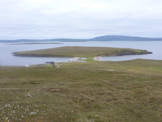
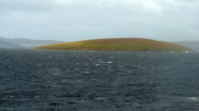
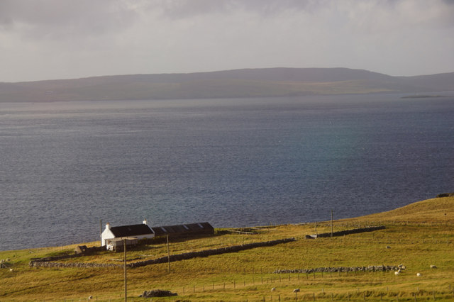
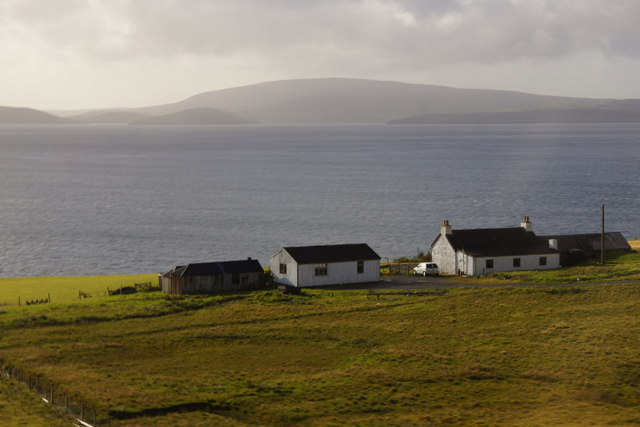
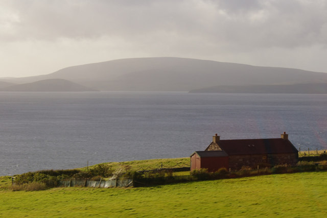
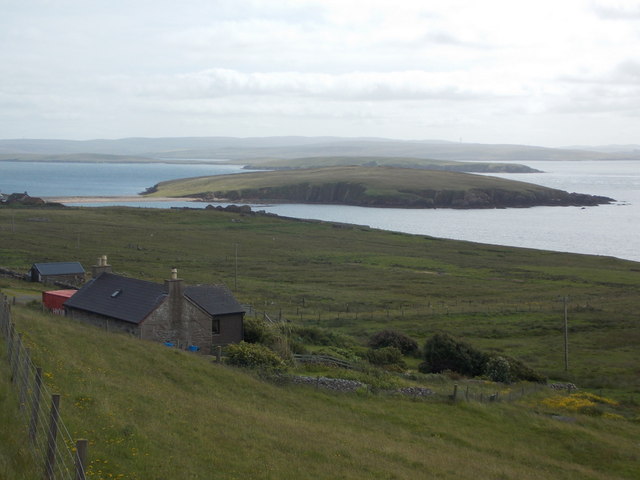
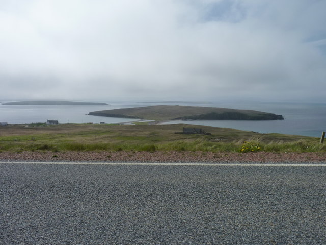
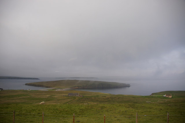
Ayre of Northburn, located in the picturesque Shetland Islands of Scotland, is a stunning beach renowned for its natural beauty and tranquility. Situated on the west coast of the mainland, Ayre of Northburn offers visitors a unique coastal experience.

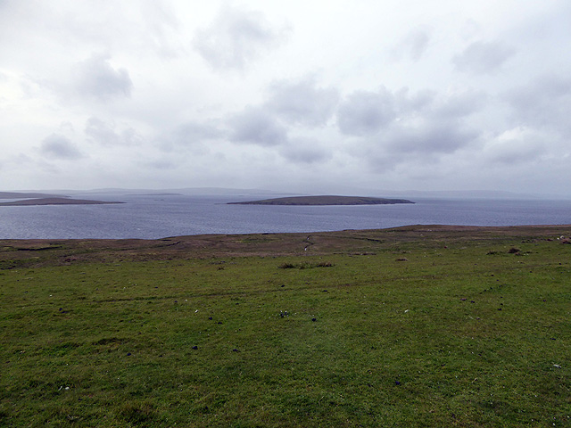
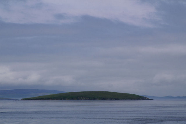
The beach stretches over a mile, with pristine white sands that contrast beautifully with the crystal-clear turquoise waters of the North Sea. The shoreline is adorned with an abundance of fascinating rock formations, including stunning sandstone cliffs and intriguing caves, making Ayre of Northburn a haven for geology enthusiasts.

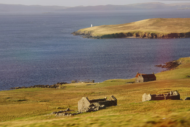
Nature lovers will also delight in the diverse flora and fauna that inhabit the area. The beach is home to various bird species, such as puffins, guillemots, and fulmars, providing ample opportunities for birdwatching. Seals can often be spotted basking on the rocks, adding to the enchanting atmosphere.

Ayre of Northburn is not just a beautiful beach but also holds historical significance. It is believed to have been an important Viking trading site, and remnants of their presence can still be found in the form of ancient ruins and artifacts. This adds an intriguing layer of cultural heritage to the beach.

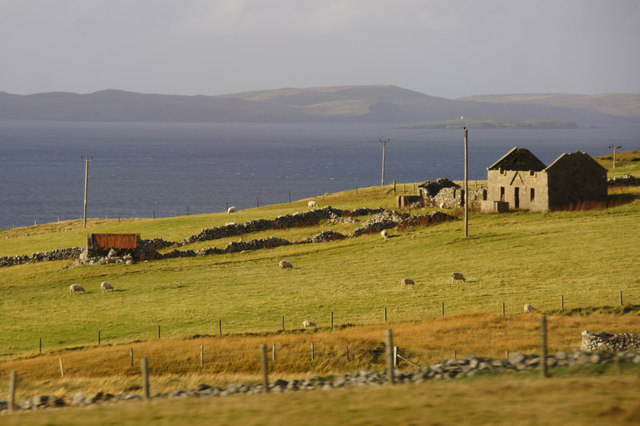
Visitors to Ayre of Northburn can enjoy leisurely walks along the shore, taking in the breathtaking scenery and the soothing sound of the waves crashing against the rocks. The beach also offers excellent opportunities for picnicking, beachcombing, and even water activities like kayaking and paddleboarding.

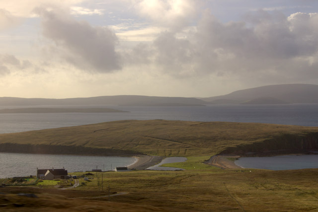
In conclusion, Ayre of Northburn is a true gem of the Shetland Islands. Its natural beauty, diverse wildlife, and historical significance make it a must-visit destination for both nature enthusiasts and those seeking a peaceful retreat by the sea.

If you have any feedback on the listing, please let us know in the comments section below.

Ayre of Northburn Images

Images are sourced within 2km of 60.520442/-1.1735946 or Grid Reference HU4582. Thanks to Geograph Open Source API. All images are credited.

Houses at Ulsta Seen from Easter Knowes on the road to Burravoe.
Houses at Ulsta
Seen from Easter Knowes on the road to Burravoe.
West Yell: Ness of Sound A small (almost) island attached to Yell by an isthmus. In the background is Ronas Hill, on the mainland of Shetland.
West Yell: Ness of Sound
A small (almost) island attached to Yell by an isthmus. In the background is Ronas Hill, on the mainland of Shetland.
West Yell: postbox № ZE2 39 A small postbox, a modern replacement for the old box still in its pillar a little beyond (see <a href="https://www.geograph.org.uk/photo/2632485">HU4582 : West Yell: disused postbox</a> for a close-up). Its collection time, daily except Sunday, is 10:15am.
West Yell: postbox № ZE2 39
A small postbox, a modern replacement for the old box still in its pillar a little beyond (see HU4582 : West Yell: disused postbox for a close-up). Its collection time, daily except Sunday, is 10:15am.
West Yell: disused postbox A George V-reign postbox, long disused and situated a couple of yards from its modern replacement (see <a href="https://www.geograph.org.uk/photo/2632479">HU4582 : West Yell: postbox № ZE2 39</a>). An Ordnance Survey benchmark is etched into the stone pillar.
West Yell: disused postbox
A George V-reign postbox, long disused and situated a couple of yards from its modern replacement (see HU4582 : West Yell: postbox № ZE2 39). An Ordnance Survey benchmark is etched into the stone pillar.
Ulsta: the post office A tiny post office serving the little village of Ulsta, open weekdays from 9am till 1pm. I was glad to make use of it as a cashpoint. The almost makeshift postbox in the wall is seen here: <a href="https://www.geograph.org.uk/photo/2647798">HU4680 : Ulsta: postbox at the post office</a>.
Ulsta: the post office
A tiny post office serving the little village of Ulsta, open weekdays from 9am till 1pm. I was glad to make use of it as a cashpoint. The almost makeshift postbox in the wall is seen here: HU4680 : Ulsta: postbox at the post office.
Ulsta: postbox at the post office No more than a slot in the wall of <a href="https://www.geograph.org.uk/photo/2647797">HU4680 : Ulsta: the post office</a>, this is Ulsta's postbox and is evidently emptied from inside the post office.

I would usually give this image the title "Postbox № ..." but it seems to have escaped inclusion on the Royal Mail's list, possibly because the list exists to inform which size information plate is required and this box does not have one.
Ulsta: postbox at the post office
No more than a slot in the wall of HU4680 : Ulsta: the post office, this is Ulsta's postbox and is evidently emptied from inside the post office. I would usually give this image the title "Postbox № ..." but it seems to have escaped inclusion on the Royal Mail's list, possibly because the list exists to inform which size information plate is required and this box does not have one.
Ulsta: view towards Uynarey Looking across the road junction at the north end of the village, with the island of Uynarey a short distance across Yell Sound. The main A968 across Yell is the major road at this junction.
Ulsta: view towards Uynarey
Looking across the road junction at the north end of the village, with the island of Uynarey a short distance across Yell Sound. The main A968 across Yell is the major road at this junction.
Uynarey from the Yell Sound ferry Uynarey is an uninhabited island in Yell Sound just to the north of the bigger Bigga ! The photo was taken as the ferry approached the Ulsta terminal on Yell.
Uynarey from the Yell Sound ferry
Uynarey is an uninhabited island in Yell Sound just to the north of the bigger Bigga ! The photo was taken as the ferry approached the Ulsta terminal on Yell.
Ruins at Clothan, West Yell The Ness of Sound is in the background, and North Mainland is beyond that.
Ruins at Clothan, West Yell
The Ness of Sound is in the background, and North Mainland is beyond that.
Ruin at North-the-burn, Setter, West Yell
Ness of Sound, West Yell
House at Sound, West Yell Overlooking Yell Sound.
House at Sound, West Yell
Overlooking Yell Sound.
Kirkhouse, West Yell Ronas Hill is in the background.
Kirkhouse, West Yell
Ronas Hill is in the background.
Everhoull, West Yell Ronas Hill in the background across Yell Sound.
Everhoull, West Yell
Ronas Hill in the background across Yell Sound.
West Yell: a house with a view A small house alongside the A968, with fine views across Ness of Sound, the headland that is connected to Yell by an isthmus. Uynarey is the island behind it.
West Yell: a house with a view
A small house alongside the A968, with fine views across Ness of Sound, the headland that is connected to Yell by an isthmus. Uynarey is the island behind it.
Road near West Yell With Ness of Sound and farther away the island of Uynarey.
Road near West Yell
With Ness of Sound and farther away the island of Uynarey.
Ness of Sound, West Yell A haar in Yell Sound obscures north Mainland.
Ness of Sound, West Yell
A haar in Yell Sound obscures north Mainland.
Looking towards Uynarey across Yell Sound
Show me another place!

Ayre of Northburn is located at Grid Ref: HU4582 (Lat: 60.520442, Lng: -1.1735946)

Unitary Authority: Shetland Islands

Police Authority: Highlands and Islands

What 3 Words

///everyone.unclaimed.shampoo. Near Ulsta, Shetland Islands

Related Wikis

Uynarey

Uynarey is one of the Shetland islands in Yell Sound, just to the north of Bigga, and east of Brother Island. It is an RSPB reserve. The name comes from...

Ulsta

Ulsta is a village in the south-west of the island of Yell, Shetland, Scotland. North Ness Hall is the local community facility. The car ferry to Toft...

Bigga, Shetland

Bigga is an uninhabited island in the Yell Sound between the Mainland and Yell in Shetland, Scotland. == Geography and geology == Just over 1,000 metres...

Brother Isle

Brother Isle (Old Norse: breiðare øy meaning broad beach island) is a small, uninhabited island in Shetland, Scotland. It lies between the islands of Yell...

Copister

Copister is a village in Yell. It is a former centre for haaf fishing, and has a shingle beach. == References == Blackadder, Jill Slee (2003). Shetland...

Little Roe

Little Roe is an island in Yell Sound in the Shetland Islands == History == The island's name is Norse in origin, from Rauðey Litla, meaning "small red...

Toft, Shetland

Toft is a ferry port approximately one mile north of Mossbank on Mainland, Shetland, Scotland. From here, a car ferry service to Ulsta on the island of...

Orfasay

Orfasay (Old Norse: Orfyrisey, meaning "tidal island") is one of the Shetland Islands. == Geography == Orfasay is a tidal island in Yell Sound, connected...

Nearby Amenities

Located within 500m of 60.520442,-1.1735946
Barrier: cattle_grid
Lat/Long: 60.5228558/-1.1674207
Power: pole
Lat/Long: 60.5213395/-1.1656858
Power: pole
Lat/Long: 60.5208142/-1.1669491
Power: pole
Lat/Long: 60.5203773/-1.1679737
Power: pole
Lat/Long: 60.521652/-1.1649312
Power: pole
Lat/Long: 60.5175675/-1.166809
Power: pole
Lat/Long: 60.5181114/-1.1669941
Power: pole
Lat/Long: 60.5181972/-1.1656878
Power: pole
Lat/Long: 60.5189483/-1.1651058
Power: pole
Lat/Long: 60.5186275/-1.1656181
The data included in this document is from www.openstreetmap.org. The data is made available under ODbL.

Have you been to Ayre of Northburn?

Leave your review of Ayre of Northburn below (or comments, questions and feedback).