South Ayre

Beach in Shetland

Scotland

South Ayre

Hamnavoe: Andrew Halcrow’s Shop Hamnavoe village store also houses the post office.
Hamnavoe: Andrew Halcrow’s Shop Credit: Chris Downer

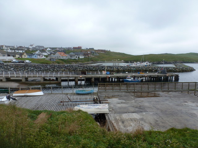
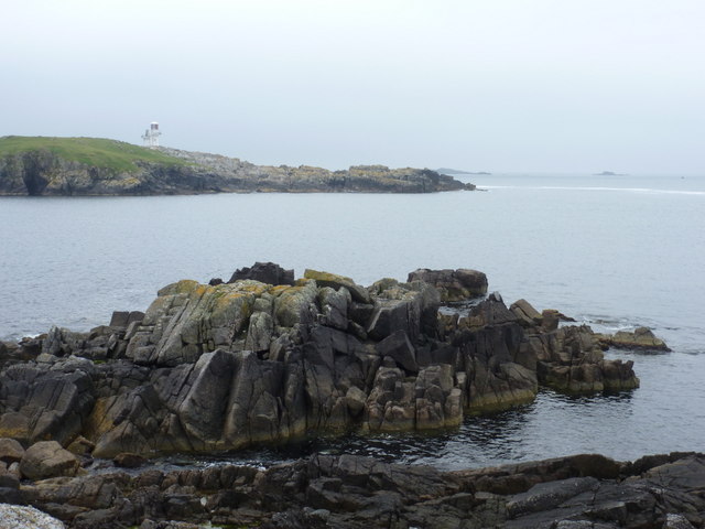
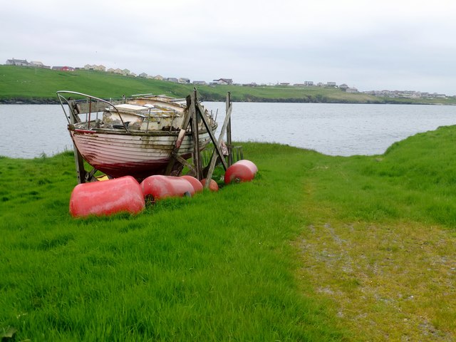
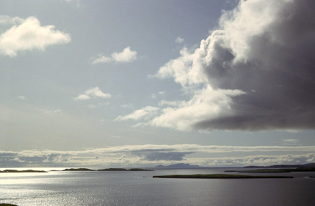
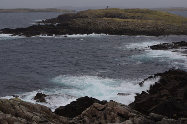
South Ayre is a picturesque beach located on the southern coast of Shetland, an archipelago in Scotland. Situated in the village of Sandwick, this sandy stretch of coastline offers visitors a tranquil and serene setting to enjoy the outdoors.

The beach is nestled amidst a stunning landscape featuring rolling sand dunes, vibrant wildflowers, and breathtaking views of the North Sea. The golden sand stretches for approximately 1.5 kilometers, providing ample space for beachgoers to relax, take leisurely walks, or engage in various recreational activities.

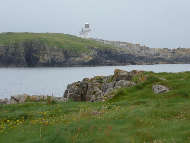
South Ayre is known for its crystal-clear waters, which are perfect for swimming, paddleboarding, and kayaking. The beach also attracts anglers who come to cast their lines in search of a variety of fish species, including cod, mackerel, and haddock.

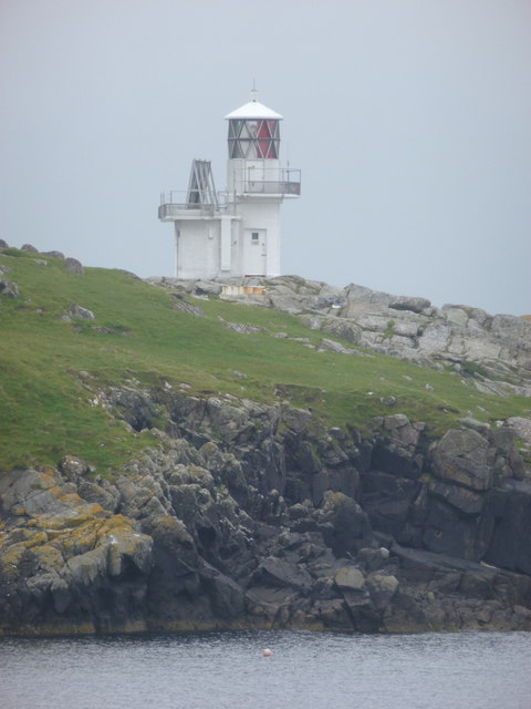
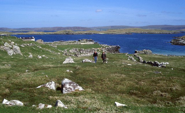
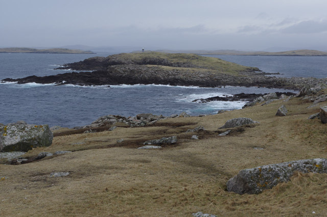
Nature enthusiasts will appreciate the diverse wildlife found in the area. South Ayre is a popular spot for birdwatching, with numerous seabirds, such as puffins and guillemots, nesting on the nearby cliffs. It is also home to a variety of marine life, including seals and otters, which can often be spotted playing in the water.

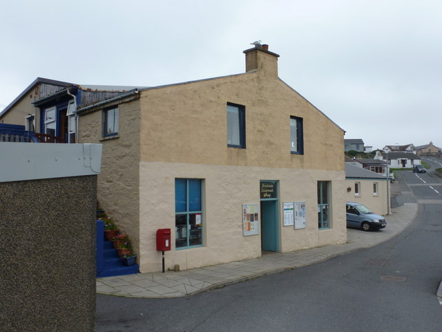
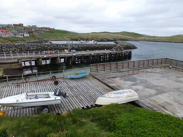
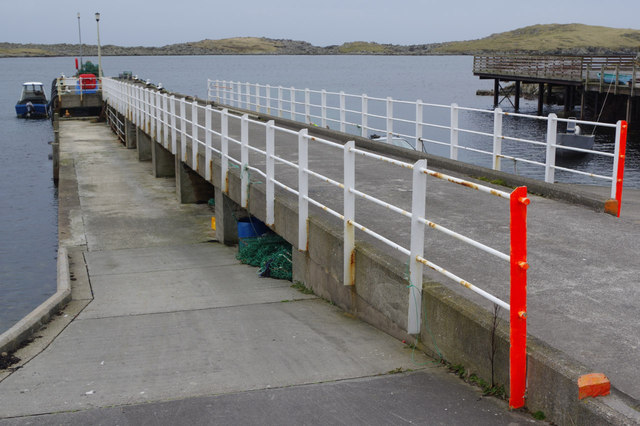
The beach is easily accessible, with a car park located nearby and public transportation options available. Facilities such as toilets and picnic areas are available, ensuring a comfortable visit for all. South Ayre offers a peaceful and unspoiled coastal experience, making it a must-visit destination for nature lovers and those seeking a tranquil escape in Shetland.

If you have any feedback on the listing, please let us know in the comments section below.

South Ayre Images

Images are sourced within 2km of 60.122107/-1.3350593 or Grid Reference HU3737. Thanks to Geograph Open Source API. All images are credited.

Hamnavoe: Andrew Halcrow’s Shop Hamnavoe village store also houses the post office.
Hamnavoe: Andrew Halcrow’s Shop
Hamnavoe village store also houses the post office.
Hamnavoe: postbox № ZE2 20 This postbox stands outside <a href="https://www.geograph.org.uk/photo/2701248">HU3635 : Hamnavoe: Andrew Halcrow’s Shop</a> - the postal scales can be seen through the window. The box is emptied at 10am on weekdays and Saturdays.
Hamnavoe: postbox № ZE2 20
This postbox stands outside HU3635 : Hamnavoe: Andrew Halcrow’s Shop - the postal scales can be seen through the window. The box is emptied at 10am on weekdays and Saturdays.
Hamnavoe: across the harbour Looking across the head of Hamna Voe, which forms the little harbour, with the marina in the background.
Hamnavoe: across the harbour
Looking across the head of Hamna Voe, which forms the little harbour, with the marina in the background.
Hamnavoe: view across Hamna Voe to Fugla Ness Looking across the entrance to the voe, with the light of Fugla Ness across the water.
Hamnavoe: view across Hamna Voe to Fugla Ness
Looking across the entrance to the voe, with the light of Fugla Ness across the water.
Hamnavoe: rocks below Scarva Stack Looking out from the western tip of Scarva Stack, across the entrance of Hamna Voe with Skeggies visible faintly in the background, beyond the tip of Fugla Ness with its navigation light.
Hamnavoe: rocks below Scarva Stack
Looking out from the western tip of Scarva Stack, across the entrance of Hamna Voe with Skeggies visible faintly in the background, beyond the tip of Fugla Ness with its navigation light.
Hamnavoe: Fugla Ness light A navigational aid for vessels entering Hamna Voe, the sea inlet in the foreground.
Hamnavoe: Fugla Ness light
A navigational aid for vessels entering Hamna Voe, the sea inlet in the foreground.
Hamnavoe marina One or two inshore fishing boats, but mainly pleasure craft.
Hamnavoe marina
One or two inshore fishing boats, but mainly pleasure craft.
Bruna Ness Bagged with Tricky Speirs with view towards the bridge that connect Trondra to West Burra.
Name: Bruna Ness
Hill number: 104041
Height: 59m / 194ft
Area:22: Shetland Islands
Class:0
Grid ref: HU382368 (est)
Drop: 43m
Col: 16m
Bruna Ness
Bagged with Tricky Speirs with view towards the bridge that connect Trondra to West Burra. Name: Bruna Ness Hill number: 104041 Height: 59m / 194ft Area:22: Shetland Islands Class:0 Grid ref: HU382368 (est) Drop: 43m Col: 16m
Old Boat Near Setter Old boat near hamlet of Setter with view across to Hamnavoe.
Old Boat Near Setter
Old boat near hamlet of Setter with view across to Hamnavoe.
Head of Hamna Voe With pier and stone breakwater enclosing marina.
Head of Hamna Voe
With pier and stone breakwater enclosing marina.
Ruins and landing place in Sandy Voe on Oxna Walking up towards the larger of two lochs on the uninhabited island of Oxna. The boat is moored in Sandy Voe, close to the ruins of a small settlement. The island of Papa is in the background.
Ruins and landing place in Sandy Voe on Oxna
Walking up towards the larger of two lochs on the uninhabited island of Oxna. The boat is moored in Sandy Voe, close to the ruins of a small settlement. The island of Papa is in the background.
Evening view west from the Ness of Westshore Once the ridge is climbed to the west of Scalloway the view extends over the nearby islands of Lunga, Linga and Hildasay before the long stretch of sea to Foula on the western horizon.
Evening view west from the Ness of Westshore
Once the ridge is climbed to the west of Scalloway the view extends over the nearby islands of Lunga, Linga and Hildasay before the long stretch of sea to Foula on the western horizon.
Islands west from Point of the Pund, Mainland West to Foula over Langa and the islets south of Hildasay.
Islands west from Point of the Pund, Mainland
West to Foula over Langa and the islets south of Hildasay.
Setter, Burra Isle The old boat serves as a chicken hut and an old millstone lies abandoned in this crofter's yard. The houses of Hamnavoe are visible and in the distance is the snow-clad island of Foula.
Setter, Burra Isle
The old boat serves as a chicken hut and an old millstone lies abandoned in this crofter's yard. The houses of Hamnavoe are visible and in the distance is the snow-clad island of Foula.
Hamnavoe Pier The pier stretches out into the sheltered waters of Hamna Voe, a facility for the fishing village which was only connected by road to the Shetland mainland in 1971.
Hamnavoe Pier
The pier stretches out into the sheltered waters of Hamna Voe, a facility for the fishing village which was only connected by road to the Shetland mainland in 1971.
Fugla Ness Looking from Pundsar to the headland and lighthouse at Fugla Ness, reached across a boulder-strewn causeway.
Fugla Ness
Looking from Pundsar to the headland and lighthouse at Fugla Ness, reached across a boulder-strewn causeway.
Fugla Ness Looking across from Pundsar.
Fugla Ness
Looking across from Pundsar.
Fugla Ness Lighthouse This lighthouse was built in 1936, replacing an earlier light that dated back to 1893. It has a maximum range of 10 miles and guides vessels into Hamnavoe and Scalloway.
Fugla Ness Lighthouse
This lighthouse was built in 1936, replacing an earlier light that dated back to 1893. It has a maximum range of 10 miles and guides vessels into Hamnavoe and Scalloway.
Show me another place!

South Ayre is located at Grid Ref: HU3737 (Lat: 60.122107, Lng: -1.3350593)

Unitary Authority: Shetland Islands

Police Authority: Highlands and Islands

What 3 Words

///flattens.newsreel.collides. Near Scalloway, Shetland Islands

Nearby Locations

Hogg of Papa South Ayre

Related Wikis

Papa, Shetland

Papa (Scots: Papa; Old Norse: Papey, meaning "the island of the priests") is an uninhabited island in the Scalloway Islands, Shetland, Scotland. Papa lies...

Green Holm

Green Holm, (HU382379), is a small uninhabited island 500 metres north of Burra Ness at the north end of the island of Burra and on the west side of the...

West Head of Papa

West Head of Papa is a small tidal island off Papa in Shetland, and is one of the Scalloway Islands. It is 21m at its highest point. East Head of Papa...

Langa, Shetland

Langa (Old Norse: Langey ) is the collective name for two uninhabited islands off Hildasay, in Shetland, Scotland. The islands are connected by a tombolo...

Oxna

Oxna is one of the Scalloway Islands, lying north west of Burra in Shetland, Scotland. Oxna has an area of 68 hectares (170 acres). The island has been...

Linga, Scalloway Islands

Linga is a small island off Hildasay in the Shetland Islands. It is one of the Scalloway Islands. Haswell-Smith compares Hildasay and the adjacent islands...

Cheynies

The Cheynies are a group of reefs and small islands, between Oxna and Hildasay in the Shetland Islands, Scotland. They have been considerably eroded in...

Trondra

Trondra (Scots: Trondra) is one of the Scalloway Islands, a subgroup of the Shetland Islands in Scotland. It shelters the harbour of Scalloway and has...

Have you been to South Ayre?

Leave your review of South Ayre below (or comments, questions and feedback).