Dritness

Beach in Orkney

Scotland

Dritness

Gloup at the Vat The natural arch and gloup at the Vat of Kirbuster. Gloup comes from the Old Norse "gluppa" -a chasm- the local name for a blow hole.
Sea thrift carpets the edge of the chasm.
Gloup at the Vat Credit: Adam Ward

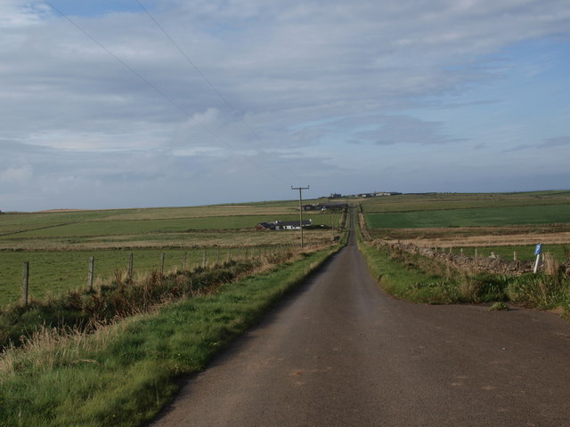
Dritness, located in Orkney, is a picturesque beach area that offers visitors a stunning natural landscape and a peaceful atmosphere. Situated on the northeastern coast of Mainland Orkney, Dritness is known for its rugged beauty, pristine sandy beaches, and crystal-clear turquoise waters.

The beach at Dritness stretches over a mile long and is backed by striking sand dunes, with grassy areas providing a perfect spot for picnics or sunbathing. The dunes not only add to the beauty of the beach but also serve as a natural barrier against the strong winds that are common in the area.

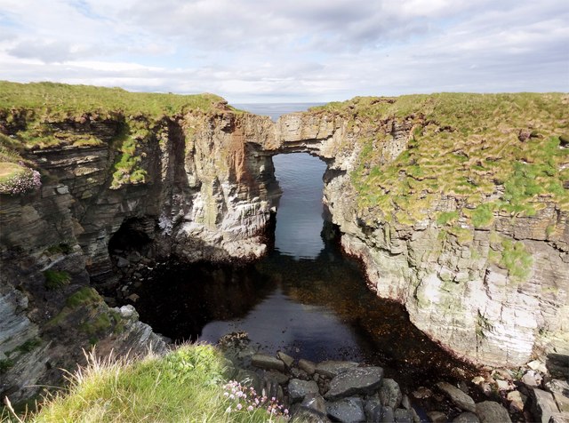
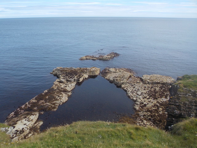
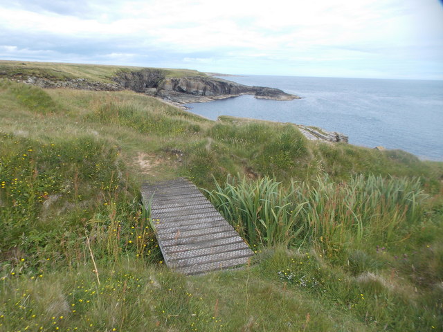
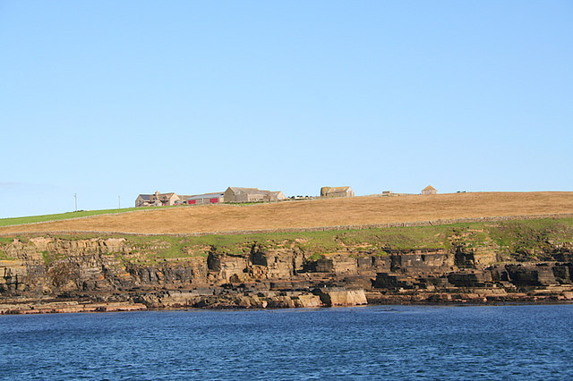
The beach is relatively quiet and secluded, making it an ideal destination for those seeking a tranquil getaway. Visitors can enjoy leisurely walks along the shoreline, collecting seashells, or simply basking in the serenity of the surroundings. The views from the beach are particularly breathtaking, with panoramic vistas of the nearby sea stacks, cliffs, and the expansive North Sea.

Nature enthusiasts will appreciate the abundance of wildlife that can be spotted at Dritness. Seals are known to frequent the area, and seabirds such as puffins, guillemots, and kittiwakes can be observed nesting on the cliffs. During certain times of the year, lucky visitors might even catch a glimpse of orcas or dolphins swimming offshore.

Dritness beach offers a true escape from the hustle and bustle of everyday life, providing a serene and unspoiled environment that showcases the natural beauty of Orkney's coast. Whether you are seeking a peaceful stroll along the shoreline, a chance to witness diverse wildlife, or simply a place to relax and unwind, Dritness beach is a must-visit destination.

If you have any feedback on the listing, please let us know in the comments section below.

Dritness Images

Images are sourced within 2km of 59.109027/-2.5523271 or Grid Reference HY6824. Thanks to Geograph Open Source API. All images are credited.

Gloup at the Vat The natural arch and gloup at the Vat of Kirbuster. Gloup comes from the Old Norse "gluppa" -a chasm- the local name for a blow hole.
Sea thrift carpets the edge of the chasm.
Gloup at the Vat
The natural arch and gloup at the Vat of Kirbuster. Gloup comes from the Old Norse "gluppa" -a chasm- the local name for a blow hole. Sea thrift carpets the edge of the chasm.
Fulmar in the Pink A Fulmar poses beside some Sea Pink or Thrift on the cliffs surrounding the Vat of Kirbuster.
Fulmar in the Pink
A Fulmar poses beside some Sea Pink or Thrift on the cliffs surrounding the Vat of Kirbuster.
Stronsay: Vat of Kirbuster A spectacular natural arch on the east coast of the island, alternatively spelt Kirbister depending on where you look.
Stronsay: Vat of Kirbuster
A spectacular natural arch on the east coast of the island, alternatively spelt Kirbister depending on where you look.
Stronsay: natural arch near Burgh Head A rather spectacular arch; you would not know from the top of the headland that you were essentially on stilts.
Stronsay: natural arch near Burgh Head
A rather spectacular arch; you would not know from the top of the headland that you were essentially on stilts.
Stronsay: path to the coast A straight, paved path between two sets of fields leads from the parking lay-by at Kirbuster to the spectacular east coast walks.
Stronsay: path to the coast
A straight, paved path between two sets of fields leads from the parking lay-by at Kirbuster to the spectacular east coast walks.
Stronsay: Ramma Geo One of many narrow inlets (or geos) along this spectacular stretch of coast.
Stronsay: Ramma Geo
One of many narrow inlets (or geos) along this spectacular stretch of coast.
Stronsay: stile on the coast path The only wall that interrupts this stretch of the cliff-top path is crossed by a stile. Once across, the path turns sharp left thanks to a sea inlet immediately alongside us.
Stronsay: stile on the coast path
The only wall that interrupts this stretch of the cliff-top path is crossed by a stile. Once across, the path turns sharp left thanks to a sea inlet immediately alongside us.
Stronsay: rockpool below the cliff-top path The rocks below us have formed a large pool with only the narrowest of outlets to the open sea.
Stronsay: rockpool below the cliff-top path
The rocks below us have formed a large pool with only the narrowest of outlets to the open sea.
Stronsay: a narrow, unnamed geo A very narrow sea inlet, like many along this stretch of coast.
Stronsay: a narrow, unnamed geo
A very narrow sea inlet, like many along this stretch of coast.
Stronsay: Two Castles Not what you expect to see in a photo entitled 'Two Castles'. This is the name of the two stacks in the picture. The nearer one is called Tams Castle and, according to internet research and large-scale maps but not visible, there are remains of buildings on its top. Some of the walls are over 1m high and up to 0.8m thick, although they are thickly overgrown so it is not possible to detect them from here. They are ancient and of unknown purpose but thought to be some kind of medieval hermitage.
Stronsay: Two Castles
Not what you expect to see in a photo entitled 'Two Castles'. This is the name of the two stacks in the picture. The nearer one is called Tams Castle and, according to internet research and large-scale maps but not visible, there are remains of buildings on its top. Some of the walls are over 1m high and up to 0.8m thick, although they are thickly overgrown so it is not possible to detect them from here. They are ancient and of unknown purpose but thought to be some kind of medieval hermitage.
Stronsay: sticky-outy rock at Middle Banks Between two headlands themselves spectacular, a narrow piece of rock projects even more dramatically from the cliffs.
Stronsay: sticky-outy rock at Middle Banks
Between two headlands themselves spectacular, a narrow piece of rock projects even more dramatically from the cliffs.
Stronsay: overhanging cliff face at Middle Banks Part of an immensely spectacular stretch of coastline, this narrow headland projects dramatically and has quite an overhang as well as a hole in it - see <a href="https://www.geograph.org.uk/photo/4713733">HY6923 : Stronsay: close-up of a rocky headland</a>.
Stronsay: overhanging cliff face at Middle Banks
Part of an immensely spectacular stretch of coastline, this narrow headland projects dramatically and has quite an overhang as well as a hole in it - see HY6923 : Stronsay: close-up of a rocky headland.
Stronsay: close-up of a rocky headland A rather spectacular headland, which has been eroded into an interesting shape with overhang and a peculiar narrow hole.
Stronsay: close-up of a rocky headland
A rather spectacular headland, which has been eroded into an interesting shape with overhang and a peculiar narrow hole.
Stronsay: footbridge near the Vat of Kirbuster The coast path hereabouts crosses several small watercourses, and this is one of few to have a little bridge to help.
Stronsay: footbridge near the Vat of Kirbuster
The coast path hereabouts crosses several small watercourses, and this is one of few to have a little bridge to help.
Stronsay: postbox № KW17 53, Everbay This postbox is of a modern design, constructed of pressed steel and designed to be more robust, rustproof and theft-proof than the traditional cast iron box that it will have replaced in the last couple of years.

This particular style of box is becoming quite commonplace in these remote, exposed parts.
Stronsay: postbox № KW17 53, Everbay
This postbox is of a modern design, constructed of pressed steel and designed to be more robust, rustproof and theft-proof than the traditional cast iron box that it will have replaced in the last couple of years. This particular style of box is becoming quite commonplace in these remote, exposed parts.
Sunset beyond Odin Ness, Stronsay Taken from the Shetland ferry several km to the SW.
Sunset beyond Odin Ness, Stronsay
Taken from the Shetland ferry several km to the SW.
Road to Kirbuster On the island of Stronsay, one of the Orkney north isles, this minor road leads to the farm of Kirbuster and the small car parking space used by people exploring the coastal cliffs, geos, rock arch, etc.
Road to Kirbuster
On the island of Stronsay, one of the Orkney north isles, this minor road leads to the farm of Kirbuster and the small car parking space used by people exploring the coastal cliffs, geos, rock arch, etc.
Cliffs near Vat of Kirbuster The path along the top of the cliffs takes one almost to eye level with the gulls on their nests.
Cliffs near Vat of Kirbuster
The path along the top of the cliffs takes one almost to eye level with the gulls on their nests.
Show me another place!

Dritness is located at Grid Ref: HY6824 (Lat: 59.109027, Lng: -2.5523271)

Unitary Authority: Orkney Islands

Police Authority: Highlands and Islands

What 3 Words

///nuns.beaks.winds. Near Whitehall, Orkney Islands

Related Wikis

Odness

Odness is a peninsula and headland on the island of Stronsay, in Orkney, Scotland. The Odness peninsula contains the farm of Odiness. Odness is also within...

Stronsay

Stronsay () is an island in Orkney, Scotland. It is known as Orkney's 'Island of Bays', owing to an irregular shape with miles of coastline, with three...

Whitehall, Orkney

Whitehall is the village on the island of Stronsay, in the Orkney Islands of Scotland. It is a small village with about 50 houses. It also has a shop...

Papa Stronsay

Papa Stronsay (Scots: Papa Stronsee; Old Norse: Papey Minni) is a small island in Orkney, Scotland, lying north east of Stronsay. It is 74 hectares (183...

Sons of the Most Holy Redeemer

The Congregation of the Sons of the Most Holy Redeemer (Latin: Filii Sanctissimi Redemptoris; FSSR), commonly known as the Transalpine Redemptorists or...

Linga Sound, Orkney

Linga Sound is the strait between the islands of Linga Holm and Stronsay in the Orkney islands of Scotland. It leads into St. Catherines Bay from the north...
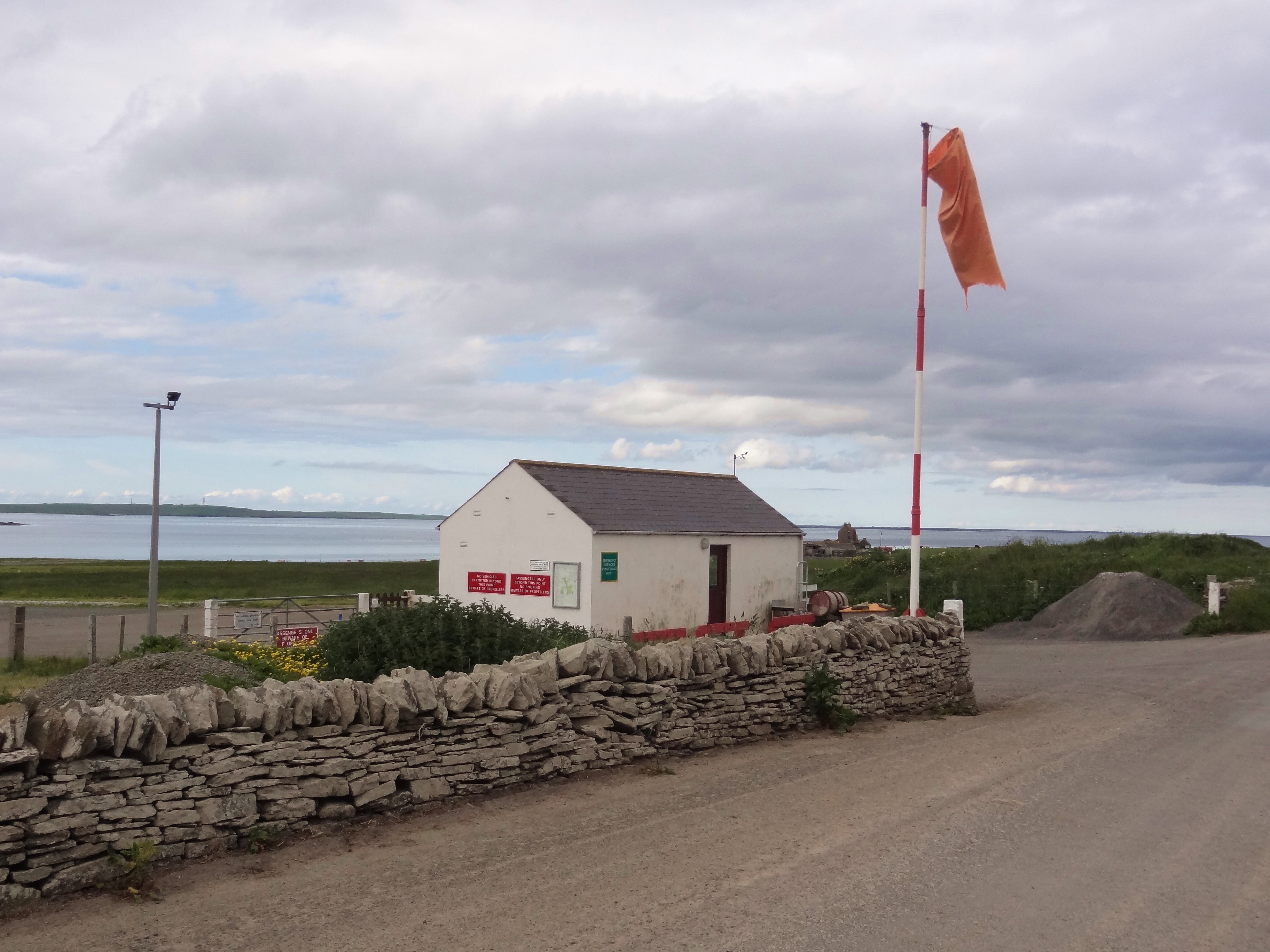
Stronsay Airport

Stronsay Airport (IATA: SOY, ICAO: EGER) is located 15 nautical miles (28 km; 17 mi) northeast by north of Kirkwall Airport on Stronsay, Orkney Islands...

Linga Holm

Linga Holm, commonly known as Linga, Midgarth and the Holm of Midgarth is an uninhabited Scottish island extending to approximately 57 hectares (0.22...

Nearby Amenities

Located within 500m of 59.109027,-2.5523271
Power: pole
Lat/Long: 59.1082518/-2.5593574
Power: pole
Lat/Long: 59.1092847/-2.5581694
Power: pole
Lat/Long: 59.1104668/-2.5567643
Power: pole
Lat/Long: 59.1117078/-2.5553273
Power: pole
Lat/Long: 59.1129128/-2.5539318
The data included in this document is from www.openstreetmap.org. The data is made available under ODbL.

Have you been to Dritness?

Leave your review of Dritness below (or comments, questions and feedback).