West Sands

Beach in Banffshire

Scotland

West Sands

Logie Head Logie Head comprises the whole of this promontory. At both ends of the headland the rocks belong to the Cullen Quartzite Formation, but in between is the Dicky Hare Semipelite Member. In simple terms, quartzite is metamorphosed pure sand, but semipelite is metamorphosed muddy sand. As well as being metamorphosed, the strata have been tilted through 90º by tectonic forces, and you can see in this view that the cliff looks like a row of verticals. The name Dicky Hare is applied to the beach below the semipelite cliffs, but I have no as yet discovered the origin of this rather odd name.
Logie Head Credit: Anne Burgess

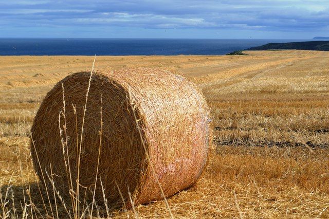
West Sands is a stunning beach located in Banffshire, Scotland. Situated on the north-east coast of the country, this beach offers breathtaking views of the North Sea and is a popular destination for both locals and tourists alike.

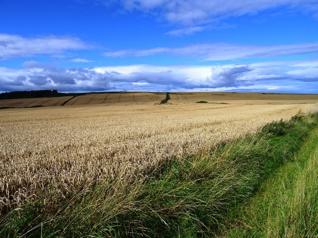
Stretching for approximately two miles, West Sands boasts a vast expanse of golden sand, making it an ideal spot for sunbathing, picnicking, and leisurely walks. The beach is backed by dunes, which not only provide a natural barrier against wind but also create a picturesque backdrop for visitors. These dunes are home to various species of plants and wildlife, adding to the beauty and ecological significance of the area.

West Sands is known for its pristine waters, which are relatively calm and safe for swimming. Lifeguards are on duty during peak seasons, ensuring the safety of beachgoers. Furthermore, the beach offers excellent conditions for various water sports, including surfing, kayaking, and paddleboarding. It is not uncommon to see enthusiasts taking advantage of the waves and enjoying their chosen activities.

The beach is easily accessible, with ample parking available nearby. There are also several amenities in the vicinity, including cafes, restaurants, and public toilets, making it convenient for visitors to spend a day at the beach.

Overall, West Sands in Banffshire is a picturesque and family-friendly beach, offering stunning views, soft sand, and a range of recreational opportunities. It is a must-visit destination for nature lovers and beach enthusiasts looking to enjoy the beauty of the Scottish coastline.

If you have any feedback on the listing, please let us know in the comments section below.

West Sands Images

Images are sourced within 2km of 57.693263/-2.7788368 or Grid Reference NJ5367. Thanks to Geograph Open Source API. All images are credited.

Logie Head Logie Head comprises the whole of this promontory. At both ends of the headland the rocks belong to the Cullen Quartzite Formation, but in between is the Dicky Hare Semipelite Member. In simple terms, quartzite is metamorphosed pure sand, but semipelite is metamorphosed muddy sand. As well as being metamorphosed, the strata have been tilted through 90º by tectonic forces, and you can see in this view that the cliff looks like a row of verticals. The name Dicky Hare is applied to the beach below the semipelite cliffs, but I have no as yet discovered the origin of this rather odd name.
Logie Head
Logie Head comprises the whole of this promontory. At both ends of the headland the rocks belong to the Cullen Quartzite Formation, but in between is the Dicky Hare Semipelite Member. In simple terms, quartzite is metamorphosed pure sand, but semipelite is metamorphosed muddy sand. As well as being metamorphosed, the strata have been tilted through 90º by tectonic forces, and you can see in this view that the cliff looks like a row of verticals. The name Dicky Hare is applied to the beach below the semipelite cliffs, but I have no as yet discovered the origin of this rather odd name.
Crathie Point Vaugue path through the grass down to the rocky headland of Crathie Point
Crathie Point
Vaugue path through the grass down to the rocky headland of Crathie Point
Crathie Point Lichen covered rocks at Crathie Point
Crathie Point
Lichen covered rocks at Crathie Point
View from Crathie Point Looking East towards Garron Point
View from Crathie Point
Looking East towards Garron Point
Lichen covered cliffs at Crathie Point
Findlater Castle Remnants of the largely 15th century castle constructed by Sir William Ogilvy of Auchleven  on an earlier 13th century site. Nowadays the site is only accessible to the intrepid. The information board gives the following warning 'THE CASTLE PROMONTORY IS DANGEROUS ~ PLEASE DO NOT TAKE UNNECESSARY RISKS'.
Findlater Castle
Remnants of the largely 15th century castle constructed by Sir William Ogilvy of Auchleven on an earlier 13th century site. Nowadays the site is only accessible to the intrepid. The information board gives the following warning 'THE CASTLE PROMONTORY IS DANGEROUS ~ PLEASE DO NOT TAKE UNNECESSARY RISKS'.
Beach at Findlater Castle The castle could be supplied by sea with boats drawn up onto the beach below the castle.
Beach at Findlater Castle
The castle could be supplied by sea with boats drawn up onto the beach below the castle.
Harvest time at Barnyards of Findlater
Slopes of Crannoch Hill Farmland near Barnyards of Findlater.
Slopes of Crannoch Hill
Farmland near Barnyards of Findlater.
Path below Dicky Hare The shore path from Cullen to Sandend runs below the hill Dicky Hare and around Logie Head
Path below Dicky Hare
The shore path from Cullen to Sandend runs below the hill Dicky Hare and around Logie Head
Crag by the Cullen to Sandend shore path Looking down on this crag near Logie Head from the shore path below Dicky Hare
Crag by the Cullen to Sandend shore path
Looking down on this crag near Logie Head from the shore path below Dicky Hare
Cullen to Sandend shore path The path winds its way around the bottom of the hill Dicky Hare, near Logie Head
Cullen to Sandend shore path
The path winds its way around the bottom of the hill Dicky Hare, near Logie Head
Cullen to Sandend shore path The path runs below the hill Dicky Hare
Cullen to Sandend shore path
The path runs below the hill Dicky Hare
Cullen Salmon Bothy Circular Path Newly upgraded, the path continues back to Cullen by taking the right fork
Cullen Salmon Bothy Circular Path
Newly upgraded, the path continues back to Cullen by taking the right fork
Cullen Salmon Bothy Circular Path Looking back towards Cullen at Muckle Hythe, the path has been recently upgraded to a high standard
Cullen Salmon Bothy Circular Path
Looking back towards Cullen at Muckle Hythe, the path has been recently upgraded to a high standard
Thrift on the shore at Muckle Hythe The recently upgraded Cullen Salmon Bothy Circular Path be seen behind the Thrift
Thrift on the shore at Muckle Hythe
The recently upgraded Cullen Salmon Bothy Circular Path be seen behind the Thrift
Cullen to Sandend shore path The path winds its way around the bottom of the hill Dicky Hare, heading towards Logie Head
Cullen to Sandend shore path
The path winds its way around the bottom of the hill Dicky Hare, heading towards Logie Head
Cullen to Sandend shore path The path here passes around the bottom of Dicky Hare, past these vertical rocks
Cullen to Sandend shore path
The path here passes around the bottom of Dicky Hare, past these vertical rocks
Show me another place!

West Sands is located at Grid Ref: NJ5367 (Lat: 57.693263, Lng: -2.7788368)

Unitary Authority: Aberdeenshire

Police Authority: North East

What 3 Words

///wedding.tonight.mows. Near Cullen, Moray

Nearby Locations

West Sands Sunnyside

Related Wikis

Findlater Castle

Findlater Castle is the old seat of the Earls of Findlater and Seafield, sitting on a 50-foot (15 m)-high cliff overlooking the Moray Firth on the coast...
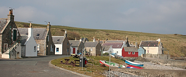
Sandend

Sandend (Scots: Sanine) is a small fishing village near Banff and Portsoy, Scotland, typical of the area. It was "a considerable seatown as early as 1624...

Tochieneal railway station

Tochieneal railway station was a railway station that served the small industrial village of Tochieneal, close to Cullen in Moray. The railway station...

Cullen railway station

Cullen railway station was a railway station that served the small fishing village of Cullen, close to Portknockie in Moray. The railway station was opened...

Cullen Town Hall

Cullen Town Hall is a municipal building in The Square, Cullen, Moray, Scotland. The structure, which is currently used as a heritage centre, is a Category...
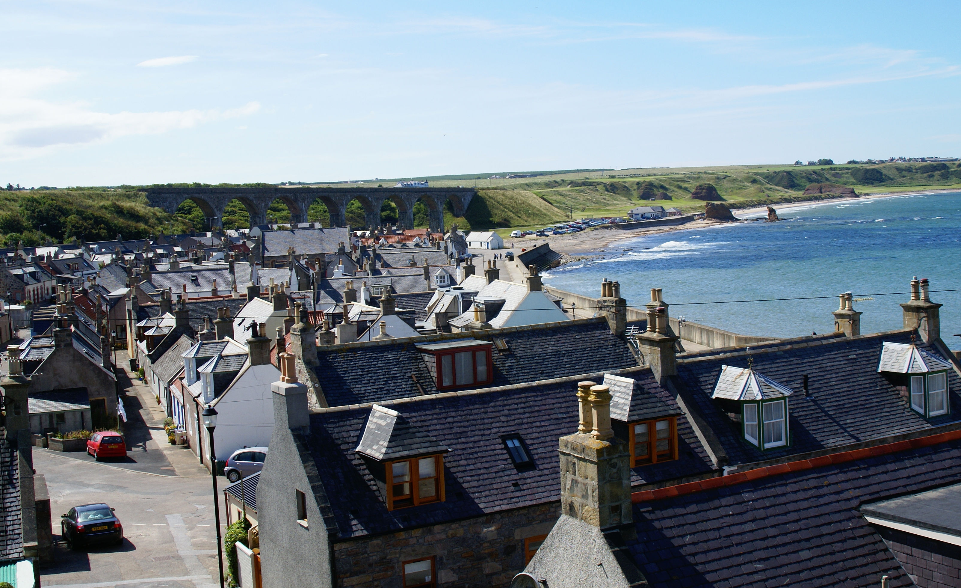
Cullen, Moray

Cullen (Scottish Gaelic: Inbhir Cuilinn) is a village and former royal burgh in Moray but historically in Banffshire, Scotland, on the North Sea coast...

Cullen Castle

Cullen Castle was a royal castle about 0.5 miles (0.80 km) west of Cullen, Moray, Scotland, west of the burn of Deskford, and south of Seatown. The remains...

Glassaugh railway station

Glassaugh railway station was a railway station that served the rural area of Glassaugh and the nearby Glenglassaugh distillery close to Portsoy in Moray...

Nearby Amenities

Located within 500m of 57.693263,-2.7788368
Source: PGS
Lat/Long: 57.6930674/-2.7705797
Source: PGS
Lat/Long: 57.6926874/-2.7708045
Source: PGS
Lat/Long: 57.6925636/-2.7707521
Source: PGS
Lat/Long: 57.6927705/-2.7725798
Source: PGS
Lat/Long: 57.6929026/-2.7725801
Source: PGS
Lat/Long: 57.6932594/-2.7737423
Source: PGS
Lat/Long: 57.6936222/-2.7742188
Source: PGS
Lat/Long: 57.6937369/-2.7742779
Source: PGS
Lat/Long: 57.6938128/-2.7744602
Created By: almien_coastlines
Source: PGS
Lat/Long: 57.693176/-2.775475
Source: PGS
Lat/Long: 57.6932505/-2.7759639
Source: PGS
Lat/Long: 57.6930381/-2.7764569
Source: PGS
Lat/Long: 57.6929111/-2.7769133
Created By: almien_coastlines
Source: PGS
Lat/Long: 57.69254/-2.777391
Source: PGS
Lat/Long: 57.6928341/-2.7783771
Source: PGS
Lat/Long: 57.6931757/-2.7790264
Source: PGS
Lat/Long: 57.6933976/-2.7795809
Source: PGS
Lat/Long: 57.6935957/-2.7800473
Created By: almien_coastlines
Source: PGS
Lat/Long: 57.693825/-2.780252
Created By: almien_coastlines
Source: PGS
Lat/Long: 57.693954/-2.781207
Created By: almien_coastlines
Source: PGS
Lat/Long: 57.694213/-2.78264
Source: PGS
Lat/Long: 57.6946627/-2.7843825
Source: PGS
Lat/Long: 57.6948879/-2.7849477
Source: PGS
Lat/Long: 57.6951017/-2.7854356
Created By: almien_coastlines
Source: PGS
Lat/Long: 57.69537/-2.785742
Created By: almien_coastlines
Source: PGS
Lat/Long: 57.695626/-2.78574
Tourism: viewpoint
Lat/Long: 57.6927414/-2.7704968
The data included in this document is from www.openstreetmap.org. The data is made available under ODbL.

Have you been to West Sands?

Leave your review of West Sands below (or comments, questions and feedback).