Letto Sands

Beach in Orkney

Scotland

Letto Sands

Old Milestone by the B9066, Kirkbrae, Westray By the B9066, in parish of Westray (District), Kirkbrae, at 'Blind Summit' sign.

Inscription once read:- : (Pierowall 2) : : (Rapness 6) : 

Surveyed

Milestone Society National ID: OR_WYPWRP02.
Old Milestone by the B9066, Kirkbrae, Westray Credit: Milestone Society

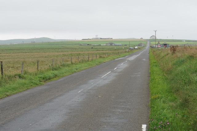
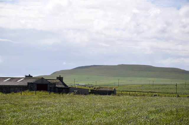
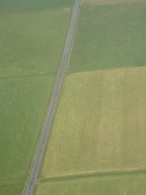
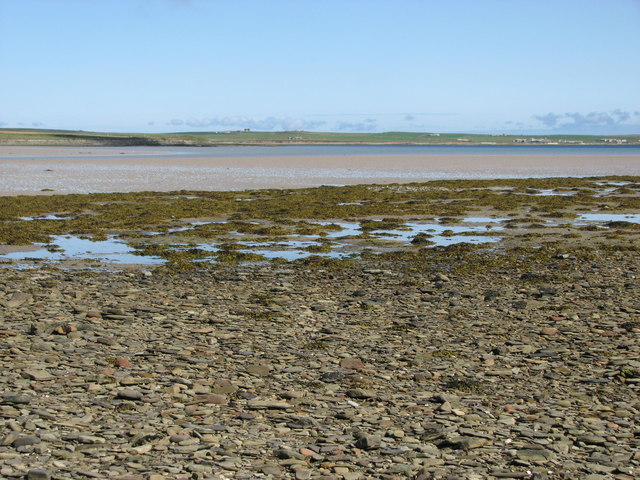
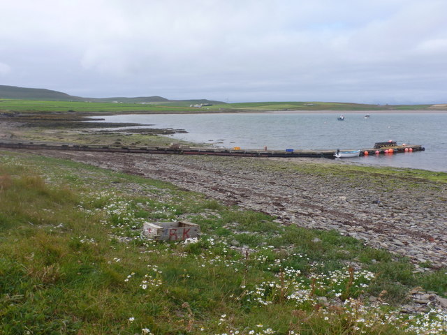
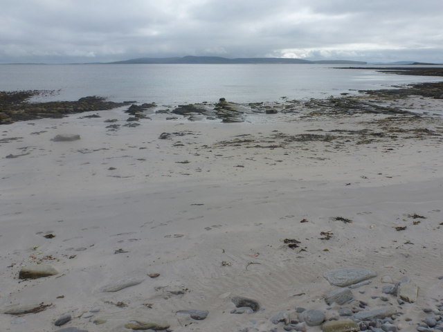
Letto Sands is a picturesque beach located on the western coast of the island of Sanday in Orkney, Scotland. With its stunning natural beauty and serene atmosphere, it is a popular destination for tourists and locals alike.

The beach stretches for approximately one mile and is renowned for its pristine white sands, which are composed of fine grains and have a soft, powdery texture. The crystal-clear turquoise waters of the North Sea gently lap against the shore, creating a tranquil and inviting setting.

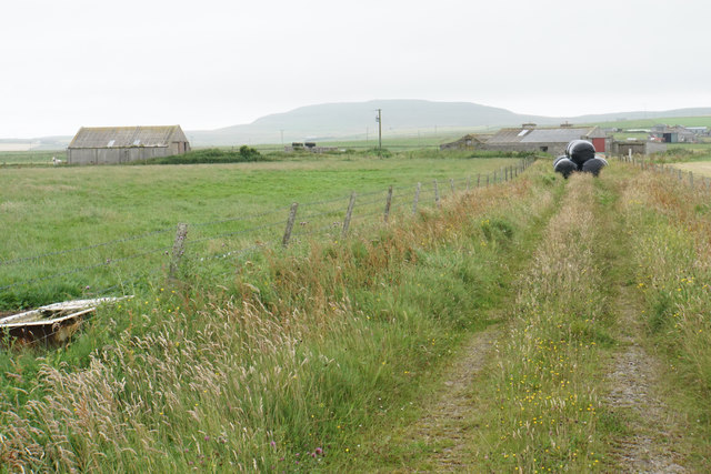
Letto Sands is surrounded by a backdrop of rolling sand dunes, which not only add to its scenic charm but also provide shelter from the wind, making it an ideal spot for sunbathing and picnicking. The dunes also serve as a habitat for various species of plants and wildlife, offering nature enthusiasts an opportunity to explore the diverse flora and fauna of the area.

The beach is accessible via a short walk from the nearby village of Kettletoft, where visitors can find parking facilities and amenities such as cafes and shops. The area is well-maintained, with designated paths and signposts to guide visitors to the beach and ensure their safety.

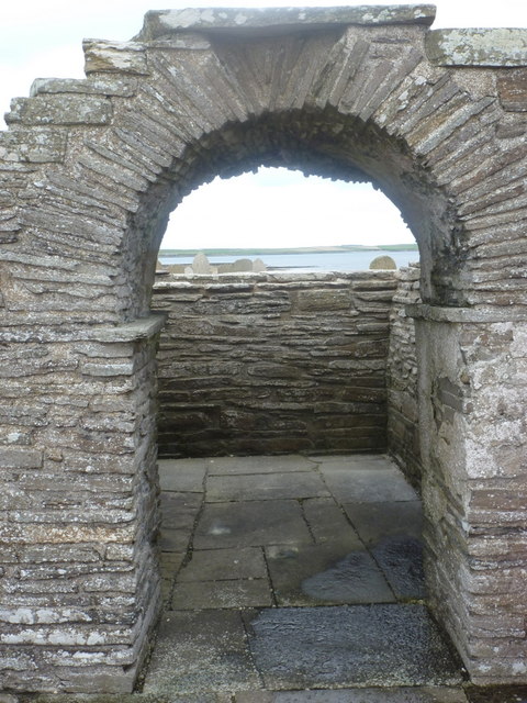
Letto Sands is not only a place of natural beauty but also holds historical significance. The remains of a Viking burial ground can be found nearby, adding an element of intrigue and cultural exploration to the beach experience.

Overall, Letto Sands is a hidden gem in Orkney, offering visitors a peaceful and idyllic coastal getaway with its stunning sands, breathtaking views, and rich history.

If you have any feedback on the listing, please let us know in the comments section below.
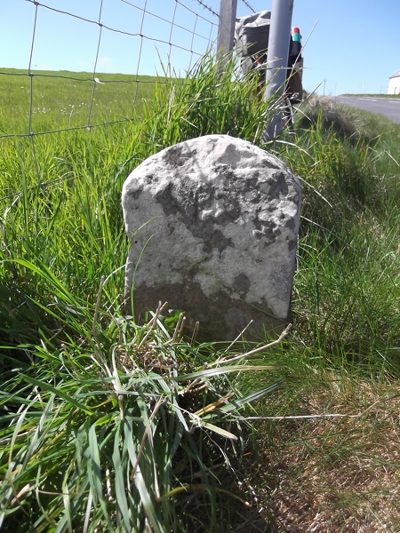
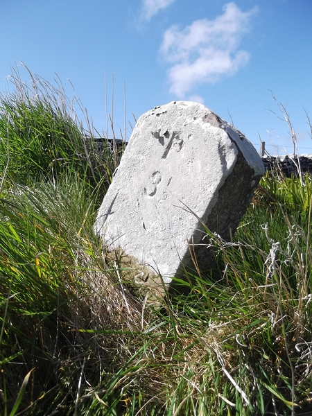
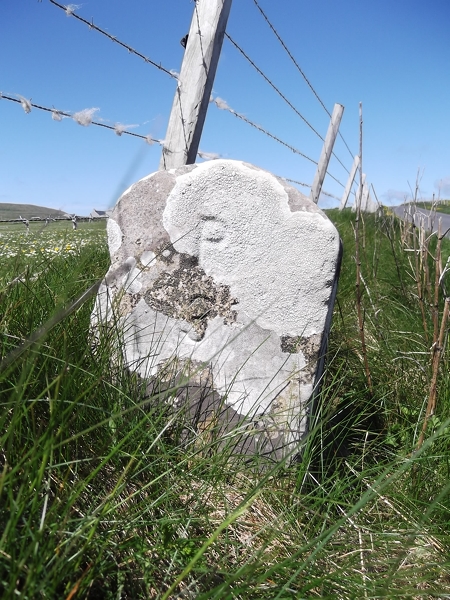
Letto Sands Images

Images are sourced within 2km of 59.287748/-2.9647418 or Grid Reference HY4544. Thanks to Geograph Open Source API. All images are credited.

Old Milestone by the B9066, Kirkbrae, Westray By the B9066, in parish of Westray (District), Kirkbrae, at 'Blind Summit' sign.

Inscription once read:- : (Pierowall 2) : : (Rapness 6) : 

Surveyed

Milestone Society National ID: OR_WYPWRP02.
Old Milestone by the B9066, Kirkbrae, Westray
By the B9066, in parish of Westray (District), Kirkbrae, at 'Blind Summit' sign. Inscription once read:- : (Pierowall 2) : : (Rapness 6) : Surveyed Milestone Society National ID: OR_WYPWRP02.
Old Milestone facing Bay of Tuquoy, Westray Parish By the UC road, in parish of Westray (District), Tuquoy, 100m South of corner near farm.

Inscription reads:- : P / 3½ : (To Pierowall)

Surveyed

Milestone Society National ID: OR_WYPWTQ04.
Old Milestone facing Bay of Tuquoy, Westray Parish
By the UC road, in parish of Westray (District), Tuquoy, 100m South of corner near farm. Inscription reads:- : P / 3½ : (To Pierowall) Surveyed Milestone Society National ID: OR_WYPWTQ04.
Old Milestone by the B6097, Midbea, Westray By the B6097, in parish of Westray (District), 100m North of crossroads corner, on verge.

Inscription reads:- : P / 3 : : T / ½ :  (To Pierowall and Tuquoy)

Surveyed

Milestone Society National ID: OR_WYPWTQ03.
Old Milestone by the B6097, Midbea, Westray
By the B6097, in parish of Westray (District), 100m North of crossroads corner, on verge. Inscription reads:- : P / 3 : : T / ½ : (To Pierowall and Tuquoy) Surveyed Milestone Society National ID: OR_WYPWTQ03.
Old Milestone by the B9067, south of Pierowall Milestone by the B9067, in parish of Westray (District), South of track to Lengemire, 100m North of corner.

Inscription reads:-
: P / 2 : : T / 1½ :
(To Pierowall and Tuquoy) 

Surveyed

Milestone Society National ID: OR_WYPWTQ02
Old Milestone by the B9067, south of Pierowall
Milestone by the B9067, in parish of Westray (District), South of track to Lengemire, 100m North of corner. Inscription reads:- : P / 2 : : T / 1½ : (To Pierowall and Tuquoy) Surveyed Milestone Society National ID: OR_WYPWTQ02
Farm track to East Gretna Green Silage bales are being stored on this track, but there is another track for access to the farm off the main road.
Farm track to East Gretna Green
Silage bales are being stored on this track, but there is another track for access to the farm off the main road.
The B9066 near Gretna Green Heading towards Pierowall through the centre of Westray.
The B9066 near Gretna Green
Heading towards Pierowall through the centre of Westray.
Track towards Garth You are not sure from the map whether there is a track here, or how far it goes.
Track towards Garth
You are not sure from the map whether there is a track here, or how far it goes.
East Gretna Green In the distance can be seen Fitty Hill, at 169m (555ft) the highest point on Westray.
East Gretna Green
In the distance can be seen Fitty Hill, at 169m (555ft) the highest point on Westray.
Bay of Tuquoy Small fishing boat by the shore of the Bay of Tuquoy.
Bay of Tuquoy
Small fishing boat by the shore of the Bay of Tuquoy.
Westray: straight stretch of the B9066 Looking down on the main road through the island, from a plane bound for Kirkwall from Westray.
Westray: straight stretch of the B9066
Looking down on the main road through the island, from a plane bound for Kirkwall from Westray.
Bay of Tuquoy Bay of Tuquoy at low tide.
Bay of Tuquoy
Bay of Tuquoy at low tide.
Midbea: postbox № KW17 67 An Elizabeth II-reign postbox stands alongside the George V wall box which it replaces, outside the old schoolhouse at Midbea. The collection time is 11am daily except Sunday - but post collected will not leave the island the same day.
Midbea: postbox № KW17 67
An Elizabeth II-reign postbox stands alongside the George V wall box which it replaces, outside the old schoolhouse at Midbea. The collection time is 11am daily except Sunday - but post collected will not leave the island the same day.
Tuquoy: a small jetty The road comes to an end at a small hut by this little jetty extending into the Bay of Tuquoy.
Tuquoy: a small jetty
The road comes to an end at a small hut by this little jetty extending into the Bay of Tuquoy.
Tuquoy: rocks at Point o’ the Scurroes Looking across the sea towards the island of Rousay, with the rocky ledges in the foreground.
Tuquoy: rocks at Point o’ the Scurroes
Looking across the sea towards the island of Rousay, with the rocky ledges in the foreground.
Tuquoy: Whale Sand A couple of small lengths of beach, this being one of them, punctuates the rocky shoreline along this part of the Westray coast. The island of Rousay faces us in the distance.
Tuquoy: Whale Sand
A couple of small lengths of beach, this being one of them, punctuates the rocky shoreline along this part of the Westray coast. The island of Rousay faces us in the distance.
Tuquoy: Cross Kirk A small ruined chapel by the water's edge, currently undergoing renovation work.
Tuquoy: Cross Kirk
A small ruined chapel by the water's edge, currently undergoing renovation work.
Tuquoy: Cross Kirk churchyard Looking across the graveyard at <a href="https://www.geograph.org.uk/photo/2630796">HY4543 : Tuquoy: Cross Kirk</a>, a view cunningly avoiding the most conspicuous of the renovation work, although a couple of scaffold poles are visible.
Tuquoy: Cross Kirk churchyard
Looking across the graveyard at HY4543 : Tuquoy: Cross Kirk, a view cunningly avoiding the most conspicuous of the renovation work, although a couple of scaffold poles are visible.
Tuquoy: looking through the church arch A view through the arch of <a href="https://www.geograph.org.uk/photo/2630796">HY4543 : Tuquoy: Cross Kirk</a>, with the renovation work currently underway behind us. The tops of the gravestones can be seen over the east wall of the church, with the Rapness part of Westray across the other side of the Bay of Tuquoy.
Tuquoy: looking through the church arch
A view through the arch of HY4543 : Tuquoy: Cross Kirk, with the renovation work currently underway behind us. The tops of the gravestones can be seen over the east wall of the church, with the Rapness part of Westray across the other side of the Bay of Tuquoy.
Show me another place!

Letto Sands is located at Grid Ref: HY4544 (Lat: 59.287748, Lng: -2.9647418)

Unitary Authority: Orkney Islands

Police Authority: Highlands and Islands

What 3 Words

///mothering.liberty.struggle. Near Pierowall, Orkney Islands

Nearby Locations

Letto Sands

Related Wikis

Westside Church

Westside Church, (also known as Cross Kirk), is a ruined 12th century church located on the island of Westray in Orkney, Scotland. Archaeological excavations...

Westray

Westray (, Scots: Westree) is one of the Orkney Islands in Scotland, with a usual resident population of just under 600 people. Its main village is Pierowall...

Pierowall

Pierowall is a village of Westray in the Orkney Islands, off the coast of the northern Scottish mainland. The village is the island's largest settlement...

Lady Kirk

The Lady Kirk (or St Mary's Kirk) at Pierowall is a ruined 17th-century church on the island of Westray, in Orkney, Scotland. The church was built in 1674...

Nearby Amenities

Located within 500m of 59.287748,-2.9647418
Power: pole
Lat/Long: 59.2921114/-2.9627814
Power: pole
Lat/Long: 59.2916819/-2.9633406
Power: pole
Lat/Long: 59.2913296/-2.9638344
Power: pole
Lat/Long: 59.2907113/-2.9646663
Power: pole
Lat/Long: 59.2901494/-2.9654216
Power: pole
Lat/Long: 59.289576/-2.9661724
Power: pole
Lat/Long: 59.2890682/-2.9668601
Power: pole
Lat/Long: 59.2883808/-2.967798
Power: pole
Lat/Long: 59.2877452/-2.9686683
Power: pole
Lat/Long: 59.2871107/-2.9694957
Power: pole
Lat/Long: 59.2866178/-2.9701563
Power: pole
Lat/Long: 59.2860663/-2.9708936
Power: pole
Lat/Long: 59.2855423/-2.9716174
Power: pole
Lat/Long: 59.2891926/-2.9687427
Power: pole
Lat/Long: 59.2893089/-2.9706163
Power: pole
Lat/Long: 59.2894298/-2.9724087
Power: pole
Lat/Long: 59.2914425/-2.9656832
The data included in this document is from www.openstreetmap.org. The data is made available under ODbL.

Have you been to Letto Sands?

Leave your review of Letto Sands below (or comments, questions and feedback).