Edderton Sands

Beach in Ross-shire

Scotland

Edderton Sands

Towards Edderton and the Struie
Towards Edderton and the Struie Credit: Peter Moore

Edderton Sands is a picturesque beach located in the county of Ross-shire, Scotland. Situated along the North Sea coast, it offers visitors a serene and tranquil environment to enjoy a day by the sea.

The beach boasts a long stretch of golden sand, which is perfect for sunbathing, picnicking, and leisurely strolls. The sand is soft and inviting, making it a popular spot for families and beachgoers alike. Edderton Sands is also known for its clear waters, which are ideal for swimming and paddling during the warmer months.

Surrounded by rolling hills and stunning coastal scenery, Edderton Sands offers breathtaking views and a sense of peace and tranquility. The beach is backed by sand dunes, which provide a natural barrier from the wind and create a sense of privacy. It is also home to a variety of wildlife, including seabirds and marine life, making it a popular spot for birdwatching and nature enthusiasts.

Facilities at Edderton Sands are limited, with no lifeguards on duty and minimal amenities. However, this adds to the charm and unspoiled nature of the beach, allowing visitors to truly connect with the natural surroundings. It is advisable to bring food, water, and any necessary beach equipment, as there are no nearby shops or cafes.

Overall, Edderton Sands offers a peaceful and scenic escape from the hustle and bustle of daily life, providing visitors with an opportunity to relax, unwind, and enjoy the beauty of the Scottish coastline.

If you have any feedback on the listing, please let us know in the comments section below.

Edderton Sands Images

Images are sourced within 2km of 57.837203/-4.1412128 or Grid Reference NH7285. Thanks to Geograph Open Source API. All images are credited.

Towards Edderton and the Struie
Old East Parish Church and graveyard Edderton
Meikle Ferry (South) pier The pier at Ferry Point was the southern terminus of the Meikle Ferry. Prior to the end of the 18th century all traffic relied on the ferries at Meikle and Littleferry for communication and trade across the Dornoch Firth.

In the summer of 1809 a ferry so overloaded with passengers travelling from the Sutherland side of the Kyle, was swamped by waves and 99 people were drowned including Sheriff McCulloch of Dornoch who had urged the ferry men to leave some of the passengers behind. People were reluctant to use the ferry after this and travelled the long way around via the new iron bridge at Bonar built by Telford in 1812. There were plans in hand to build a bridge at the Meikle Ferry and such a bridge was designed by Robert Stevenson somewhere about 1830. The bridge was never built according to his plan, but a similar bridge of modern day materials was built in 1992 which cut out the road through Edderton, Ardgay and Bonar bridge, carrying the A9.
Meikle Ferry (South) pier
The pier at Ferry Point was the southern terminus of the Meikle Ferry. Prior to the end of the 18th century all traffic relied on the ferries at Meikle and Littleferry for communication and trade across the Dornoch Firth. In the summer of 1809 a ferry so overloaded with passengers travelling from the Sutherland side of the Kyle, was swamped by waves and 99 people were drowned including Sheriff McCulloch of Dornoch who had urged the ferry men to leave some of the passengers behind. People were reluctant to use the ferry after this and travelled the long way around via the new iron bridge at Bonar built by Telford in 1812. There were plans in hand to build a bridge at the Meikle Ferry and such a bridge was designed by Robert Stevenson somewhere about 1830. The bridge was never built according to his plan, but a similar bridge of modern day materials was built in 1992 which cut out the road through Edderton, Ardgay and Bonar bridge, carrying the A9.
Meikle Ferry (North) pier This pier was the northern terminus of the Meikle Ferry. Prior to the end of the 18th century all traffic relied on the ferries at Meikle and Littleferry for communication and trade across the Dornoch Firth.

In the summer of 1809 a ferry so overloaded with passengers travelling from the Sutherland side of the Kyle, was swamped by waves and 99 people were drowned including Sheriff McCulloch of Dornoch who had urged the ferry men to leave some of the passengers behind. People were reluctant to use the ferry after this and travelled the long way around via the new iron bridge at Bonar built by Telford in 1812. There were plans in hand to build a bridge at the Meikle Ferry and such a bridge was designed by Robert Stevenson somewhere about 1830. The bridge was never built according to his plan, but a similar bridge of modern day materials was built in 1992 which cut out the road through Edderton, Ardgay and Bonar bridge, carrying the A9.
Meikle Ferry (North) pier
This pier was the northern terminus of the Meikle Ferry. Prior to the end of the 18th century all traffic relied on the ferries at Meikle and Littleferry for communication and trade across the Dornoch Firth. In the summer of 1809 a ferry so overloaded with passengers travelling from the Sutherland side of the Kyle, was swamped by waves and 99 people were drowned including Sheriff McCulloch of Dornoch who had urged the ferry men to leave some of the passengers behind. People were reluctant to use the ferry after this and travelled the long way around via the new iron bridge at Bonar built by Telford in 1812. There were plans in hand to build a bridge at the Meikle Ferry and such a bridge was designed by Robert Stevenson somewhere about 1830. The bridge was never built according to his plan, but a similar bridge of modern day materials was built in 1992 which cut out the road through Edderton, Ardgay and Bonar bridge, carrying the A9.
A flock of Twites (Winter visitors) Drying off after bathing in a nearby puddle.
A flock of Twites (Winter visitors)
Drying off after bathing in a nearby puddle.
Boat at Meikle Ferry Slip
Wall beside the slipway of Meikle Ferry A bright and windy day appropriate for reading all about the ferry disaster that cost 99 lives in 1809.
Wall beside the slipway of Meikle Ferry
A bright and windy day appropriate for reading all about the ferry disaster that cost 99 lives in 1809.
Cambuscarrie Bay Towards Ardmore from the Dornoch Firth Bridge
Cambuscarrie Bay
Towards Ardmore from the Dornoch Firth Bridge
Dornoch Firth Bridge A short section of the A9, the longest road in Scotland, connecting Stirling to Thurso.
Dornoch Firth Bridge
A short section of the A9, the longest road in Scotland, connecting Stirling to Thurso.
Stream culverted below railway The stretch of single track railway is between Tain and Bonar Bridge; the minor stream enters the Dornoch Firth almost immediately beyond the embankment.
Stream culverted below railway
The stretch of single track railway is between Tain and Bonar Bridge; the minor stream enters the Dornoch Firth almost immediately beyond the embankment.
Buildings on Ness of Portnaculter The Ness of Portnaculter is a peninsula on the south side of the Dornoch Firth; a road runs its length reaching the buildings at the end which are variously houses, old war-time barrack buildings and a fish/shellfish processing plant.
Buildings on Ness of Portnaculter
The Ness of Portnaculter is a peninsula on the south side of the Dornoch Firth; a road runs its length reaching the buildings at the end which are variously houses, old war-time barrack buildings and a fish/shellfish processing plant.
North-eastern shore of Ness of Portnaculter The Ness of Portnaculter is a peninsula on the south side of the Dornoch Firth; the view is along the shingle beach of the north-east side of the feature towards Ferry Point from where a ferry once ran across the firth.
North-eastern shore of Ness of Portnaculter
The Ness of Portnaculter is a peninsula on the south side of the Dornoch Firth; the view is along the shingle beach of the north-east side of the feature towards Ferry Point from where a ferry once ran across the firth.
Edderton Sands from Ness of Portnaculter Edderton Sands is the flat exposed area - part of Dornoch Firth - below the dark left side peak which is Struie Hill.
Edderton Sands from Ness of Portnaculter
Edderton Sands is the flat exposed area - part of Dornoch Firth - below the dark left side peak which is Struie Hill.
Church and graveyard at Edderton Edderton Old Kirk dates from 1743 and is 'Grade A' listed by Historic Scotland; the graveyard has a Pictish Cross Slab dating from the 9th century.
Church and graveyard at Edderton
Edderton Old Kirk dates from 1743 and is 'Grade A' listed by Historic Scotland; the graveyard has a Pictish Cross Slab dating from the 9th century.
The north landing point at Meikle Ferry
Last house on the road to Meikle Ferry
Dornoch Firth View Looking inland from the southern end of the Dornoch Bridge with the tide quite well out.
Dornoch Firth View
Looking inland from the southern end of the Dornoch Bridge with the tide quite well out.
The A9 heading over the Dornoch Bridge As the elements began to close in with mist soon descending which, in a way, added to the beauty of the area.
The A9 heading over the Dornoch Bridge
As the elements began to close in with mist soon descending which, in a way, added to the beauty of the area.
Show me another place!

Edderton Sands is located at Grid Ref: NH7285 (Lat: 57.837203, Lng: -4.1412128)

Unitary Authority: Highland

Police Authority: Highlands and Islands

What 3 Words

///door.grapevine.advances. Near Tain, Highland

Related Wikis

Meikle Ferry disaster

The Meikle Ferry took passengers across the tidal Dornoch Firth in North Scotland. On 16 August 1809, in clear weather conditions, the overloaded ferry...

Edderton

Edderton (Scottish Gaelic: Eadardan) is a village near Tain, lying on the shores of the Dornoch Firth, Easter Ross and is in the Highland council area...
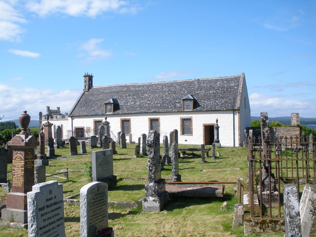
Edderton Cross Slab

Edderton Cross Slab is a Class III Pictish stone standing in the old graveyard of the village of Edderton, Easter Ross. The stone is of red sandstone...

Dornoch Firth Bridge

The Dornoch Firth Bridge is a road bridge over the Dornoch Firth, carrying traffic between Tain and Dornoch. == History == It was built for the Scottish...

Have you been to Edderton Sands?

Leave your review of Edderton Sands below (or comments, questions and feedback).