Woodybay Beach

Beach in Devon North Devon

England

Woodybay Beach

Lynton : Country Lane A small lane heads through the countryside.
Lynton : Country Lane Credit: Lewis Clarke

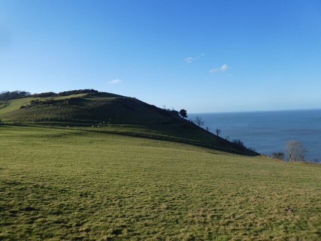
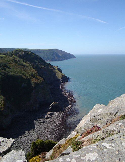
Woodybay Beach is a picturesque coastal gem located on the North Devon coastline in England. It is situated near the village of Parracombe, within the Exmoor National Park. This secluded beach offers visitors a serene and tranquil escape from the hustle and bustle of everyday life.

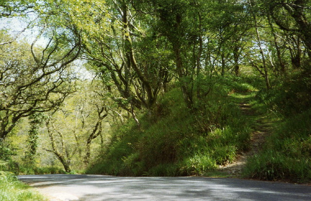
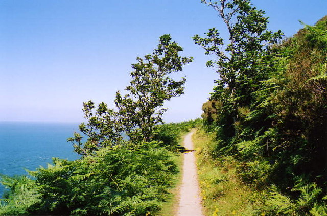
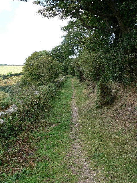
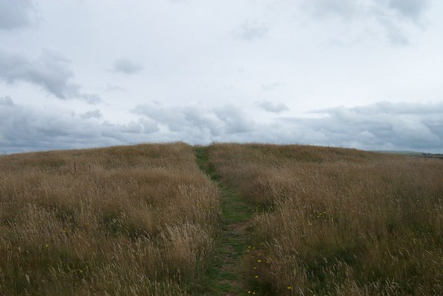
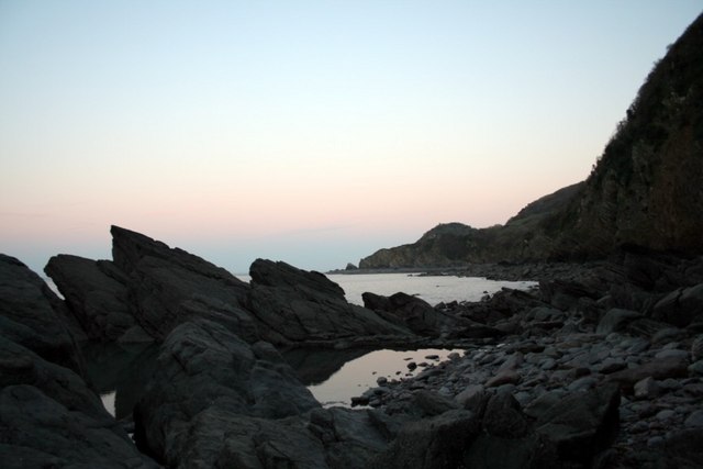
With its rugged cliffs, golden sands, and crystal-clear waters, Woodybay Beach is a haven for nature lovers and beach enthusiasts. The beach is accessible via a steep and winding path, adding to its secluded charm. It is advised to wear appropriate footwear and exercise caution while descending to the beach.

The beach is fairly small, measuring approximately 200 meters in length, but it offers breathtaking views of the surrounding cliffs and rolling hills. It is an ideal spot for picnicking, sunbathing, and exploring the diverse marine life in rock pools at low tide.

Woodybay Beach is popular among surfers, kayakers, and paddleboarders due to its consistent waves and calm waters. The beach is generally less crowded than other popular beaches in the area, making it a perfect retreat for those seeking solitude and tranquility.

There are limited facilities available at Woodybay Beach, including a small car park and toilets. Visitors are advised to bring their own food, water, and beach essentials as there are no nearby shops or cafes.

Overall, Woodybay Beach offers an idyllic coastal experience with its unspoiled beauty and peaceful ambiance. It is a hidden gem that showcases the natural splendor of the Devon coastline.

If you have any feedback on the listing, please let us know in the comments section below.

Woodybay Beach Images

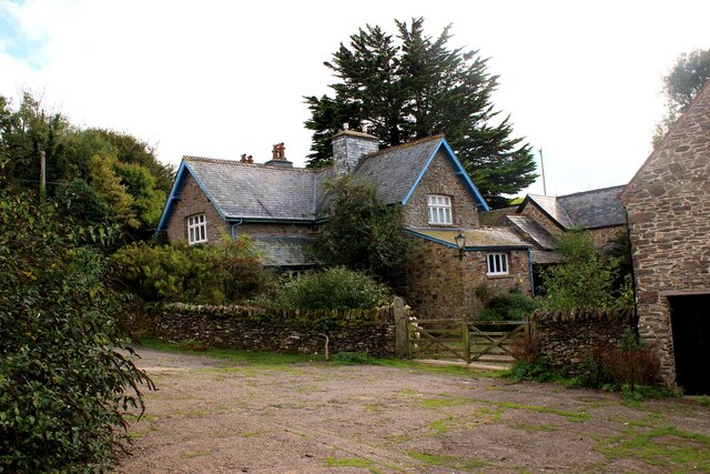
Images are sourced within 2km of 51.225269/-3.8891188 or Grid Reference SS6849. Thanks to Geograph Open Source API. All images are credited.

Lynton : Country Lane A small lane heads through the countryside.
Lynton : Country Lane
A small lane heads through the countryside.
Lynton : Grassy Field & Sheep The sheep have a view over the coastline.
Lynton : Grassy Field & Sheep
The sheep have a view over the coastline.
Sixacre Farm - the farmhouse Sixacre Farm or Six Acre Farm? The OS maps show the former, other sources the latter, but I'll go with the OS!
Sixacre Farm - the farmhouse
Sixacre Farm or Six Acre Farm? The OS maps show the former, other sources the latter, but I'll go with the OS!
Coast west of Wringcliff Bay
Martinhoe Church
Martinhoe Church
Lee Abbey
Lee Abbey
Martinhoe: the coast road above Woody Bay
Martinhoe: coast path The South West Coast Path near West Woody Bay Wood, between Heddon's Mouth and Woody Bay
Martinhoe: coast path
The South West Coast Path near West Woody Bay Wood, between Heddon's Mouth and Woody Bay
Footpath Between Six Acre Wood and Six Acre Farm Looking towards the wood.  Part of a loop walk via Lynton and the Valley of the Rocks.
Footpath Between Six Acre Wood and Six Acre Farm
Looking towards the wood. Part of a loop walk via Lynton and the Valley of the Rocks.
Martinhoe: limekiln at Woody Bay Limekiln above the beach. Limestone and culm burnt in the kiln were shipped across the Bristol Channel in sailing vessels from South Wales
Martinhoe: limekiln at Woody Bay
Limekiln above the beach. Limestone and culm burnt in the kiln were shipped across the Bristol Channel in sailing vessels from South Wales
Wringapeak A natural arch at the west end of Woody Bay. Taken from the Exmoor Coast Cruise boat.
Wringapeak
A natural arch at the west end of Woody Bay. Taken from the Exmoor Coast Cruise boat.
Martinhoe: towards Woolhanger Common Seen from Martinhoe Common Cross, looking south-south-east
Martinhoe: towards Woolhanger Common
Seen from Martinhoe Common Cross, looking south-south-east
Martinhoe: West Woodybay Wood Looking west-north-west on the lower coastal path from Woody Bay to The Hunters Inn
Martinhoe: West Woodybay Wood
Looking west-north-west on the lower coastal path from Woody Bay to The Hunters Inn
Roman Fort just off the coastal path A worthy short excursion off the coastal path, the views are spectacular from the top.
Roman Fort just off the coastal path
A worthy short excursion off the coastal path, the views are spectacular from the top.
Rockpools and Crock Point at Sunset
Lee Bay and Crock Point The sign in the field amused me. Crock Point is at the far end of Lee Bay, and Woody Bay is beyond it.
Lee Bay and Crock Point
The sign in the field amused me. Crock Point is at the far end of Lee Bay, and Woody Bay is beyond it.
Woody Bay Viewpoint This junction is some 150m above sea level overlooking Woody Bay, Bristol Channel.
Woody Bay Viewpoint
This junction is some 150m above sea level overlooking Woody Bay, Bristol Channel.
Woody Bay Viewpoint From Croscombe Lane at 280m above sea level, this view overlooks the Woody Bay with SS6848 in the far distance. Typical example of Devon walling.
Woody Bay Viewpoint
From Croscombe Lane at 280m above sea level, this view overlooks the Woody Bay with SS6848 in the far distance. Typical example of Devon walling.
Show me another place!

Woodybay Beach is located at Grid Ref: SS6849 (Lat: 51.225269, Lng: -3.8891188)

Administrative County: Devon

District: North Devon

Police Authority: Devon and Cornwall

What 3 Words

///ruffle.walked.natural. Near Lynton, Devon

Related Wikis

Woody Bay, Devon

Woody Bay is a bay on the North Devon coast of England, 3 miles (4.8 km) west of Lynton and 8 miles (13 km) east of Combe Martin with a stony beach. It...

Martinhoe

Martinhoe is a small settlement and civil parish in North Devon district of Devon, England. Martinhoe is within the Exmoor National Park, the smallest...

Lee Abbey

Lee Abbey, founded in 1946, is an ecumenical Christian community between Woody Bay and Lynmouth in Devon, England. It is a Grade II listed building. The...

Wringcliff Bay

Wringcliff Bay, also known as Wring Cliff Cove, is a bay on the Bristol Channel of northern Devon, England. It lies to the northwest of the village of...

Nearby Amenities

Located within 500m of 51.225269,-3.8891188
Source: PGS
Lat/Long: 51.2279469/-3.8839296
Source: PGS
Lat/Long: 51.227652/-3.884358
Source: PGS
Lat/Long: 51.2274527/-3.8848667
Source: PGS
Lat/Long: 51.2270059/-3.8851385
Source: PGS
Lat/Long: 51.2269602/-3.8850635
Source: PGS
Lat/Long: 51.2267711/-3.8854509
Source: PGS
Lat/Long: 51.2265298/-3.8860011
Source: PGS
Lat/Long: 51.2263373/-3.8865384
Source: PGS
Lat/Long: 51.2262091/-3.8870797
Source: PGS
Lat/Long: 51.2261416/-3.8874647
Source: PGS
Lat/Long: 51.2260805/-3.8881782
Source: PGS
Lat/Long: 51.2259092/-3.8888644
Source: PGS
Lat/Long: 51.2257992/-3.8893276
Source: PGS
Lat/Long: 51.2257851/-3.8896586
Source: PGS
Lat/Long: 51.2255248/-3.8898715
Source: PGS
Lat/Long: 51.2254508/-3.8901505
Source: PGS
Lat/Long: 51.2253188/-3.8906398
Source: PGS
Lat/Long: 51.2251996/-3.8910597
Source: PGS
Lat/Long: 51.224854/-3.8921059
Source: PGS
Lat/Long: 51.2247699/-3.8925608
Source: PGS
Lat/Long: 51.2246881/-3.8940375
Source: PGS
Lat/Long: 51.2247397/-3.8942764
Source: PGS
Lat/Long: 51.2248792/-3.8946314
Source: PGS
Lat/Long: 51.2253074/-3.8953164
Source: PGS
Lat/Long: 51.2255715/-3.8954768
Source: PGS
Lat/Long: 51.2256884/-3.8956861
Source: PGS
Lat/Long: 51.2259673/-3.8961842
Woody Bay
Natural: bay
Wikidata: Q8033631
Wikipedia: en:Woody Bay, Devon
Lat/Long: 51.2273149/-3.8937961
Bench
Material: wood
Lat/Long: 51.2232611/-3.8949513
Waterway: waterfall
Lat/Long: 51.2240778/-3.8953503
Source: PGS
Lat/Long: 51.2251108/-3.8950019
Source: PGS
Lat/Long: 51.2248792/-3.8946314
Post Box
Operator: Royal Mail
Post Box Type: wall
Ref: EX31 41
Lat/Long: 51.2226835/-3.8917297
The data included in this document is from www.openstreetmap.org. The data is made available under ODbL.

Have you been to Woodybay Beach?

Leave your review of Woodybay Beach below (or comments, questions and feedback).