Westcombe Beach

Beach in Devon South Hams

England

Westcombe Beach

Coast path above Fernycombe Beach Crossing a hanging combe above the cliffs shown in <a href="https://www.geograph.org.uk/photo/6997038">SX6146 : Cliffs, Fernycombe Beach</a>.
Coast path above Fernycombe Beach Credit: Derek Harper

Westcombe Beach is a picturesque coastal destination located in the county of Devon, England. Situated in the South West region of the country, it is a popular beach known for its natural beauty and tranquil atmosphere. The beach is easily accessible, with convenient parking facilities nearby.

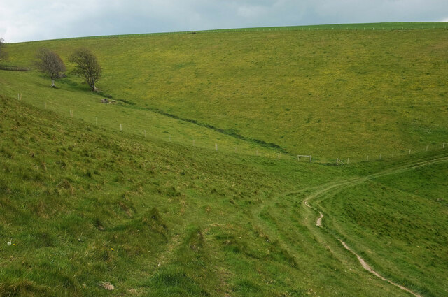
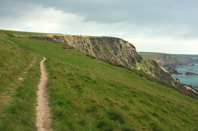
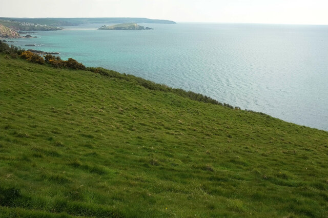
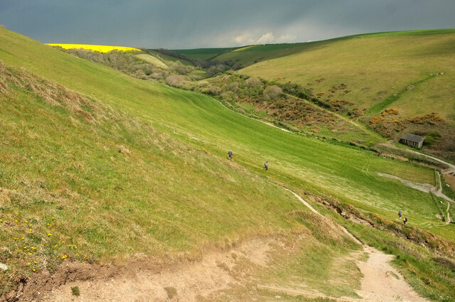
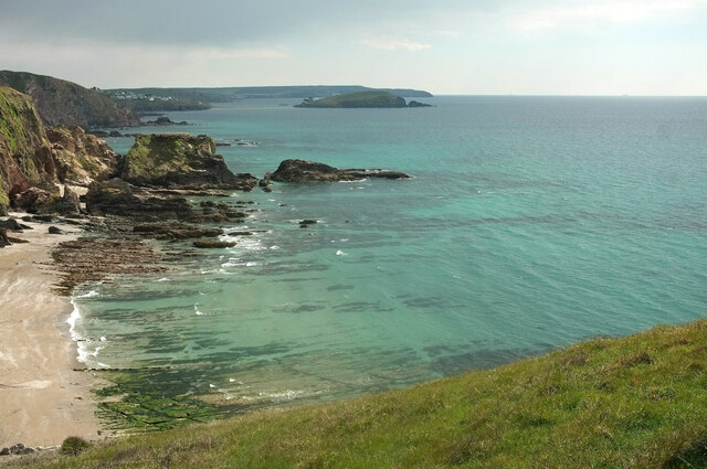
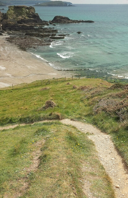
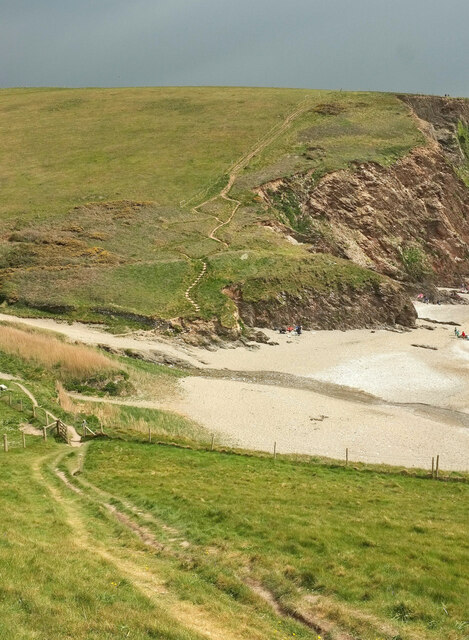
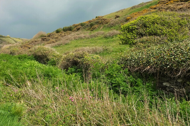
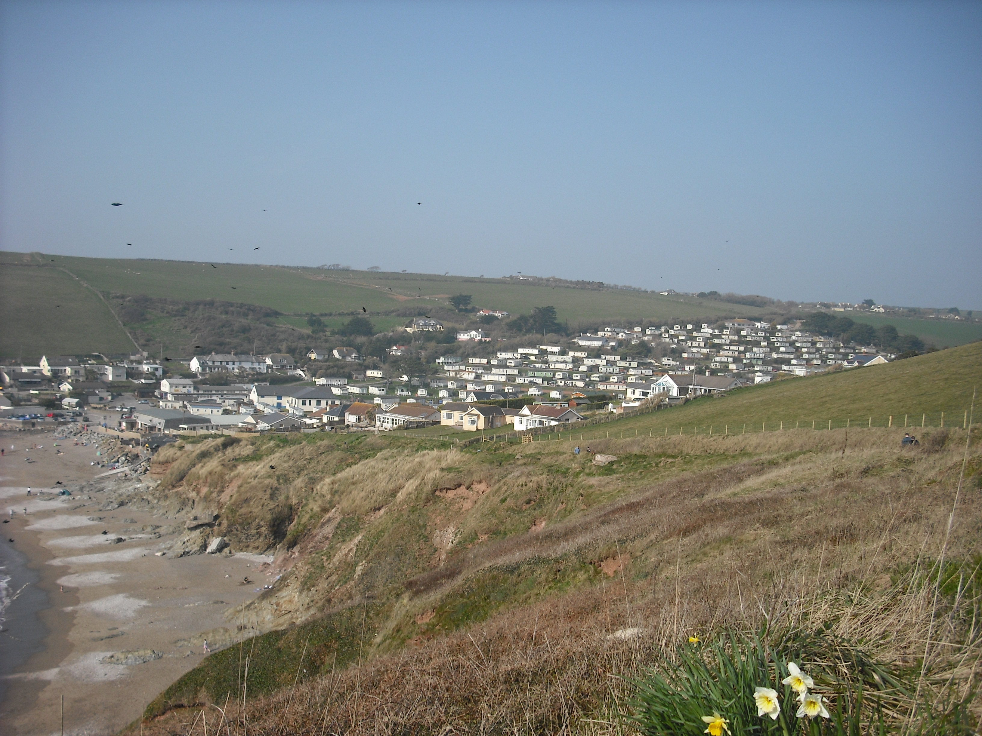
Westcombe Beach boasts a long stretch of golden sand, gently sloping into the crystal-clear waters of the English Channel. The beach is surrounded by rugged cliffs, providing a stunning backdrop and offering breathtaking views of the surrounding landscape. During low tide, a variety of rock pools are revealed, perfect for exploring and discovering fascinating marine life.

The beach is known for its cleanliness and has been awarded the prestigious Blue Flag status, ensuring visitors of its high environmental and water quality standards. It is a family-friendly destination, with lifeguards on duty during peak periods, ensuring the safety of swimmers and water sports enthusiasts.

Westcombe Beach offers a range of activities for visitors to enjoy. The calm waters are ideal for swimming, paddleboarding, and kayaking, while the sandy shore provides ample space for sunbathing and building sandcastles. The beach is also a popular spot for picnics and beach games, attracting locals and tourists alike.

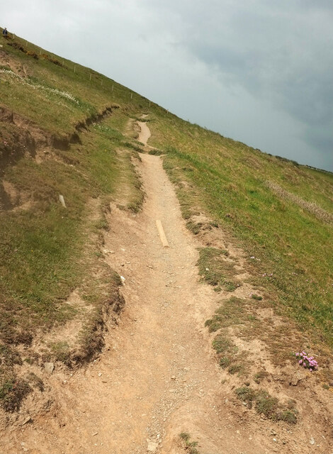
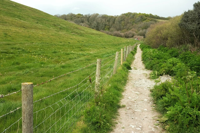
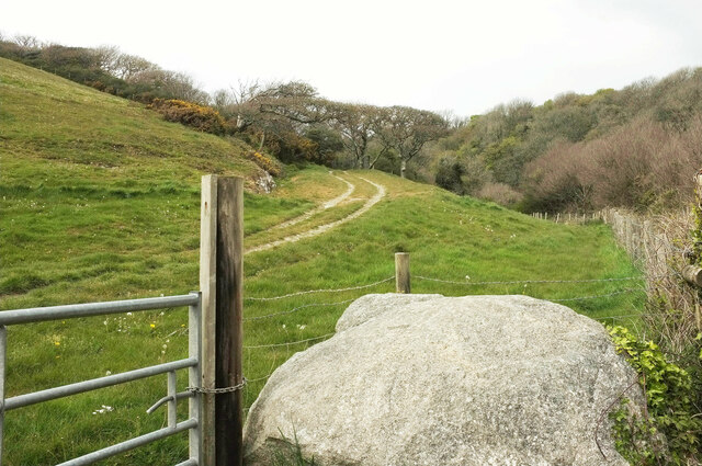
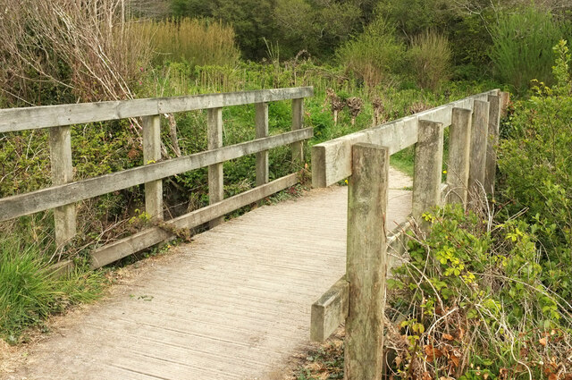
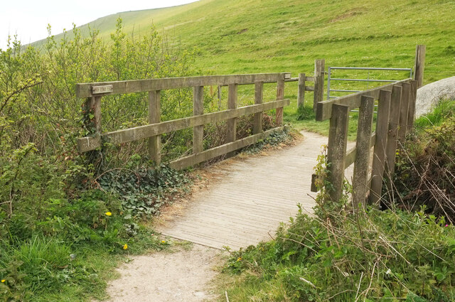
A coastal path runs along the cliffs, providing an opportunity for scenic walks and hikes, allowing visitors to explore the surrounding area and enjoy stunning panoramic views. Wildlife enthusiasts may also spot various seabirds and marine creatures during their visit.

With its natural beauty, cleanliness, and range of activities, Westcombe Beach is a must-visit destination for beach lovers and nature enthusiasts in Devon.

If you have any feedback on the listing, please let us know in the comments section below.

Westcombe Beach Images

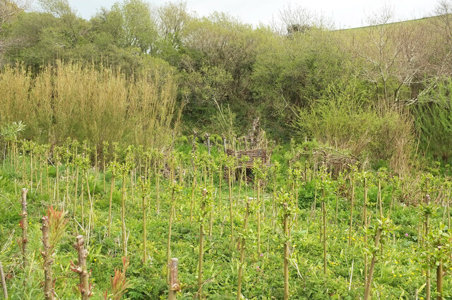
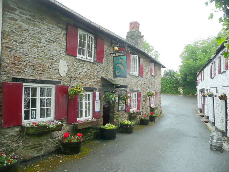
Images are sourced within 2km of 50.295961/-3.9172147 or Grid Reference SX6345. Thanks to Geograph Open Source API. All images are credited.

Coast path above Fernycombe Beach Crossing a hanging combe above the cliffs shown in <a href="https://www.geograph.org.uk/photo/6997038">SX6146 : Cliffs, Fernycombe Beach</a>.
Coast path above Fernycombe Beach
Crossing a hanging combe above the cliffs shown in SX6146 : Cliffs, Fernycombe Beach.
Grassland above Fernycombe Beach A fence parallels the cliff edge and the coast path.
Grassland above Fernycombe Beach
A fence parallels the cliff edge and the coast path.
Gorse near The Beacon Looking the other way from <a href="https://www.geograph.org.uk/photo/6997193">SX6146 : Grassland above Fernycombe Beach</a>, showing the coastline from Battisborough island to Stoke Point (left).
Gorse near The Beacon
Looking the other way from SX6146 : Grassland above Fernycombe Beach, showing the coastline from Battisborough island to Stoke Point (left).
Combe above Freshwater A somewhat less interesting picture than <a href="https://www.geograph.org.uk/photo/1511386">SX6246 : Combe above Freshwater</a>. Below the camera, the coast path follows Kingston footpath 8 across a hanging combe.
Combe above Freshwater
A somewhat less interesting picture than SX6246 : Combe above Freshwater. Below the camera, the coast path follows Kingston footpath 8 across a hanging combe.
Approaching Hoist Point The coast path follows Kingston footpath 8, with the cliff of Hoist Point ahead.
Approaching Hoist Point
The coast path follows Kingston footpath 8, with the cliff of Hoist Point ahead.
Grassland above Hoist Beach A view from the coast path across the sloping grassland, with Burgh Island prominent in the distance.
Grassland above Hoist Beach
A view from the coast path across the sloping grassland, with Burgh Island prominent in the distance.
Westcombe from the coast path Taken on the precipitous descent down Kingston footpath 8 from Hoist Point, looking up the valley, which is also Wiscombe, as it's Wiscombe Lane that climbs up it towards Kingston. But below me is Westcombe Beach.
Westcombe from the coast path
Taken on the precipitous descent down Kingston footpath 8 from Hoist Point, looking up the valley, which is also Wiscombe, as it's Wiscombe Lane that climbs up it towards Kingston. But below me is Westcombe Beach.
Coast path above Westcombe Beach Kingston footpath 8 climbs away from the bend where <a href="https://www.geograph.org.uk/photo/6830735">SX6345 : Rocks below Hoist Point</a> was taken.
Coast path above Westcombe Beach
Kingston footpath 8 climbs away from the bend where SX6345 : Rocks below Hoist Point was taken.
Rocks off Westcombe Beach A stack and reefs run out to sea between the beach and Aylmer Cove. In the background are Burgh Island and Bolt Tail.
Rocks off Westcombe Beach
A stack and reefs run out to sea between the beach and Aylmer Cove. In the background are Burgh Island and Bolt Tail.
Approaching Westcombe Beach The coast path, following Kingston footpath 8, twists down to the rear of the beach.
Approaching Westcombe Beach
The coast path, following Kingston footpath 8, twists down to the rear of the beach.
Coast path at Westcombe Beach Following Kingston Footpath 8 down to cross the stream, and then Ringmore Footpath 15 up steeply beyond it, as the parish boundary follows the stream.
Coast path at Westcombe Beach
Following Kingston Footpath 8 down to cross the stream, and then Ringmore Footpath 15 up steeply beyond it, as the parish boundary follows the stream.
Wiscombe Hedges and bushes on the lower valley side in the area shown in <a href="https://www.geograph.org.uk/photo/6997564">SX6345 : Westcombe from the coast path</a>.
Wiscombe
Hedges and bushes on the lower valley side in the area shown in SX6345 : Westcombe from the coast path.
Hemlock water dropwort, Wiscombe I could be mistaken, but this looks like Conium maculatum, possibly Britain's most poisonous plant, and very common in late spring in and around South Devon watercourses.
Hemlock water dropwort, Wiscombe
I could be mistaken, but this looks like Conium maculatum, possibly Britain's most poisonous plant, and very common in late spring in and around South Devon watercourses.
Footpath, Wiscombe Shown in <a href="https://www.geograph.org.uk/photo/1511844">SX6346 : Path up Westcombe</a>, where I have described it as a permissive path. It is now a fully-fledged public footpath, Kingston Footpath 10.
Footpath, Wiscombe
Shown in SX6346 : Path up Westcombe, where I have described it as a permissive path. It is now a fully-fledged public footpath, Kingston Footpath 10.
Track, Wiscombe A private track seen from Kingston Footpath 10. The track follows a western branch if the valley towards Scobbiscombe Farm; the public footpath keeps to the main Wiscombe valley.
Track, Wiscombe
A private track seen from Kingston Footpath 10. The track follows a western branch if the valley towards Scobbiscombe Farm; the public footpath keeps to the main Wiscombe valley.
Footbridge, Wiscombe Kingston Footpath 10 crosses the stream down Wiscombe. This looks right from <a href="https://www.geograph.org.uk/photo/6998149">SX6346 : Track, Wiscombe</a>. In the background is <a href="https://www.geograph.org.uk/photo/6825304">SX6346 : Willow plantation near Butts Brake</a>.
Footbridge, Wiscombe
Kingston Footpath 10 crosses the stream down Wiscombe. This looks right from SX6346 : Track, Wiscombe. In the background is SX6346 : Willow plantation near Butts Brake.
Footbridge, Wiscombe Seen in <a href="https://www.geograph.org.uk/photo/6998167">SX6346 : Footbridge, Wiscombe</a>, it carries Kingston Footpath 10 down towards Westcombe Beach. The boulder shown in <a href="https://www.geograph.org.uk/photo/6998149">SX6346 : Track, Wiscombe</a> can also be seen.
Footbridge, Wiscombe
Seen in SX6346 : Footbridge, Wiscombe, it carries Kingston Footpath 10 down towards Westcombe Beach. The boulder shown in SX6346 : Track, Wiscombe can also be seen.
Willow plantation, Wiscombe Also shown in <a href="https://www.geograph.org.uk/photo/6825304">SX6346 : Willow plantation near Butts Brake</a>.
Willow plantation, Wiscombe
Show me another place!

Westcombe Beach is located at Grid Ref: SX6345 (Lat: 50.295961, Lng: -3.9172147)

Administrative County: Devon

District: South Hams

Police Authority: Devon and Cornwall

What 3 Words

///skirt.grumbles.cuddled. Near Modbury, Devon

Related Wikis

Ringmore

Ringmore is a village and civil parish in the South Hams district, on the coast of Devon, England. The population taken at the 2011 census was 208. �...

Challaborough

Challaborough is a village and popular surfing beach in the District of South Hams on the south coast of Devon, England. The village is in the parish of...

Kingston, Devon

Kingston is civil parish and small scattered village in the South Hams, Devon, England. It is three miles south west of Modbury and about a mile from the...

Bigbury-on-Sea

Bigbury-on-Sea is a village in the South Hams district on the south coast of Devon, England. It is part of the civil parish of Bigbury which is centred...

Nearby Amenities

Located within 500m of 50.295961,-3.9172147
Source: PGS
Lat/Long: 50.2944205/-3.9122144
Bench
Backrest: no
Lat/Long: 50.2972972/-3.921565
Hoist Point
Place: locality
Source Name: OS OpenData StreetView
Lat/Long: 50.2973415/-3.9207029
Tourism: viewpoint
Lat/Long: 50.2971593/-3.9213929
Information: guidepost
Tourism: information
Lat/Long: 50.2951377/-3.9125639
Bench
Backrest: no
Lat/Long: 50.2950161/-3.9107774
The data included in this document is from www.openstreetmap.org. The data is made available under ODbL.

Have you been to Westcombe Beach?

Leave your review of Westcombe Beach below (or comments, questions and feedback).