Aberffraw Sands

Beach in Anglesey

Wales

Aberffraw Sands

St. Cwyfan’s Chapel, Anglesey St Cwyfan's Church is a Grade II listed medieval church in Anglesey, Wales. Located on the small tidal island. It is popularly known as the "Little Church in the Sea". The church dates from the 12th century, with some renovations made in the 19th century.

<span class="nowrap"><a title="https://en.wikipedia.org/wiki/St_Cwyfan%27s_Church,_Llangwyfan" rel="nofollow ugc noopener" href="https://en.wikipedia.org/wiki/St_Cwyfan%27s_Church,_Llangwyfan">Link</a><img style="margin-left:2px;" alt="External link" title="External link - shift click to open in new window" src="https://s1.geograph.org.uk/img/external.png" width="10" height="10"/></span>
St. Cwyfan’s Chapel, Anglesey Credit: Brian Deegan

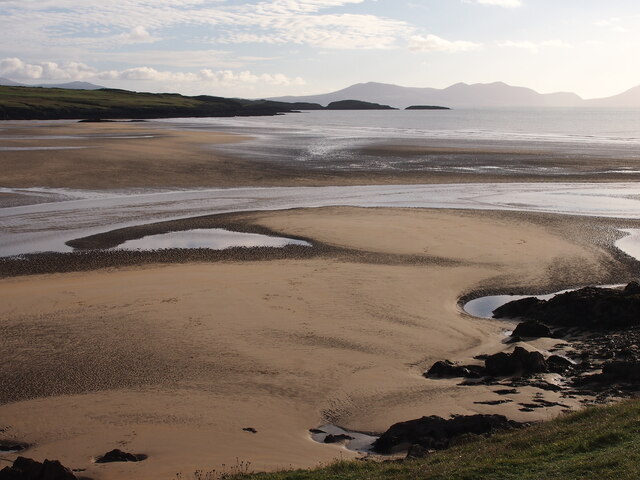
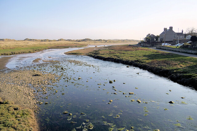
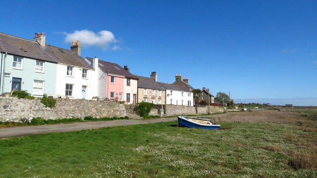
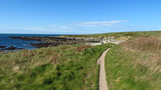
Aberffraw Sands is a stunning beach located on the southwest coast of Anglesey, a picturesque island in North Wales, United Kingdom. This golden sandy beach stretches for approximately 2 miles and is backed by rolling dunes, creating a serene and natural atmosphere.

The beach offers breathtaking views of the Irish Sea and is known for its untouched beauty. The crystal-clear waters are perfect for swimming, and the beach is also popular among water sports enthusiasts, especially for windsurfing and kiteboarding.

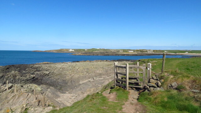
Aberffraw Sands is an area of Special Scientific Interest (SSSI) due to its rich wildlife and unique habitats. Visitors can spot a variety of bird species, including oystercatchers, curlews, and terns, making it a haven for birdwatchers. The dunes are also home to rare plants and insects, adding to the ecological importance of this beach.

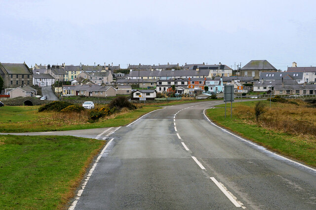
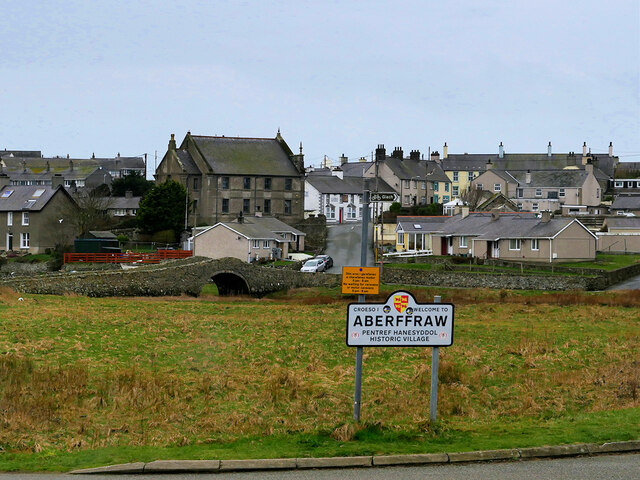
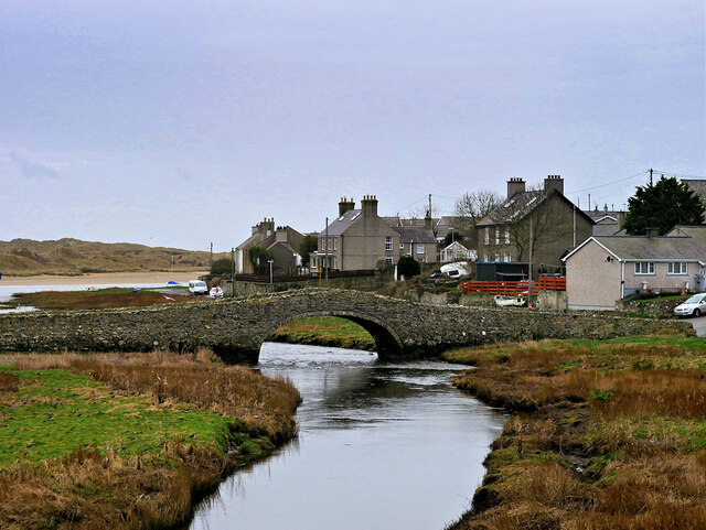
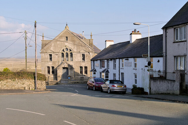
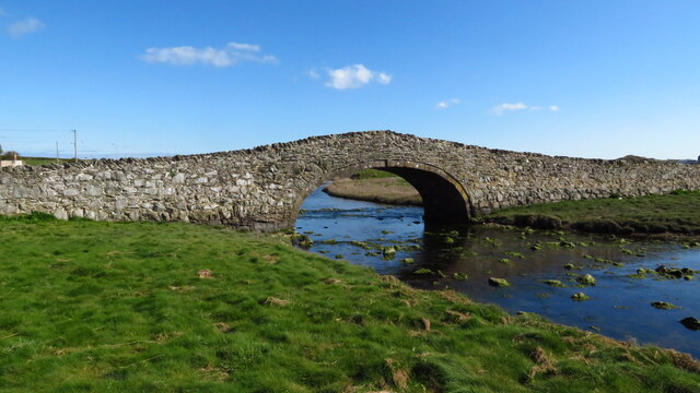
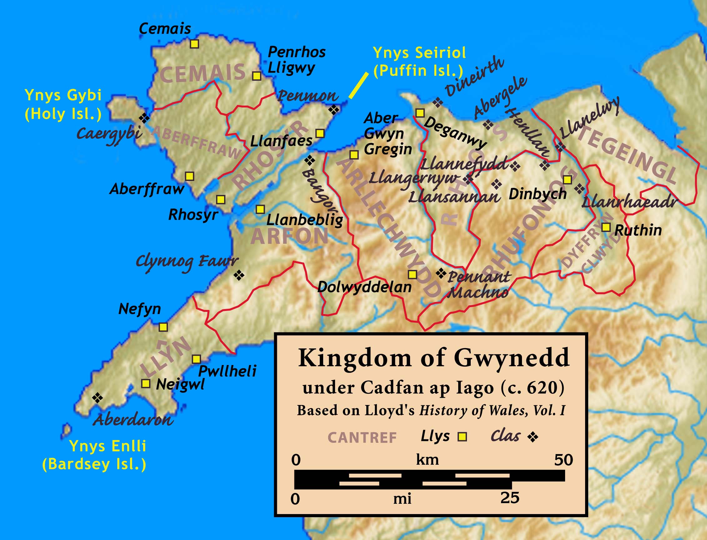
The village of Aberffraw itself is steeped in history and has a charming, traditional Welsh atmosphere. It was once the capital of the Kingdom of Gwynedd and is home to the remains of the 13th-century Aberffraw Castle. Visitors can explore the village, enjoy a stroll along the river, or indulge in local delicacies at the quaint cafes and pubs.

Aberffraw Sands offers ample parking facilities and is easily accessible for visitors of all ages. It provides a peaceful and idyllic setting for a relaxing day at the beach, surrounded by nature's beauty and the rich history of Anglesey.

If you have any feedback on the listing, please let us know in the comments section below.

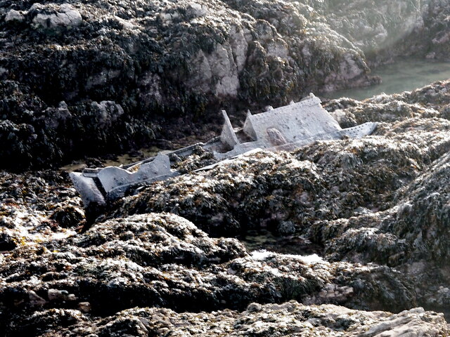
Aberffraw Sands Images

Images are sourced within 2km of 53.181709/-4.4630098 or Grid Reference SH3567. Thanks to Geograph Open Source API. All images are credited.

St. Cwyfan’s Chapel, Anglesey St Cwyfan's Church is a Grade II listed medieval church in Anglesey, Wales. Located on the small tidal island. It is popularly known as the "Little Church in the Sea". The church dates from the 12th century, with some renovations made in the 19th century.

<span class="nowrap"><a title="https://en.wikipedia.org/wiki/St_Cwyfan%27s_Church,_Llangwyfan" rel="nofollow ugc noopener" href="https://en.wikipedia.org/wiki/St_Cwyfan%27s_Church,_Llangwyfan">Link</a><img style="margin-left:2px;" alt="External link" title="External link - shift click to open in new window" src="https://s1.geograph.org.uk/img/external.png" width="10" height="10"/></span>
St. Cwyfan’s Chapel, Anglesey
St Cwyfan's Church is a Grade II listed medieval church in Anglesey, Wales. Located on the small tidal island. It is popularly known as the "Little Church in the Sea". The church dates from the 12th century, with some renovations made in the 19th century. LinkExternal link
Ship Wreckage, Porth Aels Possibly part of the steamer 'Kyle Prince' that sank on the 8th of October 1938.
Ship Wreckage, Porth Aels
Possibly part of the steamer 'Kyle Prince' that sank on the 8th of October 1938.
Traeth Mawr
Traeth Mawr
Cattle Grazing, Tywyn Aberffraw
Layby on the A4080 crossing Tywyn Aberffraw The A4080 road runs for 24½ miles along the southwestern side of Anglesey. It starts on the A5 at Llanfair Pwllgwyngyll and passes through several villages before terminating on the A5 between Bryngwran and Gwalchmai.
Layby on the A4080 crossing Tywyn Aberffraw
The A4080 road runs for 24½ miles along the southwestern side of Anglesey. It starts on the A5 at Llanfair Pwllgwyngyll and passes through several villages before terminating on the A5 between Bryngwran and Gwalchmai.
Approaching Aberffraw on the A4080 The A4080 road runs for 24½ miles along the southwestern side of Anglesey. It starts on the A5 at Llanfair Pwllgwyngyll and passes through several villages before terminating on the A5 between Bryngwran and Gwalchmai.
Approaching Aberffraw on the A4080
The A4080 road runs for 24½ miles along the southwestern side of Anglesey. It starts on the A5 at Llanfair Pwllgwyngyll and passes through several villages before terminating on the A5 between Bryngwran and Gwalchmai.
Aberffraw Aberffraw is a small village on the southwest coast of the Isle of Anglesey by the west bank of the Afon Ffraw. Access by road is by way of the A4080.
Aberffraw
Aberffraw is a small village on the southwest coast of the Isle of Anglesey by the west bank of the Afon Ffraw. Access by road is by way of the A4080.
Pont Aberffraw A single-span, hump-backed bridge of rubble masonry built in 1731 across Afon Ffraw. The bridge is now in use as a footbridge over the river having been closed to vehicular traffic when the new road bridge spanning the Afon Ffraw was built.

It is grade II-listed (Cadw reference 5258 <span class="nowrap"><a title="http://cadwpublic-api.azurewebsites.net/reports/listedbuilding/FullReport?lang=en&id=5259" rel="nofollow ugc noopener" href="http://cadwpublic-api.azurewebsites.net/reports/listedbuilding/FullReport?lang=en&id=5259">Link</a><img style="margin-left:2px;" alt="External link" title="External link - shift click to open in new window" src="https://s1.geograph.org.uk/img/external.png" width="10" height="10"/></span> ).
Pont Aberffraw
A single-span, hump-backed bridge of rubble masonry built in 1731 across Afon Ffraw. The bridge is now in use as a footbridge over the river having been closed to vehicular traffic when the new road bridge spanning the Afon Ffraw was built. It is grade II-listed (Cadw reference 5258 LinkExternal link ).
Pont Aberffraw A single-span, hump-backed bridge of rubble masonry constructed in 1731 across Afon Ffraw. The bridge is now in use as a footbridge over the river having been closed to vehicular traffic when the new road bridge spanning the Afon Ffraw was built.

It is grade II-listed (Cadw reference 5258 <span class="nowrap"><a title="http://cadwpublic-api.azurewebsites.net/reports/listedbuilding/FullReport?lang=en&id=5259" rel="nofollow ugc noopener" href="http://cadwpublic-api.azurewebsites.net/reports/listedbuilding/FullReport?lang=en&id=5259">Link</a><img style="margin-left:2px;" alt="External link" title="External link - shift click to open in new window" src="https://s1.geograph.org.uk/img/external.png" width="10" height="10"/></span> ).
Pont Aberffraw
A single-span, hump-backed bridge of rubble masonry constructed in 1731 across Afon Ffraw. The bridge is now in use as a footbridge over the river having been closed to vehicular traffic when the new road bridge spanning the Afon Ffraw was built. It is grade II-listed (Cadw reference 5258 LinkExternal link ).
Afon Ffraw at Aberffraw
Seion Methodist Chapel, Abberffraw Nineteenth century Methodist chapel. a slate plaque to the right of the entrance reads "Eglwys Fethodistaidd Seion 1887". Grade II listed building (Cadw reference 20964 <span class="nowrap"><a title="https://cadwpublic-api.azurewebsites.net/reports/listedbuilding/FullReport?lang=en&id=20964" rel="nofollow ugc noopener" href="https://cadwpublic-api.azurewebsites.net/reports/listedbuilding/FullReport?lang=en&id=20964">Link</a><img style="margin-left:2px;" alt="External link" title="External link - shift click to open in new window" src="https://s1.geograph.org.uk/img/external.png" width="10" height="10"/></span> ).
Seion Methodist Chapel, Abberffraw
Nineteenth century Methodist chapel. a slate plaque to the right of the entrance reads "Eglwys Fethodistaidd Seion 1887". Grade II listed building (Cadw reference 20964 LinkExternal link ).
Minor road near Aberffraw
Aberffraw Old Bridge
Aberffraw - riverside cottages
The mouth of the Afon Ffraw & Aberffraw Sands
Coastal path at Porth Lleidiog near Aberffraw
On the coast path approaching Porth Cwyfan
St Cwyfan's Church near Aberffraw
Show me another place!

Aberffraw Sands is located at Grid Ref: SH3567 (Lat: 53.181709, Lng: -4.4630098)

Unitary Authority: Isle of Anglesey

Police Authority: North Wales

What 3 Words

///risking.kiosk.producing. Near Rhosneigr, Isle of Anglesey

Related Wikis

Aberffraw

Aberffraw is a village and community on the south west coast of the Isle of Anglesey in Wales. The village is 9 miles from the island's capital, Llangefni...

St Beuno's Church, Aberffraw

St Beuno's Church, Aberffraw is a 12th-century parish church in Anglesey, north Wales. A church was established in Aberffraw in the 7th century by St Beuno...

Aberffraw (cantref)

Aberffraw was one of the three medieval cantrefs on the island of Anglesey, north Wales, in the Kingdom of Gwynedd as a cadet branch, named the House of...

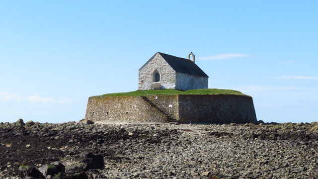
St Cwyfan's Church, Llangwyfan

St Cwyfan's Church (Welsh: Eglwys Cwyfan) is a Grade II*-listed medieval church in Llangadwaladr, Anglesey, Wales. Located on the small tidal island of...

Nearby Amenities

Located within 500m of 53.181709,-4.4630098
Created By: dmgroom_coastlines
Source: PGS
Lat/Long: 53.1797228/-4.4576157
Barrier: kissing_gate
Lat/Long: 53.184278/-4.467625
Source: PGS
Lat/Long: 53.1813213/-4.4703573
Bench
Note: Stone Seat
Lat/Long: 53.1828977/-4.4675461
The data included in this document is from www.openstreetmap.org. The data is made available under ODbL.

Have you been to Aberffraw Sands?

Leave your review of Aberffraw Sands below (or comments, questions and feedback).