Mol a Bhuailt

Beach in Sutherland

Scotland

Mol a Bhuailt

Houses at Achriesgill Achriesgill is a scattered settlement, presumably once a crofting community, alongside the B801 to the north of Loch Inchard.
Houses at Achriesgill Credit: Trevor Littlewood

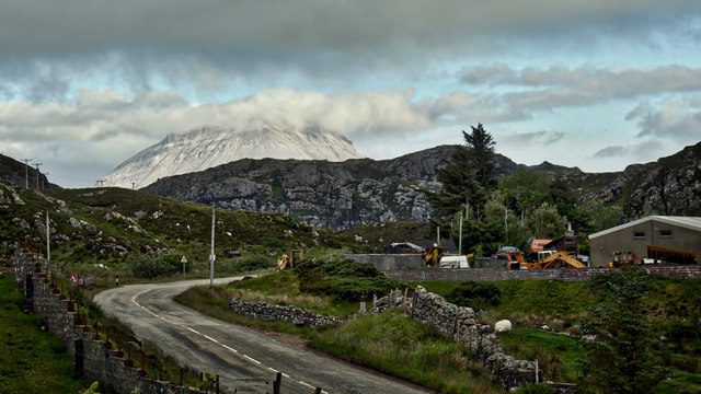
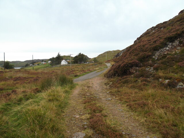
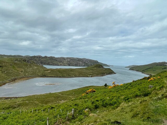
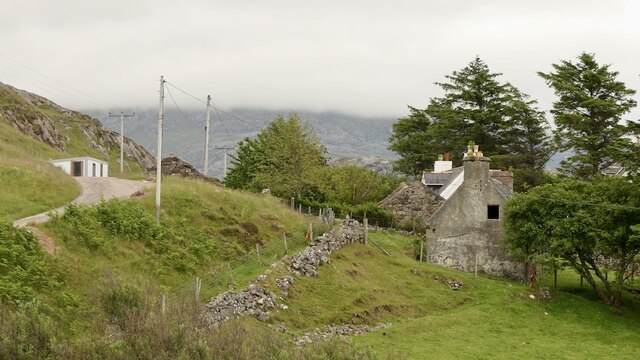
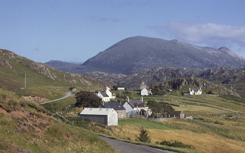
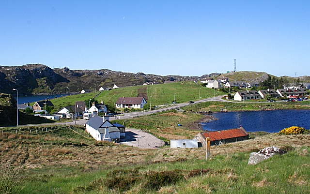
Mol a Bhuailt Beach, located in Sutherland, Scotland, is a picturesque coastal destination known for its natural beauty and tranquility. Situated on the North Sea coast, this beach stretches over a mile long and provides breathtaking views of the surrounding rugged cliffs and rolling hills. Its remote location offers visitors a sense of seclusion and escape from the hustle and bustle of everyday life.

The beach is characterized by its golden sandy shores, which are perfect for long walks, sunbathing, and picnics. The crystal-clear waters are relatively calm, making it a popular spot for swimming and paddling, especially during the warmer summer months. The beach also benefits from having a lifeguard on duty, ensuring the safety of visitors.

Nature enthusiasts will appreciate the diverse wildlife that can be spotted in and around Mol a Bhuailt Beach. Seals, dolphins, and various seabirds are often seen in the area, providing a unique opportunity for wildlife observation and photography.

The beach is easily accessible by car, with a nearby car park available for visitors. Facilities such as public toilets and a café can be found nearby, providing convenience for visitors during their beach excursion.

Overall, Mol a Bhuailt Beach offers a serene and unspoiled coastal experience, making it an ideal destination for those seeking peace and tranquility amidst the stunning natural beauty of Sutherland, Scotland.

If you have any feedback on the listing, please let us know in the comments section below.

Mol a Bhuailt Images

Images are sourced within 2km of 58.448054/-5.0169773 or Grid Reference NC2455. Thanks to Geograph Open Source API. All images are credited.

Houses at Achriesgill Achriesgill is a scattered settlement, presumably once a crofting community, alongside the B801 to the north of Loch Inchard.
Houses at Achriesgill
Achriesgill is a scattered settlement, presumably once a crofting community, alongside the B801 to the north of Loch Inchard.
War memorial, Kinlochbervie Kinlochbervie's war memorial is located above the southern end of Loch Innis na Bà Buidhe; the hills in the distance rise above the west shore of that loch.
War memorial, Kinlochbervie
Kinlochbervie's war memorial is located above the southern end of Loch Innis na Bà Buidhe; the hills in the distance rise above the west shore of that loch.
Kinlochbervie War Memorial
Loch Sheigra in summer
Loch Sheigra and Loch Inchard
Foinaven from Inshegra An overcast, rather dull evening but late on the clouds broke over Foinaven shining white with its covering of quartzite rock and boulders. Shame about the ubiquitous graveyard for redundant motor vehicles in the foreground. Foinaven is, of course, with its neighbour Arkle, famous after the pair of eponymous racehorses from the stable of the Duchess of Westminster in the 1960s.

From my photo-diary for 26 June 2019 see <span class="nowrap"><a title="http://www.fhithich.uk/?p=21311" rel="nofollow ugc noopener" href="http://www.fhithich.uk/?p=21311">Link</a><img style="margin-left:2px;" alt="External link" title="External link - shift click to open in new window" src="https://s1.geograph.org.uk/img/external.png" width="10" height="10"/></span>
Foinaven from Inshegra
An overcast, rather dull evening but late on the clouds broke over Foinaven shining white with its covering of quartzite rock and boulders. Shame about the ubiquitous graveyard for redundant motor vehicles in the foreground. Foinaven is, of course, with its neighbour Arkle, famous after the pair of eponymous racehorses from the stable of the Duchess of Westminster in the 1960s. From my photo-diary for 26 June 2019 see LinkExternal link
Path at Achriesgill East
Ruin by Loch Inchard
Summit of Cnoc Garbh
Old bridge over Achriesgill Water
Looking west to Cnoc an Leathaid Bhàin
Ancient fence across the moor
Loch Sheigra
Loch Sheigra
Achriesgill Bay A small bay to the east of Loch Inchard
Achriesgill Bay
A small bay to the east of Loch Inchard
Achriesgill Beside Loch Inchard on the road to Kinlochbervie.
Achriesgill
Beside Loch Inchard on the road to Kinlochbervie.
B801, Achriesgill Lewisian gneiss crags in the background.
B801, Achriesgill
Lewisian gneiss crags in the background.
Head of Loch Sheigra
Cafe, Inshegra In an old school building. At the time there was outdoor seating only.
Cafe, Inshegra
In an old school building. At the time there was outdoor seating only.
Show me another place!

Mol a Bhuailt is located at Grid Ref: NC2455 (Lat: 58.448054, Lng: -5.0169773)

Unitary Authority: Highland

Police Authority: Highlands and Islands

What 3 Words

///scorpions.charts.fries. Near Oldshoremore, Highland

Related Wikis

Inshegra

Inshegra is a small crofting village, located two miles south east of Badcall and lies at the south east coast of Loch Inchard, in Lairg, Sutherland,...

Badcall, Rhiconich

Badcall is a remote crofting township, located on the northern shore of the sea loch, Loch Inchard, in Sutherland, Scottish Highlands and is in the Scottish...

Achriesgill

Achriesgill (Scottish Gaelic: Achadh Rìdhisgil) is a village that lies on the eastern bank of Loch Inchard in Lairg, Sutherland, in the Scottish council...

Kinlochbervie High School

Kinlochbervie High School (Scottish Gaelic: Ard Sgoil Cheann Loch Biorbhaidh) is a secondary school in Kinlochbervie, in the county of Sutherland in the...

Kinlochbervie

Kinlochbervie (Scottish Gaelic: Ceann Loch Biorbhaidh, IPA: [ˈkʲʰaun̪ˠˈɫ̪ɔxˈpiɾivɪ]) is a scattered harbour village in the north west of Sutherland, in...

Achlyness

Achlyness (Scottish Gaelic:Achadh Linn an Eas) is a crofting hamlet on the shores of Loch Inchard, located near Rhiconich, Sutherland, Scotland, within...

Rhiconich

Rhiconich is a remote hamlet, located at the head of Loch Inchard, in Sutherland, Scottish Highlands in the Scottish council area of Highland. Rhiconich...

Oldshoremore

Oldshoremore is a scattered crofting hamlet in the Eddrachillis parish of Sutherland, Scotland. It incorporates around twenty houses, though several of...

Nearby Amenities

Located within 500m of 58.448054,-5.0169773
Source: PGS
Lat/Long: 58.4524541/-5.0161532
Source: PGS
Lat/Long: 58.4522219/-5.0153182
Source: PGS
Lat/Long: 58.4520791/-5.0146631
Source: PGS
Lat/Long: 58.4518458/-5.0138773
Source: PGS
Lat/Long: 58.4515841/-5.0130658
Source: PGS
Lat/Long: 58.4512769/-5.012515
Source: PGS
Lat/Long: 58.451042/-5.0116658
Source: PGS
Lat/Long: 58.450272/-5.0135417
Source: PGS
Lat/Long: 58.4502923/-5.0139527
Source: PGS
Lat/Long: 58.4505147/-5.0144378
Source: PGS
Lat/Long: 58.4505821/-5.0150713
Source: PGS
Lat/Long: 58.4507826/-5.0161955
Source: PGS
Lat/Long: 58.4510047/-5.0172475
Source: PGS
Lat/Long: 58.4510684/-5.0179509
Source: PGS
Lat/Long: 58.4511439/-5.0187332
Source: PGS
Lat/Long: 58.4508259/-5.0199182
Created By: almien_coastlines
Source: PGS
Lat/Long: 58.45042/-5.019751
Source: PGS
Lat/Long: 58.4502974/-5.0197337
Source: PGS
Lat/Long: 58.4498725/-5.0192066
Created By: almien_coastlines
Source: PGS
Lat/Long: 58.449667/-5.018731
Created By: almien_coastlines
Source: PGS
Lat/Long: 58.449543/-5.018479
Created By: almien_coastlines
Source: PGS
Lat/Long: 58.449419/-5.018228
Created By: almien_coastlines
Source: PGS
Lat/Long: 58.449295/-5.017976
Created By: almien_coastlines
Source: PGS
Lat/Long: 58.449171/-5.017726
Source: PGS
Lat/Long: 58.4479746/-5.0166962
Source: PGS
Lat/Long: 58.4479201/-5.0175571
Source: PGS
Lat/Long: 58.4477229/-5.0180896
Source: PGS
Lat/Long: 58.4472695/-5.0183839
Source: PGS
Lat/Long: 58.4468193/-5.018133
Created By: almien_coastlines
Source: PGS
Lat/Long: 58.446737/-5.01783
Created By: almien_coastlines
Source: PGS
Lat/Long: 58.446613/-5.017579
Created By: almien_coastlines
Source: PGS
Lat/Long: 58.446489/-5.017327
Source: PGS
Lat/Long: 58.4464093/-5.0171083
Source: PGS
Lat/Long: 58.445693/-5.0159487
Source: PGS
Lat/Long: 58.4455163/-5.0158368
Source: PGS
Lat/Long: 58.4454617/-5.0159075
Source: PGS
Lat/Long: 58.4453067/-5.0157924
Source: PGS
Lat/Long: 58.4451003/-5.0155997
Source: PGS
Lat/Long: 58.444964/-5.0151633
Created By: almien_coastlines
Source: PGS
Lat/Long: 58.444503/-5.013306
The data included in this document is from www.openstreetmap.org. The data is made available under ODbL.

Have you been to Mol a Bhuailt?

Leave your review of Mol a Bhuailt below (or comments, questions and feedback).