Rusey Beach

Beach in Cornwall

England

Rusey Beach

Cliff top above Saddle Rock The grass-topped stack in the centre is Gull Rock and the headland in the middle distance is Cambeak.
Cliff top above Saddle Rock Credit: David Martin

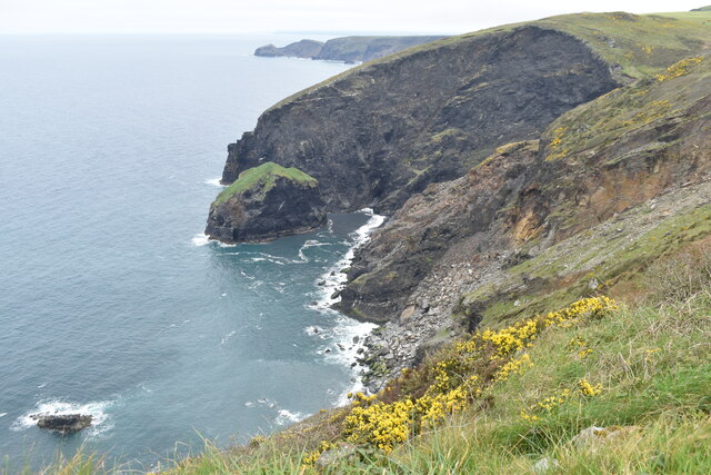
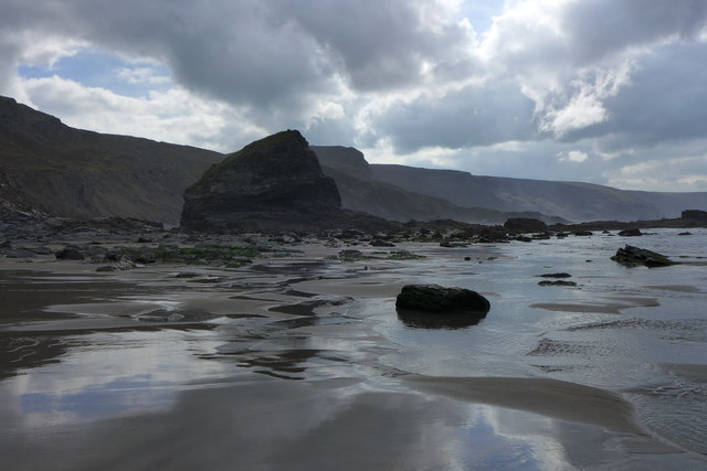
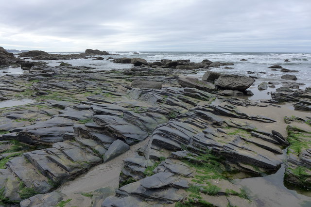
Rusey Beach is a picturesque sandy beach located on the north coast of Cornwall, England. Situated between the popular towns of Bude and Crackington Haven, Rusey Beach is a hidden gem known for its natural beauty and tranquility.

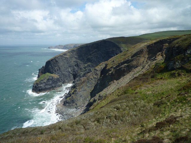
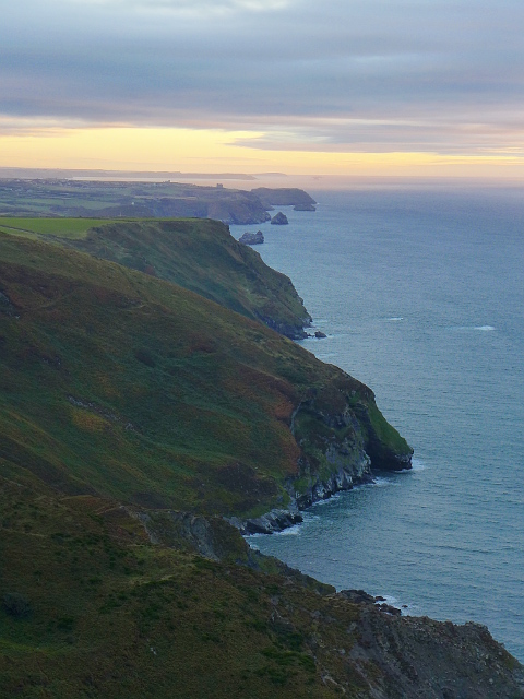
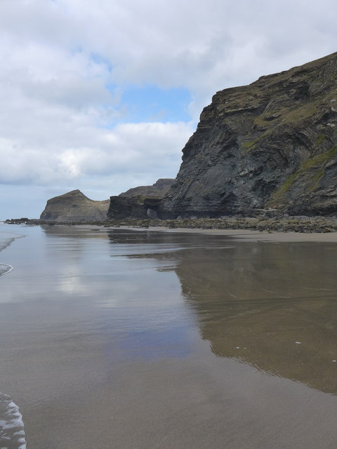
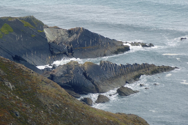
Measuring approximately 300 meters in length, the beach is backed by towering cliffs, which provide a stunning backdrop and offer a sense of seclusion. The sand at Rusey Beach is golden and soft, making it an ideal spot for sunbathing, picnicking, or building sandcastles.

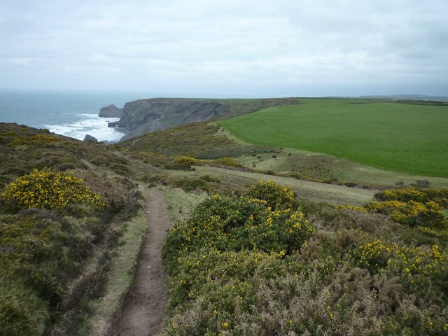
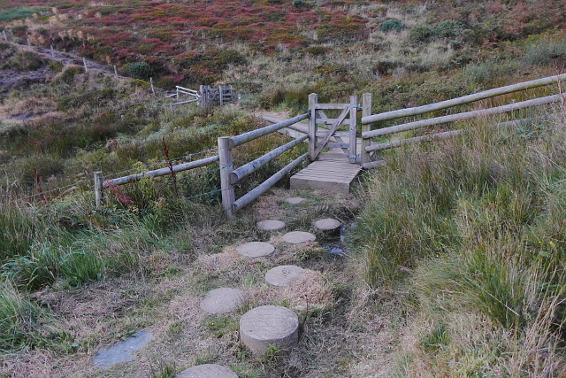
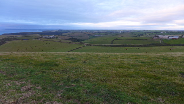
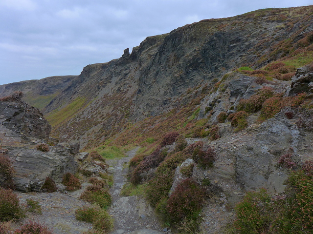
The beach is accessible via a narrow footpath, which winds its way down from the cliff top, adding to the sense of adventure and exclusivity. The path can be steep in places and may not be suitable for those with mobility issues.

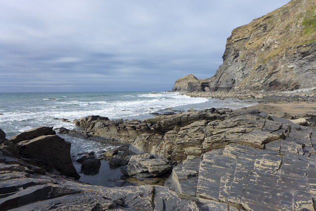
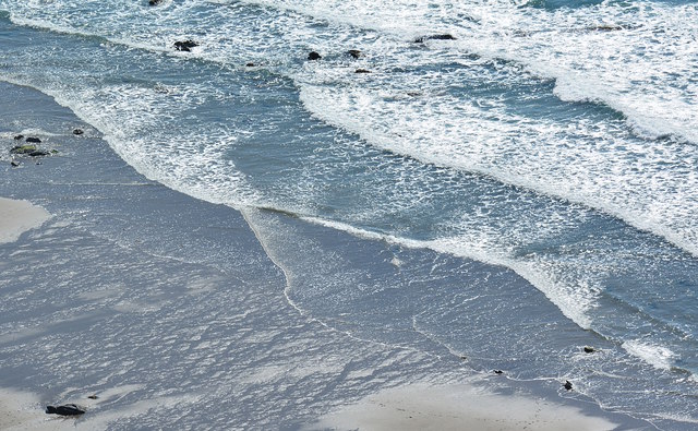
Rusey Beach is renowned for its excellent surfing conditions, attracting wave enthusiasts from near and far. The powerful Atlantic swells create consistent breaks that are suitable for both beginners and experienced surfers. However, caution should be exercised, as the beach is not patrolled by lifeguards.

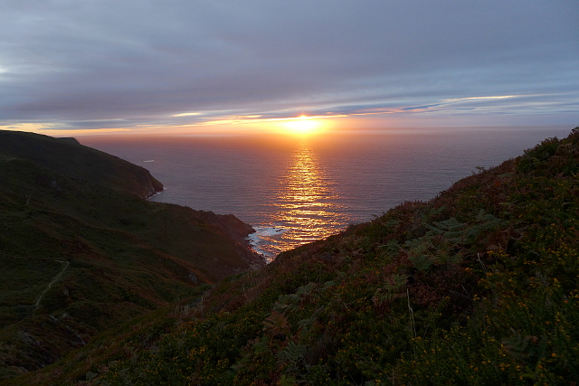
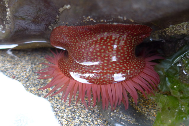
The beach is surrounded by unspoiled natural beauty, with the cliffs providing a habitat for various seabirds, including gulls and fulmars. Visitors may be lucky enough to spot dolphins or seals playing in the surrounding waters.

Facilities at Rusey Beach are limited, with no shops or cafes in the immediate vicinity. It is advisable to bring along all necessary supplies, including food and drinks. Parking is also limited, and it is recommended to arrive early to secure a spot.

If you have any feedback on the listing, please let us know in the comments section below.

Rusey Beach Images

Images are sourced within 2km of 50.715677/-4.6562115 or Grid Reference SX1294. Thanks to Geograph Open Source API. All images are credited.

Cliff top above Saddle Rock The grass-topped stack in the centre is Gull Rock and the headland in the middle distance is Cambeak.
Cliff top above Saddle Rock
The grass-topped stack in the centre is Gull Rock and the headland in the middle distance is Cambeak.
Cliffs above Gull Rock Gull Rock is the grass-topped stack just left of centre.
Cliffs above Gull Rock
Gull Rock is the grass-topped stack just left of centre.
Buckator and Gull Rock
Descent to Little Strand
Looking to Newton From the parking by Newton Farm looking to Newton
Looking to Newton
From the parking by Newton Farm looking to Newton
Evening on the coastal path near Beeny
South West Coast Path near Rusey Beach
Sunset near Rusey Beach Taken from the South West Coast Path.
Sunset near Rusey Beach
Taken from the South West Coast Path.
Dusk at the coastal path near Rusey Beach View over Buckator to Tintagel. Rumps Point (Polzeath) and Trevose Head (Constantine Bay) can be seen in the distance.
Dusk at the coastal path near Rusey Beach
View over Buckator to Tintagel. Rumps Point (Polzeath) and Trevose Head (Constantine Bay) can be seen in the distance.
Samphire Rock from Little Strand
Rocks at Little Strand
Little Strand View to the Northern Door.
Little Strand
View to the Northern Door.
Farmland near Pengold Farm
Rocks on the way from the Strangles to Little Strand The Northern Door can be seen in the distance.
Rocks on the way from the Strangles to Little Strand
The Northern Door can be seen in the distance.
Beach life at Little Strand A Strawberry anemone (actinia fragacea) at low tide.
Beach life at Little Strand
A Strawberry anemone (actinia fragacea) at low tide.
Voter Run With a very strange stripe pattern.
Voter Run
With a very strange stripe pattern.
Path to the Strangles
The beach at The Strangles, near Trevigue, North Cornwall Taken from the coast path.
The beach at The Strangles, near Trevigue, North Cornwall
Taken from the coast path.
Show me another place!

Rusey Beach is located at Grid Ref: SX1294 (Lat: 50.715677, Lng: -4.6562115)

Unitary Authority: Cornwall

Police Authority: Devon and Cornwall

What 3 Words

///fists.trousers.toffee. Near Jacobstow, Cornwall

Related Wikis

Pengold

Pengold is a hamlet near St Gennys in Cornwall, England, UK. Pengold is southwest of Higher Crackington. == References ==

St Juliot

St Juliot is a civil parish in north-east Cornwall, England, United Kingdom. The parish is entirely rural and the settlements within it are the hamlets...

Beeny

Beeny is a hamlet in north Cornwall, England, UK. It is in a sheltered valley near the coast two miles (3 km) north-east of Boscastle. == Literary allusions... ==

Tresparrett Posts

Tresparrett Posts is a hamlet in the civil parish of St Gennys in north Cornwall, England, United Kingdom. == References ==

Nearby Amenities

Located within 500m of 50.715677,-4.6562115
Source: PGS
Lat/Long: 50.7199996/-4.6546096
Source: PGS
Lat/Long: 50.7188544/-4.6547745
Source: PGS
Lat/Long: 50.7178426/-4.6546777
Source: PGS
Lat/Long: 50.7167421/-4.65469
Source: PGS
Lat/Long: 50.7158286/-4.6551302
Source: PGS
Lat/Long: 50.7155991/-4.6553208
Source: PGS
Lat/Long: 50.7154037/-4.6552018
Source: PGS
Lat/Long: 50.7151669/-4.6556778
Source: PGS
Lat/Long: 50.7149782/-4.6559405
Source: PGS
Lat/Long: 50.7152033/-4.6567726
Source: PGS
Lat/Long: 50.7151287/-4.6575896
Source: PGS
Lat/Long: 50.7149244/-4.6581947
Source: PGS
Lat/Long: 50.7146496/-4.6587311
Source: PGS
Lat/Long: 50.714925/-4.6597516
Source: PGS
Lat/Long: 50.7148112/-4.6601506
Source: PGS
Lat/Long: 50.713976/-4.658718
Source: PGS
Lat/Long: 50.7134374/-4.6593669
Source: PGS
Lat/Long: 50.7133192/-4.6598014
Source: PGS
Lat/Long: 50.7135182/-4.6608559
Source: PGS
Lat/Long: 50.712867/-4.6605275
Source: PGS
Lat/Long: 50.7126453/-4.6606923
Source: PGS
Lat/Long: 50.7126039/-4.6611773
High Cliff
Ele: 223
Natural: peak
Lat/Long: 50.7176619/-4.6503917
Rusey Beach
Place: locality
Lat/Long: 50.7170883/-4.6542659
Bench
Backrest: no
Lat/Long: 50.7177005/-4.6503526
Bench
Backrest: no
Survey Date: 2022-12-17
Lat/Long: 50.7115715/-4.6561862
Barrier: kissing_gate
Lat/Long: 50.7113524/-4.6565452
Barrier: kissing_gate
Lat/Long: 50.71675/-4.650513
The data included in this document is from www.openstreetmap.org. The data is made available under ODbL.

Have you been to Rusey Beach?

Leave your review of Rusey Beach below (or comments, questions and feedback).