Pentreath Beach

Beach in Cornwall

England

Pentreath Beach

Kynance Cove beach
Kynance Cove beach Credit: Tom Page

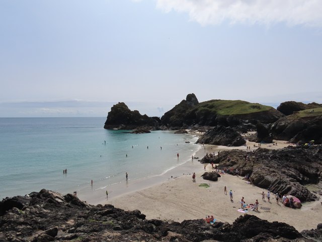
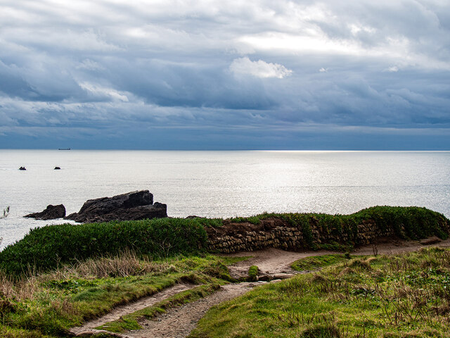
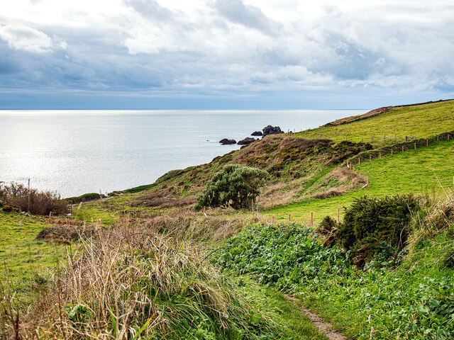
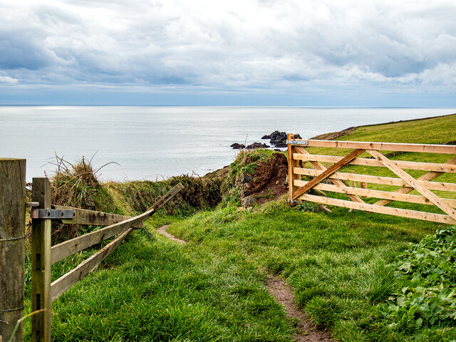
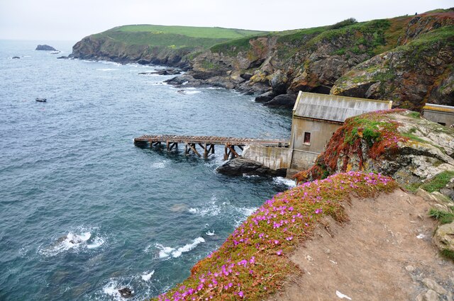
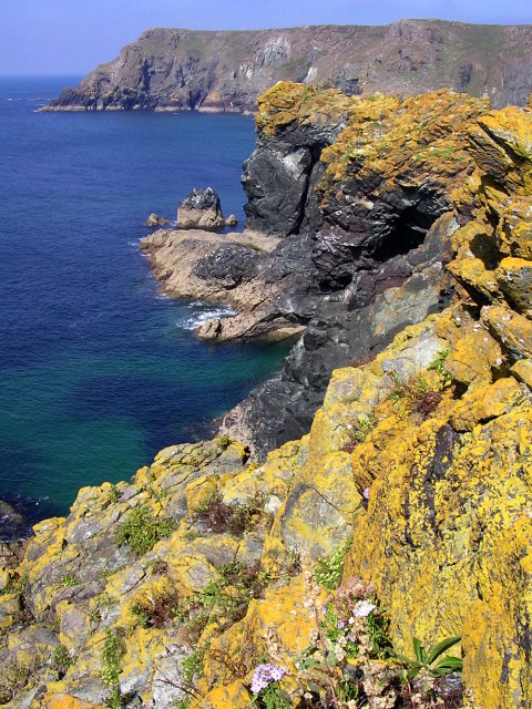
Pentreath Beach is a picturesque, secluded beach located on the southern coast of Cornwall, England. Situated in the parish of St Buryan, this hidden gem is nestled between rugged cliffs and offers stunning panoramic views of the Atlantic Ocean.

The beach itself is relatively small, with golden sands that stretch for around 200 meters at low tide. It is known for its tranquility and natural beauty, attracting visitors seeking a peaceful and relaxing seaside experience. Due to its remote location, Pentreath Beach remains relatively untouched, with little commercial development or facilities available.

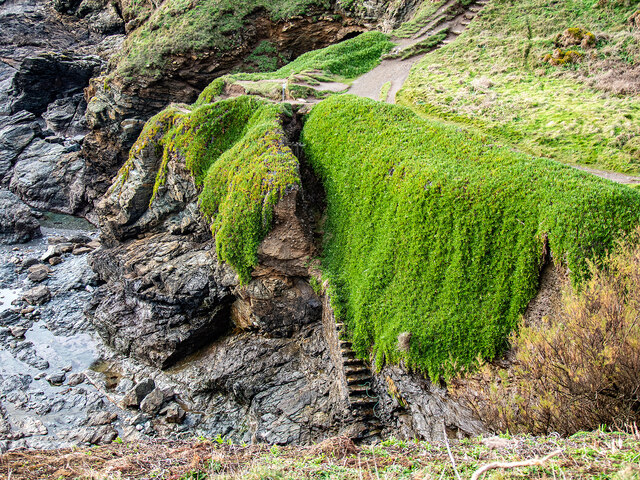
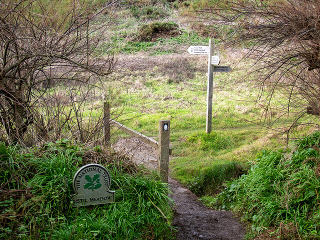
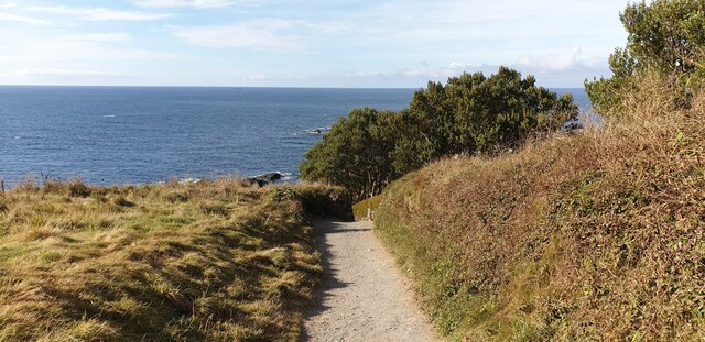
Access to the beach is restricted to a steep and narrow footpath, making it unsuitable for those with mobility issues or young children. However, the challenging journey is rewarded with a secluded and unspoiled coastal haven. The beach is also accessible by boat, and many visitors choose to explore the area by sea.

Pentreath Beach is a popular spot for swimming, although caution is advised as there are no lifeguards on duty. The clear and pristine waters, along with the absence of crowds, make it an idyllic spot for snorkeling and diving enthusiasts.

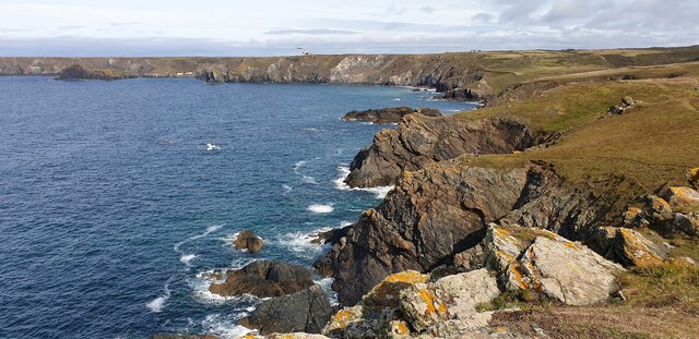
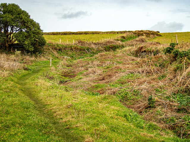
Nature lovers will appreciate the rich marine life found in the area, including seals, dolphins, and a variety of seabirds. The beach is also surrounded by breathtaking coastal walks, providing an opportunity to explore the rugged cliffs and admire the stunning scenery.

In summary, Pentreath Beach is a hidden gem in Cornwall, offering a peaceful and unspoiled coastal experience for those seeking tranquility and natural beauty.

If you have any feedback on the listing, please let us know in the comments section below.

Pentreath Beach Images

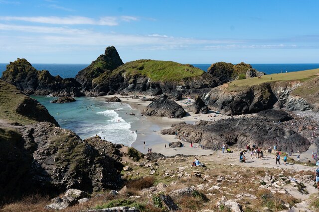
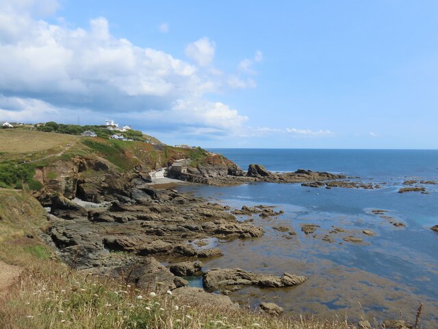
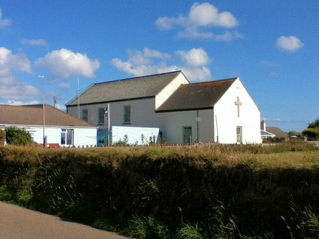
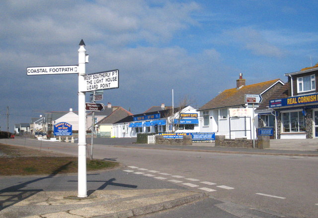
Images are sourced within 2km of 49.97016/-5.2190854 or Grid Reference SW6912. Thanks to Geograph Open Source API. All images are credited.

Kynance Cove beach
Kynance Cove beach
Cliffs below Pistil Meadow A view of the cliffs below Pistil Meadow, from the S W Coastal Path.
Cliffs below Pistil Meadow
A view of the cliffs below Pistil Meadow, from the S W Coastal Path.
Kynance Cove from Pistil Meadow headland Asparagus Island and Kynance Cove from Pistil Meadow headland.
Kynance Cove from Pistil Meadow headland
Asparagus Island and Kynance Cove from Pistil Meadow headland.
Cliffs near Pentreath Beach Some cliffs on the S W Coastal Path between Pentreath Beach and Lizard Point.
Cliffs near Pentreath Beach
Some cliffs on the S W Coastal Path between Pentreath Beach and Lizard Point.
Polpeor Cove
Polpeor Cove
Crane Ledges
Crane Ledges
Fields near Lizard village
Kynance Cove
Kynance Cove
Steps down to Polpeor Cove After you!
Steps down to Polpeor Cove
After you!
Entering Pistil Meadow Legend has it that this was the burial site of 200 souls lost in the wreck of the Royal Anne Galley in 1721. This has now probably been disproved by a study conducted in 2014-16 <span class="nowrap"><a title="https://thisismast.org//research/pistil-meadow-and-the-royal-anne.html" rel="nofollow ugc noopener" href="https://thisismast.org//research/pistil-meadow-and-the-royal-anne.html">Link</a><img style="margin-left:2px;" alt="External link" title="External link - shift click to open in new window" src="https://s1.geograph.org.uk/img/external.png" width="10" height="10"/></span>
Entering Pistil Meadow
Legend has it that this was the burial site of 200 souls lost in the wreck of the Royal Anne Galley in 1721. This has now probably been disproved by a study conducted in 2014-16 LinkExternal link
Looking out from Pistil Meadow Shag Rock on the left.
Looking out from Pistil Meadow
Shag Rock on the left.
Bridleway leading from Pistil Meadow to Lizard Village
Looking down on Pistil Meadow From the bridleway down from Lizard Village.
Looking down on Pistil Meadow
From the bridleway down from Lizard Village.
Farm gates by the bridleway Down from Lizard Village.
Farm gates by the bridleway
Down from Lizard Village.
The Lizard Lifeboat Station The Lizard Lifeboat Station at Lizard Point, below the Lighthouse.
The Lizard Lifeboat Station
The Lizard Lifeboat Station at Lizard Point, below the Lighthouse.
The Lizard Lighthouse Foghorn The Lizard Foghorn comprises two diaphone horns operated by compressed air, nowadays electrically operated giving one three second blast every thirty seconds when air moisture exceeds a certain figure.  Originally it was operated by a steam compressor, changed to diesel operation after 1907.
The Lizard Lighthouse Foghorn
The Lizard Foghorn comprises two diaphone horns operated by compressed air, nowadays electrically operated giving one three second blast every thirty seconds when air moisture exceeds a certain figure. Originally it was operated by a steam compressor, changed to diesel operation after 1907.
Lizard Methodist Church
Footpath down to Lizard Point A footpath leading down to Lizard Point.
Footpath down to Lizard Point
A footpath leading down to Lizard Point.
Show me another place!

Pentreath Beach is located at Grid Ref: SW6912 (Lat: 49.97016, Lng: -5.2190854)

Unitary Authority: Cornwall

Police Authority: Devon and Cornwall

What 3 Words

///standards.owned.missions. Near Landewednack, Cornwall

Related Wikis

Pentreath

Higher Pentreath and Lower Pentreath (Cornish: Penntreth, representing penn an treth, meaning head (of) the beach) are hamlets to the west of Praa Sands...

Kynance Cove

Kynance Cove (Cornish: Porth Keynans, meaning ravine cove) is a cove on the eastern side of Mount's Bay, Cornwall, England. It is situated on the Lizard...

Asparagus Island

Asparagus Island (Cornish: Enys Merlosowen) is a small tidal island on the eastern side of Mount's Bay, within the parish of Mullion, Cornwall, United...

Lizard (village)

Lizard, also known as The Lizard, is a village on the Lizard peninsula in Cornwall, England, United Kingdom. It is situated about ten miles (16 km) south...

Nearby Amenities

Located within 500m of 49.97016,-5.2190854
Barrier: stile
Foot: yes
Material: stone
Source: survey
Step Count: 2
Stile: stepover
Lat/Long: 49.9716512/-5.2178206
Barrier: stile
Foot: yes
Material: stone
Source: survey
Stile: stepover
Lat/Long: 49.9703024/-5.2174789
Barrier: stile
Lat/Long: 49.973137/-5.2242267
Barrier: stile
Foot: yes
Material: stone
Source: survey
Step Count: 5
Stile: stepover
Lat/Long: 49.9696548/-5.2169164
The Lizard - Caerthillian National Nature Reserve
Leisure: nature_reserve
Operator: Natural England
Lat/Long: 49.9685514/-5.2163226
The Lizard - Caerthillian National Nature Reserve
Board Type: nature
Information: board
Source: survey
Tourism: information
Lat/Long: 49.9696794/-5.2168824
Ford: yes
Lat/Long: 49.9680623/-5.2156661
Kyance Carn Goon Substation
Brand: National Grid
Brand Wikidata: Q1465461
Operator: National Grid Electricity Distribution Plc
Operator Old: Western Power Distribution
Operator Wikidata: Q7988183
Owner: National Grid Electricity Distribution (South West) Plc
Owner Wikidata: Q114397866
Power: substation
Voltage: 11000
Lat/Long: 49.9737346/-5.2174145
Check Date: 2022-05-07
Source: survey
Traffic Calming: hump
Lat/Long: 49.9740115/-5.2223055
Barrier: cattle_grid
Bicycle: yes
Foot: yes
Motorcar: yes
Motorcycle: yes
Source: survey
Lat/Long: 49.9737316/-5.2156468
Source: survey
Traffic Calming: hump
Lat/Long: 49.9736311/-5.2165071
Check Date: 2022-05-07
Source: survey
Traffic Calming: hump
Lat/Long: 49.9739796/-5.2182901
Barrier: stile
Foot: yes
Material: stone
Source: survey
Stile: stepover
Lat/Long: 49.9734481/-5.2159857
Barrier: entrance
Source: survey;gps
Lat/Long: 49.9673574/-5.2158149
Caerthillian Cove
Name Kw: Porth Godhelin
Place: locality
Lat/Long: 49.9674385/-5.2181682
Barrier: stile
Material: stone
Source: survey;gps
Step Count: 4
Stile: stepover
Lat/Long: 49.9691734/-5.2166573
Barrier: stile
Lat/Long: 49.9672942/-5.2157426
The data included in this document is from www.openstreetmap.org. The data is made available under ODbL.

Have you been to Pentreath Beach?

Leave your review of Pentreath Beach below (or comments, questions and feedback).