Tràigh Bhàn

Beach in Argyllshire

Scotland

Tràigh Bhàn

Moorland beside unsurfaced road to RSPB reserve A minor road crosses the peninsula of The Oa eventually becoming unsurfaced and presumably unadopted. It reaches the RSPB reserve after a kilometre or so of rough motoring.
Moorland beside unsurfaced road to RSPB reserve Credit: Trevor Littlewood

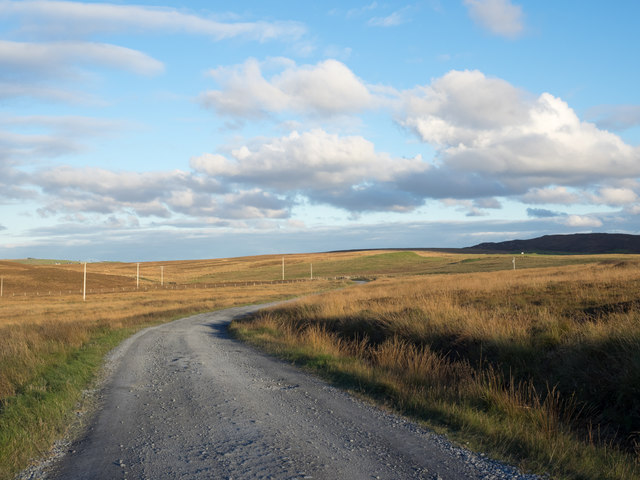
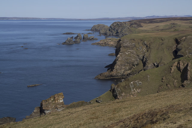
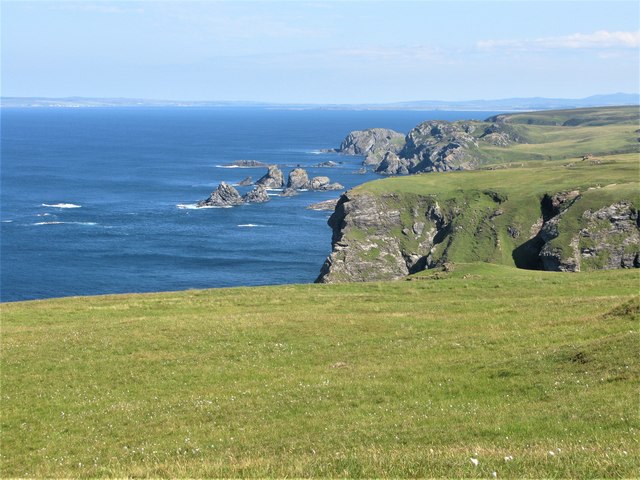
Tràigh Bhàn, located in Argyllshire, Scotland, is a picturesque beach renowned for its stunning natural beauty. With its pristine white sands stretching for approximately two miles along the coastline, it offers a tranquil and idyllic escape for visitors seeking a peaceful retreat.

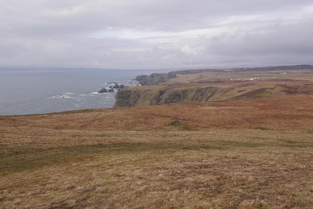
Nestled in a secluded bay, Tràigh Bhàn boasts crystal-clear turquoise waters that gently lap against the shore, creating a serene and relaxing atmosphere. The beach's remote location ensures that it remains relatively uncrowded throughout the year, providing visitors with a sense of tranquility and solitude.

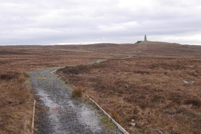
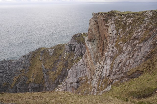
Surrounded by rugged cliffs and rolling hills, Tràigh Bhàn offers breathtaking panoramic views of the surrounding landscape, making it a popular spot for nature lovers and photographers. The area is abundant in wildlife, with a diverse range of bird species frequenting the beach, including oystercatchers and curlews.

Tràigh Bhàn is also a haven for outdoor enthusiasts, offering a variety of activities such as swimming, picnicking, and beachcombing. The beach's pristine sands are perfect for leisurely walks, while the calm waters provide opportunities for water sports like kayaking and paddleboarding.

For those seeking a taste of local culture and history, nearby attractions include the picturesque village of Tayvallich and the historic Kilmory Castle. Visitors can also explore the surrounding Argyll Forest Park, an expansive area of woodland known for its rich biodiversity.

Overall, Tràigh Bhàn in Argyllshire is a hidden gem, offering visitors a serene and unspoiled beach experience amidst stunning natural surroundings.

If you have any feedback on the listing, please let us know in the comments section below.
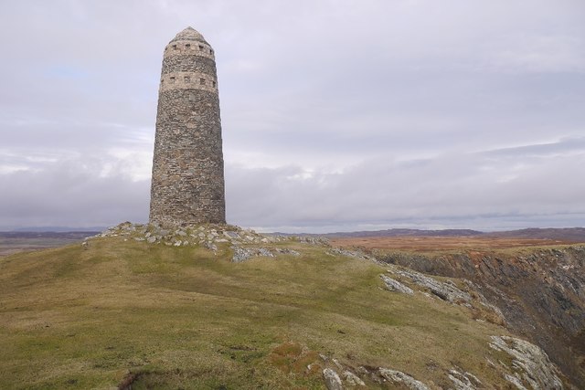
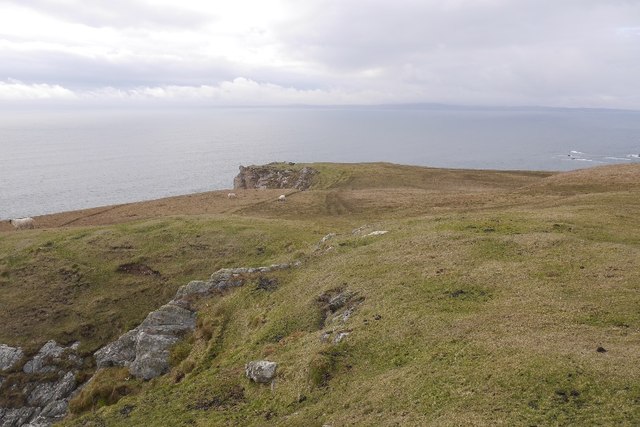
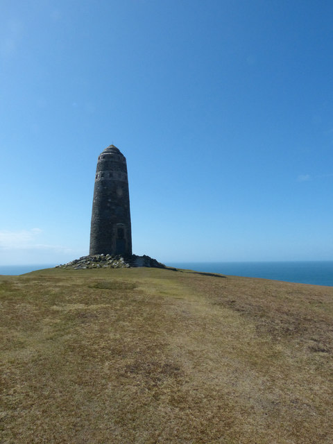
Tràigh Bhàn Images

Images are sourced within 2km of 55.608681/-6.3292895 or Grid Reference NR2743. Thanks to Geograph Open Source API. All images are credited.

Moorland beside unsurfaced road to RSPB reserve A minor road crosses the peninsula of The Oa eventually becoming unsurfaced and presumably unadopted. It reaches the RSPB reserve after a kilometre or so of rough motoring.
Moorland beside unsurfaced road to RSPB reserve
A minor road crosses the peninsula of The Oa eventually becoming unsurfaced and presumably unadopted. It reaches the RSPB reserve after a kilometre or so of rough motoring.
Low hill on rough grazing from path to American Monument A path runs from the RSPB reserve at The Oa to the American Monument passing the low hill at the centre of the image on its south side.
Low hill on rough grazing from path to American Monument
A path runs from the RSPB reserve at The Oa to the American Monument passing the low hill at the centre of the image on its south side.
Unsurfaced public road near to Kinnabus The road serves farms on The Oa but is also the access for the RSPB reserve on the peninsula.
Unsurfaced public road near to Kinnabus
The road serves farms on The Oa but is also the access for the RSPB reserve on the peninsula.
Old field boundary Grassed over dyke, Upper Killeyan.
Old field boundary
Grassed over dyke, Upper Killeyan.
Wetland, Upper Killeyan Beside the path to the American Monument.
Wetland, Upper Killeyan
Beside the path to the American Monument.
Path from the American Monument A waymarked path on the Mull of Oa.
Path from the American Monument
A waymarked path on the Mull of Oa.
Path to the American Monument The wet path at the Mull of Oa is being upgraded but there are still some very wet bits.
Path to the American Monument
The wet path at the Mull of Oa is being upgraded but there are still some very wet bits.
Coastal heath, Mull of Oa The west side of the Mull of Oa.
Coastal heath, Mull of Oa
The west side of the Mull of Oa.
Mull of Oa triangulation pillar Good viewpoint for the north coast of Ireland and Kintyre.
Mull of Oa triangulation pillar
Good viewpoint for the north coast of Ireland and Kintyre.
The American Monument, Mull of Oa The American Monument is on the tip of the Mull of Oa at the extreme southwest of the island of Islay. It commemorates the loss of two troop ships, The Tuscania and The Otranto in 1918. 
It actually overlooks the spot where the former of these sank on 5th February 1918 having been torpedoed by the German U-boat UB-77 while carrying American troops to Europe. She sank with the loss of 210 lives. 
The second tragedy struck eight months later, on 6th October, very near the end of WWI - when another troop ship the HMS Otranto collided with HMS Kashmir. This incident was even more costly in human lives, with the loss of 431 comprising 351 US servicemen and 80 British crew.
The monument was erected in 1920 by the American Red Cross to commemorate these disasters and the souls who perished. It was designed by the architect Robert Walker and stands about 20m (65') tall perched on cliffs that rise 132m (433') above the sea. (The nearby trig pillar being recorded as at 131m) It resembles a lighthouse but has two bands of lighter coloured stones near its domed top. These bands have regular blank window-like niches around them. There is a large plaque set into the base of the monument on the landward side and above it is the head and wings of an American Eagle clutching a wreath in its talons.
The plaque reads:
Sacred to the Immortal Memory of those American Soldiers and Sailors who gave their lives for their country in the Wrecks of the Transports "Tuscania" and "Otranto" --- February 5th 1918 *** October 6th 1918
This Monument was Erected by The American Red Cross near to the spot where so many of The Victims of The Disasters Sleep in Everlasting Peace
.... (in italics there follows this verse) ....
On Fame's Eternal camping ground
Their silent tents are spread
While Glory keeps with solemn round
The bivouac of the dead
-----------------------------------------
On the seaward side is another smaller plaque encircled by a wreath - this reads:
A Tribute from Woodrow Wilson
President of
The United States of America
To the memory of his fellow citizens who gave their lives for their country in nearby waters
1918
The American Monument, Mull of Oa
The American Monument is on the tip of the Mull of Oa at the extreme southwest of the island of Islay. It commemorates the loss of two troop ships, The Tuscania and The Otranto in 1918. It actually overlooks the spot where the former of these sank on 5th February 1918 having been torpedoed by the German U-boat UB-77 while carrying American troops to Europe. She sank with the loss of 210 lives. The second tragedy struck eight months later, on 6th October, very near the end of WWI - when another troop ship the HMS Otranto collided with HMS Kashmir. This incident was even more costly in human lives, with the loss of 431 comprising 351 US servicemen and 80 British crew. The monument was erected in 1920 by the American Red Cross to commemorate these disasters and the souls who perished. It was designed by the architect Robert Walker and stands about 20m (65') tall perched on cliffs that rise 132m (433') above the sea. (The nearby trig pillar being recorded as at 131m) It resembles a lighthouse but has two bands of lighter coloured stones near its domed top. These bands have regular blank window-like niches around them. There is a large plaque set into the base of the monument on the landward side and above it is the head and wings of an American Eagle clutching a wreath in its talons. The plaque reads: Sacred to the Immortal Memory of those American Soldiers and Sailors who gave their lives for their country in the Wrecks of the Transports "Tuscania" and "Otranto" --- February 5th 1918 *** October 6th 1918 This Monument was Erected by The American Red Cross near to the spot where so many of The Victims of The Disasters Sleep in Everlasting Peace .... (in italics there follows this verse) .... On Fame's Eternal camping ground Their silent tents are spread While Glory keeps with solemn round The bivouac of the dead ----------------------------------------- On the seaward side is another smaller plaque encircled by a wreath - this reads: A Tribute from Woodrow Wilson President of The United States of America To the memory of his fellow citizens who gave their lives for their country in nearby waters 1918
Coastal heath, Mull of Oa The west side of the headland with a view  towards the Rhinos.
Coastal heath, Mull of Oa
The west side of the headland with a view towards the Rhinos.
Crags, Mull of Oa A fresh rockfall.
Crags, Mull of Oa
A fresh rockfall.
Bog near Kinnabus Peat cuttings.
Bog near Kinnabus
Peat cuttings.
The American Monument on the Mull of Oa This is the monument to the large number of drowned Americans, who perished when their troopships sank in 1918. This ships were the Tuscania and the Otranto. There were two separate sinkings and large loss of life in each. The monument is built in the shape of a lighthouse and has a large plaque describing the situation.
The American Monument on the Mull of Oa
This is the monument to the large number of drowned Americans, who perished when their troopships sank in 1918. This ships were the Tuscania and the Otranto. There were two separate sinkings and large loss of life in each. The monument is built in the shape of a lighthouse and has a large plaque describing the situation.
Cliffs at the Mull of Oa These are the Oa cliffs looking north.
Cliffs at the Mull of Oa
These are the Oa cliffs looking north.
Car Park at the start of the route to the American Monument, Islay The route starts out as a track leaving the car park at the far end. Soon after this point a path leading to the American Monument leaves the track.
Car Park at the start of the route to the American Monument, Islay
The route starts out as a track leaving the car park at the far end. Soon after this point a path leading to the American Monument leaves the track.
Kissing Gate on the Path to the American Monument, Islay It's amazing how many different ways there are for opening gates and kissing gates. This was one of the more common ones.
Kissing Gate on the Path to the American Monument, Islay
It's amazing how many different ways there are for opening gates and kissing gates. This was one of the more common ones.
Cliffs at the Mull of Oa, Islay Cliffs just to the west of the <a href="https://www.geograph.org.uk/photo/5831864">NR2741 : American Monument and Trig Point at the Mull of Oa, Islay</a>.
Cliffs at the Mull of Oa, Islay
Show me another place!

Tràigh Bhàn is located at Grid Ref: NR2743 (Lat: 55.608681, Lng: -6.3292895)

Unitary Authority: Argyll and Bute

Police Authority: Argyll and West Dunbartonshire

What 3 Words

///protest.rosier.renovated. Near Port Ellen, Argyll & Bute

Related Wikis

Eas Mòr, lower

Eas Mor (lower) is a waterfall on the Abhainn Ghil on the island of Islay, in Scotland. It lies on the west coast of The Oa peninsula north of Lower Killeyan...

Eas Mòr, upper

Eas Mor is a waterfall is a waterfall on the Abhainn Ghil on the island of Islay in Scotland. It lies on The Oa peninsula south of Giol and west of Lenavore...

The Oa

The Oa ( OH) (Scottish Gaelic: An Obha) is a rocky peninsula in the southwest of the island of Islay, in Argyll, Scotland. It is an RSPB nature reserve...

Machrie golf course

The Machrie Golf Course, or "The Machrie Links", is located on Islay, in Scotland. The word "machrie" is a corruption of the Scottish Gaelic machair, which...

Port Ellen distillery

Port Ellen distillery is located in Port Ellen on the isle of Islay, Scotland. It initially operated between 1825 and 1983 when production shut down....

Islay Airport

Islay Airport (IATA: ILY, ICAO: EGPI) (also known as Glenegedale Airport) (Scottish Gaelic: Port-adhair Ìle) is located 4.5 nautical miles (8.3 kilometres...

St John's Church, Port Ellen

St John's Church, Port Ellen is a Category B listed building in Port Ellen, Islay, Argyll and Bute, Scotland. == History == The memorial stone for the...

Port Ellen

Port Ellen (Scottish Gaelic: Port Ìlein) is a small town on the island of Islay, in Argyll, Scotland. The town is named after the wife of its founder,...

Nearby Amenities

Located within 500m of 55.608681,-6.3292895
Power: pole
Lat/Long: 55.6055445/-6.3236753
Curries Cottage
Place: locality
Lat/Long: 55.6053762/-6.3251657
The data included in this document is from www.openstreetmap.org. The data is made available under ODbL.

Have you been to Tràigh Bhàn?

Leave your review of Tràigh Bhàn below (or comments, questions and feedback).