Tràigh nan Uan

Beach in Argyllshire

Scotland

Tràigh nan Uan

New house at Cloiche Farm Built in a typical Tiree style with pitch roofs the house has all modern conveniences, including a poly-tunnel and solar panels.
New house at Cloiche Farm Credit: Alpin Stewart

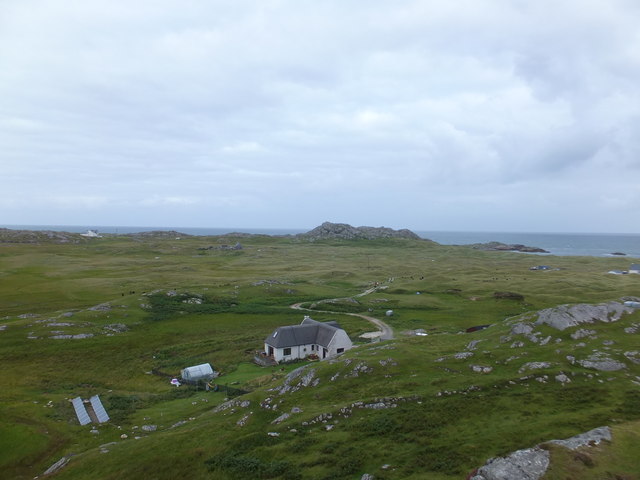
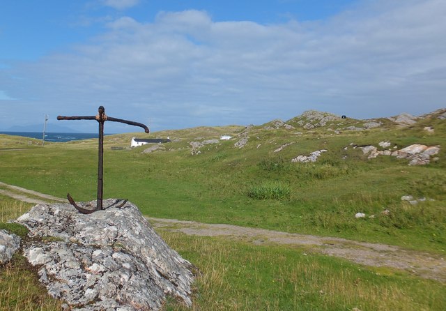
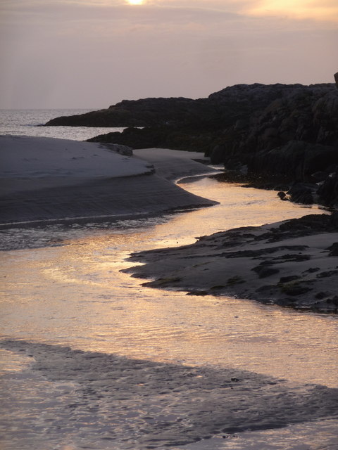
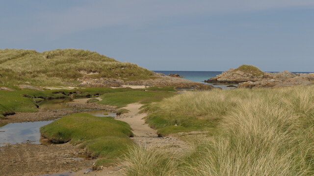
Tràigh nan Uan, also known as Otter Bay, is a stunning beach located in Argyllshire, Scotland. Situated on the west coast of Scotland, this beach offers breathtaking views of the surrounding landscapes and provides a peaceful and serene setting for visitors.

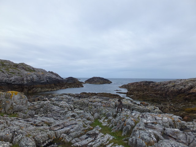
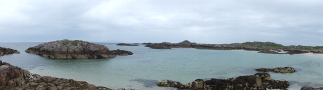
The beach is characterized by its golden sands and crystal-clear turquoise waters, which are remarkably clean and inviting. The shoreline stretches for approximately 1.5 kilometers, providing ample space for beachgoers to relax, take long walks, or engage in various water activities.

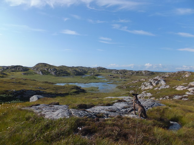
Tràigh nan Uan is known for its rich wildlife, particularly its population of otters, which give the bay its name. These playful creatures can often be spotted swimming or playing in the bay, adding to the magical atmosphere of the beach.

The beach is backed by rolling sand dunes, which are home to a diverse range of plant and animal species. Nature enthusiasts will appreciate the opportunity to explore the dunes and observe the unique flora and fauna that thrive in this coastal environment.

Tràigh nan Uan offers a tranquil escape from the hustle and bustle of everyday life. It is an ideal destination for those seeking relaxation, as well as outdoor enthusiasts looking to engage in activities such as swimming, sunbathing, picnicking, or even birdwatching.

Overall, Tràigh nan Uan is a hidden gem along the Argyllshire coastline, offering a picturesque and peaceful beach experience with its stunning scenery, abundant wildlife, and opportunities for outdoor recreation.

If you have any feedback on the listing, please let us know in the comments section below.

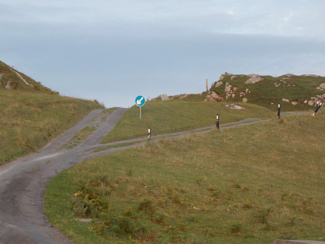
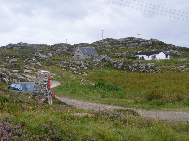
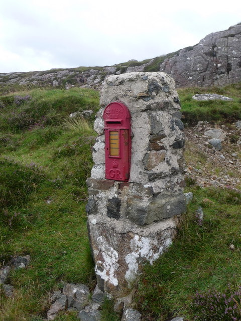
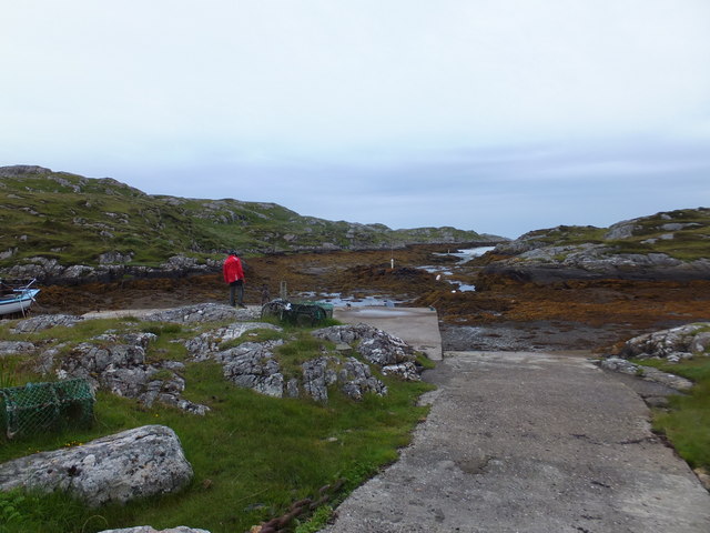
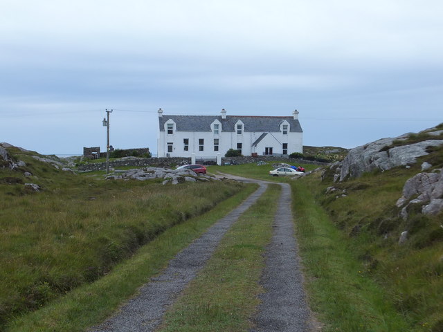
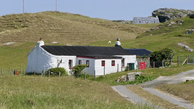
Tràigh nan Uan Images

Images are sourced within 2km of 56.682031/-6.5050247 or Grid Reference NM2463. Thanks to Geograph Open Source API. All images are credited.

New house at Cloiche Farm Built in a typical Tiree style with pitch roofs the house has all modern conveniences, including a poly-tunnel and solar panels.
New house at Cloiche Farm
Built in a typical Tiree style with pitch roofs the house has all modern conveniences, including a poly-tunnel and solar panels.
Rough croft land south of Struan, Isle of Coll
A' Chròic A short scramble is required to gain this rocky summit.

Name: A' Chròic
Hill number: 10525
Height: 43m / 141ft
Parent (Ma/M): none
Area: 17F: Coll and Tiree
Class: 0
Grid ref: NM 22957 62779
Summit feature: rock outcrop
Drop: 30m
Col: 13m  NM229626
A' Chròic
A short scramble is required to gain this rocky summit. Name: A' Chròic Hill number: 10525 Height: 43m / 141ft Parent (Ma/M): none Area: 17F: Coll and Tiree Class: 0 Grid ref: NM 22957 62779 Summit feature: rock outcrop Drop: 30m Col: 13m NM229626
Beart an Fhir Eighth TuMP of the day with Iain Brown and Martin Richardson.

Name: Beart an Fhir
Hill number: 10509
Height: 56m / 184ft
Parent (Ma/M): none
Area: 17F: Coll and Tiree
Class: 0
Grid ref: NM 24756 62699
Summit feature: grassy outcrop
Drop: 30m
Col: 26m  NM255622
Beart an Fhir
Eighth TuMP of the day with Iain Brown and Martin Richardson. Name: Beart an Fhir Hill number: 10509 Height: 56m / 184ft Parent (Ma/M): none Area: 17F: Coll and Tiree Class: 0 Grid ref: NM 24756 62699 Summit feature: grassy outcrop Drop: 30m Col: 26m NM255622
Isle of Coll: an unnamed stream reaches the sea Looking along the final stretch of an unnamed but fairly substantial river as it nears its journey's end.
Isle of Coll: an unnamed stream reaches the sea
Looking along the final stretch of an unnamed but fairly substantial river as it nears its journey's end.
Isle of Coll: dual carriageway on the B8072 A small section of 'dual carriageway' on this narrow road with passing places heading to the north of the island. The back of the corresponding sign for oncoming traffic can also be seen.
Isle of Coll: dual carriageway on the B8072
A small section of 'dual carriageway' on this narrow road with passing places heading to the north of the island. The back of the corresponding sign for oncoming traffic can also be seen.
Isle of Coll: hold-up on the B8072 Not a delay which featured on the radio traffic updates. These cows would slowly - very slowly! - make their way along the road on encountering my car, rather than to one side. On turning the corner here I could see the more distant ones too and therefore realised the going would not be quick for now.
Isle of Coll: hold-up on the B8072
Not a delay which featured on the radio traffic updates. These cows would slowly - very slowly! - make their way along the road on encountering my car, rather than to one side. On turning the corner here I could see the more distant ones too and therefore realised the going would not be quick for now.
Isle of Coll: Bousd Two of the three properties on a little track off the B8072 at the north end of Coll.
Isle of Coll: Bousd
Two of the three properties on a little track off the B8072 at the north end of Coll.
Isle of Coll: postbox № PA78 104, Bousd This little George-V postbox is set into a brick pillar at <a href="https://www.geograph.org.uk/photo/4109935">NM2563 : Isle of Coll: Bousd</a> and serves the properties here along with the scattering of others in the surrounding area of northern Coll.

It has nonstandard collection times - see <a href="https://www.geograph.org.uk/photo/4109951">NM2563 : Isle of Coll: collection plate on the postbox at Bousd</a>.
Isle of Coll: postbox № PA78 104, Bousd
This little George-V postbox is set into a brick pillar at NM2563 : Isle of Coll: Bousd and serves the properties here along with the scattering of others in the surrounding area of northern Coll. It has nonstandard collection times - see NM2563 : Isle of Coll: collection plate on the postbox at Bousd.
Isle of Coll: collection plate on the postbox at Bousd A very old style of collection plate is still in use on this small, remote postbox (<a href="https://www.geograph.org.uk/photo/4109944">NM2563 : Isle of Coll: postbox № PA78 104, Bousd</a>).

The times are nonstandard - 8:15 on Monday and Wednesday and Saturday mornings, and 7:30 on Friday mornings. Presumably the ferry timetables for Tuesdays and Saturdays are such that no post collected would leave the island until the following day anyway.
Isle of Coll: collection plate on the postbox at Bousd
A very old style of collection plate is still in use on this small, remote postbox (NM2563 : Isle of Coll: postbox № PA78 104, Bousd). The times are nonstandard - 8:15 on Monday and Wednesday and Saturday mornings, and 7:30 on Friday mornings. Presumably the ferry timetables for Tuesdays and Saturdays are such that no post collected would leave the island until the following day anyway.
Wet and boggy area North of Loch na Cloiche
Rocky inlet below A' Chroic, Isle of Coll
Bay and islands north of Cloiche, Isle of Coll
Jetty at Cornaig Bay, Isle of Coll
Dwelling-house at Bousd, Isle of Coll I suspect that this house may once have served as a school and schoolhouse.
Dwelling-house at Bousd, Isle of Coll
I suspect that this house may once have served as a school and schoolhouse.
Tidal inlet, Tràigh Thorastain Outflow of a burn through dunes.
Tidal inlet, Tràigh Thorastain
Outflow of a burn through dunes.
Struan, Coll Cottage in the north of the island.
Struan, Coll
Cottage in the north of the island.
Machair, Bousd Behind Tràigh Bhousd.
Machair, Bousd
Behind Tràigh Bhousd.
Show me another place!

Tràigh nan Uan is located at Grid Ref: NM2463 (Lat: 56.682031, Lng: -6.5050247)

Unitary Authority: Argyll and Bute

Police Authority: Argyll and West Dunbartonshire

What 3 Words

///premature.centrally.downturn. Near Arinagour, Argyll & Bute

Related Wikis

Dùn Morbhaidh

Dùn Morbhaidh, also known as Dun Borbaidh, is a hill fort located on the Inner Hebridean island of Coll. The early 20th century antiquary Erskine Beveridge...

Cairns of Coll

The Cairns of Coll refers primarily to a region of rocky outcrops in shallow waters extending from the north end of the Island of Coll in the Inner Hebrides...

Coll

Coll (; Scottish Gaelic: Cola; Scots: Coll) is an island located west of the Isle of Mull in the Inner Hebrides of Scotland. Coll is known for its sandy...

Arinagour

Arinagour (Scottish Gaelic: Àirigh nan Gobhar, "shieling of the goats") is a village on the island of Coll, in the Argyll and Bute council area of Scotland...

Nearby Amenities

Located within 500m of 56.682031,-6.5050247
Natural: rock
Source: OS7
Tidal: yes
Lat/Long: 56.6837452/-6.507925
An t-Inbhire
Place: locality
Lat/Long: 56.6802705/-6.5068745
Eilean nan Uan
Place: locality
Lat/Long: 56.6819736/-6.5076094
Sloc na Luinge
Natural: strait
Lat/Long: 56.6834514/-6.5059756
Cornaigmore
Name Gd: Còrnaig Mhòr
Place: hamlet
Lat/Long: 56.67849/-6.5009446
Power: pole
Lat/Long: 56.6781224/-6.5013313
Power: pole
Lat/Long: 56.6803296/-6.4977559
Power: pole
Lat/Long: 56.6798493/-6.4985955
Power: pole
Lat/Long: 56.6793837/-6.4994377
Power: pole
Lat/Long: 56.6788164/-6.500473
Power: pole
Lat/Long: 56.67856/-6.5011302
The data included in this document is from www.openstreetmap.org. The data is made available under ODbL.

Have you been to Tràigh nan Uan?

Leave your review of Tràigh nan Uan below (or comments, questions and feedback).