Leac Dhubh

Beach in Ross-shire

Scotland

Leac Dhubh

Old tractor I'm no expert but I think this is a Ferguson TEA20 of about 1950 vintage with Loch Ròg Beag as a backdrop.
Old tractor Credit: Jo and Steve Turner

Leac Dhubh is a stunning beach located in Ross-shire, Scotland. Situated on the west coast, it offers breathtaking views of the North Atlantic Ocean and is surrounded by picturesque cliffs and rugged landscapes. With its pristine golden sands stretching for over a mile, Leac Dhubh is a haven for beach lovers and nature enthusiasts alike.

The beach boasts crystal-clear turquoise waters, which are perfect for swimming during the summer months. The calm and peaceful atmosphere makes it an ideal spot for relaxation, sunbathing, and picnicking. The beach is also known for its excellent fishing opportunities, attracting anglers who seek a peaceful fishing experience.

Leac Dhubh is famous for its diverse wildlife. Visitors can spot various seabirds nesting on the cliffs, such as puffins, guillemots, and kittiwakes. The surrounding heathland and dunes are home to a wide range of plant species, making it a popular destination for nature walks and birdwatching.

Despite its natural beauty, Leac Dhubh remains relatively untouched and secluded, offering visitors a sense of tranquility and escape from the hustle and bustle of everyday life. The lack of commercial development adds to its charm, making it a hidden gem among Scotland's many beaches.

Access to Leac Dhubh is via a narrow road, which adds to the sense of adventure and remoteness. The beach is best enjoyed during low tide when a vast expanse of sand is revealed, allowing visitors to explore its many nooks and crannies.

Overall, Leac Dhubh is a must-visit destination for those seeking natural beauty, serenity, and a unique coastal experience in the heart of Ross-shire.

If you have any feedback on the listing, please let us know in the comments section below.
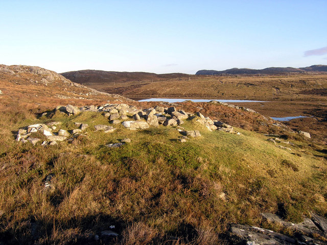
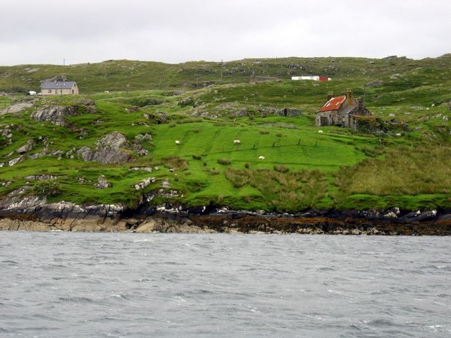
Leac Dhubh Images

Images are sourced within 2km of 58.163204/-6.8886589 or Grid Reference NB1229. Thanks to Geograph Open Source API. All images are credited.

Old tractor I'm no expert but I think this is a Ferguson TEA20 of about 1950 vintage with Loch Ròg Beag as a backdrop.
Old tractor
I'm no expert but I think this is a Ferguson TEA20 of about 1950 vintage with Loch Ròg Beag as a backdrop.
Loch Ròg Beag Viewed from Einacleite.
Loch Ròg Beag
Viewed from Einacleite.
Inlet to Loch Croistean and ford
Looking down Loch Croistean. Good brown trout fishing and a few finnock
Looking down Loch Croistean.
Good brown trout fishing and a few finnock
Ruined blackhouse, Ungaisidar
Looking towards Loch Croistean from the B8011
Cairn, Druim Sandavig, Isle of Lewis This is one of several similarly shaped cairns in the area.  See also <a href="https://www.geograph.org.uk/photo/6205869">NB1229 : Cairn, Druim Sandavig, Isle of Lewis</a>.
Cairn, Druim Sandavig, Isle of Lewis
This is one of several similarly shaped cairns in the area. See also NB1229 : Cairn, Druim Sandavig, Isle of Lewis.
Cairn, Druim Sandavig, Isle of Lewis This is one of several similarly shaped cairns in the area.  See also <a href="https://www.geograph.org.uk/photo/6205867">NB1129 : Cairn, Druim Sandavig, Isle of Lewis</a>.
Cairn, Druim Sandavig, Isle of Lewis
This is one of several similarly shaped cairns in the area. See also NB1129 : Cairn, Druim Sandavig, Isle of Lewis.
Sharp bend in the road near Loch Sanndabhat
Phonebox and Loch Rog Beag
Loch Croistean, West Lewis. Loch with boathouse at the side of the B8011.
Loch Croistean, West Lewis.
Loch with boathouse at the side of the B8011.
Loch Sanndabhat Southwest of the settlement of Ungisiadar.
Loch Sanndabhat
Southwest of the settlement of Ungisiadar.
Crofthouse at Ungisiadar Overlooking Loch Ròg Beag.
Crofthouse at Ungisiadar
Overlooking Loch Ròg Beag.
Disused Croft Buildings Ungisiadar.
Disused Croft Buildings
Ungisiadar.
Enaclete, Uig From across Little Loch Roag.  The red-roofed house belongs to Croft No.1.
Enaclete, Uig
From across Little Loch Roag. The red-roofed house belongs to Croft No.1.
Shieling on Ollashol Remains of a very old shieling on the slopes of Ollashol, above Loch Croistean in West Uig.
Shieling on Ollashol
Remains of a very old shieling on the slopes of Ollashol, above Loch Croistean in West Uig.
Croft near Einacleite Taken from boat in Loch Ròg Beag. A more distant view is shown in <a href="https://www.geograph.org.uk/photo/727392">NB1228 : Enaclete, Uig</a>
Croft near Einacleite
Taken from boat in Loch Ròg Beag. A more distant view is shown in NB1228 : Enaclete, Uig
Gate and Mailbox to No1 Ungaisidar The un-metalled track beyond the gate leads down to Ungaisidar. You soon reach the limit of vehicular access and the rest of the journey to No1 is definitely upon foot.
Gate and Mailbox to No1 Ungaisidar
The un-metalled track beyond the gate leads down to Ungaisidar. You soon reach the limit of vehicular access and the rest of the journey to No1 is definitely upon foot.
Show me another place!

Leac Dhubh is located at Grid Ref: NB1229 (Lat: 58.163204, Lng: -6.8886589)

Unitary Authority: Na h-Eileanan an Iar

Police Authority: Highlands and Islands

What 3 Words

///chins.vesting.circles. Near Carloway, Na h-Eileanan Siar

Related Wikis

Fuaigh Beag

Fuaigh Beag or Vuia Be(a)g is an island in the Outer Hebrides. It is off the west coast of Lewis near Great Bernera in Loch Roag. Its name means "little...

Gisla Hydro-Electric Scheme

Gisla Hydro-Electric Scheme was a small scheme promoted by the North of Scotland Hydro-Electric Board on the Isle of Lewis, Outer Hebrides, Scotland. It...

Flodaigh, Lewis

Flodaigh is a small island in Loch Roag on the west coast of Lewis in the Outer Hebrides of Scotland. It is about 33 hectares (82 acres) in extent and...

Loch Ròg

Loch Ròg or Loch Roag is a large sea loch on the west coast of Lewis, Outer Hebrides. It is broadly divided into East Loch Roag and West Loch Roag with...

Nearby Amenities

Located within 500m of 58.163204,-6.8886589
Ungaisiadar
Alt Name En: Ungshader
Alt Name Gd: Ungesiadar;Ungisiadar
Name En: Ungeshader
Name Gd: Ungaisiadar
Place: hamlet
Lat/Long: 58.1612124/-6.8939425
Power: pole
Lat/Long: 58.1607569/-6.8945737
Power: pole
Lat/Long: 58.1612879/-6.8935693
Power: pole
Lat/Long: 58.1617754/-6.892592
Power: pole
Lat/Long: 58.1624428/-6.8919668
Power: pole
Lat/Long: 58.162577/-6.8913154
Power: pole
Lat/Long: 58.162754/-6.8906189
Power: pole
Lat/Long: 58.1602271/-6.8945443
Leisure: slipway
Surface: concrete
Lat/Long: 58.1597531/-6.8903799
The data included in this document is from www.openstreetmap.org. The data is made available under ODbL.

Have you been to Leac Dhubh?

Leave your review of Leac Dhubh below (or comments, questions and feedback).