Mol nan Allt

Beach in Inverness-shire

Scotland

Mol nan Allt

Head of Loch Mhiabhaig Looking north to the mountains of North Harris from the B887 roadside.
Head of Loch Mhiabhaig Credit: Richard Dorrell

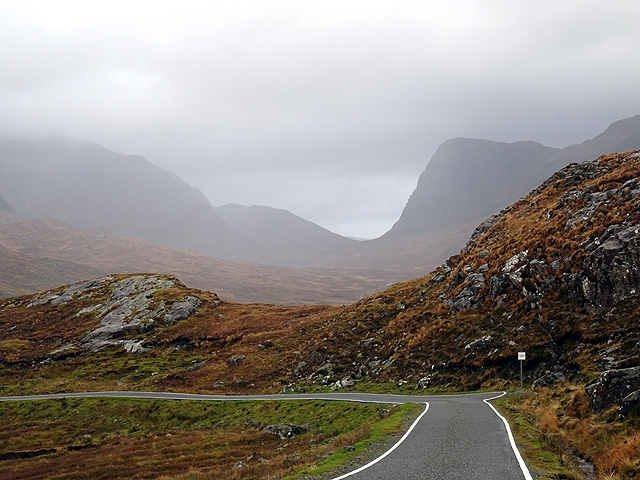
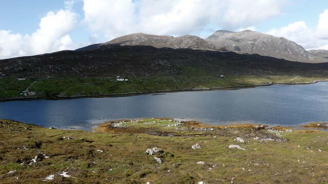
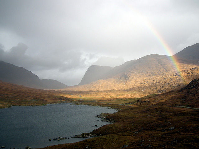
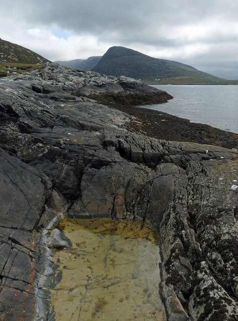
Mol nan Allt is a picturesque beach located in the county of Inverness-shire, Scotland. Situated on the western shores of Loch Morar, it offers visitors a tranquil and scenic coastal experience.

The beach is characterized by its golden sandy shores, which stretch for approximately half a mile. The crystal-clear waters of Loch Morar lap gently against the shore, inviting visitors to take a refreshing dip or enjoy a leisurely swim. The beach is also known for its calm and peaceful atmosphere, making it an ideal spot for relaxation and unwinding.

Surrounded by rolling hills and lush greenery, Mol nan Allt provides breathtaking panoramic views of the surrounding landscape. The beach is backed by a small woodland area, creating a natural boundary between the shore and the hills behind. This offers visitors the opportunity to explore the nearby woodland trails and experience the diverse flora and fauna of the area.

Mol nan Allt is also a popular spot for picnicking and beachcombing. Its remote location ensures a sense of solitude and tranquility, making it a perfect getaway from the hustle and bustle of city life. The beach is accessible by car and has parking facilities nearby, making it easily reachable for visitors.

Overall, Mol nan Allt in Inverness-shire is a hidden gem that offers a peaceful and scenic coastal experience, making it a must-visit destination for nature lovers and those seeking a serene retreat.

If you have any feedback on the listing, please let us know in the comments section below.

Mol nan Allt Images

Images are sourced within 2km of 57.934579/-6.8958057 or Grid Reference NB1004. Thanks to Geograph Open Source API. All images are credited.

Head of Loch Mhiabhaig Looking north to the mountains of North Harris from the B887 roadside.
Head of Loch Mhiabhaig
Looking north to the mountains of North Harris from the B887 roadside.
On the B887 road from Tarbert to Huisinis The higher hills which form the backdrop are on the opposite side of Loch Mhiabhaig, which is hidden by the landscape.
On the B887 road from Tarbert to Huisinis
The higher hills which form the backdrop are on the opposite side of Loch Mhiabhaig, which is hidden by the landscape.
A rainbow viewed across Loch Mhiabhaig
OS Bolt, Àird an Tolmachain, Harris The bolt can be seen attached to the bedrock in the centre of the photo, below the cairn. It is marked with the triangulation pillar symbol on the OS 1:25,000 map, but is not shown on the 1:50,000 (as viewed on OS Maps 09/08/16).
OS Bolt, Àird an Tolmachain, Harris
The bolt can be seen attached to the bedrock in the centre of the photo, below the cairn. It is marked with the triangulation pillar symbol on the OS 1:25,000 map, but is not shown on the 1:50,000 (as viewed on OS Maps 09/08/16).
Loch Mhiabhaig from the B887 The prominent hill is Sròn Scourst.
Loch Mhiabhaig from the B887
The prominent hill is Sròn Scourst.
Crofts at Miabhaig In the foreground is a fragment of the old road.
Crofts at Miabhaig
In the foreground is a fragment of the old road.
Miavaig kelp kilns A group of three kelp kilns on a low knoll on the edge of Loch Miabhaig. <span class="nowrap"><a title="https://canmore.org.uk/site/336865/m100-miavaig-harris" rel="nofollow ugc noopener" href="https://canmore.org.uk/site/336865/m100-miavaig-harris">Link</a><img style="margin-left:2px;" alt="External link" title="External link - shift click to open in new window" src="https://s1.geograph.org.uk/img/external.png" width="10" height="10"/></span>
Miavaig kelp kilns
A group of three kelp kilns on a low knoll on the edge of Loch Miabhaig. LinkExternal link
Blasted rock Some road improvements have been carried out above Loch Mhiabhaig.
Blasted rock
Some road improvements have been carried out above Loch Mhiabhaig.
Loch Bràigh na Lice
Loch Bràigh na Lice
The road to Huisinis Some of the difficulties both biotic and abiotic faced by the driver on the twisty road to Huisinis.
The road to Huisinis
Some of the difficulties both biotic and abiotic faced by the driver on the twisty road to Huisinis.
A rainbow over Loch Mhiabhaig Viewed from the B887 road from Hushinish to Tarbert.
A rainbow over Loch Mhiabhaig
Viewed from the B887 road from Hushinish to Tarbert.
Theilisnis Looking over Bagh Theilisnis and Ãird Chathanais.
Theilisnis
Looking over Bagh Theilisnis and Ãird Chathanais.
Picnic area at Theilisnis Overlooking Loch a Siar.
Picnic area at Theilisnis
Overlooking Loch a Siar.
Coastline, Gob a' Phuind, Harris Looking towards Loch Bun Abhainn Eadarra and Giolabhal Glas at the head of the loch.
Coastline, Gob a' Phuind, Harris
Looking towards Loch Bun Abhainn Eadarra and Giolabhal Glas at the head of the loch.
Flotsam and jetsam, Bàgh Theilisnis, Harris Looking towards Àird Chathanais.
Flotsam and jetsam, Bàgh Theilisnis, Harris
Looking towards Àird Chathanais.
Viewpoint near Miabheag
Loch a Siar
Loch a Siar
Aird Chathanais
Aird Chathanais
Show me another place!

Mol nan Allt is located at Grid Ref: NB1004 (Lat: 57.934579, Lng: -6.8958057)

Unitary Authority: Na h-Eileanan an Iar

Police Authority: Highlands and Islands

What 3 Words

///inclines.irrigate.sending. Near Tarbert, Na h-Eileanan Siar

Related Wikis

West Loch Tarbert

West Loch Tarbert (Scottish Gaelic: Loch A Siar) is a sea loch that separates the northern and southern parts of Harris in the Outer Hebrides of Scotland...

Bun Abhainn Eadarra

Bun Abhainn Eadarra or Bunavoneadar is a hamlet adjacent to the Loch Bun Abhainn Eadarra, on the south shore of North Harris, in the Outer Hebrides, Scotland...

Ardhasaig

Ardhasaig (Scottish Gaelic: Àird Àsaig) is a settlement on the western coast of north Harris, in the Outer Hebrides, Scotland. Ardhasaig is also within...

Soay Mòr

Soay Mòr (Scottish Gaelic: Sòdhaigh Mòr) is an island in West Loch Tarbert, between the northern and southern parts of Harris. The uninhabited island is...

Nearby Amenities

Located within 500m of 57.934579,-6.8958057
Passing Place
Lat/Long: 57.9383883/-6.8975557
Passing Place
Lat/Long: 57.9379602/-6.8964195
Tourism: picnic_site
Lat/Long: 57.9372643/-6.8928732
Direction: 90-270
Tourism: viewpoint
Lat/Long: 57.9372664/-6.8926474
Passing Place
Lat/Long: 57.9375337/-6.8926553
Material: wood
Power: pole
Lat/Long: 57.9388828/-6.8949552
Material: wood
Power: pole
Lat/Long: 57.9387062/-6.8933758
Passing Place
Lat/Long: 57.937739/-6.8938329
Passing Place
Lat/Long: 57.9376404/-6.8897912
Passing Place
Lat/Long: 57.9387992/-6.8986338
The data included in this document is from www.openstreetmap.org. The data is made available under ODbL.

Have you been to Mol nan Allt?

Leave your review of Mol nan Allt below (or comments, questions and feedback).