Bae Abergwaun

Bay in Pembrokeshire

Wales

Bae Abergwaun

View from the cliff top, near Needle Rock The name 'Needle Rock' appears on the map in two quite distinct places along this stretch of coastline, the other being in SN0140.  No Welsh name appears on the map, in either case.   Both localities are significant nesting sites for sea birds.
View from the cliff top, near Needle Rock Credit: Stefan Czapski

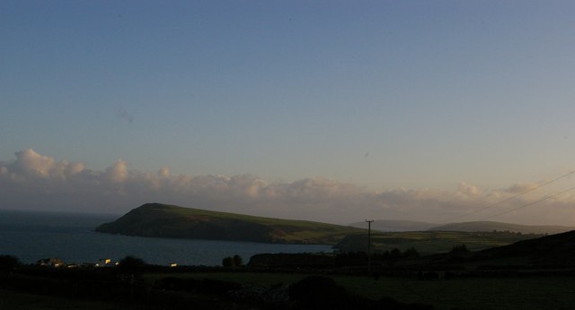
Bae Abergwaun, also known as Fishguard Bay, is located in Pembrokeshire, Wales. It is situated on the western coast of the country, overlooking the Irish Sea. The bay is named after the nearby town of Fishguard, which lies on its southern edge.

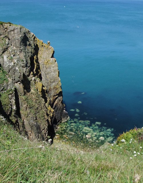
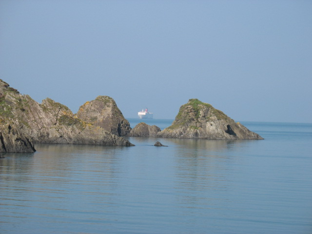
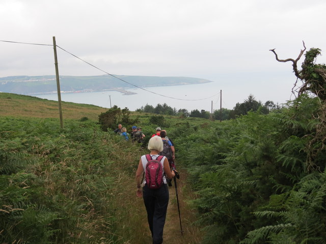
Bae Abergwaun is characterized by its beautiful sandy beaches and rocky cliffs, making it a popular destination for tourists and locals alike. The bay offers stunning panoramic views of the surrounding coastal landscape and is known for its clear blue waters. It is also home to a variety of wildlife, including seals, dolphins, and a wide range of seabirds.

The bay is not only aesthetically pleasing but also holds historical significance. It was the site of the last invasion of Britain in 1797 when French troops attempted to land. The battle that ensued, known as the Battle of Fishguard, resulted in their surrender and is commemorated with a stone monument in the area.

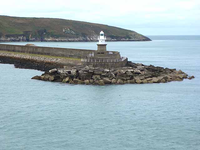
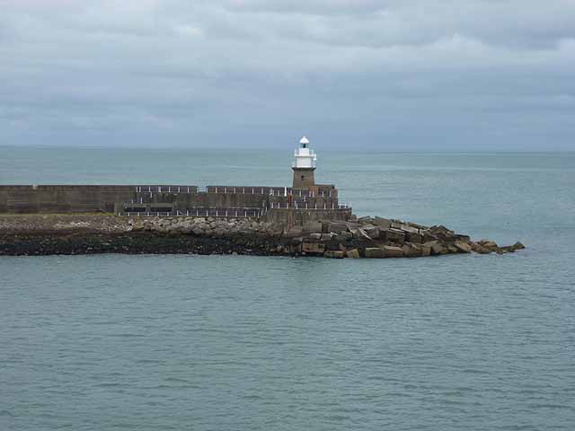
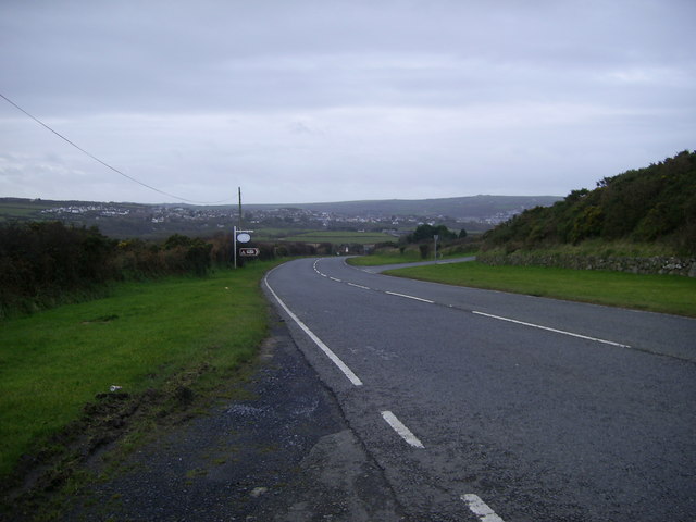
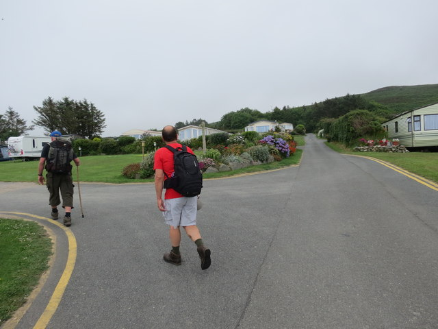
Bae Abergwaun is a hub for various water activities, such as swimming, surfing, and sailing. It also offers opportunities for coastal walks and hiking, with several trails leading to breathtaking viewpoints. Nearby attractions include the picturesque village of Lower Town, famous for its historic harbor featured in the film "Moby Dick," and the Strumble Head Lighthouse, which marks the northern entrance to the bay.

Overall, Bae Abergwaun is a scenic and historically rich destination, offering visitors a chance to immerse themselves in the natural beauty and cultural heritage of Pembrokeshire.

If you have any feedback on the listing, please let us know in the comments section below.

Bae Abergwaun Images

Images are sourced within 2km of 52.015025/-4.9476857 or Grid Reference SM9739. Thanks to Geograph Open Source API. All images are credited.

View from the cliff top, near Needle Rock The name 'Needle Rock' appears on the map in two quite distinct places along this stretch of coastline, the other being in SN0140.  No Welsh name appears on the map, in either case.   Both localities are significant nesting sites for sea birds.
View from the cliff top, near Needle Rock
The name 'Needle Rock' appears on the map in two quite distinct places along this stretch of coastline, the other being in SN0140. No Welsh name appears on the map, in either case. Both localities are significant nesting sites for sea birds.
Aber Bach (or Hescwm) cove On the horizon the Stena Line ferry nears the end of its voyage from Rosslare to Fishguard/Goodwick.
Although I did not realise it until much later, this photo was taken from the exact same spot as the photo on the title page of the National Trail Guide to the Pembrokeshire Coast Path. (A quick comparison will soon confirm this. To be precise, I am referring to my copy of the 2004 edition of the Guide.)
Aber Bach (or Hescwm) cove
On the horizon the Stena Line ferry nears the end of its voyage from Rosslare to Fishguard/Goodwick. Although I did not realise it until much later, this photo was taken from the exact same spot as the photo on the title page of the National Trail Guide to the Pembrokeshire Coast Path. (A quick comparison will soon confirm this. To be precise, I am referring to my copy of the 2004 edition of the Guide.)
Dinas Head and coastline beyond, from Castell Farm The prominent headland is Dinas Head; beyond it, to the right, in the far distance, is Cemaes Head, and on the right (closer to the camera) the land rising behind Newport Sands.  In the foreground, the Penrhyn caravan site.
Dinas Head and coastline beyond, from Castell Farm
The prominent headland is Dinas Head; beyond it, to the right, in the far distance, is Cemaes Head, and on the right (closer to the camera) the land rising behind Newport Sands. In the foreground, the Penrhyn caravan site.
Navigation light on the North Breakwater At the mouth of Fishguard Harbour
Navigation light on the North Breakwater
At the mouth of Fishguard Harbour
Navigation light on the North Breakwater At the entrance to Fishguard Harbour.
Navigation light on the North Breakwater
At the entrance to Fishguard Harbour.
Fishguard Harbour The North Breakwater in the foreground.
Fishguard Harbour
The North Breakwater in the foreground.
A487 road junction A view of the road junction heading for Fishguard from Dinas Cross. Turn right for the minor road to Fishguard Bay Caravan and Camping Park.
A487 road junction
A view of the road junction heading for Fishguard from Dinas Cross. Turn right for the minor road to Fishguard Bay Caravan and Camping Park.
North Breakwater at Fishguard Harbour The 900m North Breakwater at Fishguard Harbour.
North Breakwater at Fishguard Harbour
The 900m North Breakwater at Fishguard Harbour.
Llwybr Penrhyn Path Cerddwyr yn dilyn llwybr Cyhoeddus yn arwain i lawr at Benrhyn. Yn y pellter gellir gweld porthladd Abergwaun.

Walkers following a path descending to Penrhyn. In the distance one can see Fishguard Harbour.
Llwybr Penrhyn Path
Cerddwyr yn dilyn llwybr Cyhoeddus yn arwain i lawr at Benrhyn. Yn y pellter gellir gweld porthladd Abergwaun. Walkers following a path descending to Penrhyn. In the distance one can see Fishguard Harbour.
Maes Carafannau / Caravan Park Cerddwyr yn mynd heibio i Barc Carafannau.

Walkers passing through a Caravan Park.
Maes Carafannau / Caravan Park
Cerddwyr yn mynd heibio i Barc Carafannau. Walkers passing through a Caravan Park.
Coast path near Castell Farm The path heading westward above Aber Richard. This is footpath PP20 32/1.
Coast path near Castell Farm
The path heading westward above Aber Richard. This is footpath PP20 32/1.
Coast at Aber Richard A similar view to <a href="https://www.geograph.org.uk/photo/689122">SM9738 : Coastline east of Fishguard</a>, taken on a gloomy New Year's Day. The dramatic Needle Rock, a stack pierced by a natural arch, is in <a href="https://www.geograph.org.uk/gridref/SM9737">SM9737</a> - see also <a href="https://www.geograph.org.uk/photo/758397">SM9737 : Needle Rock</a> and <a href="https://www.geograph.org.uk/photo/758403">SM9737 : Needle Rock with natural arch</a>.
Coast at Aber Richard
A similar view to SM9738 : Coastline east of Fishguard, taken on a gloomy New Year's Day. The dramatic Needle Rock, a stack pierced by a natural arch, is in SM9737 - see also SM9737 : Needle Rock and SM9737 : Needle Rock with natural arch.
Aber Grugog The cove is enclosed by Penrhyn Mawr to the east. The coast path is following footpath PP20 32/1. In the distance is Dinas Head.
Aber Grugog
The cove is enclosed by Penrhyn Mawr to the east. The coast path is following footpath PP20 32/1. In the distance is Dinas Head.
Penrhyn Ychen The coast path turns away from the headland to cross the caravan and chalet site. There was a WWII artillery battery here. The cove below is Pwll Y Blewyn.
Penrhyn Ychen
The coast path turns away from the headland to cross the caravan and chalet site. There was a WWII artillery battery here. The cove below is Pwll Y Blewyn.
Farmland by the coast path Taken from a kissing gate on the coast path above Aber Grugog. Low cloud obscures Mynydd Melyn.
Farmland by the coast path
Taken from a kissing gate on the coast path above Aber Grugog. Low cloud obscures Mynydd Melyn.
Coast east of Penrhyn Mawr From the coast path above the headland, with Aber Hywel the first bay. Successive headlands lead to Dinas Head.
Coast east of Penrhyn Mawr
From the coast path above the headland, with Aber Hywel the first bay. Successive headlands lead to Dinas Head.
Aber Hywel Looking across the cove to Penrhyn Erw Goch; the headland is shown in <a href="https://www.geograph.org.uk/photo/645952">SM9938 : Penrhyn Erw Goch</a>. Sorry about the dismal weather, but at least it wasn't raining - yet!
Aber Hywel
Looking across the cove to Penrhyn Erw Goch; the headland is shown in SM9938 : Penrhyn Erw Goch. Sorry about the dismal weather, but at least it wasn't raining - yet!
Penrhyn Erw Goch See <a href="https://www.geograph.org.uk/photo/645952">SM9938 : Penrhyn Erw Goch</a> for a more detailed view of the headland, in rather better weather. The coves are on the east side of Aber Hywel.
Penrhyn Erw Goch
See SM9938 : Penrhyn Erw Goch for a more detailed view of the headland, in rather better weather. The coves are on the east side of Aber Hywel.
Show me another place!

Bae Abergwaun is located at Grid Ref: SM9739 (Lat: 52.015025, Lng: -4.9476857)

Unitary Authority: Pembrokeshire

Police Authority: Dyfed Powys

Also known as: Fishguard Bay

What 3 Words

///automate.layover.mimics. Near Fishguard, Pembrokeshire

Related Wikis

Fishguard Bay

Fishguard Bay (Welsh: Bae Abergwaun) is a bay on the north Pembrokeshire coast, Wales. Much of the bay's coastline is within the Pembrokeshire Coast National...

Fishguard Lifeboat Station

Fishguard Lifeboat Station (based in Goodwick, Pembrokeshire, Wales) is a Royal National Lifeboat Institution (RNLI) station. Located on the quay between...

River Gwaun

The River Gwaun (Welsh: Afon Gwaun, "Gwaun" meaning 'marsh, moor') is a river in Pembrokeshire, West Wales, which flows west to the sea at Fishguard (Welsh...

Dinas Cross

Dinas Cross (Welsh: Dinas) is both a village, a community and a former parish in Pembrokeshire, Wales. Located between Fishguard and Newport in the Pembrokeshire...

Have you been to Bae Abergwaun?

Leave your review of Bae Abergwaun below (or comments, questions and feedback).