Cornelian Bay

Bay in Yorkshire

England

Cornelian Bay

Major works at Sea Cliff Road car park Not sure what is going on here.
Major works at Sea Cliff Road car park Credit: Oliver Dixon

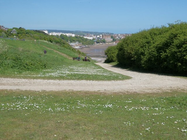
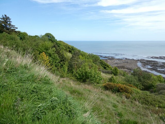
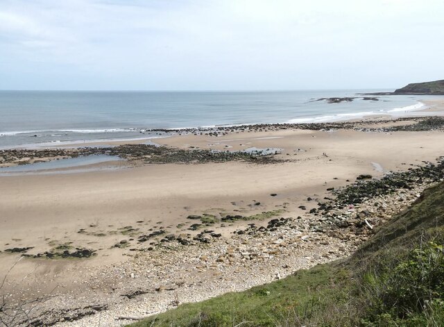
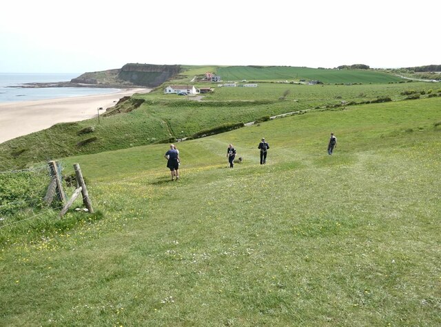
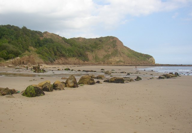
Cornelian Bay is a picturesque coastal area located in the county of Yorkshire, England. Situated on the eastern coastline of the country, it forms part of the larger town of Scarborough. The bay is encompassed by stunning cliffs, providing a dramatic backdrop to the sandy beach and pristine waters.

With its tranquil atmosphere and natural beauty, Cornelian Bay attracts locals and tourists alike. The beach stretches for approximately 2 miles, making it a popular destination for those seeking relaxation or engaging in recreational activities such as swimming, sunbathing, and beachcombing. The clean and well-maintained beach also offers a safe environment for families with children.

The bay is known for its diverse wildlife and rich marine ecosystem. Visitors can often spot various bird species, including gulls, cormorants, and oystercatchers. During low tide, rock pools are exposed, revealing an array of fascinating marine life such as crabs, starfish, and small fish.

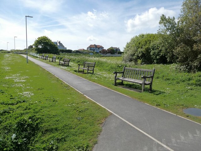
Cornelian Bay is also a favorite spot for water sports enthusiasts, with opportunities for kayaking, paddleboarding, and windsurfing. Additionally, the bay is part of the Cleveland Way National Trail, offering scenic walks along the coastline and breathtaking views of the North Sea.

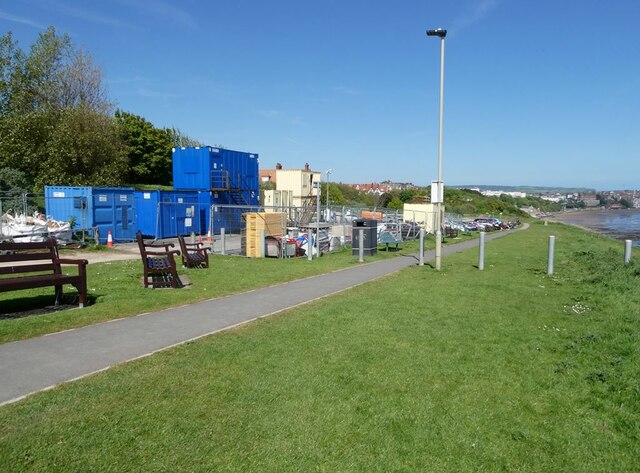
Facilities and amenities in Cornelian Bay include car parking, toilets, and nearby cafes and restaurants. The bay is easily accessible by road, and public transportation options are available for those without private vehicles. Overall, Cornelian Bay offers a delightful coastal experience, combining natural beauty, outdoor activities, and a peaceful ambiance.

If you have any feedback on the listing, please let us know in the comments section below.

Cornelian Bay Images

Images are sourced within 2km of 54.261097/-0.36962242 or Grid Reference TA0686. Thanks to Geograph Open Source API. All images are credited.

Major works at Sea Cliff Road car park Not sure what is going on here.
Major works at Sea Cliff Road car park
Not sure what is going on here.
Row of benches at Sea Cliff Road Each with its own commemorative plaque.
Row of benches at Sea Cliff Road
Each with its own commemorative plaque.
Climb on the Cleveland Way Where the National Trail climbs up from South Bay to Wheatcroft Cliff.
Climb on the Cleveland Way
Where the National Trail climbs up from South Bay to Wheatcroft Cliff.
Sea wall repairs below Holbeck Gardens
Houses on Filey Road One house has set out a substantial range of home products for sale. Filey Road is closed a short distance south of this point, although still  allowing free passage for cycles.
Houses on Filey Road
One house has set out a substantial range of home products for sale. Filey Road is closed a short distance south of this point, although still allowing free passage for cycles.
Filey Road, Osgodby Filey Road is closed a short distance south of this point, although still allowing free passage for cycles.
Filey Road, Osgodby
Filey Road is closed a short distance south of this point, although still allowing free passage for cycles.
Cleveland Way at Frank Cliff The National Trail works its way between the wooded clifftop and the fields.
Cleveland Way at Frank Cliff
The National Trail works its way between the wooded clifftop and the fields.
Houses at junction of Osgodby Lane and Filey Road
A peep inside Knipe Point From 1933 to 1974 Knipe Point was a holiday camp for NALGO members. From 1985 onwards it was redeveloped as a residential community with a mixture of permanent and holiday homes. This view was taken through an emergency gate on the north side of the estate.
A peep inside Knipe Point
From 1933 to 1974 Knipe Point was a holiday camp for NALGO members. From 1985 onwards it was redeveloped as a residential community with a mixture of permanent and holiday homes. This view was taken through an emergency gate on the north side of the estate.
Wave-cut platform at Black Rocks A remarkable circular rock formation.
Wave-cut platform at Black Rocks
A remarkable circular rock formation.
Scarborough South Cliff Golf Club The houses of Osgodby beyond.
Scarborough South Cliff Golf Club
The houses of Osgodby beyond.
Vegetated slopes at the north end of Frank Cliff
Coast south of White Nab Osgodby Point <a href="https://www.geograph.org.uk/gridref/TA0685">TA0685</a> in the middle distance.
Coast south of White Nab
Osgodby Point TA0685 in the middle distance.
Cleveland Way at  Tenants' Cliff The National Trail descends through  Cayton Woods by a series of precipitous flights of steps.
Cleveland Way at Tenants' Cliff
The National Trail descends through Cayton Woods by a series of precipitous flights of steps.
Path repairs at  Tenants'  Cliff Two workers enjoying their lunch break whilst working on maintenance of the precipitous path down to Cayton Bay.
Path repairs at Tenants' Cliff
Two workers enjoying their lunch break whilst working on maintenance of the precipitous path down to Cayton Bay.
Cayton Sands The magnificent sweep of beach at Cayton Bay.
Cayton Sands
The magnificent sweep of beach at Cayton Bay.
Cleveland Way above Cayton Bay The National Trail follows an undulating course across the steep hillside above the bay.
Cleveland Way above Cayton Bay
The National Trail follows an undulating course across the steep hillside above the bay.
Cleveland Way above Cayton Bay The National Trail descends across steep grassland towards the bay
Cleveland Way above Cayton Bay
The National Trail descends across steep grassland towards the bay
Show me another place!

Cornelian Bay is located at Grid Ref: TA0686 (Lat: 54.261097, Lng: -0.36962242)

Division: North Riding

Administrative County: North Yorkshire

Police Authority: North Yorkshire

What 3 Words

///informed.delight.carriage. Near Scarborough, North Yorkshire

Related Wikis

Cornelian Bay, North Yorkshire

Cornelian Bay is a bay of the North Sea near Scarborough, North Yorkshire, England. It is located between the headlands of White Nab and Knipe Point, just...

Knipe Point

Knipe Point (or Osgodby Point) is a rocky headland on the North Sea coast, between Cornelian Bay and Cayton Bay in North Yorkshire, England. From this...

Holbeck Hall Hotel

The Holbeck Hall Hotel was a clifftop hotel in Scarborough, North Yorkshire, England, owned by the Turner family. It was built in 1879 by George Alderson...

Osgodby, coastal North Yorkshire

Osgodby is a village and civil parish in the district and county of North Yorkshire, England. Until 2023, it was in the borough of Scarborough. Approximately...
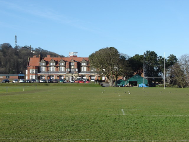
Scarborough College

Scarborough College is a private coeducational day and boarding school aged 3–18 years in Scarborough, North Yorkshire, England. It was founded in 1898...
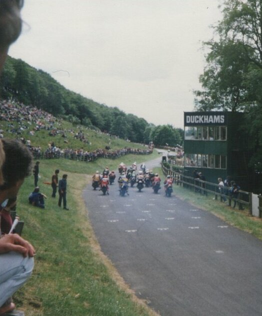
Oliver's Mount

Oliver's Mount is an area of high ground overlooking Scarborough, North Yorkshire, England. It offers views over the town, a tribute monument to the war...

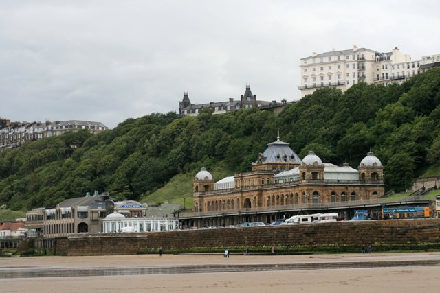
The Spa, Scarborough

Scarborough Spa is a Grade II* listed building in South Bay, Scarborough, North Yorkshire, England. It is a venue for conferences, exhibitions, entertainment...

Scarborough War Memorial

Scarborough War Memorial is a war memorial at the north end of Oliver's Mount in the town of Scarborough in North Yorkshire. It is listed Grade II on the...

Nearby Amenities

Located within 500m of 54.261097,-0.36962242
Source: PGS
Lat/Long: 54.2567321/-0.3712995
Source: PGS
Lat/Long: 54.2570044/-0.3717525
Source: PGS
Lat/Long: 54.2572532/-0.372076
Source: PGS
Lat/Long: 54.2575145/-0.3725673
Source: PGS
Lat/Long: 54.2578197/-0.372715
Source: PGS
Lat/Long: 54.2579594/-0.3730154
Source: PGS
Lat/Long: 54.2604337/-0.3751801
Source: PGS
Lat/Long: 54.2606975/-0.3751908
Source: PGS
Lat/Long: 54.2612291/-0.3751213
Source: PGS
Lat/Long: 54.261776/-0.3754486
Source: PGS
Lat/Long: 54.2622154/-0.3757436
Source: PGS
Lat/Long: 54.2624199/-0.3761422
Source: PGS
Lat/Long: 54.2627539/-0.3766985
Source: PGS
Lat/Long: 54.2585915/-0.3735818
Source: PGS
Lat/Long: 54.2582619/-0.3732392
Source: PGS
Lat/Long: 54.2587929/-0.3743309
Source: PGS
Lat/Long: 54.2590207/-0.3747069
The data included in this document is from www.openstreetmap.org. The data is made available under ODbL.

Have you been to Cornelian Bay?

Leave your review of Cornelian Bay below (or comments, questions and feedback).