Sand Wick

Bay in Shetland

Scotland

Sand Wick

Hill of Bixsetter, east of Sellafirth
Hill of Bixsetter, east of Sellafirth Credit: Mike Pennington

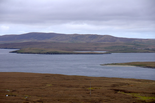
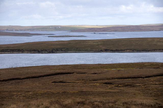
Sand Wick is a picturesque bay located on the east coast of Shetland, Scotland. Situated near the village of Cunningsburgh, it is known for its stunning beauty and tranquil atmosphere.

The bay is characterized by its sandy beach, which stretches for approximately half a mile. The sand is soft and golden, making it an ideal spot for beach enthusiasts and families looking to relax and unwind. The crystal-clear waters of the North Sea gently lap against the shore, creating a soothing soundtrack for visitors.

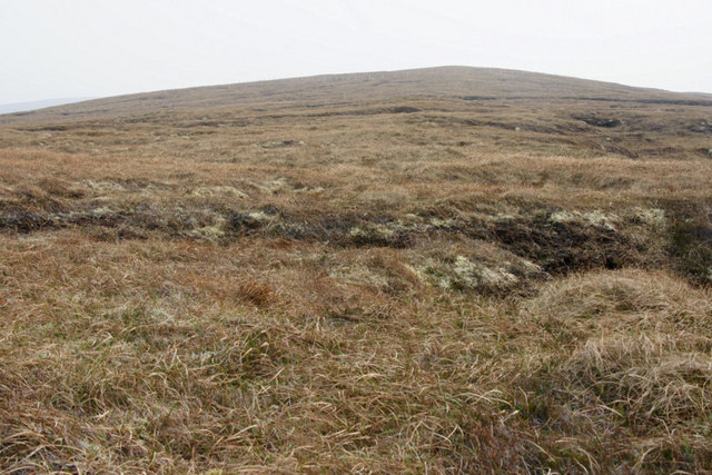
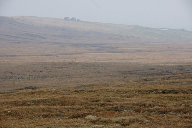
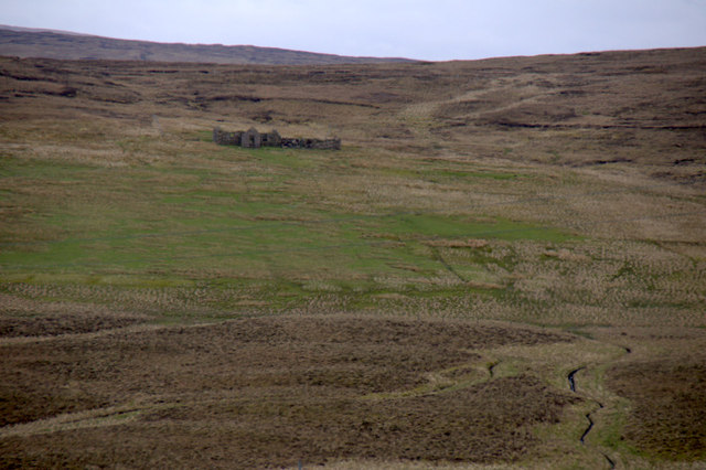
Surrounded by rugged cliffs and rolling hills, Sand Wick offers breathtaking views of the surrounding landscape. The bay is also home to a variety of wildlife, including seals, seabirds, and occasionally even dolphins, making it a haven for nature lovers and birdwatchers.

For those interested in outdoor activities, Sand Wick provides opportunities for fishing and coastal walks. The bay is also a popular spot for water sports such as kayaking and windsurfing, attracting enthusiasts from near and far.

Despite its remote location, Sand Wick is easily accessible by road, with a small car park available for visitors. Facilities in the area are limited, so visitors are advised to bring their own food and drinks for a day by the beach.

Overall, Sand Wick in Shetland is a hidden gem, offering a peaceful and idyllic setting for those seeking natural beauty and tranquility.

If you have any feedback on the listing, please let us know in the comments section below.

Sand Wick Images

Images are sourced within 2km of 60.649033/-0.99835727 or Grid Reference HU5496. Thanks to Geograph Open Source API. All images are credited.

Hill of Bixsetter, east of Sellafirth
Black Park, North Sandwick Looking towards North Sandwick.
Black Park, North Sandwick
Looking towards North Sandwick.
Setter, North Sandwick Ruined crofthouse across the valley from the extant houses.
Setter, North Sandwick
Ruined crofthouse across the valley from the extant houses.
Mid House, North Sandwick
Burra Ness from North Sandwick In the distance is the Solitaire, the largest pipe-laying vessel in the world, currently laying a pipeline which will take gas from the Laggan-Tormore gasfields west of Shetland to Mainland Scotland.
Burra Ness from North Sandwick
In the distance is the Solitaire, the largest pipe-laying vessel in the world, currently laying a pipeline which will take gas from the Laggan-Tormore gasfields west of Shetland to Mainland Scotland.
Burra Ness from North Sandwick The broch on Burra Ness with the Lambhoga peninsula on Fetlar beyond.
Burra Ness from North Sandwick
The broch on Burra Ness with the Lambhoga peninsula on Fetlar beyond.
North Sand Wick, Yell View across the bay to Burra Ness, with Fetlar in the distance.
North Sand Wick, Yell
View across the bay to Burra Ness, with Fetlar in the distance.
North Sand Wick, Yell Burra Ness and Hascosay in the background.
North Sand Wick, Yell
Burra Ness and Hascosay in the background.
View across Bluemull Sound from the Hill of Gutcher Yell in the foreground, the north end of Linga in the sound and Unst in the distance, with Loch of Belmont in the centre and the Valla Field ridge in the background.
View across Bluemull Sound from the Hill of Gutcher
Yell in the foreground, the north end of Linga in the sound and Unst in the distance, with Loch of Belmont in the centre and the Valla Field ridge in the background.
View to Uyeasound from the Hill of Gutcher Looking from Yell in the foreground and across Linga to the Holm of Heogland off the coast of Unst. Uyea Sound, separating Uyea from Unst, is beyond Heogland, and the settlement of Uyeasound is visible on the far left.
View to Uyeasound from the Hill of Gutcher
Looking from Yell in the foreground and across Linga to the Holm of Heogland off the coast of Unst. Uyea Sound, separating Uyea from Unst, is beyond Heogland, and the settlement of Uyeasound is visible on the far left.
South end of Linga Uninhabited island at the south end of Bluemull Sound between Yell and Unst (but nearer to Yell). Unst beyond.
South end of Linga
Uninhabited island at the south end of Bluemull Sound between Yell and Unst (but nearer to Yell). Unst beyond.
North Sandwick The house of Easter House above North Sandwick.
North Sandwick
The house of Easter House above North Sandwick.
Southern tip of Linga Uyeasound on Unst in the background.
Southern tip of Linga
Uyeasound on Unst in the background.
Southern tip of Linga Wedder Holm in the distance.
Southern tip of Linga
Wedder Holm in the distance.
West end of Burra Ness from the sea
Kirkabister, Burraness, from the sea
West end of Burra Ness from the sea The hill of Burraness in the background.
West end of Burra Ness from the sea
The hill of Burraness in the background.
Coastline of Burra Ness from the sea
Show me another place!

Sand Wick is located at Grid Ref: HU5496 (Lat: 60.649033, Lng: -0.99835727)

Unitary Authority: Shetland Islands

Police Authority: Highlands and Islands

What 3 Words

///dialect.postings.energetic. Near Gutcher, Shetland Islands

Related Wikis

Burra Ness Broch

Burra Ness Broch is an iron-age broch located on the east coast of the island of Yell, Shetland, Scotland. == Location == Burra Ness Broch (grid reference...

North Isles

The North Isles are the northern islands of the Shetland Islands, Scotland. The main islands in the group are Yell, Unst and Fetlar. Sometimes the islands...

Linga, Bluemull Sound

Linga is a very small uninhabited island in the Bluemull Sound, Shetland, Scotland. It is one of many islands in Shetland called Linga. It has an area...

Gutcher

Gutcher is a settlement on the northeast coast of Yell in the Shetland islands. From here, rollon/roll off ferry services to Belmont on Unst and Hamars...

Basta, Shetland

Basta is a hamlet on the island of Yell in the Shetland islands of Scotland. It is on the shores of Basta Voe and is in the parish of Yell. == References... ==

Sound Gruney

For other islands with similar names, see Gruney (disambiguation) Sound Gruney is one of the Shetland islands. It lies about 1.5 kilometres (0.93 mi)...

Hascosay

Hascosay (Scots: Hascosay; Old Norse "Hafskotsey") is a small island lying between Yell and Fetlar in the Shetland Islands, Scotland. == Geography and... ==

Bluemull Sound

Bluemull Sound is the strait between Unst and Yell in Shetland's North Isles. A ferry service crosses it regularly. Cullivoe is on the Yell side, and the...

Nearby Amenities

Located within 500m of 60.649033,-0.99835727
Power: pole
Lat/Long: 60.6532086/-1.0008874
Power: pole
Lat/Long: 60.6529904/-1.0001927
Power: pole
Lat/Long: 60.6526499/-0.9994363
Power: pole
Lat/Long: 60.6528918/-1.0008847
Power: pole
Lat/Long: 60.6527524/-1.0020246
Power: pole
Lat/Long: 60.6524646/-1.0009169
Power: pole
Lat/Long: 60.6520557/-1.0009303
North Sandwick
Place: hamlet
Lat/Long: 60.6529454/-1.0005843
The data included in this document is from www.openstreetmap.org. The data is made available under ODbL.

Have you been to Sand Wick?

Leave your review of Sand Wick below (or comments, questions and feedback).