Bay of Ollaberry

Bay in Shetland

Scotland

Bay of Ollaberry

Loch of Queyfirth from Greystane It should be obvious how the adjacent house gets its name.
Loch of Queyfirth from Greystane Credit: Mike Pennington

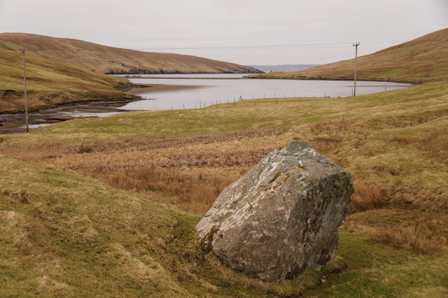
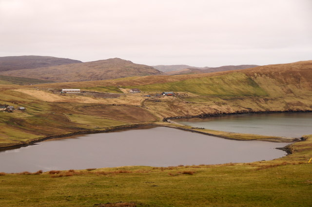
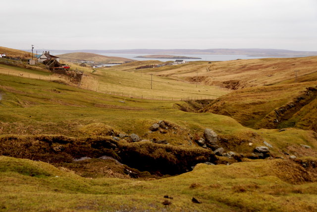
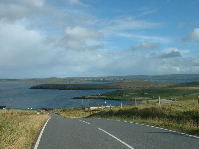
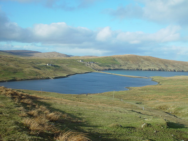
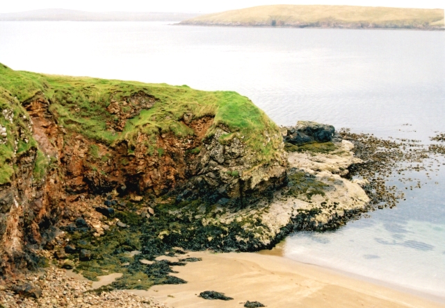
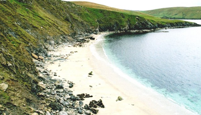
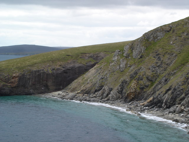
The Bay of Ollaberry is a picturesque inlet located on the northwest coast of the Shetland Islands, Scotland. Nestled between the villages of Ollaberry and Hillswick, the bay offers stunning views of rugged cliffs, rolling hills, and crystal-clear waters. It is situated on the Atlantic Ocean, providing a gateway to the dramatic coastal landscapes for locals and visitors alike.

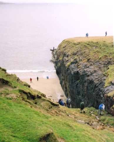
The bay is known for its diverse wildlife, with seabirds such as puffins, guillemots, and razorbills nesting along its cliffs. Seals can often be seen lounging on the rocks or swimming in the bay's calm waters, while occasionally, whales and dolphins pass through the area, delighting those lucky enough to witness their presence.

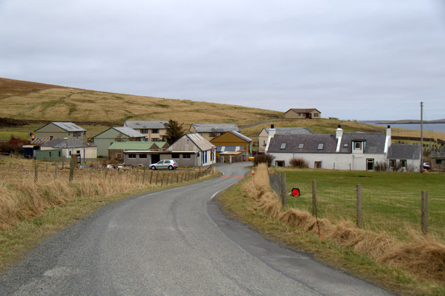
The small fishing community of Ollaberry, which overlooks the bay, contributes to the region's charm. Historically, fishing has been a significant industry in this area, with the bay serving as a natural harbor for local fishing boats. Fishing remains an essential part of the local economy, and visitors can witness the traditional methods employed by the fishermen.

The Bay of Ollaberry is also a popular destination for outdoor enthusiasts, offering opportunities for hiking, birdwatching, and photography. The nearby hills and cliffs provide breathtaking viewpoints, particularly during sunset or sunrise when the bay is bathed in a warm, golden light. Visitors can explore the rugged coastline, discovering hidden coves and secluded beaches, or simply enjoy a peaceful picnic while taking in the serene surroundings.

In summary, the Bay of Ollaberry is a stunning coastal inlet in Shetland, offering breathtaking views, abundant wildlife, and a glimpse into the local fishing community. It is a place of natural beauty and tranquility, inviting visitors to immerse themselves in the rugged charm of the Shetland Islands.

If you have any feedback on the listing, please let us know in the comments section below.

Bay of Ollaberry Images

Images are sourced within 2km of 60.504096/-1.3369203 or Grid Reference HU3680. Thanks to Geograph Open Source API. All images are credited.

Loch of Queyfirth from Greystane It should be obvious how the adjacent house gets its name.
Loch of Queyfirth from Greystane
It should be obvious how the adjacent house gets its name.
Loch of Queyfirth from Hill of Ollaberry The loch is really an arm of the sea, with an outflow at low tide and the sea encroaching at high tide.
Loch of Queyfirth from Hill of Ollaberry
The loch is really an arm of the sea, with an outflow at low tide and the sea encroaching at high tide.
Blythoid, Ollaberry Looking across Yell Sound to Sullom Voe Terminal.
Blythoid, Ollaberry
Looking across Yell Sound to Sullom Voe Terminal.
Wind turbines on Hill of Ollaberry
Runnadale, Ollaberry Small housing estate at the end of the road.
Runnadale, Ollaberry
Small housing estate at the end of the road.
Small burn entering the Bay of Ollaberry Looking across to Ollaberry and the hill the Back of Ollaberry.
Small burn entering the Bay of Ollaberry
Looking across to Ollaberry and the hill the Back of Ollaberry.
Eastwick, Ollaberry Looking across the small burn and a cabbage patch towards an old kirk.
Eastwick, Ollaberry
Looking across the small burn and a cabbage patch towards an old kirk.
Hillside, Ollaberry
Hillside, Ollaberry
East Hogaland, Ollaberry The apparently un-named burn flows into the Bay of Ollaberry.
East Hogaland, Ollaberry
The apparently un-named burn flows into the Bay of Ollaberry.
Blythot, Ollaberry, Shetland Picture taken at Blythot, above Ollaberry, looking over East Ness to Gluss Isle in Sullom Voe. Sullom Voe Oil Terminal is in the background
Blythot, Ollaberry, Shetland
Picture taken at Blythot, above Ollaberry, looking over East Ness to Gluss Isle in Sullom Voe. Sullom Voe Oil Terminal is in the background
Bay of Ollaberry The B9079 leads to this small village at the northern end of the Shetland Mainland.
Bay of Ollaberry
The B9079 leads to this small village at the northern end of the Shetland Mainland.
Loch of Queyfirth, Shetland If you take the road from Upper Ollaberry signposted Leon you come over the ridge to the west the Hill of Ollaberry and are greeted with this view of the Loch of Queyfirth and Quey Firth.
Loch of Queyfirth, Shetland
If you take the road from Upper Ollaberry signposted Leon you come over the ridge to the west the Hill of Ollaberry and are greeted with this view of the Loch of Queyfirth and Quey Firth.
Saberstone This spectacular cliff is part of the Walls Boundary Fault, which cuts Shetland from north to south and may be the continuation of the Great Glen Fault in Scotland.
Saberstone
This spectacular cliff is part of the Walls Boundary Fault, which cuts Shetland from north to south and may be the continuation of the Great Glen Fault in Scotland.
Ollaberry A quiet village in Northmavine.
Ollaberry
A quiet village in Northmavine.
Otter Hadd The headland beyond Ollaberry
Otter Hadd
The headland beyond Ollaberry
Looking towards the Taing of Norwick The Taing is the headland beyond this fine but rather inaccessible beach.
Looking towards the Taing of Norwick
The Taing is the headland beyond this fine but rather inaccessible beach.
Ollaberry Fault An extension of the Great Glen Fault of Scotland, outcropping in Shetland. A must for all geologists.The cliff on the far side is granite; that on the nearside is schist.
Ollaberry Fault
An extension of the Great Glen Fault of Scotland, outcropping in Shetland. A must for all geologists.The cliff on the far side is granite; that on the nearside is schist.
Loch of Queyfirth
Loch of Queyfirth
Show me another place!

Bay of Ollaberry is located at Grid Ref: HU3680 (Lat: 60.504096, Lng: -1.3369203)

Unitary Authority: Shetland Islands

Police Authority: Highlands and Islands

What 3 Words

///pleasing.bandaged.clipped. Near Toft, Shetland Islands

Related Wikis

Ollaberry

Ollaberry (Old Norse: Olafrsberg, meaning Olaf's Hill) is a village on Mainland, Shetland, Scotland on the west shore of Yell Sound, 10.9 miles (17.5 km...

Lamba, Shetland

Lamba is an uninhabited island in Yell Sound in Shetland. It lies 1.5 km (0.93 mi) north of the entrance to the Sullom Voe inlet and 1.4 kilometres (0...

Voe, Northmavine

Voe is a settlement on the Northmavine peninsula of Mainland, Shetland, Scotland. It is at the head of Ronas Voe and just off the A970 road. == Whaling... ==

Northmavine

Northmavine or Northmaven (Old Norse: Norðan Mæfeið, meaning ‘the land north of the Mavis Grind’) is a peninsula in northwest Mainland Shetland in Scotland...

Nearby Amenities

Located within 500m of 60.504096,-1.3369203
Post Office
Ollaberry Post Office
Addr City: Shetland
Addr Country: GB
Addr Postcode: ZE2 9RT
Addr Suburb: Ollaberry
Brand: Post Office
Brand Wikidata: Q1783168
Operator: Post Office
Ref Pol Id: 145857
Lat/Long: 60.5074052/-1.335412
Barrier: cattle_grid
Lat/Long: 60.5023364/-1.3443767
Ollaberry
Place: village
Lat/Long: 60.5077048/-1.3344248
Post Box
Note: Box number is same as Out Skerries box
Operator: Royal Mail
Operator Wikidata: Q638098
Ref: ZE2 125
Lat/Long: 60.5074374/-1.3352413
Barrier: cattle_grid
Lat/Long: 60.5054333/-1.3455404
Passing Place
Lat/Long: 60.5066163/-1.3386432
Passing Place
Lat/Long: 60.5067423/-1.3436062
Passing Place
Lat/Long: 60.5073834/-1.3373822
Passing Place
Lat/Long: 60.5075441/-1.3355891
Barrier: cattle_grid
Lat/Long: 60.5015228/-1.3431084
Power: pole
Lat/Long: 60.5044043/-1.3456535
Power: pole
Lat/Long: 60.5047621/-1.3448542
Power: pole
Lat/Long: 60.5049893/-1.3442802
Power: pole
Lat/Long: 60.5055056/-1.3431215
Power: pole
Lat/Long: 60.5058965/-1.3422069
Power: pole
Lat/Long: 60.5063772/-1.3410884
Power: pole
Lat/Long: 60.5049681/-1.3443258
Power: pole
Lat/Long: 60.505499/-1.3451037
Power: pole
Lat/Long: 60.5081745/-1.3347957
Power: pole
Lat/Long: 60.5083043/-1.3353374
Power: pole
Lat/Long: 60.5085131/-1.3362169
Power: pole
Lat/Long: 60.5081073/-1.3371013
Power: pole
Lat/Long: 60.5077793/-1.3377963
Power: pole
Lat/Long: 60.5075055/-1.3384314
Power: pole
Lat/Long: 60.5072436/-1.3390498
Power: pole
Lat/Long: 60.5067138/-1.3398335
Power: pole
Lat/Long: 60.5066371/-1.3417724
Power: pole
Lat/Long: 60.5070937/-1.3370725
Power: pole
Lat/Long: 60.5074571/-1.337444
Power: pole
Lat/Long: 60.5069327/-1.3384362
Power: pole
Lat/Long: 60.5071911/-1.3379377
Power: pole
Lat/Long: 60.5073162/-1.3356585
Power: pole
Lat/Long: 60.5009287/-1.3359365
Power: pole
Lat/Long: 60.5008532/-1.3366987
Power: pole
Lat/Long: 60.5007871/-1.3373817
Power: pole
Lat/Long: 60.5007446/-1.3378227
Power: pole
Lat/Long: 60.5005251/-1.3389851
Power: pole
Lat/Long: 60.5002466/-1.3405333
Power: pole
Lat/Long: 60.5002266/-1.3414488
Power: pole
Lat/Long: 60.5028039/-1.3444254
Power: pole
Lat/Long: 60.50308/-1.3452379
Power: pole
Lat/Long: 60.5032842/-1.3458155
Power: pole
Lat/Long: 60.503565/-1.345317
Power: pole
Lat/Long: 60.5038565/-1.3448017
Power: pole
Lat/Long: 60.5041208/-1.3443248
Power: pole
Lat/Long: 60.5043887/-1.3440827
The data included in this document is from www.openstreetmap.org. The data is made available under ODbL.

Have you been to Bay of Ollaberry?

Leave your review of Bay of Ollaberry below (or comments, questions and feedback).