Husawick

Bay in Shetland

Scotland

Husawick

Baggage handling at Foula airstrip Islanders' shopping from Lerwick is being offloaded whilst day visitors wait to load their bags for the return trip.
Baggage handling at Foula airstrip Credit: Lis Burke

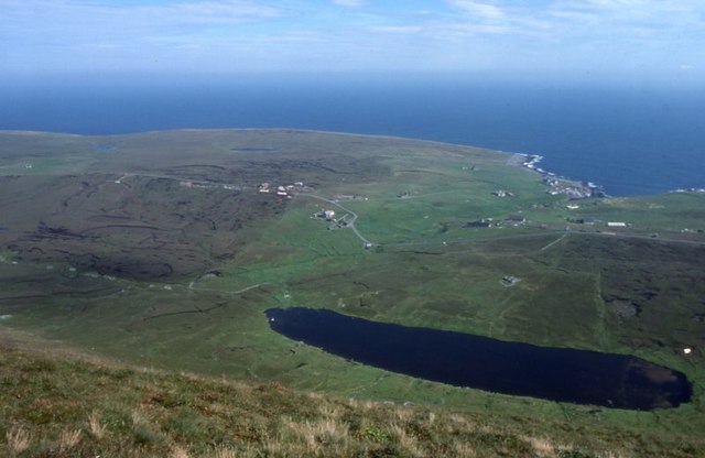
Husawick, Shetland (Bay) is a picturesque village situated on the east coast of the Mainland, the largest island of the Shetland archipelago in Scotland. With a population of around 150 residents, this remote bay is known for its stunning natural beauty and tranquil surroundings.

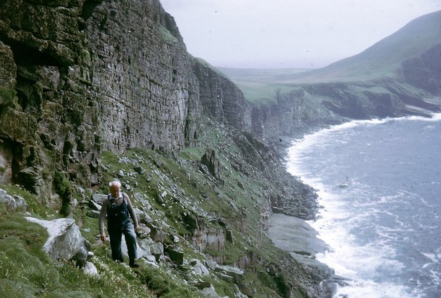
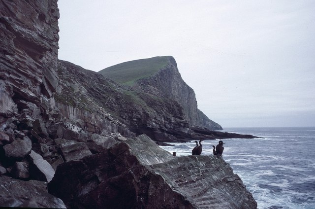
The bay of Husawick is characterized by a long stretch of sandy beach, framed by rugged cliffs and overlooked by rolling green hills. The crystal-clear waters of the bay are a haven for wildlife, attracting various species of seabirds, seals, and even occasional sightings of dolphins and whales.

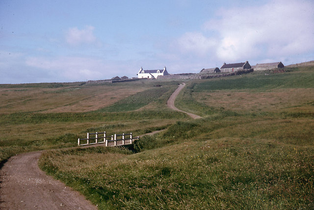
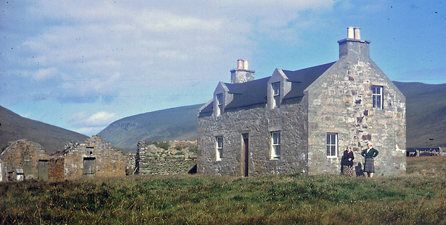
The village itself is made up of a small cluster of traditional stone cottages and houses, giving it a charming and timeless feel. Although Husawick is primarily a residential area, there is a small café and a few local businesses that cater to both residents and visitors.

Husawick is an ideal destination for nature enthusiasts and outdoor adventurers. The bay offers excellent opportunities for walking, hiking, and birdwatching, with several walking trails that wind through the surrounding countryside, providing breathtaking views of the coastline.

With its unspoiled beauty and tranquil atmosphere, Husawick, Shetland (Bay) is a hidden gem in the Shetland Islands, offering a peaceful retreat for those seeking a break from the hustle and bustle of modern life.

If you have any feedback on the listing, please let us know in the comments section below.
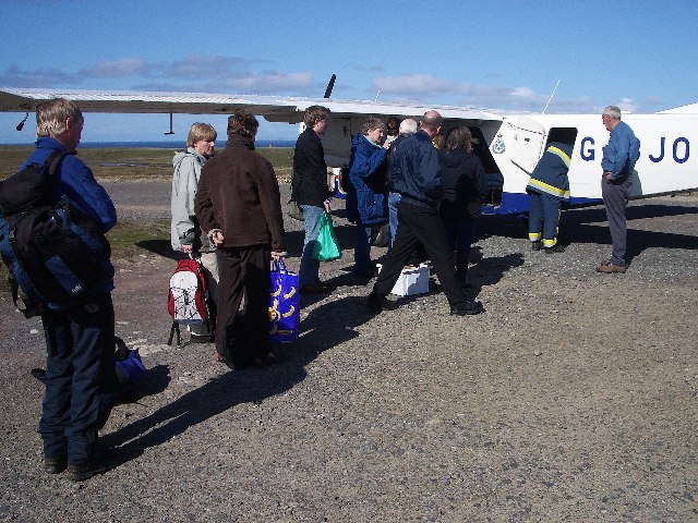
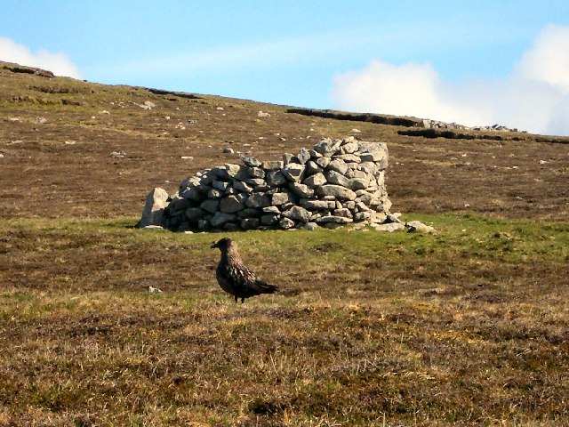
Husawick Images

Images are sourced within 2km of 60.11738/-2.0743454 or Grid Reference HT9536. Thanks to Geograph Open Source API. All images are credited.

Baggage handling at Foula airstrip Islanders' shopping from Lerwick is being offloaded whilst day visitors wait to load their bags for the return trip.
Baggage handling at Foula airstrip
Islanders' shopping from Lerwick is being offloaded whilst day visitors wait to load their bags for the return trip.
Plantiecrub on Foula Plantiecrubs were used by crofters to keep their kale and cabbage seedlings safe from grazing by livestock. The bird in the foreground is a bonxie (great skua).
Plantiecrub on Foula
Plantiecrubs were used by crofters to keep their kale and cabbage seedlings safe from grazing by livestock. The bird in the foreground is a bonxie (great skua).
Cliffs north-west of Da Smaalie, Foula These cliffs are on the west coast of Foula where the land rises steeply to the main ridge of hills that crosses the island.
Cliffs north-west of Da Smaalie, Foula
These cliffs are on the west coast of Foula where the land rises steeply to the main ridge of hills that crosses the island.
Approaching Foula Taken from the Islander plane as it came in to land, this is a view across one square of the southern promontory. The houses in the distance are at the southern end of the island road with Da Noup beyond them.
Approaching Foula
Taken from the Islander plane as it came in to land, this is a view across one square of the southern promontory. The houses in the distance are at the southern end of the island road with Da Noup beyond them.
Mill Loch, Foula With Ham beyond.
Mill Loch, Foula
With Ham beyond.
The Noup, Foula Taken from the cliffs at the end of the valley of Da Smaalie.
The Noup, Foula
Taken from the cliffs at the end of the valley of Da Smaalie.
Sneck o' da Smaalie, Foula A crack in the rocks in the cliffs at the end of the valley of Da Smaalie. Slithering down and over the rocks down to the wave-cut beach at the bottom is a popular Sunday afternoon day out on Foula - or it was the day we descended.
Sneck o' da Smaalie, Foula
A crack in the rocks in the cliffs at the end of the valley of Da Smaalie. Slithering down and over the rocks down to the wave-cut beach at the bottom is a popular Sunday afternoon day out on Foula - or it was the day we descended.
Sneck  o' da Smaalie, Foula The view looking back up the crack in the cliffs after the descent. The upper and lower entrances to the Sneck are in different gridsquares.
Sneck o' da Smaalie, Foula
The view looking back up the crack in the cliffs after the descent. The upper and lower entrances to the Sneck are in different gridsquares.
Severe Gale in Hellabriks Wick The gale delayed the islanders' mail boat for a week and extended my visit to Foula. See <a href="https://www.geograph.org.uk/photo/3558525">HT9636 : Coastal View Towards Lighthouse, Foula</a> for a similar view in better weather after the installation of the lighthouse on Da Sooth Ness.
Severe Gale in Hellabriks Wick
The gale delayed the islanders' mail boat for a week and extended my visit to Foula. See HT9636 : Coastal View Towards Lighthouse, Foula for a similar view in better weather after the installation of the lighthouse on Da Sooth Ness.
On a traverse of Ufshins There is a terrace beneath the major cliffs that can be accessed through the Sneck of Smallie.  You feel really remote down here.
On a traverse of Ufshins
There is a terrace beneath the major cliffs that can be accessed through the Sneck of Smallie. You feel really remote down here.
Puffins on the Ufshins Fabulous birds!
Puffins on the Ufshins
Fabulous birds!
The road to Biggings 1964 This was the last stretch of the road that led south from Ham
The road to Biggings 1964
This was the last stretch of the road that led south from Ham
Punds 1964 The Isbister sisters were living in Punds in 1964.  Their father had built the house one winter when the laird was away and against the wishes of the laird.  I believe that this was the first one and a half storey house on Foula other than the home of the laird.
Punds 1964
The Isbister sisters were living in Punds in 1964. Their father had built the house one winter when the laird was away and against the wishes of the laird. I believe that this was the first one and a half storey house on Foula other than the home of the laird.
View to The Noup over Mucklebrik from above Ufshins The vertical cleft of da Sneck o da Smallie is visible.  This cleft provides access to Ufshins and an exciting sheeptrack/footpath that eventually brings you out at the top of the cliffs.
View to The Noup over Mucklebrik from above Ufshins
The vertical cleft of da Sneck o da Smallie is visible. This cleft provides access to Ufshins and an exciting sheeptrack/footpath that eventually brings you out at the top of the cliffs.
Ufshins Looking back along the terrace towards the Sneck of the Smallie.  This is an exhilarating walk.
Ufshins
Looking back along the terrace towards the Sneck of the Smallie. This is an exhilarating walk.
Scarfs on the cliffs north of the Noup, Foula Scarf is the Shetland name for the Shag (Phalacrocorax aristotelis). Taken from the boulder beach at the base of the Sneck o' da Smaalie.
Scarfs on the cliffs north of the Noup, Foula
Scarf is the Shetland name for the Shag (Phalacrocorax aristotelis). Taken from the boulder beach at the base of the Sneck o' da Smaalie.
View to the Noup from below Da Smaalie, Foula
Mucklebrik's Wick, Foula The view from the end of the valley of Da Smaalie, looking out towards the headland of Wester Hoevdi.
Mucklebrik's Wick, Foula
The view from the end of the valley of Da Smaalie, looking out towards the headland of Wester Hoevdi.
Show me another place!

Husawick is located at Grid Ref: HT9536 (Lat: 60.11738, Lng: -2.0743454)

Unitary Authority: Shetland Islands

Police Authority: Highlands and Islands

What 3 Words

///wizard.cabinets.signified. Near Walls, Shetland Islands

Nearby Locations

Hellabrik's Wick Husawick

Related Wikis

Foula Airfield

Foula Airfield (IATA: FOA) is an airfield located on the remote island of Foula, part of the Shetland Islands in the north of Scotland. == History == The...

Foula

Foula (), located in the Shetland archipelago of Scotland, is one of the United Kingdom's most remote permanently inhabited islands. Owned since the turn...

RMS Oceanic (1899)

RMS Oceanic was a transatlantic ocean liner built for the White Star Line. She sailed on her maiden voyage on 6 September 1899 and was the largest ship...

Nearby Amenities

Located within 500m of 60.11738,-2.0743454
Barrier: cattle_grid
Lat/Long: 60.1191633/-2.0665368
Addr Housename: Da Biggins
Source: OS OpenData StreetView
Lat/Long: 60.1182718/-2.068842
Addr Housename: Cruglie
Source: OS OpenData StreetView
Lat/Long: 60.1189507/-2.0684131
Hellabrik's Wick
Place: locality
Lat/Long: 60.1146582/-2.0738352
Da Nab
Place: locality
Lat/Long: 60.114948/-2.0682636
Husawick
Place: locality
Lat/Long: 60.117012/-2.0743586
The data included in this document is from www.openstreetmap.org. The data is made available under ODbL.

Have you been to Husawick?

Leave your review of Husawick below (or comments, questions and feedback).