Bath Road

Settlement in Middlesex

England

Bath Road

Heathrow airport Taxi area approaching terminal 5.
Heathrow airport Credit: Alan Hughes

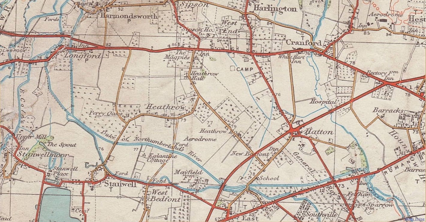
Bath Road is a major thoroughfare located in the county of Middlesex, England. Stretching approximately 10 miles, it connects the towns of Hounslow and Harmondsworth, passing through the suburban areas of Cranford and Longford along the way. Bath Road has a rich history, dating back centuries.

The road derives its name from the ancient Roman road that once existed in the same location, which connected London to the southwest of England, including the historic city of Bath. Today, Bath Road serves as a vital transportation route, with heavy traffic flow throughout the day.

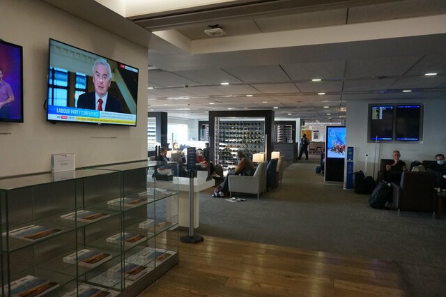
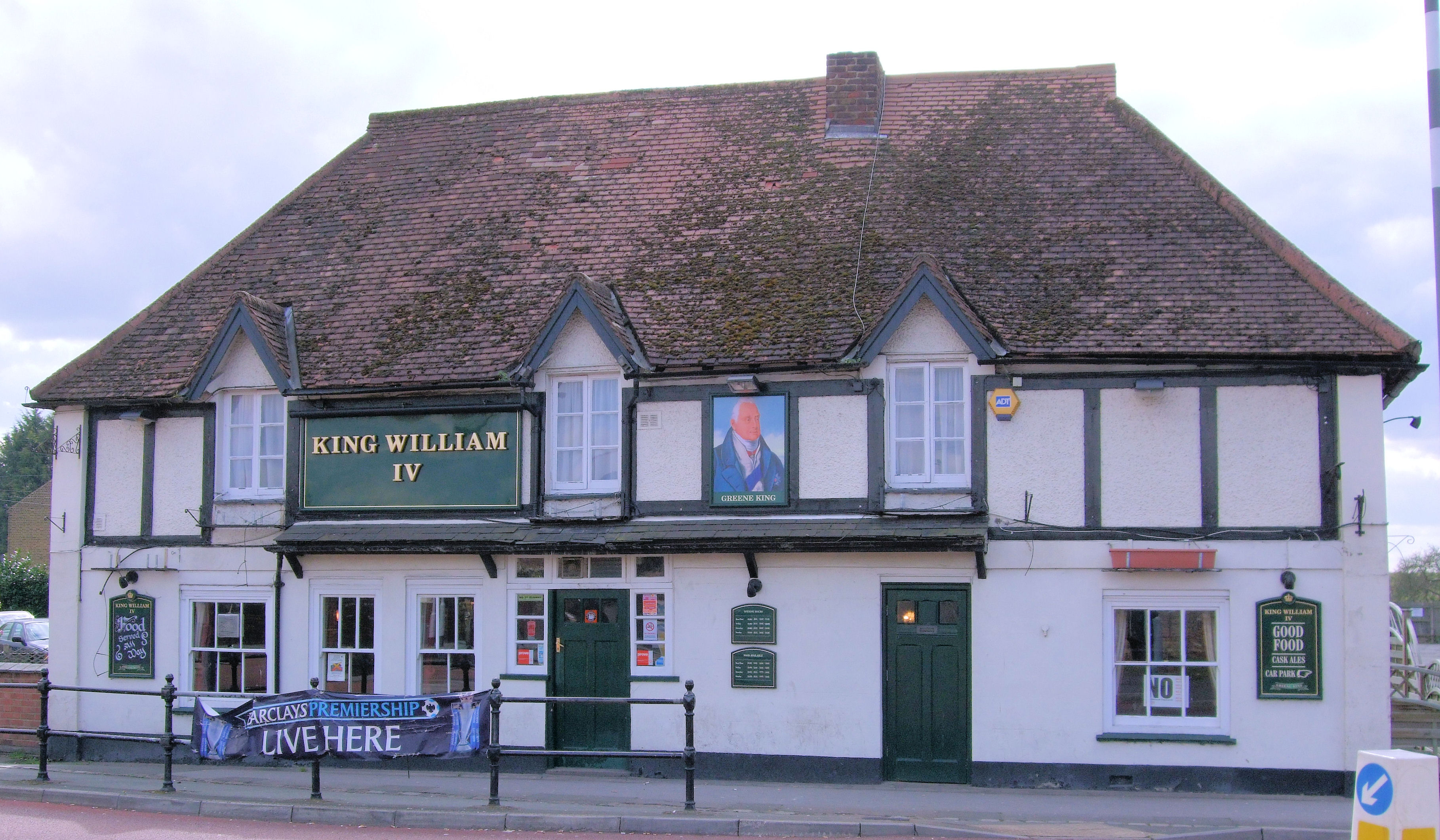
The road is predominantly lined with residential properties, ranging from detached houses to apartment complexes. There are also several commercial establishments, including convenience stores, restaurants, and local businesses, catering to the needs of the residents and commuters. The proximity to London Heathrow Airport, one of the busiest airports in the world, makes Bath Road a popular choice for hotels and guesthouses, providing accommodation for travelers.

In addition to its residential and commercial offerings, Bath Road boasts several green spaces, including parks and recreational areas, providing a pleasant environment for residents and visitors. The road is also well-served by public transportation, with several bus routes and nearby train stations, ensuring convenient access to surrounding areas.

Overall, Bath Road in Middlesex is a bustling, diverse, and well-connected area, offering a mix of residential, commercial, and recreational amenities, making it an attractive place to live, work, and explore.

If you have any feedback on the listing, please let us know in the comments section below.
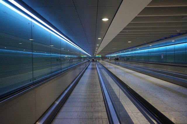
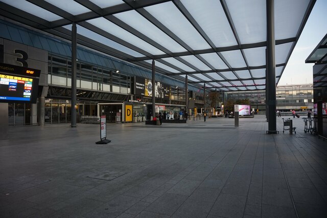
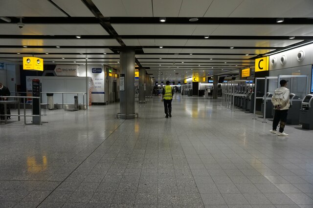
Bath Road Images

Images are sourced within 2km of 51.480835/-0.456202 or Grid Reference TQ0776. Thanks to Geograph Open Source API. All images are credited.

Heathrow airport Taxi area approaching terminal 5.
Heathrow airport
Taxi area approaching terminal 5.
Heathrow Bus Station at T2, T3
Terminal Two at Heathrow Airport
Travelling Walkway towards terminal 3, Heathrow Airport
Entrance to terminal three, Heathrow Airport
Checkin area at terminal 3, Heathrow Airport
Gin display at duty free, T3, Heathrow Airport
Lounge 1 at T3, Heathrow Airport
KLM plane PH-EXV heading for take off at Heathrow Taken from Lounge 1 at T3, Heathrow Airport.
KLM plane PH-EXV heading for take off at Heathrow
Taken from Lounge 1 at T3, Heathrow Airport.
Air American plane at T3 Heathrow
Finnair to Helsinki ready for boarding at T3, Heathrow
Air China B-8385 Airbus A330-300 Heads for runway 27R at Heathrow Airport.
Air China B-8385 Airbus A330-300
Heads for runway 27R at Heathrow Airport.
United N12006, &87 Dreamliner Taken off on runway 27R Heathrow Airport.
United N12006, &87 Dreamliner
Taken off on runway 27R Heathrow Airport.
Runway 27R at Heathrow Airport
American plane taxiing to 27R runway at Heathrow airport
Fuel tanks a Heathrow Airport
Terminal 2, Heathrow Airport Viewed from a plane which had just taken off.
Terminal 2, Heathrow Airport
Viewed from a plane which had just taken off.
The Cathay Pacific Lounge, Heathrow This terminal 3 lounge is next to gate #11 and is used by Business Class travellers.
The Cathay Pacific Lounge, Heathrow
This terminal 3 lounge is next to gate #11 and is used by Business Class travellers.
Show me another place!

Bath Road is located at Grid Ref: TQ0776 (Lat: 51.480835, Lng: -0.456202)

Unitary Authority: Hillingdon

Police Authority: Metropolitan

What 3 Words

///reward.appear.tests. Near West Drayton, London

Nearby Locations

Bath Road

Related Wikis

Windsor Link Railway

The Windsor Link Railway was a proposed new railway in Windsor, Berkshire, connecting the Great Western and South Western franchise areas and linking both...

Heathrow Airport

Heathrow Airport (), called London Airport until 1966 and now known as London Heathrow (IATA: LHR, ICAO: EGLL), is the main international airport serving...

Great West Aerodrome

The Great West Aerodrome, also known as Harmondsworth Aerodrome or Heathrow Aerodrome, was a grass airfield, operational between 1930 and 1944. It was...

Sipson

Sipson is a village in the London Borough of Hillingdon, the westernmost borough of Greater London, England. It is 14.3 miles (23 km) west of Charing Cross...

Nearby Amenities

Located within 500m of 51.480835,-0.456202
Maxspeed: 30 mph
Traffic Sign: maxspeed
Lat/Long: 51.4823673/-0.4526313
Crossing
Bicycle: yes
Crossing: unmarked
Lat/Long: 51.4812646/-0.4553086
Motorway Junction
Concorde Roundabout
Exit To: Heathrow Tunnel
Layer: 3
Ref: 4A
Lat/Long: 51.4820074/-0.4524875
Turning Circle
Lat/Long: 51.4819091/-0.4591368
Turning Circle
Lat/Long: 51.482041/-0.4572525
Crossing
Crossing: uncontrolled
Crossing Island: yes
Tactile Paving: yes
Lat/Long: 51.481153/-0.4499134
Crossing
Button Operated: yes
Crossing: traffic_signals
Crossing Island: yes
Crossing Ref: toucan
Tactile Paving: yes
Lat/Long: 51.4814435/-0.4500519
Give Way
Direction: forward
Lat/Long: 51.479714/-0.4497539
Traffic Signals
Traffic Signals: signal
Traffic Signals Direction: forward
Lat/Long: 51.4807187/-0.4522714
Bus Stop
Bath Road / Newport Road
Bus: yes
Local Ref: BT
Naptan AtcoCode: 490008014W
Naptan Bearing: W
Naptan CommonName: Heathrow Boulevard
Naptan Indicator: Stop BT
Naptan Street: BATH ROAD
Naptan Verified: no
Public Transport: platform
Ref: 76476
Lat/Long: 51.4810204/-0.4632285
Bus Stop
Sipson Road
Local Ref: BP
Naptan AtcoCode: 490008021W
Naptan Bearing: W
Naptan CommonName: Heathrow Police Station
Naptan Indicator: Stop BP
Naptan Street: BATH ROAD
Naptan Verified: no
Public Transport: platform
Lat/Long: 51.481213/-0.4516535
Bus Stop
Newport Road
Local Ref: BB
Naptan AtcoCode: 490010245E
Naptan Bearing: E
Naptan CommonName: Newport Road
Naptan Indicator: Stop BB
Naptan Street: BATH ROAD
Naptan Verified: no
Public Transport: platform
Ref: 52018
Lat/Long: 51.4810328/-0.4619334
Bus Stop
Newport Road
Local Ref: BS
Naptan AtcoCode: 490010245N
Naptan Bearing: N
Naptan CommonName: Newport Road
Naptan Indicator: Stop BS
Naptan Street: NEWPORT ROAD
Naptan Verified: no
Public Transport: platform
Ref: 54728
Lat/Long: 51.4803364/-0.4595553
Bus Stop
Nene Road Roundabout
Local Ref: BN
Naptan AtcoCode: 490010174E
Naptan Bearing: E
Naptan CommonName: Nene Road Roundabout
Naptan Indicator: Stop BN
Naptan Verified: no
Public Transport: platform
Lat/Long: 51.4795628/-0.4506139
Bus Stop
Sipson Way / Blunts Avenue
Local Ref: BC
Naptan AtcoCode: 490012177E
Naptan Bearing: E
Naptan CommonName: Sipson Way Blunts Avenue
Naptan Indicator: Stop BC
Naptan Street: BATH ROAD
Naptan Verified: no
Public Transport: platform
Lat/Long: 51.481384/-0.454781
Crossing
Crossing: uncontrolled
Crossing Island: yes
Tactile Paving: yes
Lat/Long: 51.4811485/-0.449762
Fly Emirates A380
Description: Aeroplane
Source: Bing
Tourism: artwork
Lat/Long: 51.4806838/-0.452991
Stop
Lat/Long: 51.4804617/-0.4525099
Traffic Signals
Traffic Signals: signal
Traffic Signals Direction: forward
Lat/Long: 51.480813/-0.452433
Traffic Signals
Traffic Signals: signal
Traffic Signals Direction: forward
Lat/Long: 51.4821561/-0.4526259
Mini Roundabout
Direction: clockwise
Lat/Long: 51.4798148/-0.4573179
Crossing
Lat/Long: 51.4802268/-0.4553196
Crossing
Crossing: marked
Lat/Long: 51.4801991/-0.451167
Give Way
Direction: forward
Lat/Long: 51.4805174/-0.4551091
Maxspeed: 50 mph
Traffic Sign: maxspeed
Lat/Long: 51.4823794/-0.4529198
Traffic Signals
Traffic Signals: signal
Traffic Signals Direction: forward
Lat/Long: 51.4820549/-0.4527785
Source: OS_OpenData_VectorMapDistrict
Lat/Long: 51.4795583/-0.4528474
Source: OS_OpenData_VectorMapDistrict
Lat/Long: 51.4795683/-0.452919
Source: OS_OpenData_VectorMapDistrict
Lat/Long: 51.479588/-0.453048
Source: OS_OpenData_VectorMapDistrict
Lat/Long: 51.4796009/-0.453127
Source: OS_OpenData_VectorMapDistrict
Lat/Long: 51.4797707/-0.4531413
Source: OS_OpenData_VectorMapDistrict
Lat/Long: 51.4797709/-0.4530504
Source: OS_OpenData_VectorMapDistrict
Lat/Long: 51.4797711/-0.4529224
Source: OS_OpenData_VectorMapDistrict
Lat/Long: 51.4797712/-0.4528461
Traffic Signals
Traffic Signals Direction: forward
Lat/Long: 51.4796188/-0.4494824
Crossing
Button Operated: yes
Crossing: traffic_signals
Crossing Island: separate
Crossing Markings: dots
Crossing Signals: yes
Crossing Ref: toucan
Tactile Paving: yes
Lat/Long: 51.4812396/-0.4503124
Barrier: lift_gate
Lat/Long: 51.4804117/-0.4509516
Crossing
Bicycle: yes
Crossing: unmarked
Crossing Ref: toucan
Lat/Long: 51.4802112/-0.4496684
Traffic Signals
Traffic Signals: bus_priority
Traffic Signals Direction: forward
Lat/Long: 51.4827579/-0.4525991
Maxspeed: 50 mph
Traffic Sign: maxspeed
Lat/Long: 51.4845598/-0.4527169
General Roy's Baseline (Northwest End) Cannon Monument
Historic: monument
Wikidata: Q15031128
Wikipedia: en:Principal Triangulation of Great Britain
Lat/Long: 51.4797904/-0.4502508
Traffic Signals
Crossing: no
Traffic Signals: traffic_lights
Traffic Signals Direction: forward
Lat/Long: 51.4812008/-0.449403
Traffic Signals
Crossing: no
Traffic Signals: traffic_lights
Traffic Signals Direction: forward
Lat/Long: 51.4813571/-0.4503313
Crossing
Button Operated: yes
Crossing: traffic_signals
Crossing Island: separate
Crossing Markings: dots
Crossing Signals: yes
Crossing Ref: toucan
Tactile Paving: yes
Lat/Long: 51.4813347/-0.4494132
Traffic Signals
Traffic Signals: signal
Traffic Signals Direction: forward
Lat/Long: 51.4807847/-0.4523399
Crossing
Crossing: unmarked
Crossing Island: no
Lat/Long: 51.4817501/-0.4501478
Heathrow
Ele: 24.4
Man Made: monitoring_station
Monitoring Weather: yes
Operator: Met Office
Recording Automated: yes
Ref Icao: EGLL
Ref Wmo: 03772
Url: http://www.wetterpool.de/wetterstation-london-heathrow-airport-egll-met-office-03772-id38
Lat/Long: 51.4791599/-0.4505665
Traffic Signals
Traffic Signals: signal
Traffic Signals Direction: forward
Lat/Long: 51.4810774/-0.4499114
Cycleway: asl
Direction: forward
Lat/Long: 51.4811171/-0.4499125
Cycleway: asl
Direction: forward
Lat/Long: 51.4812041/-0.4494754
Crossing
Button Operated: yes
Check Date Crossing: 2021-12-15
Crossing: traffic_signals
Crossing Island: separate
Crossing Markings: dots
Crossing Signals: yes
Crossing Ref: toucan
Tactile Paving: yes
Lat/Long: 51.4812071/-0.449549
Crossing
Button Operated: yes
Crossing: traffic_signals
Crossing Island: separate
Crossing Markings: dots
Crossing Signals: yes
Crossing Ref: toucan
Tactile Paving: yes
Lat/Long: 51.4813538/-0.450188
Cycleway: asl
Direction: forward
Lat/Long: 51.4813555/-0.450258
Traffic Signals
Traffic Signals: signal
Traffic Signals Direction: forward
Lat/Long: 51.481452/-0.4501272
Give Way
Direction: forward
Lat/Long: 51.48167/-0.4497069
Charging Station
Tesla Supercharger Heathrow
Access: customers
Bicycle: no
Capacity: 2
Car: yes
Opening Hours: 24/7
Operator: Tesla Motors Inc.
Socket Tesla Supercharger: 2
Tesla Ref: heathrowsupercharger
Lat/Long: 51.4841392/-0.4521294
Mini Roundabout
Lat/Long: 51.4813562/-0.4592765
Parking
Lat/Long: 51.4842467/-0.4518964
Traffic Signals
Lat/Long: 51.4799132/-0.4547296
Traffic Signals
Lat/Long: 51.4800252/-0.4549079
Traffic Signals
Lat/Long: 51.4807447/-0.4582538
Traffic Signals
Crossing: no
Traffic Signals: traffic_lights
Traffic Signals Direction: forward
Lat/Long: 51.4809285/-0.4585718
Traffic Signals
Crossing: no
Traffic Signals: traffic_lights
Traffic Signals Direction: forward
Lat/Long: 51.480628/-0.4583653
Traffic Signals
Crossing: no
Traffic Signals: traffic_lights
Traffic Signals Direction: forward
Lat/Long: 51.4806339/-0.4592021
Traffic Signals
Crossing: no
Traffic Signals: traffic_lights
Traffic Signals Direction: forward
Lat/Long: 51.4807423/-0.459207
Traffic Signals
Lat/Long: 51.4810301/-0.4582067
Traffic Signals
Crossing: no
Traffic Signals: traffic_lights
Traffic Signals Direction: forward
Lat/Long: 51.4810858/-0.4582497
Traffic Signals
Traffic Signals Direction: forward
Lat/Long: 51.4794929/-0.4497953
Crossing
Crossing: unmarked
Lat/Long: 51.4802136/-0.4494863
Restaurant
Madeirinhas
Cuisine: portuguese
Name En: Madeiringas
Lat/Long: 51.4827717/-0.4550964
Crossing
Crossing: traffic_signals
Kerb: lowered
Tactile Paving: yes
Lat/Long: 51.4809617/-0.4585763
Crossing
Bicycle: yes
Crossing: unmarked
Lat/Long: 51.4813361/-0.4553097
Crossing
Bicycle: yes
Crossing: unmarked
Lat/Long: 51.4814221/-0.4553603
Car Rental
Easirent London Heathrow Airport LHR
Addr Postcode: UB7 0NA
Addr Street: Bath Road
Addr Unit: 6 Airport Gate Business Centre
Brand: Easirent
Contact Email: bookings@easirent.com
Contact Phone: +44 20 3130 0447
Lat/Long: 51.483698/-0.4601222
Crossing
Crossing: traffic_signals
Crossing Island: yes
Tactile Paving: yes
Lat/Long: 51.4814664/-0.4497478
Traffic Signals
Traffic Signals: signal
Traffic Signals Direction: backward
Lat/Long: 51.4815095/-0.4497225
Holiday Inn London - Heathrow Bath Road, an IHG Hotel
Addr City: West Drayton
Addr Housename: Bath Road
Addr Housenumber: 276
Addr Postcode: UB7 0DQ
Addr Street: Bath Road
Brand: Holiday Inn
Brand Wikidata: Q2717882
Internet Access: yes
Tourism: hotel
Lat/Long: 51.4815281/-0.4613411
Staybridge Suites London - Heathrow Bath Road, an IHG Hotel
Addr City: West Drayton
Addr Housenumber: 276A
Addr Postcode: UB7 0DQ
Addr Street: Bath Road
Brand: Staybridge Suites
Brand Wikidata: Q7605116
Internet Access: wlan
Operator: IHG
Phone: +44 20 3962 5999
Tourism: hotel
Website: https://www.ihg.com/staybridge/hotels/gb/en/west-drayton/lonbr/hoteldetail
Lat/Long: 51.4815386/-0.4617164
Street Lamp
Lamp Model: Philips SGS306
Lamp Type: SON
Ref: P12
Source: Survey of 2019-01-21
Lat/Long: 51.4822621/-0.4528163
Street Lamp
Lamp Model: Philips SGS306
Lamp Type: SON
Ref: P10
Source: Survey of 2019-01-21
Lat/Long: 51.4827783/-0.4527605
Street Lamp
Lamp Model: Philips SGS306
Lamp Type: SON
Ref: P11
Source: Survey of 2019-01-21
Lat/Long: 51.4825191/-0.4527865
Street Lamp
Lamp Model: Philips SGS306
Lamp Type: SON
Ref: P4
Source: Survey of 2019-01-21
Lat/Long: 51.4845567/-0.4526046
Street Lamp
Lamp Model: Philips SGS306
Lamp Type: SON
Ref: P5
Source: Survey of 2019-01-21
Lat/Long: 51.4842778/-0.4526267
Street Lamp
Lamp Model: Philips SGS306
Lamp Type: SON
Ref: P6
Source: Survey of 2019-01-21
Lat/Long: 51.4840072/-0.4526489
Street Lamp
Lamp Model: Philips SGS306
Lamp Type: SON
Ref: P9
Source: Survey of 2019-01-21
Lat/Long: 51.4831097/-0.4527332
Street Lamp
Lamp Model: Philips SGS306
Lamp Type: SON
Ref: P7
Source: Survey of 2019-01-21
Lat/Long: 51.4836841/-0.4526755
Street Lamp
Lamp Model: Philips SGS306
Lamp Type: SON
Ref: P8
Source: Survey of 2019-01-21
Lat/Long: 51.4833914/-0.4527066
Milestone
Ref: M4 A AS15
Lat/Long: 51.4832069/-0.4525632
Milestone
Ref: M4 B AS15
Lat/Long: 51.483168/-0.4528368
Phone
Emergency: phone
Ref: 2242-J
Lat/Long: 51.4839391/-0.4523677
Phone
Emergency: phone
Ref: 2242-K
Lat/Long: 51.4839129/-0.4529124
Barrier: height_restrictor
Maxheight: 1.9
Lat/Long: 51.4813423/-0.4591123
Crossing
Bicycle: yes
Crossing: unmarked
Lat/Long: 51.4795695/-0.4520945
Crossing
Bicycle: yes
Crossing: unmarked
Lat/Long: 51.479657/-0.4498247
Crossing
Bicycle: yes
Crossing: unmarked
Lat/Long: 51.4795608/-0.4519148
Crossing
Bicycle: yes
Crossing: unmarked
Lat/Long: 51.4800795/-0.4549429
Crossing
Crossing: marked
Lat/Long: 51.4802963/-0.4509737
Crossing
Crossing: marked
Lat/Long: 51.4803342/-0.4507898
Crossing
Crossing: unmarked
Lat/Long: 51.4811146/-0.4597318
Crossing
Bicycle: yes
Crossing: unmarked
Lat/Long: 51.4811427/-0.4621355
Crossing
Bicycle: yes
Crossing: unmarked
Lat/Long: 51.4814182/-0.4552566
Crossing
Crossing: unmarked
Crossing Island: yes
Lat/Long: 51.4815666/-0.4553992
Crossing
Lat/Long: 51.4804918/-0.4596673
Crossing
Lat/Long: 51.4801429/-0.4597735
Traffic Mirror
Lat/Long: 51.4800521/-0.4613258
Speed Camera
Maxspeed: 30 mph
Lat/Long: 51.4799826/-0.4608157
Traffic Signals
Crossing: no
Traffic Signals: pedestrian_crossing
Traffic Signals Direction: forward
Lat/Long: 51.4812368/-0.450236
Entrance: main
Level: 0
Lat/Long: 51.4815333/-0.4575059
Camera Mount: pole
Camera Type: panning
Man Made: surveillance
Surveillance: public
Surveillance Type: camera
Surveillance Zone: area
Lat/Long: 51.4815039/-0.4524023
Direction: 235
Man Made: surveillance
Surveillance: public
Surveillance Type: ALPR
Surveillance Zone: traffic
Lat/Long: 51.4821121/-0.4527454
Direction: 180
Man Made: surveillance
Surveillance: public
Surveillance Type: ALPR
Surveillance Zone: traffic
Lat/Long: 51.4847214/-0.4526763
Direction: 30
Man Made: surveillance
Surveillance: public
Surveillance Type: ALPR
Surveillance Zone: traffic
Lat/Long: 51.4821242/-0.4527381
Heathrow Civil Engineering
Office: yes
Lat/Long: 51.4806133/-0.4598493
Ref GB Tflcid: RWG231083
Traffic Calming: yes
Lat/Long: 51.4815757/-0.457453
Ref GB Tflcid: RWG231829
Traffic Calming: yes
Lat/Long: 51.4815214/-0.4582191
Ref GB Tflcid: RWG231828
Traffic Calming: yes
Lat/Long: 51.4816087/-0.4569706
Charging Station
Operator: Pod Point
Operator Wikidata: Q42888154
Lat/Long: 51.4817043/-0.4610819
Crossing
Lat/Long: 51.4807063/-0.4625374
Crossing
Lat/Long: 51.4803184/-0.4618558
Crossing
Lat/Long: 51.4801987/-0.4625022
Crossing
Lat/Long: 51.4801995/-0.4622894
Crossing
Lat/Long: 51.4802002/-0.4620647
Crossing
Lat/Long: 51.4801981/-0.4627058
Crossing
Lat/Long: 51.4801326/-0.4627503
Crossing
Lat/Long: 51.4801974/-0.4629216
Crossing
Lat/Long: 51.4801313/-0.4631725
Crossing
Lat/Long: 51.4793224/-0.4607572
Crossing
Lat/Long: 51.479187/-0.4607562
Give Way
Direction: forward
Lat/Long: 51.4800393/-0.4591088
Phone
Covered: no
Emergency: phone
Indoor: no
Ref: 2242
Lat/Long: 51.483921/-0.4527719
Give Way
Direction: forward
Lat/Long: 51.4817391/-0.4504629
Give Way
Direction: backward
Lat/Long: 51.4815278/-0.4505145
Give Way
Direction: forward
Lat/Long: 51.4819429/-0.4494097
East Entrance
Entrance: yes
Lat/Long: 51.4806727/-0.4596942
Give Way
Direction: backward
Lat/Long: 51.4810767/-0.459731
Traffic Signals
Crossing: no
Traffic Signals: traffic_lights
Traffic Signals Direction: forward
Lat/Long: 51.4811278/-0.458665
Traffic Signals
Crossing: no
Traffic Signals: pedestrian_crossing
Traffic Signals Direction: forward
Lat/Long: 51.4813378/-0.4494942
Crossing
Lat/Long: 51.4798575/-0.4552142
Crossing
Lat/Long: 51.4797372/-0.4552135
Crossing
Lat/Long: 51.4795995/-0.4552127
Crossing
Lat/Long: 51.4792075/-0.4552105
Crossing
Lat/Long: 51.4793452/-0.4552113
Crossing
Lat/Long: 51.4794688/-0.455212
Crossing
Lat/Long: 51.4797318/-0.4577619
Crossing
Lat/Long: 51.4798514/-0.4577619
Crossing
Lat/Long: 51.4798582/-0.4591434
Crossing
Lat/Long: 51.479591/-0.4591452
Crossing
Lat/Long: 51.4797372/-0.4591446
Crossing
Lat/Long: 51.4802197/-0.4543297
Crossing
Lat/Long: 51.480169/-0.4536517
Crossing
Lat/Long: 51.4801362/-0.4535636
Crossing
Lat/Long: 51.4794445/-0.4607666
Crossing
Lat/Long: 51.4801466/-0.4605521
Crossing
Lat/Long: 51.4801448/-0.4601625
Crossing
Lat/Long: 51.4812325/-0.4615355
Crossing
Lat/Long: 51.4826675/-0.4617262
The data included in this document is from www.openstreetmap.org. The data is made available under ODbL.

Have you been to Bath Road?

Leave your review of Bath Road below (or comments, questions and feedback).