Castle Haven

Bay in Kincardineshire

Scotland

Castle Haven

A Scottish delicacy You may have thought that reports of the deep fried Mars bar being a delicacy in Scotland was a mere myth, but this sign on the wall of a chip shop in Stonehaven would confirm the truth. This contributor wasn't brave enough to try the dish.
A Scottish delicacy Credit: Gordon Hatton

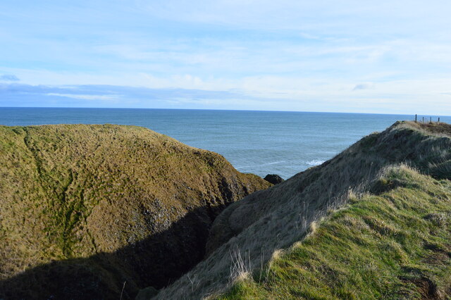
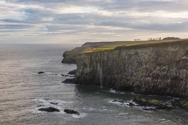
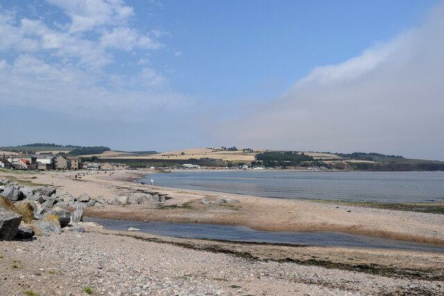
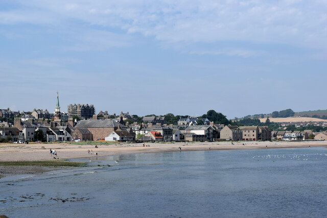
Castle Haven is a picturesque bay located in Kincardineshire, Scotland. Nestled between the villages of Stonehaven and Inverbervie, the bay offers stunning views of the North Sea and is known for its natural beauty and historical significance.

The bay is named after the prominent Castle Haven, a medieval fortress that once stood on its shores. Although the castle itself no longer exists, its remnants can still be seen in the form of stone foundations and ruins. These remnants serve as a testament to the area's rich history and attract history enthusiasts and archaeologists alike.

Castle Haven Bay is a popular destination for outdoor enthusiasts and nature lovers. The bay boasts a beautiful sandy beach, perfect for leisurely walks or sunbathing during the summer months. The crystal-clear waters of the North Sea provide an excellent opportunity for swimming, kayaking, and other water sports.

The bay is also home to a diverse range of wildlife, making it a haven for bird watchers and nature photographers. Visitors can spot various seabirds, such as gulls and cormorants, as well as seals and even dolphins if they are lucky.

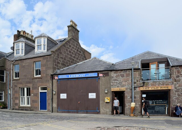
In addition to its natural beauty, Castle Haven Bay offers visitors a wide range of amenities. There are several cafes and restaurants nearby, where visitors can enjoy a meal while taking in the breathtaking views. The bay also has ample parking facilities and is easily accessible by car or public transportation.

Overall, Castle Haven Bay is a hidden gem in Kincardineshire, offering a perfect blend of history, natural beauty, and outdoor activities for visitors to enjoy.

If you have any feedback on the listing, please let us know in the comments section below.
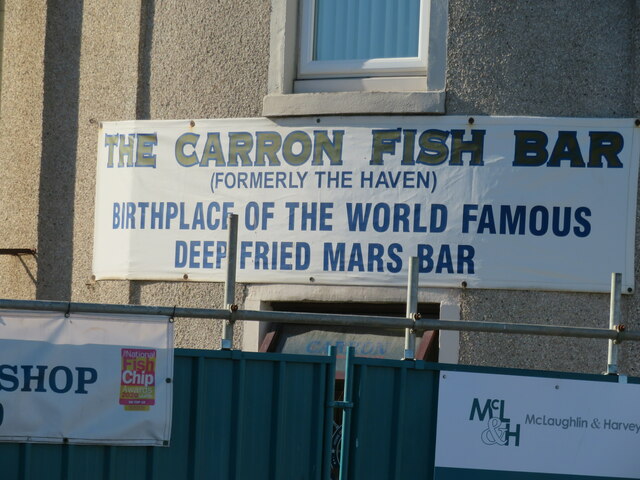
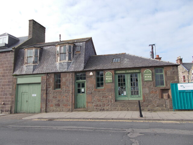
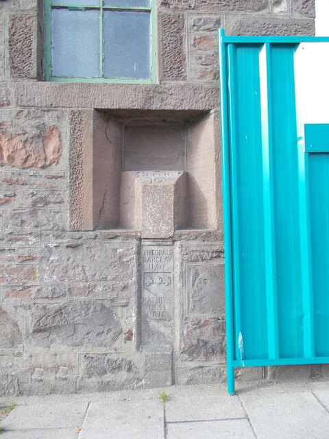
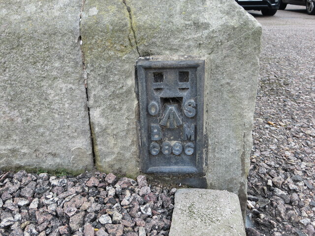
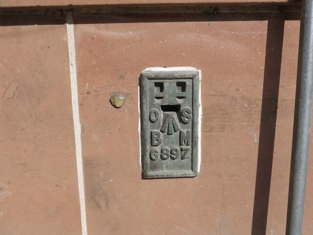
Castle Haven Images

Images are sourced within 2km of 56.949094/-2.1957813 or Grid Reference NO8884. Thanks to Geograph Open Source API. All images are credited.

A Scottish delicacy You may have thought that reports of the deep fried Mars bar being a delicacy in Scotland was a mere myth, but this sign on the wall of a chip shop in Stonehaven would confirm the truth. This contributor wasn't brave enough to try the dish.
A Scottish delicacy
You may have thought that reports of the deep fried Mars bar being a delicacy in Scotland was a mere myth, but this sign on the wall of a chip shop in Stonehaven would confirm the truth. This contributor wasn't brave enough to try the dish.
Old milestone John Briggs used this 'C listed' property at 19 Bridgfield until earlier in 2021.   It is at the south side of the bridge over Carron Water which is undergoing some flood defence works.  In the recess near the blue hoarding is a milestone and below it a slightly recessed stone plaque.   The bridge was built in 1781, widened in 1885 and rebuilt in 1973.
Old milestone
John Briggs used this 'C listed' property at 19 Bridgfield until earlier in 2021. It is at the south side of the bridge over Carron Water which is undergoing some flood defence works. In the recess near the blue hoarding is a milestone and below it a slightly recessed stone plaque. The bridge was built in 1781, widened in 1885 and rebuilt in 1973.
Old milestone A close up of the milestone in the niche at the corner of the building to the south of the bridge over Carron Water.  Inscribed on the left-hand face L/14 (for Laurencekirk), A/14 (Aberdeen) on the right and BERVIE/10 on the bevel.  The vertical plaque below is inscribed THEOBALD/BARCLAY/1150 (the first Barclays ancestor in Scotland 1150), MATHERS/1351 (Barclays acquired the Mathers estate in 1351), URIE/1647 (Barclays bought Urie estate 1647),COND/1781.  This stone was copied from the keystone on the 1781 bridge which was concealed by the 1885 widening.
Old milestone
A close up of the milestone in the niche at the corner of the building to the south of the bridge over Carron Water. Inscribed on the left-hand face L/14 (for Laurencekirk), A/14 (Aberdeen) on the right and BERVIE/10 on the bevel. The vertical plaque below is inscribed THEOBALD/BARCLAY/1150 (the first Barclays ancestor in Scotland 1150), MATHERS/1351 (Barclays acquired the Mathers estate in 1351), URIE/1647 (Barclays bought Urie estate 1647),COND/1781. This stone was copied from the keystone on the 1781 bridge which was concealed by the 1885 widening.
Ordnance Survey Flush Bracket G896 This bracket can be found on the wall of the Police Station, Stonehaven.
The recorded details give a height of 4.1664 metres above sea level.
For more details see : <span class="nowrap"><a title="https://www.bench-marks.org.uk/bm356" rel="nofollow ugc noopener" href="https://www.bench-marks.org.uk/bm356">Link</a><img style="margin-left:2px;" alt="External link" title="External link - shift click to open in new window" src="https://s1.geograph.org.uk/img/external.png" width="10" height="10"/></span>
Ordnance Survey Flush Bracket G896
This bracket can be found on the wall of the Police Station, Stonehaven. The recorded details give a height of 4.1664 metres above sea level. For more details see : LinkExternal link
Ordnance Survey Flush Bracket G897 This bracket can be found on the wall of the Town Hall, Stonehaven.
The recorded details give a height of 5.5802 metres above sea level.
For more details see : <span class="nowrap"><a title="https://www.bench-marks.org.uk/bm357" rel="nofollow ugc noopener" href="https://www.bench-marks.org.uk/bm357">Link</a><img style="margin-left:2px;" alt="External link" title="External link - shift click to open in new window" src="https://s1.geograph.org.uk/img/external.png" width="10" height="10"/></span>
Ordnance Survey Flush Bracket G897
This bracket can be found on the wall of the Town Hall, Stonehaven. The recorded details give a height of 5.5802 metres above sea level. For more details see : LinkExternal link
Downie Point This is the 'island' forming the end of Downie Point.  The flat topped island-like end of the headland isn't easily reachable on foot due to the steep gorge.
Downie Point
This is the 'island' forming the end of Downie Point. The flat topped island-like end of the headland isn't easily reachable on foot due to the steep gorge.
Dunnottar Castle Dunnottar Castle, near Stonehaven, Aberdeenshire.
Dunnottar Castle
Dunnottar Castle, near Stonehaven, Aberdeenshire.
Waterfall in Tremuda Bay The water from small burn draining the fields above forms the small but prominent waterfall.
Waterfall in Tremuda Bay
The water from small burn draining the fields above forms the small but prominent waterfall.
Carron Water meets the sea at Stonehaven Beach
Stonehaven beach The spire of the market buildings can be seen to the left.
Stonehaven beach
The spire of the market buildings can be seen to the left.
Stonehaven lifeboat station Note the typical sandstone cottage to the left.
Stonehaven lifeboat station
Note the typical sandstone cottage to the left.
Boats, inner dock, Stonehaven harbour Mostly pleasure craft along with the Golden Harvest II (registered A99 (Aberdeen)) and the derelict looking INS31 fishing boats.
Boats, inner dock, Stonehaven harbour
Mostly pleasure craft along with the Golden Harvest II (registered A99 (Aberdeen)) and the derelict looking INS31 fishing boats.
Ella at rest The Ella (registered A11 (Aberdeen)) awaits her next fishing voyage while surrounded by pleasure craft in the inner dock at Stonehaven harbour.
Ella at rest
The Ella (registered A11 (Aberdeen)) awaits her next fishing voyage while surrounded by pleasure craft in the inner dock at Stonehaven harbour.
Inner dock, Stonehaven harbour Mostly pleasure craft, but the smartly turned-out Ella (A11) is prominent in the foreground.
Inner dock, Stonehaven harbour
Mostly pleasure craft, but the smartly turned-out Ella (A11) is prominent in the foreground.
No way through The coast road from Dunnottar to Stonehaven has been blocked off and traffic must now take the A92 and the A957 farther inland.
No way through
The coast road from Dunnottar to Stonehaven has been blocked off and traffic must now take the A92 and the A957 farther inland.
Stonehaven war memorial Despite its striking design as a 'Greek temple ruin', it only merits a C-listing by Historic Environment Scotland: LB2918 <span class="nowrap"><a title="http://portal.historicenvironment.scot/designation/LB2918" rel="nofollow ugc noopener" href="http://portal.historicenvironment.scot/designation/LB2918">Link</a><img style="margin-left:2px;" alt="External link" title="External link - shift click to open in new window" src="https://s1.geograph.org.uk/img/external.png" width="10" height="10"/></span> .
Stonehaven war memorial
Despite its striking design as a 'Greek temple ruin', it only merits a C-listing by Historic Environment Scotland: LB2918 LinkExternal link .
Looking towards Downie Point... ...from Stonehaven war memorial.  The sea and sky have merged into one as a haar (sea fog) starts to develop.
Looking towards Downie Point...
...from Stonehaven war memorial. The sea and sky have merged into one as a haar (sea fog) starts to develop.
Looking towards Strathlethan Bay... ...from Stonehaven war memorial.  The dark rocks in the background are part of the Dunnottar Castle conglomerate formation (interbedded conglomerate and sandstone), being sedimentary bedrock formed between 443.8 and 393.3 million years ago during the Silurian and Devonian periods.  The ruins of Dunnottar Castle can just be seen in the distance.
Looking towards Strathlethan Bay...
...from Stonehaven war memorial. The dark rocks in the background are part of the Dunnottar Castle conglomerate formation (interbedded conglomerate and sandstone), being sedimentary bedrock formed between 443.8 and 393.3 million years ago during the Silurian and Devonian periods. The ruins of Dunnottar Castle can just be seen in the distance.
Show me another place!

Castle Haven is located at Grid Ref: NO8884 (Lat: 56.949094, Lng: -2.1957813)

Unitary Authority: Aberdeenshire

Police Authority: North East

What 3 Words

///confirms.detection.trickster. Near Stonehaven, Aberdeenshire

Related Wikis

Bowdun Head

Bowdun Head is a headland landform on the North Sea coast approximately one kilometre south of Stonehaven, Scotland.(Ordnance Survey, 2004) Slightly to...

Dunnottar Castle

Dunnottar Castle (Scottish Gaelic: Dùn Fhoithear, "fort on the shelving slope") is a ruined medieval fortress located upon a rocky headland on the north...

Dunnicaer

Dunnicaer, or Dun-na-caer, is a precipitous sea stack just off the coast of Aberdeenshire, Scotland, between Dunnottar Castle and Stonehaven. Despite the...

Strathlethan Bay

Strathlethan Bay is on the North Sea coast of Aberdeenshire, Scotland just south of Stonehaven. To the north is Downie Point near which lies Stonehaven...

Nearby Amenities

Located within 500m of 56.949094,-2.1957813
Source: PGS
Lat/Long: 56.9452025/-2.1956944
Source: PGS
Lat/Long: 56.9459969/-2.1948363
Source: PGS
Lat/Long: 56.9462669/-2.1941543
Source: PGS
Lat/Long: 56.9466824/-2.1955115
Source: PGS
Lat/Long: 56.9467082/-2.1966187
Source: PGS
Lat/Long: 56.9466304/-2.1973006
Source: PGS
Lat/Long: 56.9466455/-2.1976066
Source: PGS
Lat/Long: 56.9467036/-2.1977756
Source: PGS
Lat/Long: 56.9468001/-2.1977756
Source: PGS
Lat/Long: 56.9470342/-2.1980224
Source: PGS
Lat/Long: 56.9473004/-2.1985105
Source: PGS
Lat/Long: 56.9479532/-2.20031
Source: PGS
Lat/Long: 56.9481704/-2.2004041
Source: PGS
Lat/Long: 56.9489191/-2.1987108
Source: PGS
Lat/Long: 56.9489308/-2.1984587
Source: PGS
Lat/Long: 56.9498162/-2.197742
Source: PGS
Lat/Long: 56.9497197/-2.1965119
Source: PGS
Lat/Long: 56.9497021/-2.1961458
Created By: almien_coastlines
Source: PGS
Lat/Long: 56.949753/-2.195942
Source: PGS
Lat/Long: 56.9500734/-2.1960218
Source: PGS
Lat/Long: 56.9505586/-2.1961848
Source: PGS
Lat/Long: 56.9506279/-2.1955288
Source: PGS
Lat/Long: 56.950341/-2.1943596
Source: PGS
Lat/Long: 56.9500382/-2.193834
Source: PGS
Lat/Long: 56.9502252/-2.1922849
Source: PGS
Lat/Long: 56.9502283/-2.1921589
Source: PGS
Lat/Long: 56.950287/-2.1919772
Source: PGS
Lat/Long: 56.9505095/-2.1912115
Source: PGS
Lat/Long: 56.9506743/-2.1919317
Entrance: yes
Lat/Long: 56.9460419/-2.1962531
Tourism: viewpoint
Lat/Long: 56.9453355/-2.1998793
Source: PGS
Lat/Long: 56.9470839/-2.1981672
Source: PGS
Lat/Long: 56.9468924/-2.1990026
Source: PGS
Lat/Long: 56.9464246/-2.1978614
Source: PGS
Lat/Long: 56.9466867/-2.1961247
Source: PGS
Lat/Long: 56.9466615/-2.1961057
Source: PGS
Lat/Long: 56.9466838/-2.1960679
Source: PGS
Lat/Long: 56.9464498/-2.1949778
Source: PGS
Lat/Long: 56.9465127/-2.1952674
Source: PGS
Lat/Long: 56.9460516/-2.1947404
Source: PGS
Lat/Long: 56.9458536/-2.1952552
Source: PGS
Lat/Long: 56.9454542/-2.1952674
Source: PGS
Lat/Long: 56.945384/-2.1952352
Source: PGS
Lat/Long: 56.9451087/-2.1965655
Source: PGS
Lat/Long: 56.9453589/-2.1978328
Dunnicaer Pictish Fort
Historic: archaeological_site
Wikidata: Q28820257
Wikipedia: en:Dunnicaer
Lat/Long: 56.9528652/-2.1953349
Dunnottar Castle
Check Date: 2023-06-25
Opening Hours: Mo-Su 09:00-18:00
Shop: ticket
Lat/Long: 56.9460734/-2.1981169
Life Ring
Emergency: life_ring
Lat/Long: 56.9460981/-2.196337
Entrance: yes
Lat/Long: 56.9460429/-2.1958239
Entrance: yes
Lat/Long: 56.9460275/-2.1960656
Entrance: yes
Lat/Long: 56.9458985/-2.1963077
Barack Room
Historic: yes
Indoor: room
Ruins: yes
Start Date: c16
Lat/Long: 56.9460242/-2.1982815
Bench
Colour: brown
Material: wood
Seats: 4
Lat/Long: 56.9463099/-2.1998986
Bench
Lat/Long: 56.9494179/-2.2013258
Bench
Lat/Long: 56.9462233/-2.2006988
Bench
Lat/Long: 56.950726/-2.1993862
Bench
Lat/Long: 56.9459237/-2.2008496
Bench
Lat/Long: 56.9499435/-2.1996818
Toilets
Opening Hours: Mo-Su 09:00-18:00
Lat/Long: 56.9458012/-2.1971952
Direction: E
Tourism: viewpoint
Lat/Long: 56.9459734/-2.2006345
Entrance: yes
Lat/Long: 56.9462594/-2.1965097
The data included in this document is from www.openstreetmap.org. The data is made available under ODbL.

Have you been to Castle Haven?

Leave your review of Castle Haven below (or comments, questions and feedback).