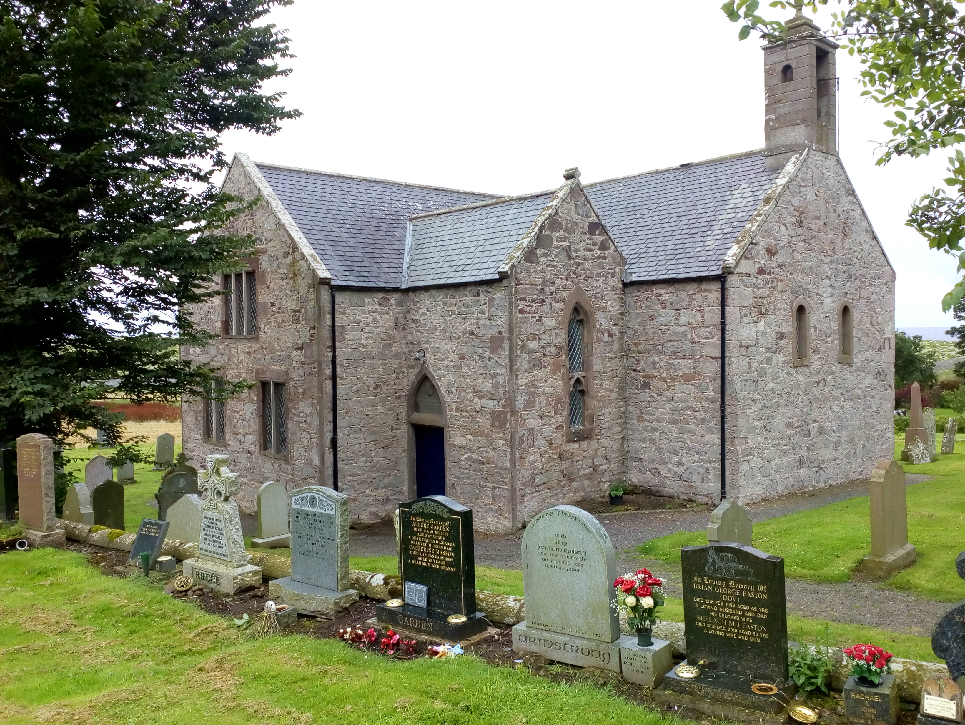
Braidon Bay

Bay in Kincardineshire

Scotland

Braidon Bay

S entrance to a through cave at Powdam The tall triangle in line with the kayak bow is the S entrance to a cave which turns right and out on the far side. Only navigable at high tide and very low swell. Powdam is round the corner and left.
S entrance to a through cave at Powdam Credit: Nigel Feilden

Braidon Bay is a picturesque bay located in Kincardineshire, Scotland. Situated along the eastern coast of Scotland, it falls within the administrative area of Aberdeenshire Council. The bay is part of the wider coastline that stretches from Stonehaven in the north to Cowie in the south.

Braidon Bay is known for its stunning natural beauty and tranquil surroundings. With its golden sandy beaches and clear blue waters, it is a popular destination for beachgoers and nature enthusiasts alike. The bay offers breathtaking views of the North Sea and is often praised for its unspoiled charm.

The bay is also home to a variety of wildlife, including seabirds, seals, and occasionally dolphins. It serves as an important habitat for several bird species, making it a haven for birdwatchers and wildlife photographers.

Braidon Bay offers plenty of recreational activities for visitors. Its expansive sandy beach is perfect for sunbathing, picnicking, and beachcombing. The bay's calm waters also attract water sports enthusiasts, with activities such as kayaking and paddleboarding being popular choices.

Nearby, there are several walking trails that offer spectacular coastal views, allowing visitors to explore the beauty of the area on foot. The bay's proximity to other attractions, such as Dunnottar Castle and the town of Stonehaven, adds to its appeal.

Overall, Braidon Bay is a hidden gem along the Scottish coastline, offering a peaceful and idyllic retreat for those seeking natural beauty and tranquility.

If you have any feedback on the listing, please let us know in the comments section below.

Braidon Bay Images

Images are sourced within 2km of 56.886738/-2.2137697 or Grid Reference NO8777. Thanks to Geograph Open Source API. All images are credited.

S entrance to a through cave at Powdam The tall triangle in line with the kayak bow is the S entrance to a cave which turns right and out on the far side. Only navigable at high tide and very low swell. Powdam is round the corner and left.
S entrance to a through cave at Powdam
The tall triangle in line with the kayak bow is the S entrance to a cave which turns right and out on the far side. Only navigable at high tide and very low swell. Powdam is round the corner and left.
E entrance to a through cave at Powdam Shows the sun shining through the S entrance. See <a href="https://www.geograph.org.uk/photo/6916374">NO8676 : S entrance to a through cave at Powdam</a>. Navigable near high tide with a very low swell. The S tunnel is narrow and the W wall leans E.
E entrance to a through cave at Powdam
Shows the sun shining through the S entrance. See NO8676 : S entrance to a through cave at Powdam. Navigable near high tide with a very low swell. The S tunnel is narrow and the W wall leans E.
Puffin Puffins breed on offshore islands or tall sea cliffs,  outside the breeding season it lives at sea.  They catch small fish such as sand eels, sprat, herring and caplin although it eats many others.
Puffin
Puffins breed on offshore islands or tall sea cliffs, outside the breeding season it lives at sea. They catch small fish such as sand eels, sprat, herring and caplin although it eats many others.
Tod Lighthouse
Tod Lighthouse
Hallhill Farm A farm overlooking the sea by Todhead.
Hallhill Farm
A farm overlooking the sea by Todhead.
Todhead Light. Todhead Lighthouse amid farmland and the North Sea beyond.
Todhead Light.
Todhead Lighthouse amid farmland and the North Sea beyond.
Todhead Lighthouse The lighthouse at Todhead Point.
Todhead Lighthouse
The lighthouse at Todhead Point.
Lambs by Todhead Lambs in a field by Todhead.
Lambs by Todhead
Lambs in a field by Todhead.
Todhead Pasture Sheep grazing by Todhead with Braidon Bay in the background.
Todhead Pasture
Sheep grazing by Todhead with Braidon Bay in the background.
Red soil of the Mearns A tilled field by Kinneff showing the red soil of the Mearns and the blue of the sea in the distance, both portrayed in the literature on local author Lewis Grassic Gibbon.
Red soil of the Mearns
A tilled field by Kinneff showing the red soil of the Mearns and the blue of the sea in the distance, both portrayed in the literature on local author Lewis Grassic Gibbon.
Fernieflatt Farm Lying between Kinneff and Braidon Bay.
Fernieflatt Farm
Lying between Kinneff and Braidon Bay.
By Fernieflatt Fernieflatt Farm by Kinneff.
By Fernieflatt
Fernieflatt Farm by Kinneff.
Glasslin Burn The wooded sides of the Glasslin Burn by Fernieflatt.
Glasslin Burn
The wooded sides of the Glasslin Burn by Fernieflatt.
Daffodil Fields Rows of Daffodils growing by Braidon.
Daffodil Fields
Rows of Daffodils growing by Braidon.
Sheep grazing above Todhead Light Photographer is standing at the verge of the narrow access road.
Sheep grazing above Todhead Light
Photographer is standing at the verge of the narrow access road.
Conglomerate shoreline south of Todhead Point
Southern approach to Catterline Photographer is above the pavement surface of the minor road
Southern approach to Catterline
Photographer is above the pavement surface of the minor road
Access drive to Fernieflatt Photographer is above the paved surface of the minor road junction.
Access drive to Fernieflatt
Photographer is above the paved surface of the minor road junction.
Show me another place!

Braidon Bay is located at Grid Ref: NO8777 (Lat: 56.886738, Lng: -2.2137697)

Unitary Authority: Aberdeenshire

Police Authority: North East

What 3 Words

///layers.midfield.candy. Near Inverbervie, Aberdeenshire

Related Wikis

Catterline

Catterline is a coastal village on the North Sea in Aberdeenshire, Scotland. It is situated about 5 miles (8.0 km) south of Stonehaven; nearby to the...

Crawton

Crawton is a former fishing community on the southeast Aberdeenshire coast in Scotland, deserted since 1927. Approximately three miles south of Stonehaven...

Kinneff

Kinneff is a roadside hamlet in Aberdeenshire, Scotland, just north of Inverbervie. To the north lies another hamlet, Catterline. Kinneff also has a primary...

Fowlsheugh

Fowlsheugh is a coastal nature reserve in Kincardineshire, northeast Scotland, known for its 70-metre-high (230 ft) cliff formations and habitat supporting...

Nearby Amenities

Located within 500m of 56.886738,-2.2137697
Source: PGS
Lat/Long: 56.8835955/-2.214067
Created By: almien_coastlines
Source: PGS
Lat/Long: 56.883551/-2.213734
Created By: almien_coastlines
Source: PGS
Lat/Long: 56.884063/-2.213723
Created By: almien_coastlines
Source: PGS
Lat/Long: 56.884578/-2.21418
Source: PGS
Lat/Long: 56.8848647/-2.2143914
Source: PGS
Lat/Long: 56.8850968/-2.2150673
Source: PGS
Lat/Long: 56.8846801/-2.2159331
Source: PGS
Lat/Long: 56.8851326/-2.2158
Source: PGS
Lat/Long: 56.8850857/-2.2163504
Source: PGS
Lat/Long: 56.885132/-2.2172098
Source: PGS
Lat/Long: 56.8854196/-2.2180114
Source: PGS
Lat/Long: 56.8858134/-2.2186916
Source: PGS
Lat/Long: 56.8866472/-2.2193558
Source: PGS
Lat/Long: 56.8873962/-2.2189915
Source: PGS
Lat/Long: 56.8879589/-2.218101
Source: PGS
Lat/Long: 56.8880532/-2.2177988
Source: PGS
Lat/Long: 56.8879928/-2.2170253
Created By: almien_coastlines
Source: PGS
Lat/Long: 56.887534/-2.216222
Created By: almien_coastlines
Source: PGS
Lat/Long: 56.887662/-2.215986
Created By: almien_coastlines
Source: PGS
Lat/Long: 56.887788/-2.215749
Created By: almien_coastlines
Source: PGS
Lat/Long: 56.887915/-2.215513
Created By: almien_coastlines
Source: PGS
Lat/Long: 56.88868/-2.215029
Source: PGS
Lat/Long: 56.8892357/-2.2156189
Source: PGS
Lat/Long: 56.8890423/-2.2151077
Created By: almien_coastlines
Source: PGS
Lat/Long: 56.889699/-2.214305
Source: PGS
Lat/Long: 56.8899387/-2.2140139
Created By: almien_coastlines
Source: PGS
Lat/Long: 56.889181/-2.213381
Created By: almien_coastlines
Source: PGS
Lat/Long: 56.889951/-2.213599
Created By: almien_coastlines
Source: PGS
Lat/Long: 56.890466/-2.214056
Source: PGS
Lat/Long: 56.890867/-2.2139704
Todhead Point
Place: locality
Lat/Long: 56.8842094/-2.2142825
Todhead
Man Made: lighthouse
Seamark Light Character: Fl
Seamark Light Colour: white
Seamark Light Group: 4
Seamark Light Height: 41
Seamark Light Period: 30
Seamark Light Range: 18
Seamark Light Reference: A 3234
Seamark Light Sequence: 0.2+(2.3)+0.2+(2.3)+0.2+(2.3)+0.2+(22.3)
Seamark Name: Todhead
Seamark Type: light_major
Lat/Long: 56.8837524/-2.215223
Reath
Natural: bay
Lat/Long: 56.8893511/-2.2144967
Braidon Bay
Natural: bay
Lat/Long: 56.8866668/-2.2171038
Power: pole
Lat/Long: 56.8878924/-2.2212964
Power: pole
Lat/Long: 56.8872445/-2.2210036
Power: pole
Lat/Long: 56.8866312/-2.2207445
Power: pole
Lat/Long: 56.8861087/-2.2204938
Power: pole
Lat/Long: 56.8851823/-2.2190339
Power: pole
Lat/Long: 56.8847461/-2.2176794
Power: pole
Lat/Long: 56.8845067/-2.2169716
Power: pole
Lat/Long: 56.8842869/-2.2163059
Power: pole
Lat/Long: 56.8831414/-2.2182495
Power: pole
Lat/Long: 56.8832983/-2.2175221
Power: pole
Lat/Long: 56.8834705/-2.2166955
Power: pole
Lat/Long: 56.8836406/-2.2159131
The data included in this document is from www.openstreetmap.org. The data is made available under ODbL.

Have you been to Braidon Bay?

Leave your review of Braidon Bay below (or comments, questions and feedback).