Arish Mell

Bay in Dorset

England

Arish Mell

Boat in Warbarrow Bay
Boat in Warbarrow Bay Credit: Basher Eyre

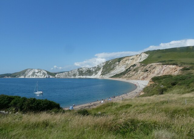
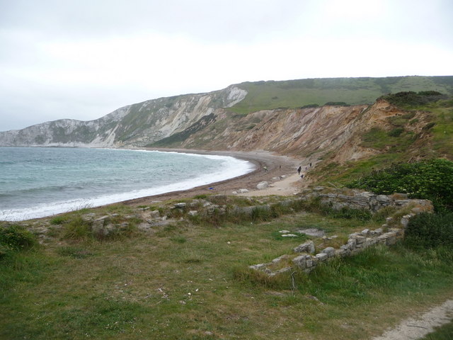
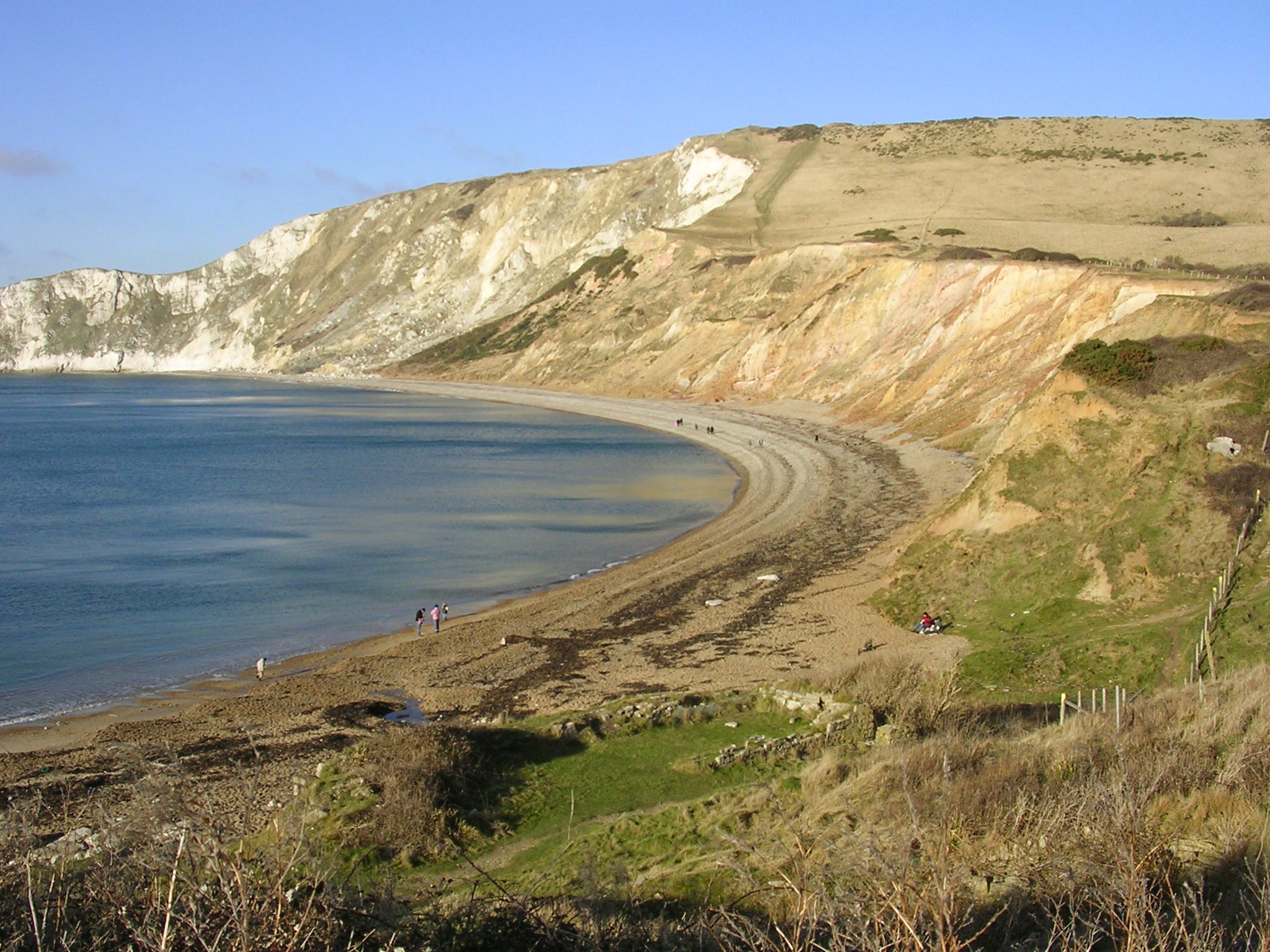
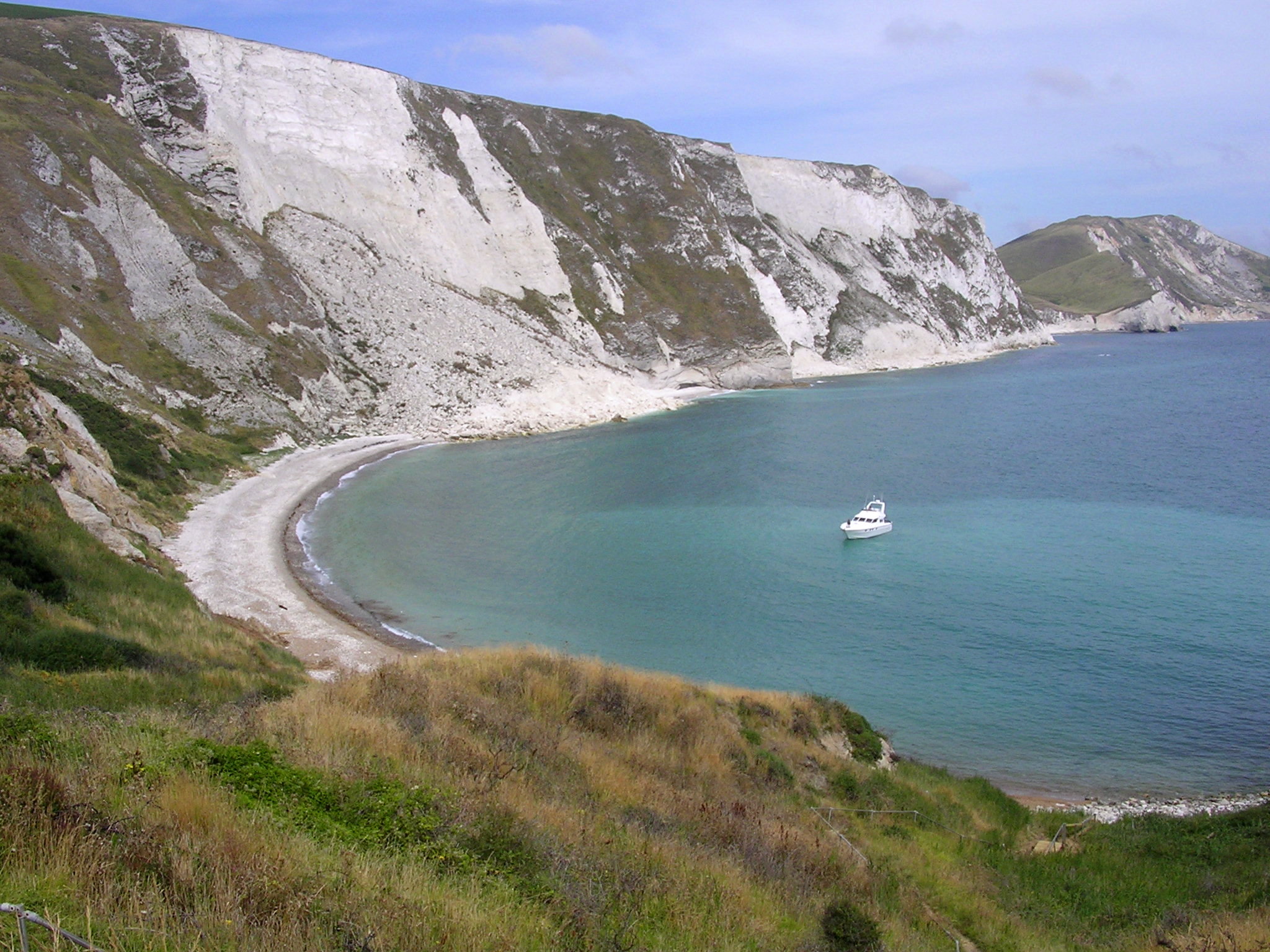
Arish Mell, located in Dorset, England, is a small coastal bay renowned for its picturesque beauty and tranquil environment. The bay is situated in close proximity to the town of Lyme Regis and is a popular destination for locals and tourists alike.

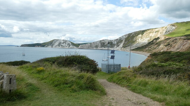
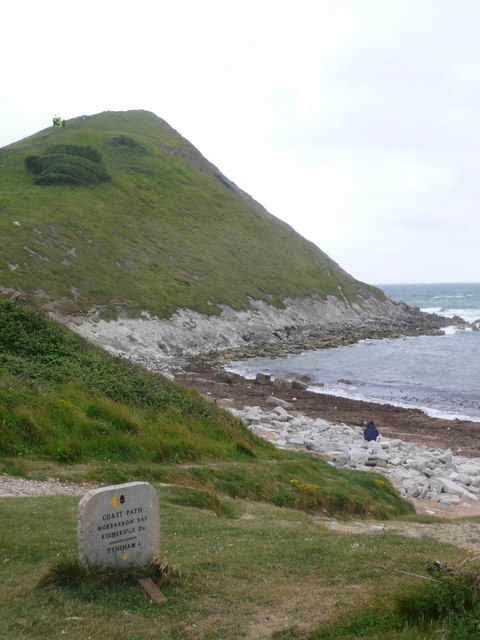
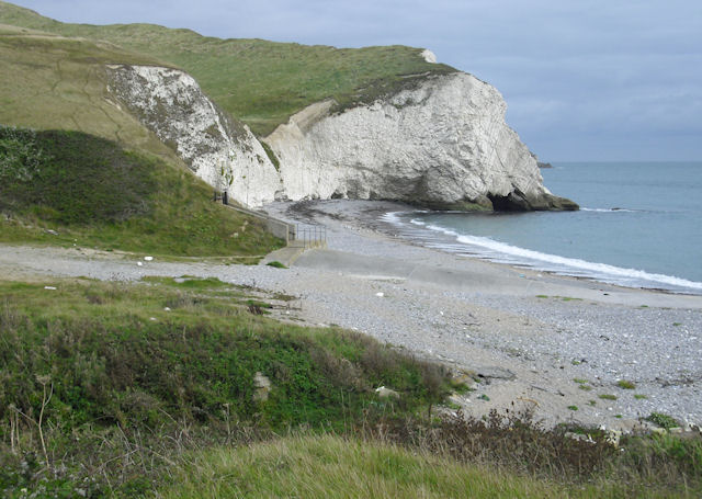
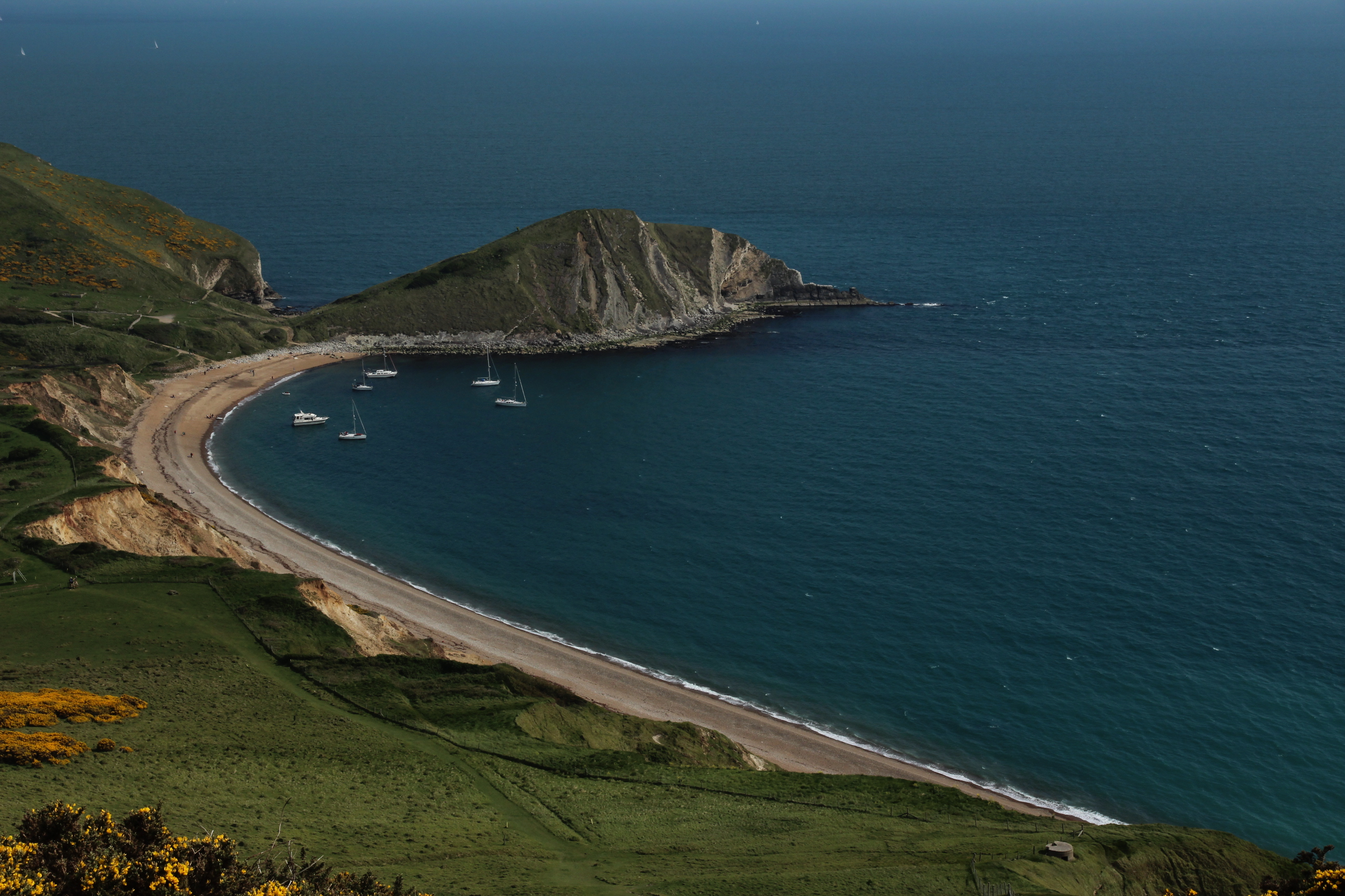
The bay boasts stunning cliffs that rise high above the pebble beach, offering breathtaking views of the surrounding area. Its unique geological formations are a result of millions of years of natural erosion and create a visually striking landscape. The bay is also known for its rich fossil deposits, attracting fossil hunters from all over the world.

Arish Mell is a haven for wildlife enthusiasts, with a diverse range of flora and fauna inhabiting the area. Birdwatchers can spot various species of seabirds, including gulls and cormorants, while dolphins and seals can occasionally be spotted offshore.

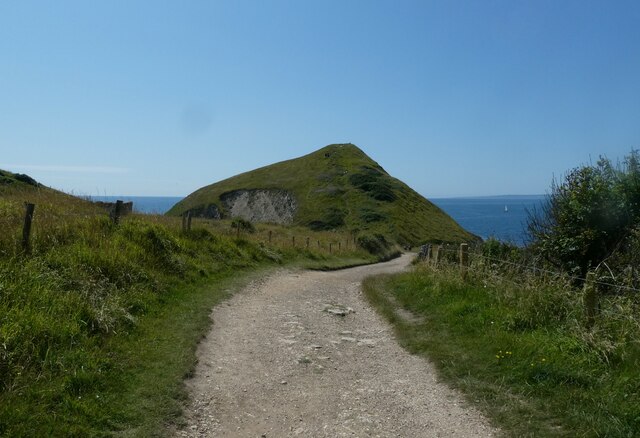
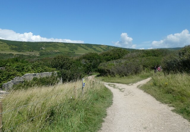
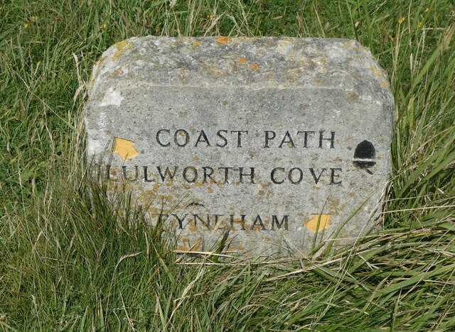
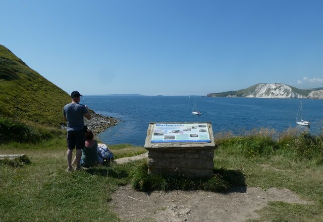
Visitors can enjoy a range of outdoor activities in Arish Mell. The bay is a popular spot for swimming, kayaking, and paddleboarding, with its calm and clear waters providing an ideal environment for water sports. The beach is also suitable for sunbathing and picnicking, and there are several walking trails that offer stunning views of the coastline.

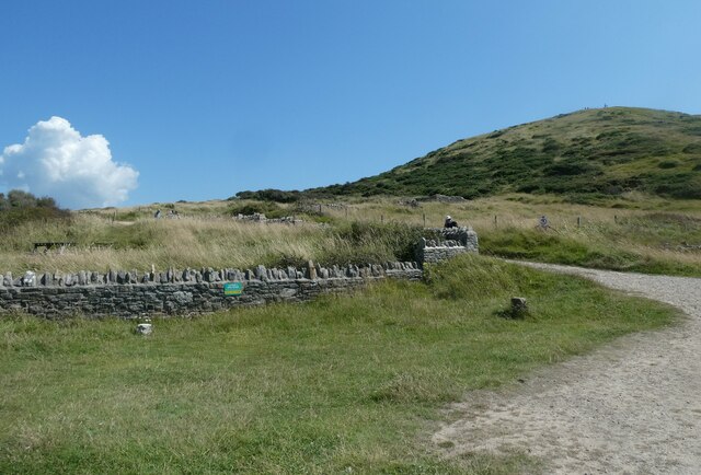
In terms of amenities, Arish Mell is well-served by nearby facilities. There are public toilets and parking available for visitors, as well as a selection of cafes and restaurants offering delicious seafood dishes.

Arish Mell, Dorset, is a hidden gem on the British coast, offering a serene and picturesque escape for nature lovers and adventure seekers alike.

If you have any feedback on the listing, please let us know in the comments section below.
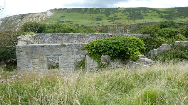
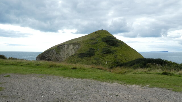
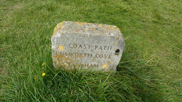
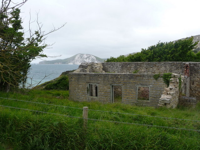
Arish Mell Images

Images are sourced within 2km of 50.621933/-2.2068025 or Grid Reference SY8580. Thanks to Geograph Open Source API. All images are credited.

Boat in Warbarrow Bay
Start of the path back from Worbarrow Bay to Tyneham
All that remains of Hope Cottages
Looking back to Worbarrow Tout
Path branch at Worbarrow Bay The left is the Hardy Way <span class="nowrap"><a title="https://www.ldwa.org.uk/ldp/members/show_path.php?path_name=Hardy+Way" rel="nofollow ugc noopener" href="https://www.ldwa.org.uk/ldp/members/show_path.php?path_name=Hardy+Way">Link</a><img style="margin-left:2px;" alt="External link" title="External link - shift click to open in new window" src="https://s1.geograph.org.uk/img/external.png" width="10" height="10"/></span> and the right the South West Coast Path <span class="nowrap"><a title="https://www.nationaltrail.co.uk/en_GB/trails/south-west-coast-path/" rel="nofollow ugc noopener" href="https://www.nationaltrail.co.uk/en_GB/trails/south-west-coast-path/">Link</a><img style="margin-left:2px;" alt="External link" title="External link - shift click to open in new window" src="https://s1.geograph.org.uk/img/external.png" width="10" height="10"/></span>
Path branch at Worbarrow Bay
The left is the Hardy Way LinkExternal link and the right the South West Coast Path LinkExternal link
Path marker at Worbarrow Bay
Information board at Worbarrow Bay
Tyneham Lulworth Cove Tyneham Lulworth Cove view
Tyneham Lulworth Cove
Tyneham Lulworth Cove view
Worbarrow building Worbarrow, what remains of the building
Worbarrow building
Worbarrow, what remains of the building
Worbarrow Tout Warbarrow Tout view
Worbarrow Tout
Warbarrow Tout view
Coastal path sign Lulworth Cove Tyneham Coastal path sign Lulworth Cove Tyneham
Coastal path sign Lulworth Cove Tyneham
Tyneham: ruined cottage and bay view Looking across Worbarrow Bay towards Bindon Hill, beyond one of the ruined cottages of Tyneham village.
Tyneham: ruined cottage and bay view
Looking across Worbarrow Bay towards Bindon Hill, beyond one of the ruined cottages of Tyneham village.
Tyneham: approaching Worbarrow Tout The path from Tyneham village approaches the coast and in front of us is Worbarrow Tout, a large lump jutting out into the sea.
Tyneham: approaching Worbarrow Tout
The path from Tyneham village approaches the coast and in front of us is Worbarrow Tout, a large lump jutting out into the sea.
Tyneham: Worbarrow information board A display gives information on the geology, flora and fauna of the area and also the history of the village, now long forgotten after the Coastguard station closed in 1911. This was some 30 years before the village of Tyneham, just up the valley, became deserted under very different circumstances.
Tyneham: Worbarrow information board
A display gives information on the geology, flora and fauna of the area and also the history of the village, now long forgotten after the Coastguard station closed in 1911. This was some 30 years before the village of Tyneham, just up the valley, became deserted under very different circumstances.
Tyneham: waves on Worbarrow Bay A windy day on this exposed bit of coast, and the waves are big and impressive as we look along the edge of Worbarrow Bay towards the slopes of Bindon Hill in the background.
Tyneham: waves on Worbarrow Bay
A windy day on this exposed bit of coast, and the waves are big and impressive as we look along the edge of Worbarrow Bay towards the slopes of Bindon Hill in the background.
Tyneham: Worbarrow Bay and Tout A cloudy day at this attractive seaside spot.
Tyneham: Worbarrow Bay and Tout
A cloudy day at this attractive seaside spot.
Tyneham: ruins of cottage on Worbarrow Bay After the closure of the coastguard station at Worbarrow Bay in 1911 had heralded the demise of the village, the requisitoning of the whole of Tyneham parish in 1943 finished it off completely. All the houses in the two villages are in ruins today, such as this one, right above the bay.
Tyneham: ruins of cottage on Worbarrow Bay
After the closure of the coastguard station at Worbarrow Bay in 1911 had heralded the demise of the village, the requisitoning of the whole of Tyneham parish in 1943 finished it off completely. All the houses in the two villages are in ruins today, such as this one, right above the bay.
Tyneham: Coast Path stone at Worbarrow With the slopes of Worbarrow Tout in the background, we look at a small stone, of a consistent design along the Dorset stretch of the South West Coast Path. It points left, slightly inland, for the two-and-a-half miles continuing along the Coast Path to Kimmeridge, and also to the left for the one mile inland to Tyneham.
Tyneham: Coast Path stone at Worbarrow
With the slopes of Worbarrow Tout in the background, we look at a small stone, of a consistent design along the Dorset stretch of the South West Coast Path. It points left, slightly inland, for the two-and-a-half miles continuing along the Coast Path to Kimmeridge, and also to the left for the one mile inland to Tyneham.
Show me another place!

Arish Mell is located at Grid Ref: SY8580 (Lat: 50.621933, Lng: -2.2068025)

Unitary Authority: Dorset

Police Authority: Dorset

What 3 Words

///escorting.presenter.jungle. Near Wool, Dorset

Related Wikis

Arish Mell

Arish Mell is a small embayment and beach between Mupe and Worbarrow Bays in Dorset, England and is part of the Jurassic Coast and the South West Coast...

Cow Corner

Cow Corner is the north-western end of Worbarrow Bay, a small secluded bay on the south coast of the Isle of Purbeck in Dorset, England. == Location... ==
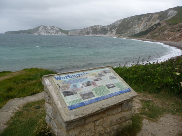
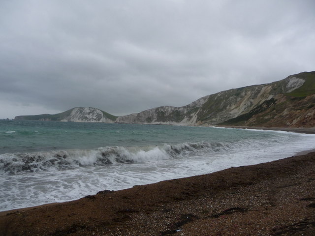
Worbarrow Bay

Worbarrow Bay is a large broad and shallow bay just to the east of Lulworth Cove on the Isle of Purbeck, Dorset, England. == Location == Worbarrow Bay...

Flower's Barrow

Flower’s Barrow is an Iron Age hillfort, built over 2500 years ago, above Worbarrow Bay in Dorset on the south coast of England. == Location == Flower...

Lulworth Abbey

Lulworth Abbey was a Trappist monastery at East Lulworth in Dorset, England, established as a priory in 1796 by Thomas Weld for refugee French Trappist...

Mupe Bay

Mupe Bay is a bay with a shingle beach to the east of Lulworth Cove in Dorset, England, and is part of the Jurassic Coast World Heritage Site. The bay...
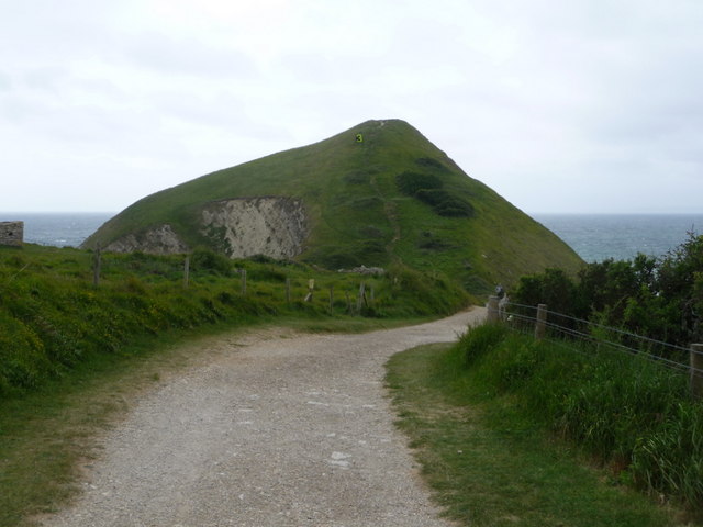
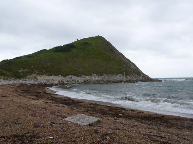
Worbarrow Tout

Worbarrow Tout is a promontory at the eastern end of Worbarrow Bay on Isle of Purbeck in Dorset on the south coast of England, about 6 kilometres (3.7...

Bestival

Bestival was a four-day music festival held in the south of England. The name Bestival is a portmanteau of the words best and festival. It had been held...

Nearby Amenities

Located within 500m of 50.621933,-2.2068025
Source: PGS
Lat/Long: 50.6206207/-2.2135262
Source: PGS
Lat/Long: 50.6207228/-2.2128074
Source: PGS
Lat/Long: 50.6209815/-2.2116379
Source: PGS
Lat/Long: 50.6210427/-2.2107367
Source: PGS
Lat/Long: 50.6210972/-2.2097711
Source: PGS
Lat/Long: 50.6213558/-2.209181
Source: PGS
Lat/Long: 50.6214784/-2.2089664
Source: PGS
Lat/Long: 50.6216281/-2.2088162
Source: PGS
Lat/Long: 50.6218459/-2.208945
Source: PGS
Lat/Long: 50.6220501/-2.208548
Source: PGS
Lat/Long: 50.6223088/-2.2073142
Source: PGS
Lat/Long: 50.6222952/-2.2062628
Source: PGS
Lat/Long: 50.6222271/-2.2054045
Source: PGS
Lat/Long: 50.6220093/-2.2047715
Source: PGS
Lat/Long: 50.6217847/-2.2047285
Source: PGS
Lat/Long: 50.6215532/-2.2047607
Source: PGS
Lat/Long: 50.6216417/-2.2043423
Source: PGS
Lat/Long: 50.6214648/-2.2041706
Source: PGS
Lat/Long: 50.621492/-2.2040097
Source: PGS
Lat/Long: 50.6217234/-2.2032802
Source: PGS
Lat/Long: 50.621948/-2.2025077
Source: PGS
Lat/Long: 50.6221999/-2.2013168
Source: PGS
Lat/Long: 50.6223769/-2.2003726
Covered: no
Leisure: picnic_table
Lat/Long: 50.6229163/-2.2080705
Arish Mell
Access: no
Natural: bay
Wikidata: Q15188521
Wikipedia: en:Arish Mell
Lat/Long: 50.6215823/-2.2068998
The data included in this document is from www.openstreetmap.org. The data is made available under ODbL.

Have you been to Arish Mell?

Leave your review of Arish Mell below (or comments, questions and feedback).