Barber's Rock

Island in Dorset

England

Barber's Rock

Worbarrow Tout Warbarrow Tout view
Worbarrow Tout Credit: Colin Prosser

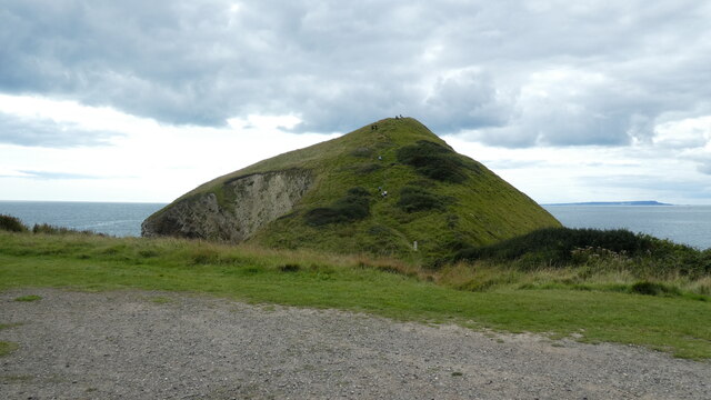
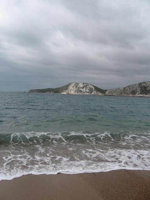
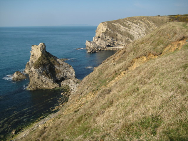
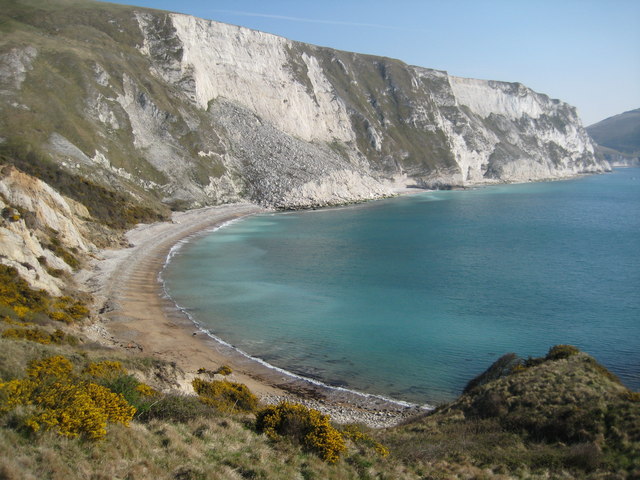
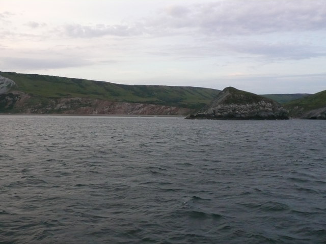
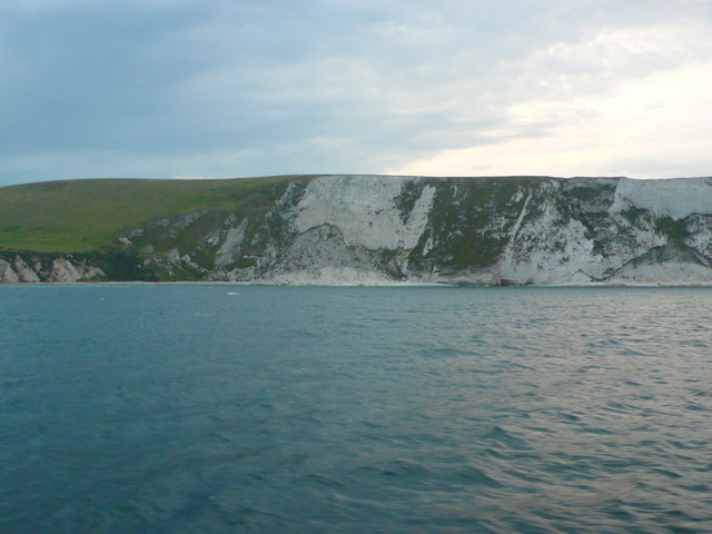
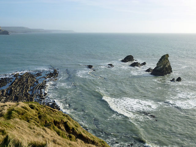
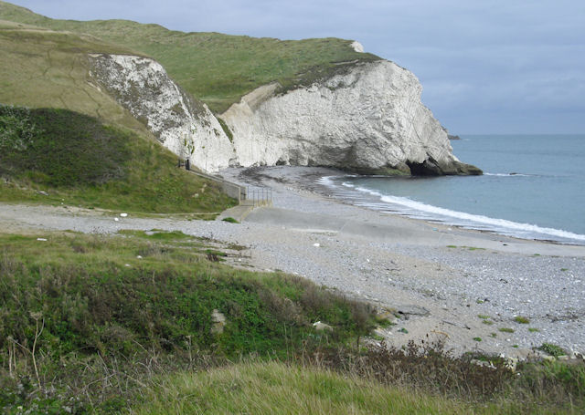
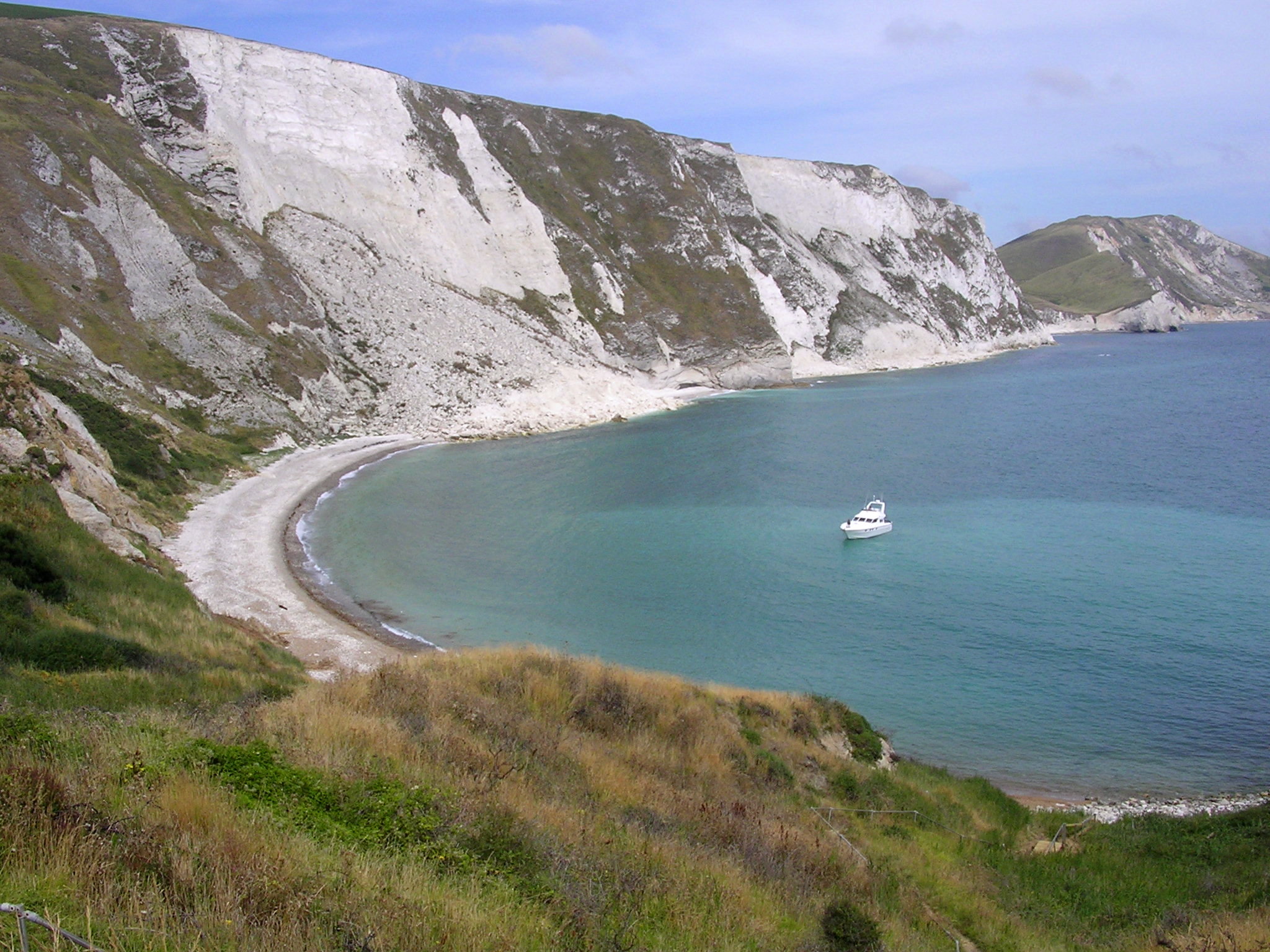
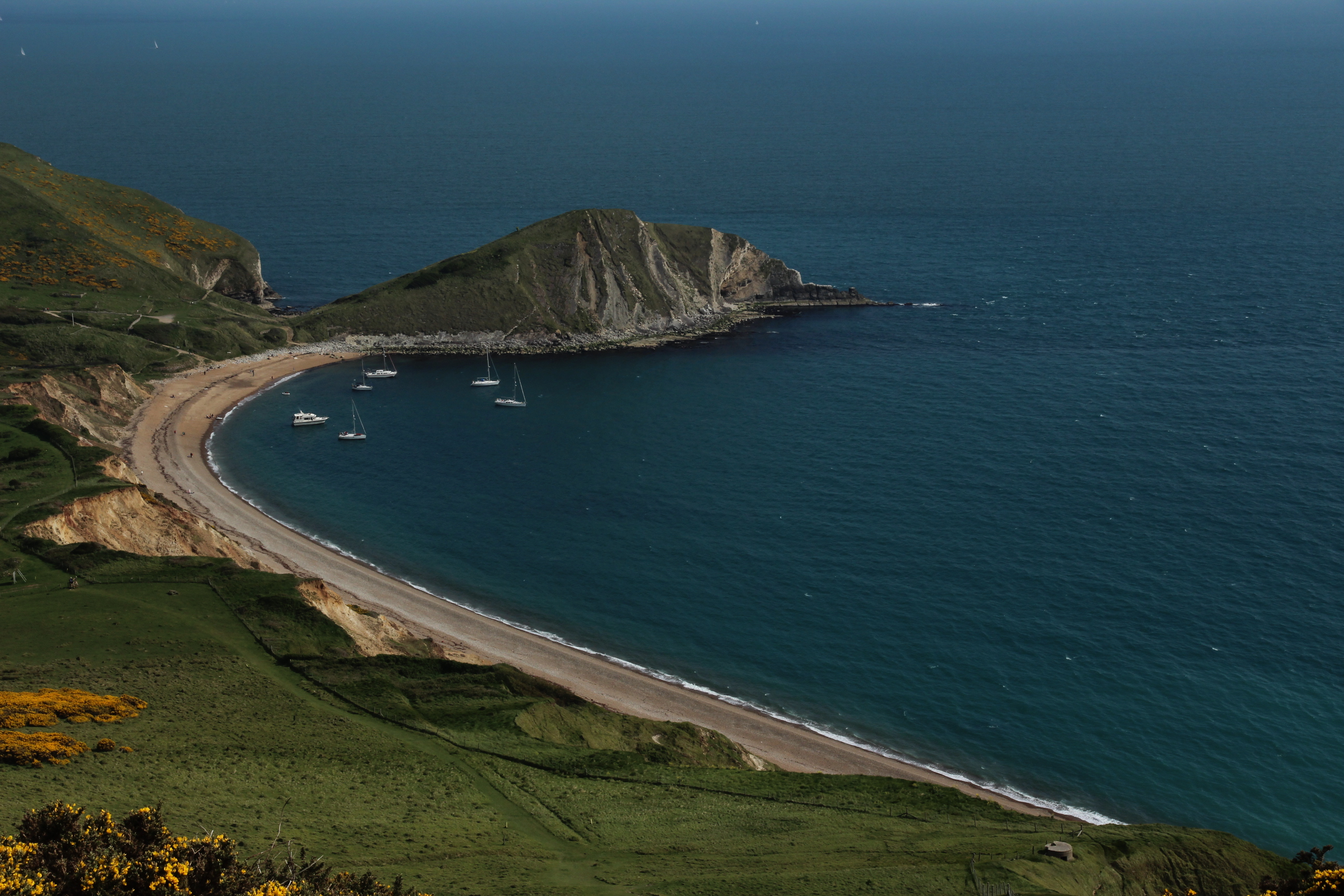
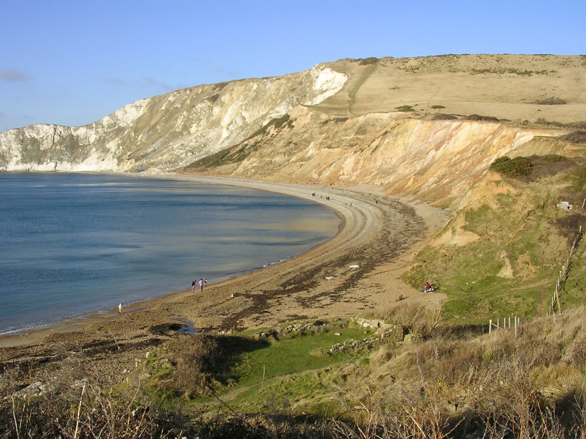
Barber's Rock is a small island located off the coast of Dorset, England. It is situated approximately 2 kilometers southeast of Portland Bill, within the English Channel. The island is a part of the Jurassic Coast, which is a UNESCO World Heritage Site known for its geological significance.

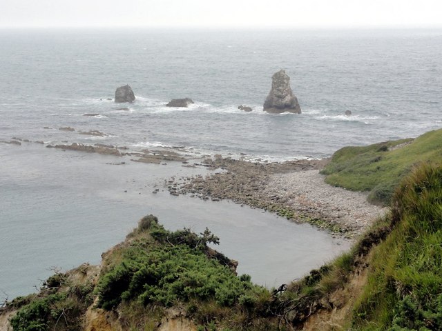
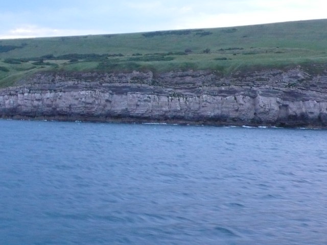
Covering an area of just 0.3 hectares, Barber's Rock is a prominent landmark in the region. Composed of limestone and other sedimentary rocks, the island is characterized by its rugged cliffs that rise steeply from the sea. The highest point on the island reaches about 6 meters above sea level.

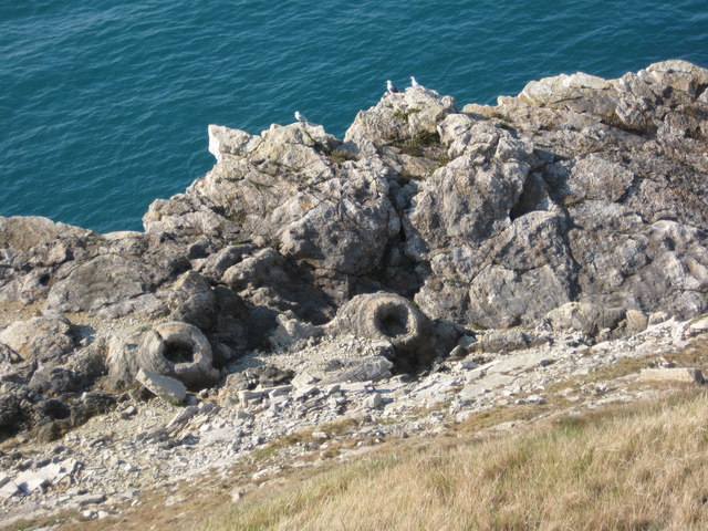
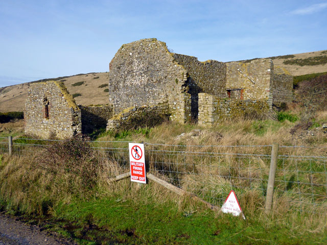
Due to its remote location and challenging terrain, Barber's Rock is uninhabited and inaccessible to the public. It is primarily known as a nesting site for various seabird species, including guillemots and razorbills. Their presence contributes to the island's ecological value.

The waters surrounding Barber's Rock are rich in marine biodiversity, attracting divers and snorkelers who are eager to explore the underwater ecosystem. The area is also popular among fishermen, as it offers opportunities for catching a variety of fish species.

While the island itself does not have any human infrastructure, the nearby town of Portland provides amenities and services for visitors. Boat trips and guided tours are available for those interested in observing the island from the water.

Barber's Rock is a captivating natural feature, offering stunning views of the Dorset coastline and providing a vital habitat for wildlife.

If you have any feedback on the listing, please let us know in the comments section below.

Barber's Rock Images

Images are sourced within 2km of 50.620114/-2.2129576 or Grid Reference SY8580. Thanks to Geograph Open Source API. All images are credited.

Worbarrow Tout Warbarrow Tout view
Worbarrow Tout
Warbarrow Tout view
Tyneham: west side of Worbarrow Tout This picture belies the almost-downward view direction of the foreground, where the rock strata head down to the bottom of the cliff. In the background, across Worbarrow Bay, we see the slopes of Rings Hill.
Tyneham: west side of Worbarrow Tout
This picture belies the almost-downward view direction of the foreground, where the rock strata head down to the bottom of the cliff. In the background, across Worbarrow Bay, we see the slopes of Rings Hill.
Tyneham: Worbarrow Bay shoreline Looking along the shore at Worbarrow, with the mighty Rings Hill providing a dramatic backdrop.
Tyneham: Worbarrow Bay shoreline
Looking along the shore at Worbarrow, with the mighty Rings Hill providing a dramatic backdrop.
Mupe Ledges and Mupe Rocks Looking down onto the headland from above Mupe Bay.
Mupe Ledges and Mupe Rocks
Looking down onto the headland from above Mupe Bay.
Little Bindon Looking toward the derelict farmhouse on the military range below Bindon Hill which is shrouded in cloud.
Little Bindon
Looking toward the derelict farmhouse on the military range below Bindon Hill which is shrouded in cloud.
Worbarrow Bay: a safe anchorage Taken from the western side of Worbarrow Tout with the slumped coastline of Rings Hill providing a perfect backdrop. The gap in the cliffs is Arish Mell.
Worbarrow Bay: a safe anchorage
Taken from the western side of Worbarrow Tout with the slumped coastline of Rings Hill providing a perfect backdrop. The gap in the cliffs is Arish Mell.
Worbarrow Bay Bindon Hill in the distance.
Worbarrow Bay
Bindon Hill in the distance.
Mupe Rocks Mupe Rocks consist of harder limestone rocks hence they are more durable against the erosion of the sea, here they viewed from the coast path above Mupe Bay.
Mupe Rocks
Mupe Rocks consist of harder limestone rocks hence they are more durable against the erosion of the sea, here they viewed from the coast path above Mupe Bay.
Mupe Bay The high chalk cliffs of Bindon Hill tower above Mupe Bay. Thousands of tonnes of rock lie at the foot of the cliff as a result of huge rockfall.
Mupe Bay
The high chalk cliffs of Bindon Hill tower above Mupe Bay. Thousands of tonnes of rock lie at the foot of the cliff as a result of huge rockfall.
Worbarrow Tout Worbarrow Tout viewed from the north, just inside the same grid square (GPS checked).
Worbarrow Tout
Worbarrow Tout viewed from the north, just inside the same grid square (GPS checked).
Fossil forest, Lulworth These fossilised tree stumps are only accessible whilst the Lulworth range is open to the public.
Fossil forest, Lulworth
These fossilised tree stumps are only accessible whilst the Lulworth range is open to the public.
World War II pill box A World War II pill box overlooking the sea above Smugglers Cove.  The South Coast Path passes this pill box which is situated on the Lulworth military range.
World War II pill box
A World War II pill box overlooking the sea above Smugglers Cove. The South Coast Path passes this pill box which is situated on the Lulworth military range.
Worbarrow Tout A view from almost due south from a boat in the bay
Worbarrow Tout
A view from almost due south from a boat in the bay
Worbarrow Tout View of Worbarrow Tout from the south west showing the headland head on.
Worbarrow Tout
View of Worbarrow Tout from the south west showing the headland head on.
Mupe Bay View of the cliffs above the bay from a boat cruising along the coast approximately 600m offshore. The right hand side of the image is in SY8480. The geology is chalk on the right hand side overlying the softer Lower Cretaceous Wealden strata on the left.
Mupe Bay
View of the cliffs above the bay from a boat cruising along the coast approximately 600m offshore. The right hand side of the image is in SY8480. The geology is chalk on the right hand side overlying the softer Lower Cretaceous Wealden strata on the left.
Cliffs at Bindon Hill These low cliffs lie between Lulworth cove in the west and Mupe Rocks in the east and the lowest cliffs are Portland stone over which lie the Purbeck beds. These are the hard resistant rocks that are seen clearly at Lulworth and Durdle door. This is where the fossil forest is found.
Cliffs at Bindon Hill
These low cliffs lie between Lulworth cove in the west and Mupe Rocks in the east and the lowest cliffs are Portland stone over which lie the Purbeck beds. These are the hard resistant rocks that are seen clearly at Lulworth and Durdle door. This is where the fossil forest is found.
Ruin, Lulworth Ranges Maps of the last 120 years have shown this without a name or function, although earlier it does not seem to have been a ruin. It is by a footpath (a track) through the ranges, open most weekends.
Ruin, Lulworth Ranges
Maps of the last 120 years have shown this without a name or function, although earlier it does not seem to have been a ruin. It is by a footpath (a track) through the ranges, open most weekends.
Mupe Ledges and some of Mupe Rocks Mupe Rocks continue in a line to the right, getting closer in. St. Aldhelm's Head is in the distance.
Mupe Ledges and some of Mupe Rocks
Mupe Rocks continue in a line to the right, getting closer in. St. Aldhelm's Head is in the distance.
Show me another place!

Barber's Rock is located at Grid Ref: SY8580 (Lat: 50.620114, Lng: -2.2129576)

Unitary Authority: Dorset

Police Authority: Dorset

What 3 Words

///petal.backyards.abundance. Near Wool, Dorset

Related Wikis

Arish Mell

Arish Mell is a small embayment and beach between Mupe and Worbarrow Bays in Dorset, England and is part of the Jurassic Coast and the South West Coast...

Mupe Bay

Mupe Bay is a bay with a shingle beach to the east of Lulworth Cove in Dorset, England, and is part of the Jurassic Coast World Heritage Site. The bay...

Worbarrow Bay

Worbarrow Bay is a large broad and shallow bay just to the east of Lulworth Cove on the Isle of Purbeck, Dorset, England. == Location == Worbarrow Bay...

Cow Corner

Cow Corner is the north-western end of Worbarrow Bay, a small secluded bay on the south coast of the Isle of Purbeck in Dorset, England. == Location... ==

Flower's Barrow

Flower’s Barrow is an Iron Age hillfort, built over 2500 years ago, above Worbarrow Bay in Dorset on the south coast of England. == Location == Flower...

Lulworth Abbey

Lulworth Abbey was a Trappist monastery at East Lulworth in Dorset, England, established as a priory in 1796 by Thomas Weld for refugee French Trappist...

Bindon Hill

Bindon Hill is an extensive Iron Age earthwork enclosing a coastal hill area on the Jurassic Coast near Lulworth Cove in Dorset, England, about 19 kilometres...

Bestival

Bestival was a four-day music festival held in the south of England. The name Bestival is a portmanteau of the words best and festival. It had been held...

Nearby Amenities

Located within 500m of 50.620114,-2.2129576
Source: PGS
Lat/Long: 50.6202191/-2.2194914
Source: PGS
Lat/Long: 50.620294/-2.2188799
Source: PGS
Lat/Long: 50.6203144/-2.2182147
Source: PGS
Lat/Long: 50.6202191/-2.2175817
Source: PGS
Lat/Long: 50.6201714/-2.2173135
Source: PGS
Lat/Long: 50.6203484/-2.2172384
Source: PGS
Lat/Long: 50.6206139/-2.2163908
Source: PGS
Lat/Long: 50.6206071/-2.2152857
Source: PGS
Lat/Long: 50.6206071/-2.214127
Source: PGS
Lat/Long: 50.6206207/-2.2135262
Source: PGS
Lat/Long: 50.6207228/-2.2128074
Source: PGS
Lat/Long: 50.6209815/-2.2116379
Source: PGS
Lat/Long: 50.6210427/-2.2107367
Source: PGS
Lat/Long: 50.6210972/-2.2097711
Source: PGS
Lat/Long: 50.6213558/-2.209181
Source: PGS
Lat/Long: 50.6214784/-2.2089664
Source: PGS
Lat/Long: 50.6216281/-2.2088162
Source: PGS
Lat/Long: 50.6218459/-2.208945
Source: PGS
Lat/Long: 50.6220501/-2.208548
Source: PGS
Lat/Long: 50.6223088/-2.2073142
Covered: no
Leisure: picnic_table
Lat/Long: 50.6229163/-2.2080705
Arish Mell
Access: no
Natural: bay
Wikidata: Q15188521
Wikipedia: en:Arish Mell
Lat/Long: 50.6215823/-2.2068998
The data included in this document is from www.openstreetmap.org. The data is made available under ODbL.

Have you been to Barber's Rock?

Leave your review of Barber's Rock below (or comments, questions and feedback).