Bowie Bate

Bay in Banffshire

Scotland

Bowie Bate

Pond at Mains of Melrose An artificial pond beside the Burn of Melrose.
Pond at Mains of Melrose Credit: Anne Burgess

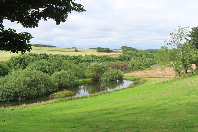
Bowie Bate, also known as Bay, is a small coastal village located in Banffshire, Scotland. Situated on the eastern coast of the country, Bay offers breathtaking views of the North Sea and is surrounded by picturesque countryside. With a population of around 500 residents, the village exudes a charming and tranquil atmosphere.

The highlight of Bay is its beautiful sandy beach, which stretches for approximately one mile. The beach is a popular spot for locals and visitors alike, offering opportunities for sunbathing, picnicking, and leisurely walks along the shore. The clean and pristine waters make it a suitable spot for swimming, and the beach is also frequented by surfers during certain times of the year.

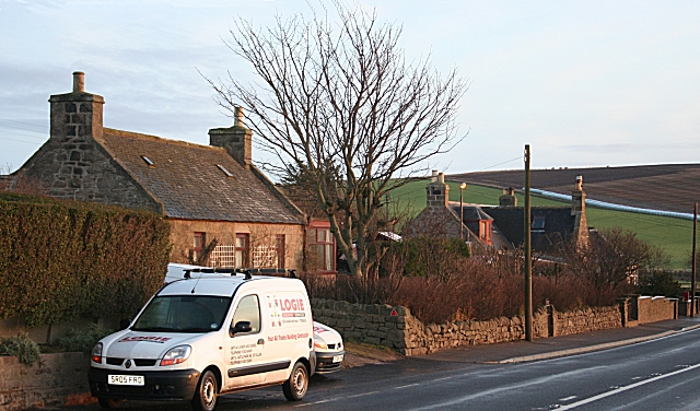
The village itself is home to a small but close-knit community. The houses are predominantly traditional stone cottages, lending an old-world charm to the area. A few local shops and pubs can be found in the village, offering essential amenities and a place to socialize.

Nature lovers will find plenty to explore in the surrounding area. The nearby Bay Forest provides a peaceful retreat, with walking trails that wind through woodland and offer glimpses of local wildlife. The rugged cliffs along the coastline are perfect for birdwatching, and visitors may spot various seabirds, including puffins and gannets.

Overall, Bowie Bate, Banffshire (Bay) is a hidden gem on the Scottish coast, offering a tranquil beach, stunning natural landscapes, and a warm community atmosphere. It is an ideal destination for those seeking a peaceful escape from city life.

If you have any feedback on the listing, please let us know in the comments section below.

Bowie Bate Images

Images are sourced within 2km of 57.672396/-2.4316238 or Grid Reference NJ7464. Thanks to Geograph Open Source API. All images are credited.

Pond at Mains of Melrose An artificial pond beside the Burn of Melrose.
Pond at Mains of Melrose
An artificial pond beside the Burn of Melrose.
Mains of Melrose Fields of ripening barley on the undulating fields at the top of the cliffs at Melrose.
Mains of Melrose
Fields of ripening barley on the undulating fields at the top of the cliffs at Melrose.
Kamered Bank The modern maps don't name the headland in the middle of the bay, but the older large-scale maps call it Kamered Bank. This is presumably from the word kame, meaning a ridge. Stocked Head, behind me, is an igneous dyke, so perhaps there is also a dyke making this headland more resistant than the psammites and pelites of the Macduff Formation that make up the cliffs here.
Kamered Bank
The modern maps don't name the headland in the middle of the bay, but the older large-scale maps call it Kamered Bank. This is presumably from the word kame, meaning a ridge. Stocked Head, behind me, is an igneous dyke, so perhaps there is also a dyke making this headland more resistant than the psammites and pelites of the Macduff Formation that make up the cliffs here.
Wild Angelica (Angelica sylvestris) A fat flower-head, reminiscent of cauliflower. Angelica is very common on the banks below the cliffs here.
Wild Angelica (Angelica sylvestris)
A fat flower-head, reminiscent of cauliflower. Angelica is very common on the banks below the cliffs here.
Goldenrod (Solidago virgaurea) The bright yellow flowers of Goldenrod are common on the grassy banks along this stretch of coast.
Goldenrod (Solidago virgaurea)
The bright yellow flowers of Goldenrod are common on the grassy banks along this stretch of coast.
Lady's Bedstraw (Galium verum) In olden days the flowers of this common plant were strewn on floors to give a pleasant scent.
Lady's Bedstraw (Galium verum)
In olden days the flowers of this common plant were strewn on floors to give a pleasant scent.
Scurrs of Greenside Scurrs of Greenside is the name given to the flat rocks and shore here. It's an interesting word. I imagined at first that it was related to the Gaelic Sgùrr, meaning a conical hill, and I couldn't see the relevance. It turns out, however, that it is from Latin scurra, meaning a buffoon, from which English gets the word scurrilous. In Scots the meaning was extended to mean a low rascal or a sheriff's officer! Over time it came to mean anything low, which makes far more sense.
Scurrs of Greenside
Scurrs of Greenside is the name given to the flat rocks and shore here. It's an interesting word. I imagined at first that it was related to the Gaelic Sgùrr, meaning a conical hill, and I couldn't see the relevance. It turns out, however, that it is from Latin scurra, meaning a buffoon, from which English gets the word scurrilous. In Scots the meaning was extended to mean a low rascal or a sheriff's officer! Over time it came to mean anything low, which makes far more sense.
White Bluebells (Campanula rotundifolia) In England these are called Harebells, but C rotundifolia is the true Bluebell of Scotland. I'd never seen a pure white one before.
White Bluebells (Campanula rotundifolia)
In England these are called Harebells, but C rotundifolia is the true Bluebell of Scotland. I'd never seen a pure white one before.
White Bluebell (Campanula rotundifolia) In England this would be called a Harebell, but C rotundifolia is the true Bluebell of Scotland. I'd never seen a pure white one before.
White Bluebell (Campanula rotundifolia)
In England this would be called a Harebell, but C rotundifolia is the true Bluebell of Scotland. I'd never seen a pure white one before.
Lady's Bedstraw (Galium verum) In olden days the flowers of this common plant were strewn on floors to give a pleasant scent.
Lady's Bedstraw (Galium verum)
In olden days the flowers of this common plant were strewn on floors to give a pleasant scent.
White Bluebells (Campanula rotundifolia) In England these are called Harebells, but C rotundifolia is the true Bluebell of Scotland. I'd never seen a pure white one before.
White Bluebells (Campanula rotundifolia)
In England these are called Harebells, but C rotundifolia is the true Bluebell of Scotland. I'd never seen a pure white one before.
Scurrs of Greenside Scurrs of Greenside is the name given to the flat rocks and shore here. It's an interesting word. I imagined at first that it was related to the Gaelic Sgùrr, meaning a conical hill, and I couldn't see the relevance. It turns out, however, that it is from Latin scurra, meaning a buffoon, from which English gets the word scurrilous. In Scots the meaning was extended to mean a low rascal or a sheriff's officer! Over time it came to mean anything low, which makes far more sense.
Scurrs of Greenside
Scurrs of Greenside is the name given to the flat rocks and shore here. It's an interesting word. I imagined at first that it was related to the Gaelic Sgùrr, meaning a conical hill, and I couldn't see the relevance. It turns out, however, that it is from Latin scurra, meaning a buffoon, from which English gets the word scurrilous. In Scots the meaning was extended to mean a low rascal or a sheriff's officer! Over time it came to mean anything low, which makes far more sense.
Sea Mayweed (Tripleurospermum maritimum) The large daisy-like flowers are plentiful along the back of the beach here.
Sea Mayweed (Tripleurospermum maritimum)
The large daisy-like flowers are plentiful along the back of the beach here.
Sea Sandwort |(Honckenya peploides) There's a large carpet of this plant on the sandy upper part of the beach. The green balls are seeds.
Sea Sandwort |(Honckenya peploides)
There's a large carpet of this plant on the sandy upper part of the beach. The green balls are seeds.
Rusting Metal There is quite a selection of rusting metal on the rocks here, presumably the remains of a ship that had come to grief. These large chunks haven't moved since <a href="https://www.geograph.org.uk/photo/2956451">NJ7564 : Rusting Remains</a> was taken ten years ago.
Rusting Metal
There is quite a selection of rusting metal on the rocks here, presumably the remains of a ship that had come to grief. These large chunks haven't moved since NJ7564 : Rusting Remains was taken ten years ago.
Winding Gear The steel hawsers are rusted almost solid. I have yet to find out which ship it was that was wrecked here.
Winding Gear
The steel hawsers are rusted almost solid. I have yet to find out which ship it was that was wrecked here.
Rusting Engine Block The engine has eight cylinders. I have not discovered the name of the vessel.
Rusting Engine Block
The engine has eight cylinders. I have not discovered the name of the vessel.
Show me another place!

Bowie Bate is located at Grid Ref: NJ7464 (Lat: 57.672396, Lng: -2.4316238)

Unitary Authority: Aberdeenshire

Police Authority: North East

What 3 Words

///dumpling.reissued.encrusted. Near Macduff, Aberdeenshire

Related Wikis

Cairn Lee

Cairn Lee is a prehistoric monument in Aberdeenshire, Scotland. Cairn Lee and proximate Longman Hill are the oldest prehistoric features in the local area...

Tarlair Swimming Pool

Tarlair Swimming Pool is a disused lido at the base of a sea cliff just outside Macduff in Aberdeenshire in Scotland. This outdoor swimming complex was...

Longmanhill

Longmanhill is a settlement in the Aberdeenshire parish of Gamrie; it is located along the A98 road connecting Fraserburgh to Macduff. This hamlet was...

A98 road

The A98 road is a major coastal road of northeast Scotland passing through Moray and Aberdeenshire. The A98 is no longer a primary route, with this status...

Nearby Amenities

Located within 500m of 57.672396,-2.4316238
Generator Source: wind
Power: generator
Lat/Long: 57.67028/-2.425949
Head of Garness
Natural: cape
Lat/Long: 57.6740595/-2.4277467
Power: pole
Lat/Long: 57.6680387/-2.430691
The data included in this document is from www.openstreetmap.org. The data is made available under ODbL.

Have you been to Bowie Bate?

Leave your review of Bowie Bate below (or comments, questions and feedback).