Bay of Bomasty

Bay in Orkney

Scotland

Bay of Bomasty

Tiffenmaka Cottage The curiously and lovely named cottage of Tiffenmaka above the Bay of Bomasty and Stronsay Firh. Looking across to Shapinsay, Mainland and Rousay.
Tiffenmaka Cottage Credit: Adam Ward

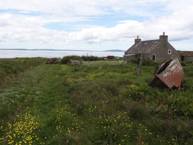
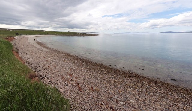
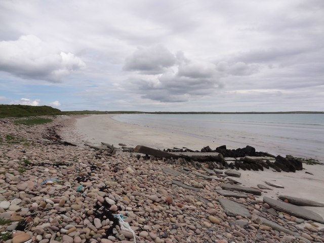
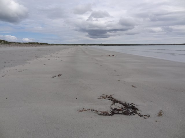
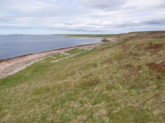
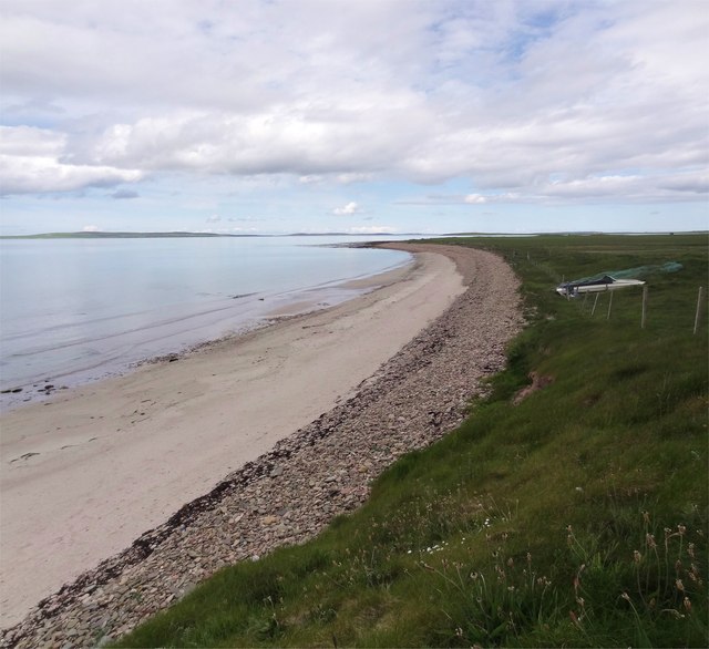
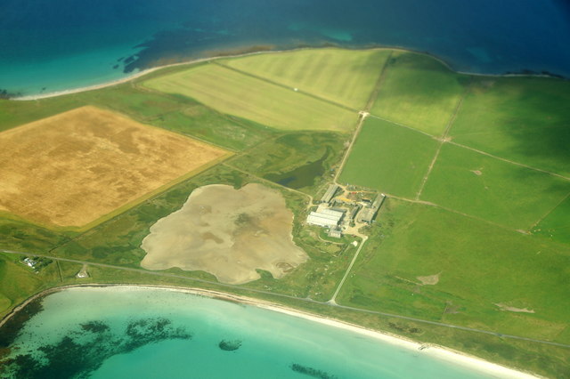
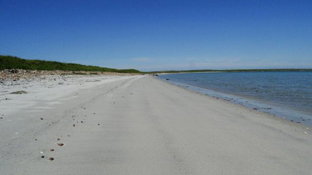
The Bay of Bomasty is a picturesque inlet located on the northeastern coast of Orkney, an archipelago in northern Scotland. Nestled between the mainland and the island of Rousay, the bay stretches roughly 2.5 kilometers in length and is characterized by its pristine sandy beach and calm, turquoise waters.

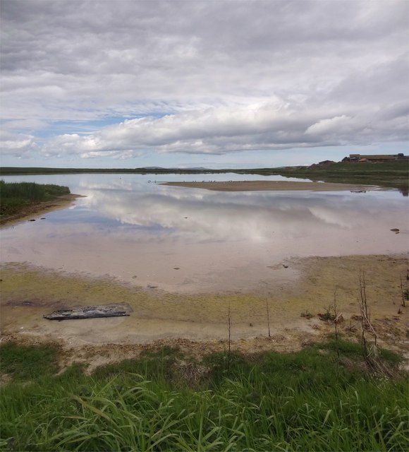
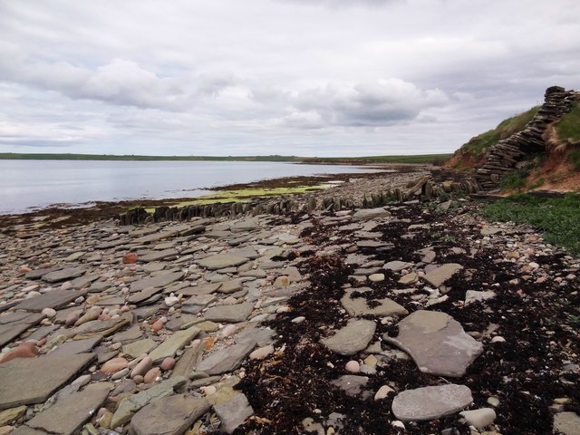
Surrounded by rolling green hills and stunning cliffs, the Bay of Bomasty offers breathtaking panoramic views of the Orkney landscape. It is a popular destination for nature enthusiasts, photographers, and beachgoers alike, who flock to the area to enjoy its tranquil atmosphere and natural beauty.

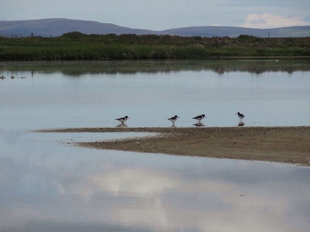
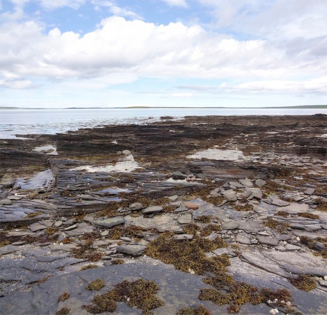
The bay's sandy beach is a haven for wildlife, attracting a variety of bird species, including oystercatchers and curlews. It is also home to a diverse range of marine life, making it a perfect spot for snorkeling and exploring the underwater world.

For those interested in history, the Bay of Bomasty holds significance as the site of the remains of a Norse settlement, dating back to the Viking era. The area has been subject to archaeological excavations, unearthing artifacts and structures that provide a glimpse into the lives of the ancient inhabitants.

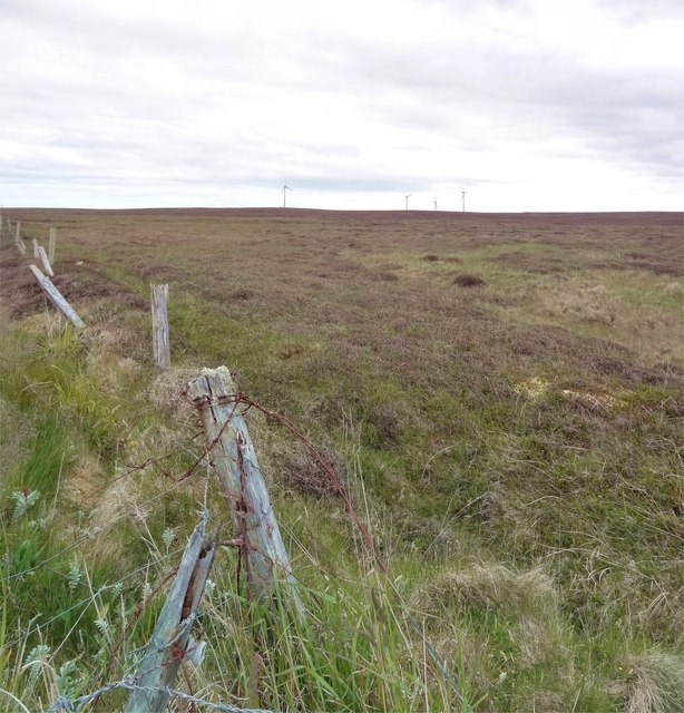
Access to the Bay of Bomasty is relatively easy, with a nearby car park and a walking trail that leads visitors down to the beach. The bay offers a tranquil escape from the hustle and bustle of everyday life, providing a unique opportunity to immerse oneself in the natural wonders and rich history of Orkney.

If you have any feedback on the listing, please let us know in the comments section below.

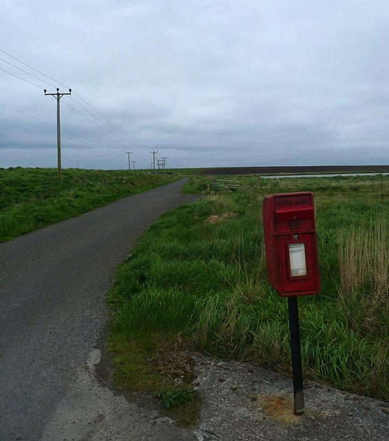
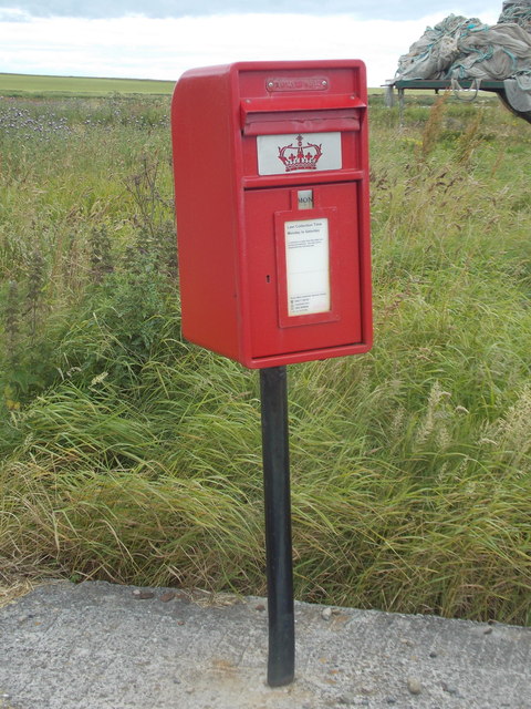
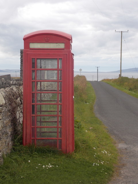
Bay of Bomasty Images

Images are sourced within 2km of 59.098071/-2.6738322 or Grid Reference HY6123. Thanks to Geograph Open Source API. All images are credited.

Tiffenmaka Cottage The curiously and lovely named cottage of Tiffenmaka above the Bay of Bomasty and Stronsay Firh. Looking across to Shapinsay, Mainland and Rousay.
Tiffenmaka Cottage
The curiously and lovely named cottage of Tiffenmaka above the Bay of Bomasty and Stronsay Firh. Looking across to Shapinsay, Mainland and Rousay.
Bay of Bomasty Bay of Bomasty on the western side of Stronsay - a fine name for a fine Bay.
The figure on the beach was in fact a professional photographer on a commission for Visit Scotland.
Bay of Bomasty
Bay of Bomasty on the western side of Stronsay - a fine name for a fine Bay. The figure on the beach was in fact a professional photographer on a commission for Visit Scotland.
Sand of Rothiesholm Looking east along the Sand of Rothiesholm, an almost 2km stretch of beautiful white sand completely deserted despite a lovely summers day.
Sand of Rothiesholm
Looking east along the Sand of Rothiesholm, an almost 2km stretch of beautiful white sand completely deserted despite a lovely summers day.
Loch of Rothiesholm Loch of Rothiesholm - a haven for many wading birds. Part of the large farm of Bu can also be seen.
Loch of Rothiesholm
Loch of Rothiesholm - a haven for many wading birds. Part of the large farm of Bu can also be seen.
Haematopus ostralegus Gregarious Oystercatchers on the Loch of Rothiesholm.
Haematopus ostralegus
Gregarious Oystercatchers on the Loch of Rothiesholm.
Seaweed, Beach and Sky The pristine beach of Sand of Rothiesholm and nary a soul in sight. Almost 2km of white sands, I am about half way along the beach so there is a similar amount of beach behind me.
Seaweed, Beach and Sky
The pristine beach of Sand of Rothiesholm and nary a soul in sight. Almost 2km of white sands, I am about half way along the beach so there is a similar amount of beach behind me.
Millfield Moss Looking across Millfield Moss from beyond the end of the road on Stronsay. The turbines of the Bu windfarm can just be seen.
Millfield Moss
Looking across Millfield Moss from beyond the end of the road on Stronsay. The turbines of the Bu windfarm can just be seen.
Stronsay Coastline Near the south end of Stronsay on the Rothiesholm peninsula looking towards Eday and Sanday.
Stronsay Coastline
Near the south end of Stronsay on the Rothiesholm peninsula looking towards Eday and Sanday.
Bight of Baywest One of the many pristine and deserted beaches on Stronsay - this one sounds like it should be in the Florida Keys!
Looking north to Eday and Sanday.
Bight of Baywest
One of the many pristine and deserted beaches on Stronsay - this one sounds like it should be in the Florida Keys! Looking north to Eday and Sanday.
North Taing Near low tide on this square of mainly rock and skerry.
North Taing
Near low tide on this square of mainly rock and skerry.
Looking to the Coppa The Coppa is the small headland seen in the distance, while here a field boundary continues right to the waters edge across the boulders on the shore.
Looking to the Coppa
The Coppa is the small headland seen in the distance, while here a field boundary continues right to the waters edge across the boulders on the shore.
Bay of Holland, Stronsay, Orkney Looking towards Holland Farm.  The photo was taken from the path which runs along the coast between Mervar and the croft which can be seen in <a href="https://www.geograph.org.uk/photo/3994555">HY6322 : Farmland, Latan, Stronsay, Orkney</a>.
Bay of Holland, Stronsay, Orkney
Looking towards Holland Farm. The photo was taken from the path which runs along the coast between Mervar and the croft which can be seen in HY6322 : Farmland, Latan, Stronsay, Orkney.
Letter box by the B9061, Stronsay, Orkney The letter box is situated by Bu Farm.  Bu Loch can be seen beyond it.
Letter box by the B9061, Stronsay, Orkney
The letter box is situated by Bu Farm. Bu Loch can be seen beyond it.
Stronsay: postbox № KW17 54, Rothiesholm This postbox is of a modern design, constructed of pressed steel and designed to be more robust, rustproof and theft-proof than the traditional cast iron box that it will have replaced in the last couple of years.

This particular style of box is becoming quite commonplace in these remote, exposed parts. A passer-by told me it was replaced about a year ago, and that sounds about right going by this picture taken in May 2014: <a href="https://www.geograph.org.uk/photo/4219905">HY6224 : Letter box by the B9061, Stronsay, Orkney</a>
Stronsay: postbox № KW17 54, Rothiesholm
This postbox is of a modern design, constructed of pressed steel and designed to be more robust, rustproof and theft-proof than the traditional cast iron box that it will have replaced in the last couple of years. This particular style of box is becoming quite commonplace in these remote, exposed parts. A passer-by told me it was replaced about a year ago, and that sounds about right going by this picture taken in May 2014: HY6224 : Letter box by the B9061, Stronsay, Orkney
Stronsay: phone box at Rothiesholm Looking along the B9061 as it heads west on the Rothiesholm peninsula.
Stronsay: phone box at Rothiesholm
Looking along the B9061 as it heads west on the Rothiesholm peninsula.
Bu, Stronsay, from the air With a dried-out Loch of Rothiesholm.
Bu, Stronsay, from the air
With a dried-out Loch of Rothiesholm.
On Stronsay - Sand of Rothiesholm at Bu
A turbine at Bu wind farm
Show me another place!

Bay of Bomasty is located at Grid Ref: HY6123 (Lat: 59.098071, Lng: -2.6738322)

Unitary Authority: Orkney Islands

Police Authority: Highlands and Islands

What 3 Words

///highbrow.adjust.selects. Near Whitehall, Orkney Islands

Nearby Locations

Bay of Bomasty

Related Wikis

Linga Holm

Linga Holm, commonly known as Linga, Midgarth and the Holm of Midgarth is an uninhabited Scottish island extending to approximately 57 hectares (0.22...

Stronsay

Stronsay () is an island in Orkney, Scotland. It is known as Orkney's 'Island of Bays', owing to an irregular shape with miles of coastline, with three...

Linga Sound, Orkney

Linga Sound is the strait between the islands of Linga Holm and Stronsay in the Orkney islands of Scotland. It leads into St. Catherines Bay from the north...

Whitehall, Orkney

Whitehall is the village on the island of Stronsay, in the Orkney Islands of Scotland. It is a small village with about 50 houses. It also has a shop...

Nearby Amenities

Located within 500m of 59.098071,-2.6738322
Power: pole
Lat/Long: 59.0947104/-2.6756993
Power: pole
Lat/Long: 59.095109/-2.6756066
Power: pole
Lat/Long: 59.095496/-2.6755108
Power: pole
Lat/Long: 59.0958979/-2.675423
Power: pole
Lat/Long: 59.0966901/-2.6701235
Power: pole
Lat/Long: 59.0966171/-2.6676885
Power: pole
Lat/Long: 59.0954805/-2.6735022
Power: pole
Lat/Long: 59.0961259/-2.6716691
Generator Method: wind_turbine
Generator Source: wind
Power: generator
Lat/Long: 59.0959527/-2.6704548
Bay of Bomasty
Natural: bay
Lat/Long: 59.0982492/-2.6729871
The data included in this document is from www.openstreetmap.org. The data is made available under ODbL.

Have you been to Bay of Bomasty?

Leave your review of Bay of Bomasty below (or comments, questions and feedback).