Bay of Stove

Bay in Orkney

Scotland

Bay of Stove

Looking towards Spurness Wind Farm
Looking towards Spurness Wind Farm Credit: Alpin Stewart

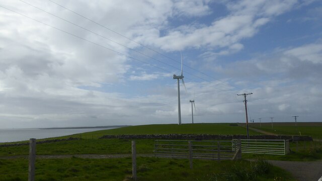
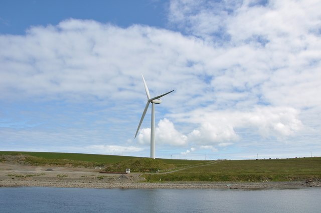
The Bay of Stove, located in the picturesque archipelago of Orkney, Scotland, is a scenic coastal area renowned for its captivating beauty and rich historical significance. Nestled on the northeastern coast of the Orkney Mainland, this bay stretches along a significant portion of the coastline, offering breathtaking views of the North Sea.

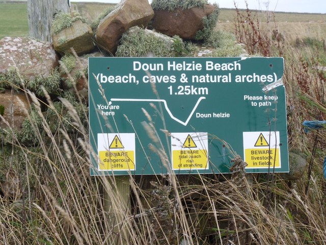
The Bay of Stove is characterized by its pristine sandy beaches, rugged cliffs, and expansive blue waters. The bay is a haven for wildlife, with various species of seabirds, including puffins and kittiwakes, frequenting the area. The surrounding waters teem with marine life, making it a popular spot for fishing and diving enthusiasts.

In addition to its natural splendor, the Bay of Stove holds historical importance. The remains of a Norse settlement, dating back to the 9th century, can be found in the vicinity, providing a glimpse into Orkney's Viking heritage. Visitors can explore the archaeological site and discover artifacts that shed light on the lives of the early settlers.

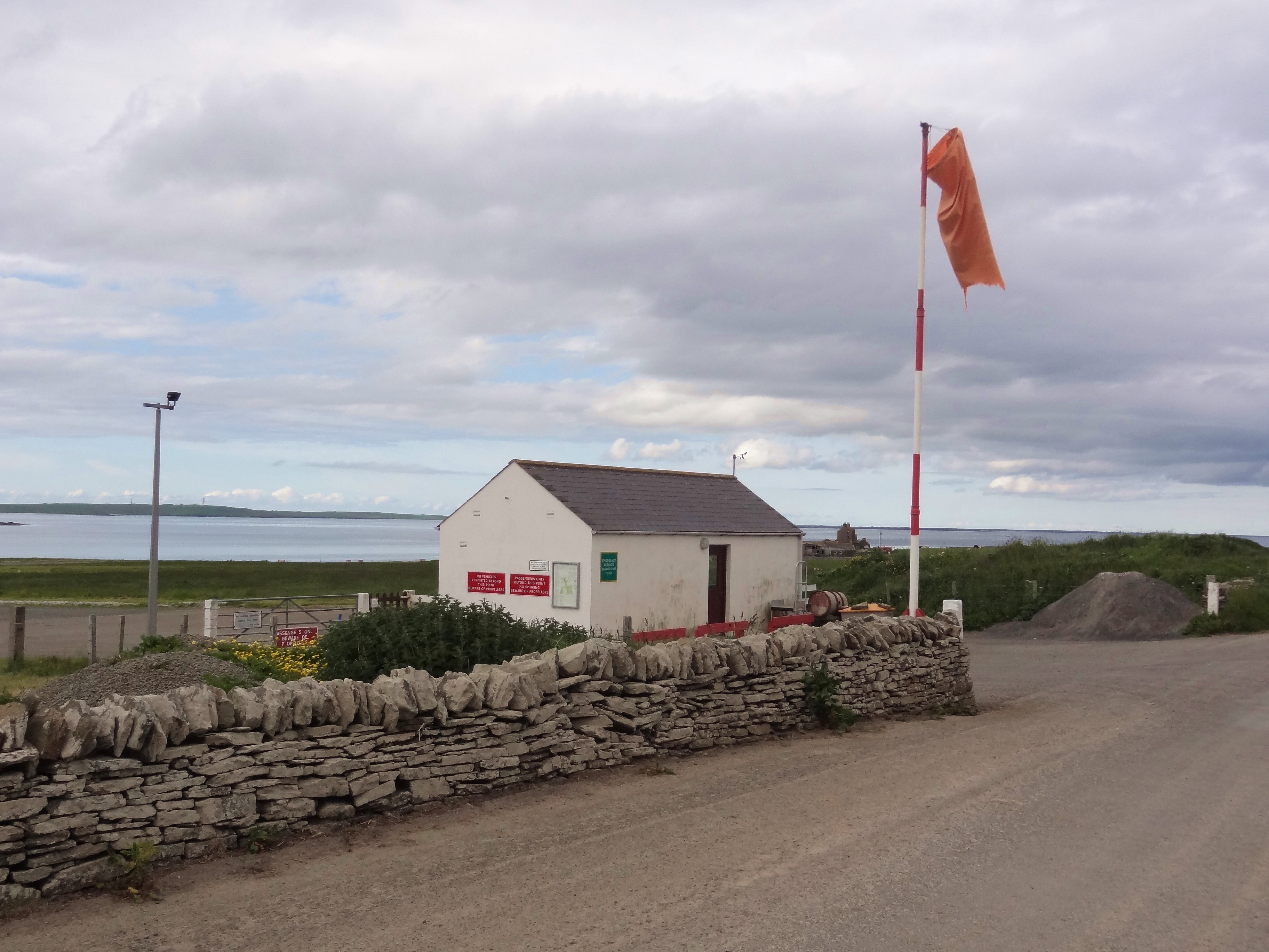
The Bay of Stove is also a gateway to other attractions in Orkney, including the nearby village of St. Margaret's Hope, known for its charming cottages and quaint shops. The bay is easily accessible by car or public transportation, and there are several accommodation options available in the surrounding area, ranging from cozy bed and breakfasts to luxury hotels.

Overall, the Bay of Stove offers a unique blend of natural beauty, wildlife, and historical significance, making it a must-visit destination for nature enthusiasts and history buffs alike.

If you have any feedback on the listing, please let us know in the comments section below.

Bay of Stove Images

Images are sourced within 2km of 59.191834/-2.6829244 or Grid Reference HY6134. Thanks to Geograph Open Source API. All images are credited.

Looking towards Spurness Wind Farm
Shielding and pier at Sanday ferry terminal
Spurness peninsula and windfarm, Sanday, Orkney Public road B9070 leading to Loth ferry terminal, Island of Sanday. Three 2.75MW wind turbines, erected in late 2004, at south end of peninsula. Land used for cattle and sheep grazing and silage growing.
Spurness peninsula and windfarm, Sanday, Orkney
Public road B9070 leading to Loth ferry terminal, Island of Sanday. Three 2.75MW wind turbines, erected in late 2004, at south end of peninsula. Land used for cattle and sheep grazing and silage growing.
Loth Pier, Sanday Looking along the pier at the Earl Sigurd, just arriving to take passengers to Kirkwall.
Loth Pier, Sanday
Looking along the pier at the Earl Sigurd, just arriving to take passengers to Kirkwall.
Electricity sub-station
Stove model farm These are the ruins of a 19th century 'model farm' with a steam engine house.
Stove model farm
These are the ruins of a 19th century 'model farm' with a steam engine house.
Wind turbine This is one of three turbines on Sanday. See <span class="nowrap"><a title="http://www.sanday.co.uk/nowthen/turbines/turbines.htm" rel="nofollow ugc noopener" href="http://www.sanday.co.uk/nowthen/turbines/turbines.htm">Link</a><img style="margin-left:2px;" alt="External link" title="External link - shift click to open in new window" src="https://s1.geograph.org.uk/img/external.png" width="10" height="10"/></span> for some pictures of parts arriving on the island.
Wind turbine
This is one of three turbines on Sanday. See LinkExternal link for some pictures of parts arriving on the island.
Gump of Spurness trig on Sanday
Ferry from Kirkwall Looking southwest, with Loth Pier behind. She can shift. And the sea really was pink.
Ferry from Kirkwall
Looking southwest, with Loth Pier behind. She can shift. And the sea really was pink.
South end of Sanday Taken from the air, from the inter island service
South end of Sanday
Taken from the air, from the inter island service
Wind turbine, Sanday Part of a larger wind farm, 3 turbines in all at this site
Wind turbine, Sanday
Part of a larger wind farm, 3 turbines in all at this site
Arriving at the ferry pier, Sanday
Snowy Sanday, from the air Taken from the Islander flight, on its way to Papay.
Snowy Sanday, from the air
Taken from the Islander flight, on its way to Papay.
Spurness Wind Farm Approaching the ferry terminal at Loth on Sanday and a good view of 2 of the 3 turbines at Spur Ness.
Spurness Wind Farm
Approaching the ferry terminal at Loth on Sanday and a good view of 2 of the 3 turbines at Spur Ness.
Loth Wind Turbine Mighty turbine towering above the harbour at Loth.
Loth Wind Turbine
Mighty turbine towering above the harbour at Loth.
Beware of Everything! Not very helpful sign for Doun Helzie beach and cave.
Beware of Everything!
Not very helpful sign for Doun Helzie beach and cave.
Doun Helzie Cave, Sanday, Orkney
Eendracht unloads at Loth Pier Sanday New Turbines are unloaded at Loth Pier Sanday for the Spur Ness Windfarm extension.
Eendracht unloads at Loth Pier Sanday
New Turbines are unloaded at Loth Pier Sanday for the Spur Ness Windfarm extension.
Show me another place!

Bay of Stove is located at Grid Ref: HY6134 (Lat: 59.191834, Lng: -2.6829244)

Unitary Authority: Orkney Islands

Police Authority: Highlands and Islands

What 3 Words

///tadpoles.punks.beefed. Near Backaland, Orkney Islands

Related Wikis

Braeswick

Braeswick is a settlement on the island of Sanday, in Orkney, Scotland. The settlement is within the parish of Cross and Burness, and is situated on the...

Sanday Light Railway

The Sanday Light Railway was a privately owned ridable miniature railway situated in Braeswick, on the island of Sanday, Orkney, Scotland. The railway...

Holm of Huip

The Holm of Huip is a small island in the Orkney Islands, in Spurness Sound to the north west of Stronsay. The Holm has a cairn on it, and a number of...

Stronsay Airport

Stronsay Airport (IATA: SOY, ICAO: EGER) is located 15 nautical miles (28 km; 17 mi) northeast by north of Kirkwall Airport on Stronsay, Orkney Islands...

Nearby Amenities

Located within 500m of 59.191834,-2.6829244
Generator Method: wind_turbine
Generator Output Electricity: yes
Generator Source: wind
Generator Type: horizontal_axis
Power: generator
Source: Bing
Lat/Long: 59.1907595/-2.6905788
Bay of Stove
Natural: bay
Lat/Long: 59.1937795/-2.6833249
The data included in this document is from www.openstreetmap.org. The data is made available under ODbL.

Have you been to Bay of Stove?

Leave your review of Bay of Stove below (or comments, questions and feedback).