Batford

Settlement in Hertfordshire St. Albans

England

Batford

Alzey Gardens Late 20th Century housing off Pigottshill Lane/Wheathampstead Road.
Alzey Gardens Credit: Ian Capper

Batford is a small village located in Hertfordshire, England. Situated on the eastern outskirts of Harpenden, it forms part of the St Albans City and District Council. The village is nestled between the River Lea and the A1081 road, offering a tranquil and picturesque setting for its residents.

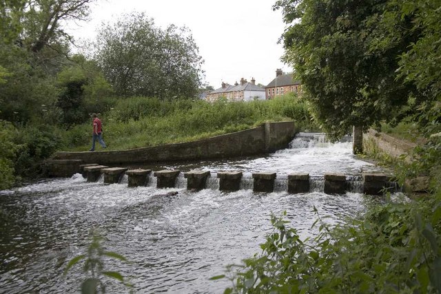
Historically, Batford was an agricultural area, known for its arable farming and watermills that once utilized the power of the River Lea. Over time, the village has gradually transformed into a residential community, attracting a mix of families and individuals seeking a quiet and rural lifestyle within close proximity to urban amenities.

The village boasts a range of amenities, including a primary school, a local convenience store, and a few traditional pubs. Batford Park, a green space located near the river, provides residents with an excellent spot for leisurely walks and recreational activities.

Transportation is convenient in Batford, with regular bus services connecting the village to nearby towns and cities. The A1081 road provides easy access to the M1 motorway, enabling commuters to reach London and other major cities relatively quickly.

Surrounded by the beautiful Hertfordshire countryside, Batford offers a charming blend of rural living and accessibility to urban centers. Its close proximity to Harpenden and St Albans provides residents with a wide range of shopping, dining, and entertainment options. With its idyllic setting and convenient location, Batford continues to be an attractive place to live for those seeking a peaceful village lifestyle.

If you have any feedback on the listing, please let us know in the comments section below.
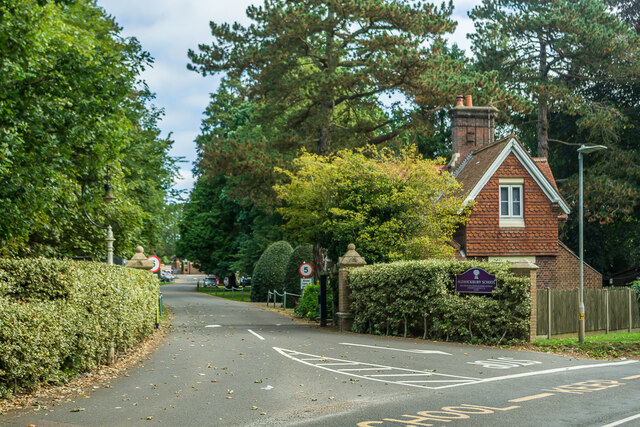
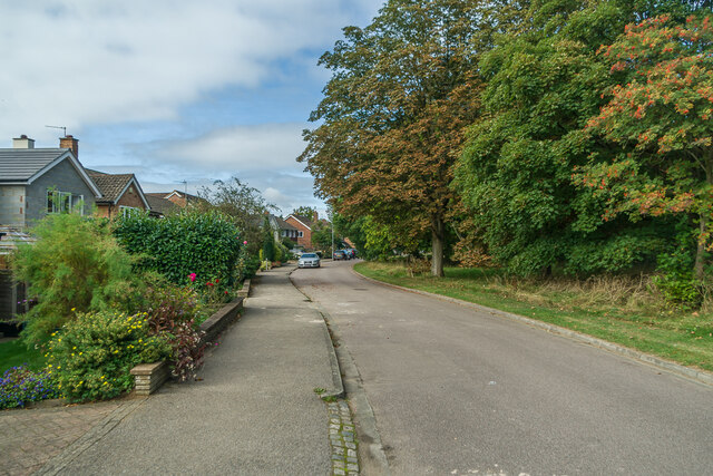
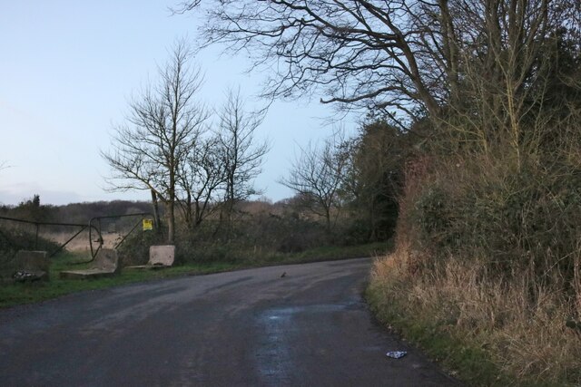
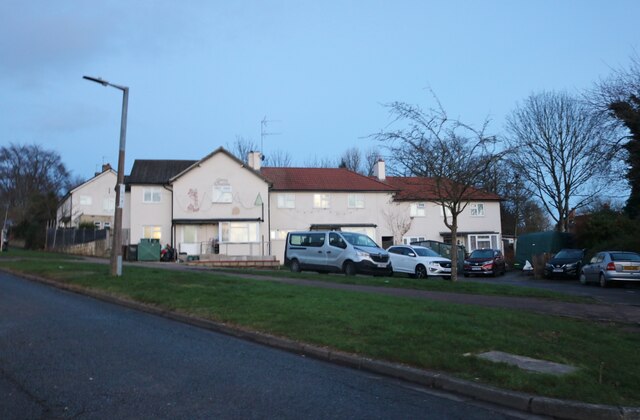
Batford Images

Images are sourced within 2km of 51.824677/-0.34056481 or Grid Reference TL1415. Thanks to Geograph Open Source API. All images are credited.

Alzey Gardens Late 20th Century housing off Pigottshill Lane/Wheathampstead Road.
Alzey Gardens
Late 20th Century housing off Pigottshill Lane/Wheathampstead Road.
Aldwickbury School Boys' prep school which in the c.1940s moved to the Victorian mansion of Aldwickbury (named Highfirs until the early 20th Century).  Seen here is the lodge by the driveway off Wheathamptead Road.
Aldwickbury School
Boys' prep school which in the c.1940s moved to the Victorian mansion of Aldwickbury (named Highfirs until the early 20th Century). Seen here is the lodge by the driveway off Wheathamptead Road.
Wheathampstead Road c.1960s housing along a service road separated from the main Wheathampstead Road by the line of trees on the right.
Wheathampstead Road
c.1960s housing along a service road separated from the main Wheathampstead Road by the line of trees on the right.
Topstreet Way c.1930s housing.
Topstreet Way
c.1930s housing.
Dalkeith Road c.1930s housing.
Dalkeith Road
c.1930s housing.
Connaught Road c.1930s housing.
Connaught Road
c.1930s housing.
Junction on Common Lane, Batford
Field in Batford
Field in Batford
Common Lane, Bower Heath
Coldharbour Lane, Harpenden
Batford Road at the junction of Lower Luton Road
Houses on Pickford Hill, Batford
Pickford Hill, Batford
Traffic island on Pickford Hill, Batford
Pickford Hill, Batford
Houses on Finley Road, Batford
Westfield Avenue, Harpenden
Westfield Road, Harpenden The railway is behind the barrier
Westfield Road, Harpenden
The railway is behind the barrier
Show me another place!

Batford is located at Grid Ref: TL1415 (Lat: 51.824677, Lng: -0.34056481)

Administrative County: Hertfordshire

District: St. Albans

Police Authority: Hertfordshire

What 3 Words

///bleak.barks.maple. Near Harpenden, Hertfordshire

Nearby Locations

Batford

Related Wikis

Harpenden East railway station

Harpenden East was one of two stations serving the town of Harpenden, the other station which remains open being Harpenden Central. Originally named Harpenden...

Batford Springs

Batford Springs is a 3.5-hectare (8.6-acre) Local Nature Reserve in Harpenden in Hertfordshire. It is owned and managed by Harpenden Town Council, and...

Sir John Lawes School

Sir John Lawes School (also known as SJL) is a mixed state secondary school with academy status in Harpenden, United Kingdom. The school has close links...

Batford

Batford is a village in Hertfordshire, England, located on the River Lea on the outskirts of Harpenden. Batford Springs is a local nature reserve alongside...

Bower Heath

Bower Heath is a hamlet in Hertfordshire, England. It is in the civil parish of Harpenden

St George's School, Harpenden

St George's School, Harpenden (also known as St George's) is a non-selective state day and boarding school in Harpenden, Hertfordshire, England, educating...
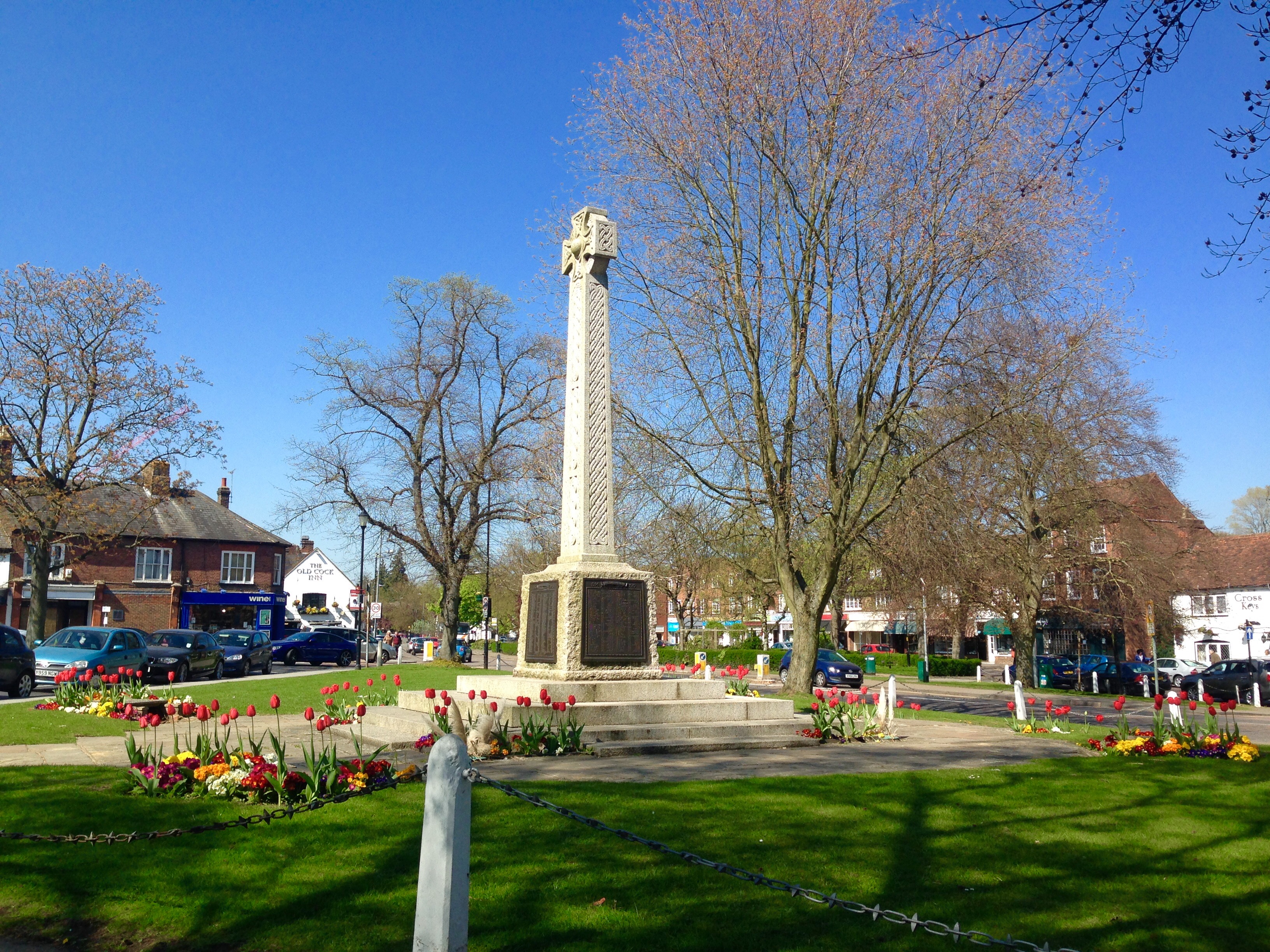
Harpenden

Harpenden () is a town and civil parish in the City and District of St Albans in the county of Hertfordshire, England. The population of the built-up area...
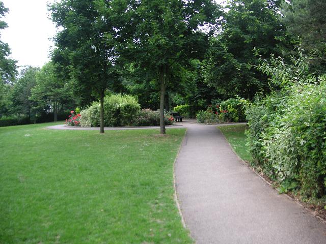
Lydekker Park

Lydekker Park is a 3-acre (1.2 ha) park in Harpenden, Hertfordshire. The land was formerly part of the garden of Harpenden Lodge, built in 1803, home...

Nearby Amenities

Located within 500m of 51.824677,-0.34056481
Mini Roundabout
Direction: clockwise
Lat/Long: 51.8250801/-0.3416845
Waterway: weir
Lat/Long: 51.822065/-0.3368741
Pub
The Malta
Addr City: Harpenden
Addr Housenumber: 110
Addr Postcode: AL5 5AH
Addr Street: Lower Luton Road
Fhrs Authority: St Albans City
Fhrs Id: 305758
Wikidata: Q83558622
Lat/Long: 51.8246673/-0.3402598
Atm
Check Date: 2022-08-17
Description: free atm
Operator: Tesco Bank
Lat/Long: 51.8246288/-0.3406868
Batford
Created By: Potlatch 0.6c
Place: suburb
Wikidata: Q4868869
Lat/Long: 51.8265018/-0.3394829
Parking
Access: yes
Created By: Potlatch 0.6c
Fee: no
Parking: surface
Lat/Long: 51.8248676/-0.3405737
Bus Stop
Tallents Crescent
Bus: yes
Naptan AtcoCode: 210021510520
Naptan Bearing: NW
Naptan CommonName: Tallents Crescent
Naptan Crossing: Common Lane
Naptan Indicator: adj
Naptan Landmark: Common Lane
Naptan NaptanCode: hrtatjwd
Naptan PlusbusZoneRef: HRPNDN
Naptan ShortCommonName: NA
Naptan Street: Milford Hill
Naptan Verified: no
Public Transport: platform
Source: naptan_import
Lat/Long: 51.8249301/-0.3338469
Bus Stop
Porters Hill
Bench: no
Bin: no
Bus: yes
Naptan AtcoCode: 210021501130
Naptan Bearing: SE
Naptan CommonName: Porters Hill
Naptan Indicator: nr
Naptan NaptanCode: hrtdajdw
Naptan PlusbusZoneRef: HRPNDN
Naptan Street: Lower Luton Road
Naptan Verified: no
Public Transport: platform
Shelter: no
Lat/Long: 51.8272944/-0.3436968
Speed Camera
Lat/Long: 51.8275553/-0.343882
Pub
Amble Inn
Addr City: Harpenden
Addr Housenumber: 182
Addr Postcode: AL5 4UL
Addr Street: Station Road
Fhrs Authority: St Albans City
Fhrs Id: 305945
Lat/Long: 51.8219143/-0.3398245
Post Box
Post Box Type: pillar
Ref: AL5 71D
Royal Cypher: EIIR
Royal Cypher Wikidata: Q33102113
Lat/Long: 51.8218037/-0.3396555
Post Box
Collection Times: Mo-Fr 09:00, Sa 07:00
Post Box Type: pillar
Ref: AL5 226D
Royal Cypher: GVIR
Royal Cypher Wikidata: Q33102169
Lat/Long: 51.8267852/-0.3399363
Bus Stop
Langdale Avenue
Bus: yes
Naptan AtcoCode: 210021500620
Naptan Bearing: NE
Naptan CommonName: Langdale Avenue
Naptan Crossing: opp Carisbrooke Road
Naptan Indicator: opp
Naptan Landmark: opp Carisbrooke Road
Naptan NaptanCode: hrtdajpa
Naptan PlusbusZoneRef: HRPNDN
Naptan ShortCommonName: NA
Naptan Street: Station Road
Naptan Verified: no
Public Transport: platform
Shelter: no
Source: naptan_import
Lat/Long: 51.8205216/-0.3409157
Bus Stop
Martham Court
Bus: yes
Naptan AtcoCode: 210021500640
Naptan Bearing: NW
Naptan CommonName: Martham Court
Naptan Crossing: Martham Court
Naptan Indicator: nr
Naptan Landmark: Martham Court
Naptan NaptanCode: hrtdajpg
Naptan PlusbusZoneRef: HRPNDN
Naptan ShortCommonName: NA
Naptan Street: Station Road
Naptan Verified: no
Public Transport: platform
Source: naptan_import
Lat/Long: 51.8230975/-0.3409536
Bus Stop
Porters Hill
Bus: yes
Naptan AtcoCode: 210021510600
Naptan Bearing: NW
Naptan CommonName: Porters Hill
Naptan Crossing: opp Lea Industrial Estate
Naptan Indicator: opp
Naptan Landmark: opp Lea Industrial Estate
Naptan NaptanCode: hrtatmad
Naptan PlusbusZoneRef: HRPNDN
Naptan ShortCommonName: NA
Naptan Street: Lower Luton Road
Naptan Verified: no
Public Transport: platform
Source: naptan_import
Lat/Long: 51.8270983/-0.3436834
Bus Stop
Willow Way
Bus: yes
Naptan AtcoCode: 210021501137
Naptan Bearing: NE
Naptan CommonName: Willow Way
Naptan Crossing: opp Hill Close
Naptan Indicator: adj
Naptan Landmark: opp Hill Close
Naptan NaptanCode: hrtjadmg
Naptan ShortCommonName: NA
Naptan Street: Porters Hill
Naptan Verified: no
Public Transport: platform
Shelter: no
Source: naptan_import
Lat/Long: 51.8271062/-0.3427962
Bus Stop
Jubilee Court
Bus: yes
Naptan AtcoCode: 210021501150
Naptan Bearing: NE
Naptan CommonName: Jubilee Court
Naptan Crossing: Lower Luton Road
Naptan Indicator: NE-bound
Naptan Landmark: Lower Luton Road
Naptan NaptanCode: hrtdagwa
Naptan PlusbusZoneRef: HRPNDN
Naptan ShortCommonName: NA
Naptan Street: Pickford Hill
Naptan Verified: no
Public Transport: platform
Shelter: no
Source: naptan_import
Lat/Long: 51.8258347/-0.3411756
Bus Stop
Pickford Hill
Bus: yes
Local Ref: NR
Naptan AtcoCode: 210021501160
Naptan Bearing: SE
Naptan CommonName: Pickford Hill
Naptan Crossing: Porters Hill
Naptan Indicator: nr
Naptan Landmark: Porters Hill
Naptan NaptanCode: hrtdagwd
Naptan PlusbusZoneRef: HRPNDN
Naptan ShortCommonName: NA
Naptan Street: Noke Shot
Naptan Verified: no
Public Transport: platform
Source: naptan_import
Lat/Long: 51.8272279/-0.3404193
Bus Stop
Noke Shot
Bench: no
Bin: no
Bus: yes
Local Ref: NR
Naptan AtcoCode: 210021501170
Naptan Bearing: NE
Naptan CommonName: Noke Shot
Naptan Crossing: opp Roundfield Avenue
Naptan Indicator: nr
Naptan Landmark: opp Roundfield Avenue
Naptan NaptanCode: hrtdagwg
Naptan PlusbusZoneRef: HRPNDN
Naptan ShortCommonName: NA
Naptan Street: Pickford Hill
Naptan Verified: no
Public Transport: platform
Shelter: no
Source: naptan_import
Lat/Long: 51.8270331/-0.3391686
Bus Stop
Whitings Close
Bench: no
Bin: yes
Bus: yes
Naptan AtcoCode: 210021501180
Naptan Bearing: NE
Naptan CommonName: Whitings Close
Naptan Crossing: opp Batford JMI School
Naptan Indicator: adj
Naptan Landmark: opp Batford JMI School
Naptan NaptanCode: hrtdagwj
Naptan PlusbusZoneRef: HRPNDN
Naptan ShortCommonName: NA
Naptan Street: Pickford Hill
Naptan Verified: no
Public Transport: platform
Shelter: no
Source: naptan_import
Lat/Long: 51.8280311/-0.3368863
Bus Stop
Holcroft Road
Bench: no
Bin: no
Bus: yes
Naptan AtcoCode: 210021501200
Naptan Bearing: S
Naptan CommonName: Holcroft Road
Naptan Crossing: opp Holcroft Road
Naptan Indicator: opp
Naptan Landmark: opp Holcroft Road
Naptan NaptanCode: hrtdagwm
Naptan PlusbusZoneRef: HRPNDN
Naptan ShortCommonName: NA
Naptan Street: Milford Hill
Naptan Verified: no
Public Transport: platform
Shelter: no
Source: naptan_import
Lat/Long: 51.8265539/-0.3342776
Bus Stop
Tallents Crescent
Bench: no
Bin: no
Bus: yes
Naptan AtcoCode: 210021501220
Naptan Bearing: SE
Naptan CommonName: Tallents Crescent
Naptan Crossing: Common Lane
Naptan Indicator: opp
Naptan Landmark: Common Lane
Naptan NaptanCode: hrtdagwp
Naptan PlusbusZoneRef: HRPNDN
Naptan ShortCommonName: NA
Naptan Street: Milford Hill
Naptan Verified: no
Public Transport: platform
Shelter: no
Source: naptan_import
Lat/Long: 51.8247909/-0.3334939
Bus Stop
The Malta PH
Bus: yes
Naptan AtcoCode: 210021501260
Naptan Bearing: SE
Naptan CommonName: The Malta PH
Naptan Crossing: Southview Road
Naptan Indicator: adj
Naptan Landmark: Southview Road
Naptan NaptanCode: hrtdagwt
Naptan PlusbusZoneRef: HRPNDN
Naptan ShortCommonName: NA
Naptan Street: Lower Luton Road
Naptan Verified: no
Public Transport: platform
Shelter: no
Source: naptan_import
Lat/Long: 51.8245913/-0.3401352
Bus Stop
Batford Road
Bus: yes
Naptan AtcoCode: 210021501280
Naptan Bearing: SE
Naptan CommonName: Batford Road
Naptan Crossing: Batford Road
Naptan Indicator: nr
Naptan Landmark: Batford Road
Naptan NaptanCode: hrtdajad
Naptan PlusbusZoneRef: HRPNDN
Naptan ShortCommonName: NA
Naptan Street: Lower Luton Road
Naptan Verified: no
Public Transport: platform
Source: naptan_import
Lat/Long: 51.8228623/-0.3369617
Bus Stop
Common Lane
Bus: yes
Naptan AtcoCode: 210021510450
Naptan Bearing: NW
Naptan CommonName: Common Lane
Naptan Crossing: Batford Mill
Naptan Indicator: opp
Naptan Landmark: Batford Mill
Naptan NaptanCode: hrtatmdw
Naptan PlusbusZoneRef: HRPNDN
Naptan ShortCommonName: NA
Naptan Street: Lower Luton Road
Naptan Verified: no
Public Transport: platform
Source: naptan_import
Lat/Long: 51.8218961/-0.335476
Bus Stop
Batford Road
Bus: yes
Naptan AtcoCode: 210021510460
Naptan Bearing: NW
Naptan CommonName: Batford Road
Naptan Crossing: opp Batford Road
Naptan Indicator: opp
Naptan Landmark: opp Batford Road
Naptan NaptanCode: hrtatmga
Naptan PlusbusZoneRef: HRPNDN
Naptan ShortCommonName: NA
Naptan Street: Lower Luton Road
Naptan Verified: no
Public Transport: platform
Shelter: yes
Source: naptan_import
Lat/Long: 51.8225731/-0.3368563
Bus Stop
The Malta PH
Bench: no
Bin: yes
Bus: yes
Naptan AtcoCode: 210021510480
Naptan Bearing: NW
Naptan CommonName: The Malta PH
Naptan Crossing: Station Road
Naptan Indicator: opp
Naptan Landmark: Station Road
Naptan NaptanCode: hrtatmgd
Naptan PlusbusZoneRef: HRPNDN
Naptan ShortCommonName: NA
Naptan Street: Lower Luton Road
Naptan Verified: no
Public Transport: platform
Shelter: yes
Source: naptan_import
Tactile Paving: no
Lat/Long: 51.8248342/-0.3411719
Bus Stop
Lower Luton Road
Bus: yes
Naptan AtcoCode: 210021510500
Naptan Bearing: NE
Naptan CommonName: Lower Luton Road
Naptan Crossing: Batford Road
Naptan Indicator: N-bound
Naptan Landmark: Batford Road
Naptan NaptanCode: hrtatmap
Naptan PlusbusZoneRef: HRPNDN
Naptan ShortCommonName: NA
Naptan Street: Common Lane
Naptan Verified: no
Public Transport: platform
Source: naptan_import
Lat/Long: 51.8221814/-0.334635
Bus Stop
Holcroft Road
Bench: no
Bus: yes
Naptan AtcoCode: 210021510540
Naptan Bearing: N
Naptan CommonName: Holcroft Road
Naptan Crossing: Finley Road
Naptan Indicator: adj
Naptan Landmark: Finley Road
Naptan NaptanCode: hrtatjwg
Naptan PlusbusZoneRef: HRPNDN
Naptan ShortCommonName: NA
Naptan Street: Milford Hill
Naptan Verified: no
Public Transport: platform
Shelter: no
Source: naptan_import
Lat/Long: 51.8259449/-0.3344687
Bus Stop
Whitings Close
Bus: yes
Naptan AtcoCode: 210021510560
Naptan Bearing: NW
Naptan CommonName: Whitings Close
Naptan Crossing: Batford JMI School
Naptan Indicator: opp
Naptan Landmark: Batford JMI School
Naptan NaptanCode: hrtatjwj
Naptan PlusbusZoneRef: HRPNDN
Naptan ShortCommonName: NA
Naptan Street: Milford Hill
Naptan Verified: no
Public Transport: platform
Source: naptan_import
Lat/Long: 51.8278943/-0.3360448
Bus Stop
Roundfield Avenue
Bus: yes
Naptan AtcoCode: 210021510570
Naptan Bearing: SE
Naptan CommonName: Roundfield Avenue
Naptan Crossing: Pickford Hill
Naptan Indicator: S-bound
Naptan Landmark: Pickford Hill
Naptan NaptanCode: hrtatjwm
Naptan PlusbusZoneRef: HRPNDN
Naptan ShortCommonName: NA
Naptan Street: Roundfield Avenue
Naptan Verified: no
Public Transport: platform
Shelter: yes
Source: naptan_import
Lat/Long: 51.8266881/-0.3391884
Bus Stop
Southview Road
Bus: yes
Naptan AtcoCode: 210021510580
Naptan Bearing: SW
Naptan CommonName: Southview Road
Naptan Crossing: Salisbury Road
Naptan Indicator: S-bound
Naptan Landmark: Salisbury Road
Naptan NaptanCode: hrtatjwp
Naptan PlusbusZoneRef: HRPNDN
Naptan ShortCommonName: NA
Naptan Street: Southview Road
Naptan Verified: no
Public Transport: platform
Shelter: no
Source: naptan_import
Lat/Long: 51.8255044/-0.3392861
Willow Way
Naptan AtcoCode: 210021510590
Naptan Bearing: SW
Naptan BusStopType: CUS
Naptan CommonName: Willow Way
Naptan Crossing: Lower Luton Road
Naptan Indicator: opp
Naptan Landmark: Lower Luton Road
Naptan NaptanCode: hrtatjwt
Naptan PlusbusZoneRef: HRPNDN
Naptan ShortCommonName: NA
Naptan Street: Porters Hill
Naptan Verified: no
Source: naptan_import
Lat/Long: 51.8270008/-0.3428887
Bus Stop
Martham Court
Bus: yes
Naptan AtcoCode: 210021511120
Naptan Bearing: SE
Naptan CommonName: Martham Court
Naptan Crossing: Martham Court
Naptan Indicator: opp
Naptan Landmark: Martham Court
Naptan NaptanCode: hrtatjdj
Naptan PlusbusZoneRef: HRPNDN
Naptan ShortCommonName: NA
Naptan Street: Station Road
Naptan Verified: no
Public Transport: platform
Shelter: yes
Source: naptan_import
Lat/Long: 51.8228762/-0.3405083
Bus Stop
Langdale Avenue
Bench: yes
Bin: yes
Bus: yes
Naptan AtcoCode: 210021511140
Naptan Bearing: S
Naptan CommonName: Langdale Avenue
Naptan Crossing: opp Manland Avenue
Naptan Indicator: adj
Naptan Landmark: opp Manland Avenue
Naptan NaptanCode: hrtatjdm
Naptan PlusbusZoneRef: HRPNDN
Naptan ShortCommonName: NA
Naptan Street: Station Road
Naptan Verified: no
Public Transport: platform
Shelter: yes
Source: naptan_import
Lat/Long: 51.8209916/-0.3398552
Traffic Calming: hump
Lat/Long: 51.8259775/-0.3459462
Traffic Calming: hump
Lat/Long: 51.8253449/-0.3473378
Traffic Calming: hump
Lat/Long: 51.8256798/-0.3465882
Waterway: weir
Lat/Long: 51.822187/-0.3373792
Allied Business Park
Place: village
Lat/Long: 51.8263412/-0.3443524
Crossing
Crossing: traffic_signals
Crossing Ref: puffin
Lat/Long: 51.822754/-0.3369614
Post Box
Post Box Type: pillar
Ref: AL5 290D
Royal Cypher: EIIR
Royal Cypher Wikidata: Q33102113
Lat/Long: 51.8261339/-0.3348433
Bench
Backrest: yes
Source: GPS, observation
Lat/Long: 51.8250555/-0.3420279
Community Centre
Batford Springs Nature Reserve Centre
Website: https://www.harpenden.gov.uk/batford-springs
Lat/Long: 51.8239124/-0.3390768
Fast Food
Balti Village
Addr City: Harpenden
Addr Housenumber: 93
Addr Postcode: AL5 5AJ
Addr Street: Lower Luton Road
Cuisine: indian
Fhrs Authority: St Albans City
Fhrs Id: 305757
Lat/Long: 51.8239472/-0.3391519
Ford: yes
Lat/Long: 51.8219881/-0.3369211
Post Box
Collection Times: Mo-Fr 09:00, Sa 07:00
Post Box Type: pillar
Ref: AL5 280D
Royal Cypher: EIIR
Royal Cypher Wikidata: Q33102113
Lat/Long: 51.8259237/-0.3464373
Post Box
Collection Times: Mo-Fr 09:00, Sa 07:00
Post Box Type: pillar
Ref: AL5 63D
Royal Cypher: EIIR
Royal Cypher Wikidata: Q33102113
Lat/Long: 51.8248249/-0.3402824
Bench
Backrest: yes
Source: observation, GPS
Lat/Long: 51.8250426/-0.3419052
Lea Valley Walk
Information: board
Tourism: information
Lat/Long: 51.8240822/-0.342511
Give Way
Direction: forward
Lat/Long: 51.8243984/-0.3426192
Crossing
Crossing: unmarked
Lat/Long: 51.8239235/-0.3421583
Direction: 140
Generator Method: photovoltaic
Generator Output Electricity: yes
Generator Solar Modules: 16
Generator Source: solar
Generator Type: solar_photovoltaic_panel
Location: roof
Power: generator
Lat/Long: 51.8204629/-0.3414365
Crossing
Crossing: unmarked
Lat/Long: 51.8218313/-0.3350271
Traffic Calming: island
Lat/Long: 51.8249976/-0.3415167
Traffic Calming: island
Lat/Long: 51.8251645/-0.3417541
Crossing
Crossing: traffic_signals
Crossing Island: no
Crossing Ref: pelican
Tactile Paving: yes
Lat/Long: 51.8252366/-0.341821
Direction: 220
Generator Method: photovoltaic
Generator Output Electricity: yes
Generator Solar Modules: 6
Generator Source: solar
Generator Type: solar_photovoltaic_panel
Location: roof
Power: generator
Lat/Long: 51.8250773/-0.3413553
Direction: 150
Generator Method: photovoltaic
Generator Output Electricity: yes
Generator Solar Modules: 24
Generator Source: solar
Generator Type: solar_photovoltaic_panel
Location: roof
Power: generator
Lat/Long: 51.8257279/-0.3425002
Direction: 150
Generator Method: photovoltaic
Generator Output Electricity: yes
Generator Solar Modules: 12
Generator Source: solar
Generator Type: solar_photovoltaic_panel
Location: roof
Power: generator
Lat/Long: 51.8260861/-0.3429096
Direction: 140
Generator Method: photovoltaic
Generator Output Electricity: yes
Generator Solar Modules: 45
Generator Source: solar
Generator Type: solar_photovoltaic_panel
Location: roof
Power: generator
Lat/Long: 51.8246768/-0.3428919
Crossing
Crossing: marked
Crossing Island: no
Tactile Paving: yes
Lat/Long: 51.8227212/-0.3403535
Traffic Calming: bump
Lat/Long: 51.8227853/-0.3458397
Traffic Calming: bump
Lat/Long: 51.8229563/-0.346111
Traffic Calming: hump
Lat/Long: 51.8229346/-0.3449693
Turning Circle
Lat/Long: 51.8234153/-0.343605
Direction: 235
Generator Method: photovoltaic
Generator Output Electricity: yes
Generator Solar Modules: 14
Generator Source: solar
Generator Type: solar_photovoltaic_panel
Location: roof
Power: generator
Lat/Long: 51.8228752/-0.3421818
Direction: 235
Generator Method: photovoltaic
Generator Output Electricity: yes
Generator Solar Modules: 15
Generator Source: solar
Generator Type: solar_photovoltaic_panel
Location: roof
Power: generator
Lat/Long: 51.824136/-0.3434793
Direction: 230
Generator Method: photovoltaic
Generator Output Electricity: yes
Generator Solar Modules: 12
Generator Source: solar
Generator Type: solar_photovoltaic_panel
Location: roof
Power: generator
Lat/Long: 51.8225651/-0.3364164
Direction: 220
Generator Method: photovoltaic
Generator Output Electricity: yes
Generator Solar Modules: 10
Generator Source: solar
Generator Type: solar_photovoltaic_panel
Location: roof
Power: generator
Lat/Long: 51.8229958/-0.3357882
Direction: 130
Generator Method: photovoltaic
Generator Output Electricity: yes
Generator Solar Modules: 5
Generator Source: solar
Generator Type: solar_photovoltaic_panel
Location: roof
Power: generator
Lat/Long: 51.8229958/-0.3358486
Direction: 240
Generator Method: photovoltaic
Generator Output Electricity: yes
Generator Solar Modules: 8
Generator Source: solar
Generator Type: solar_photovoltaic_panel
Location: roof
Power: generator
Lat/Long: 51.8249324/-0.3335307
Direction: 165
Generator Method: photovoltaic
Generator Output Electricity: yes
Generator Solar Modules: 195
Generator Source: solar
Generator Type: solar_photovoltaic_panel
Location: roof
Power: generator
Lat/Long: 51.8274633/-0.3368986
Direction: 150
Generator Method: photovoltaic
Generator Output Electricity: yes
Generator Solar Modules: 21
Generator Source: solar
Generator Type: solar_photovoltaic_panel
Location: roof
Power: generator
Lat/Long: 51.8271298/-0.3420553
Give Way
Direction: forward
Lat/Long: 51.8210386/-0.3400243
Direction: 215
Generator Method: photovoltaic
Generator Output Electricity: yes
Generator Solar Modules: 13
Generator Source: solar
Generator Type: solar_photovoltaic_panel
Location: roof
Power: generator
Lat/Long: 51.8256407/-0.3377443
Direction: 220
Generator Method: photovoltaic
Generator Output Electricity: yes
Generator Solar Modules: 10
Generator Source: solar
Generator Type: solar_photovoltaic_panel
Location: roof
Power: generator
Lat/Long: 51.8276063/-0.3396334
Direction: 150
Generator Method: photovoltaic
Generator Output Electricity: yes
Generator Solar Modules: 5
Generator Source: solar
Generator Type: solar_photovoltaic_panel
Location: roof
Power: generator
Lat/Long: 51.8280751/-0.3393964
Natural: spring
Lat/Long: 51.8244922/-0.3423669
Natural: spring
Lat/Long: 51.8235466/-0.3385143
Natural: spring
Lat/Long: 51.8230712/-0.3386615
The data included in this document is from www.openstreetmap.org. The data is made available under ODbL.

Have you been to Batford?

Leave your review of Batford below (or comments, questions and feedback).