Blackness Bay

Bay in West Lothian

Scotland

Blackness Bay

John Muir Way, west of Blackness
John Muir Way, west of Blackness Credit: Colin Park

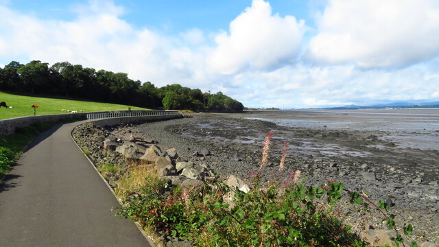
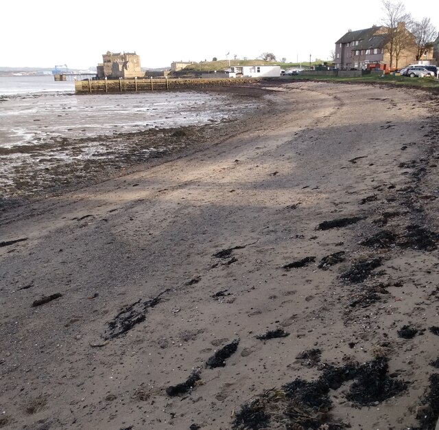
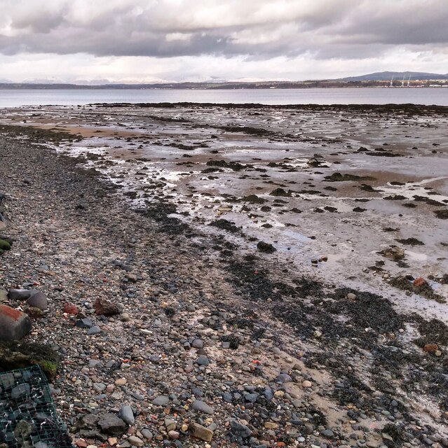
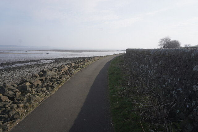
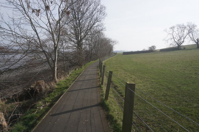
Blackness Bay is a picturesque coastal area located in West Lothian, Scotland. Situated on the southern shore of the Firth of Forth, this bay offers stunning views of the surrounding landscape and is a popular destination for locals and tourists alike.

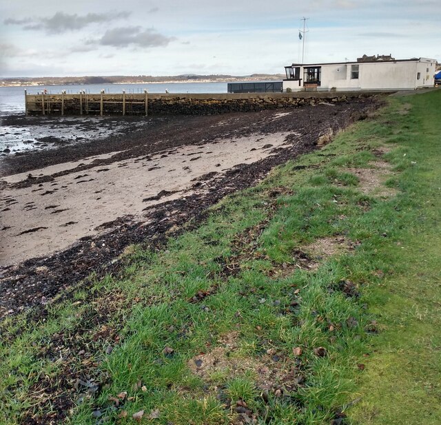
The bay is known for its tranquil atmosphere, with its calm waters and gentle waves creating a peaceful environment for visitors. The sandy beach stretches along the shoreline, providing an ideal spot for sunbathing, picnicking, or taking leisurely walks. The bay is also home to a small marina, offering opportunities for boating and sailing enthusiasts to explore the scenic coastline.

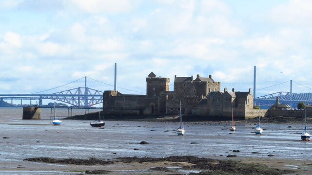
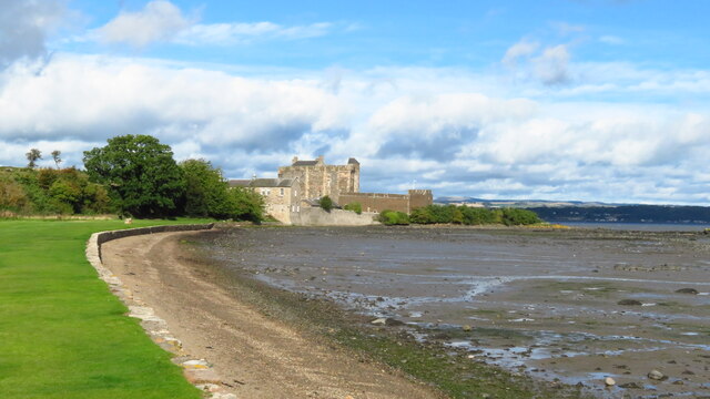
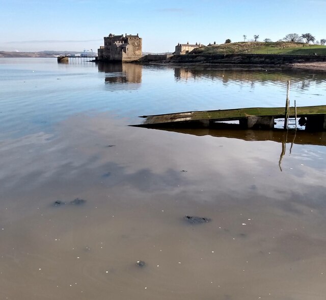
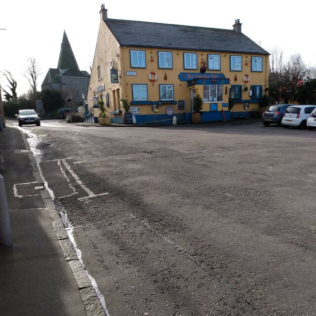
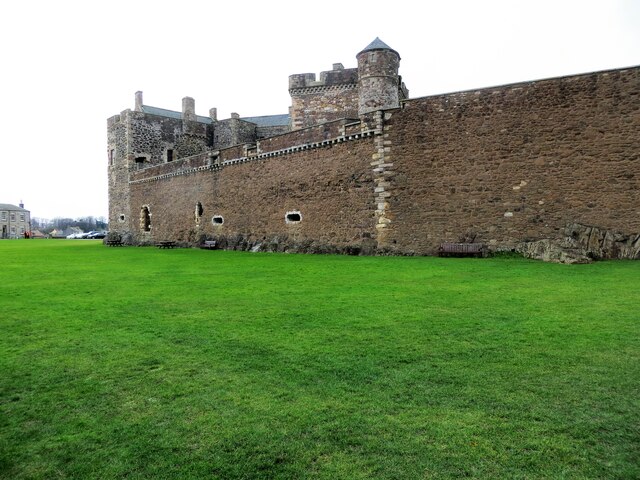
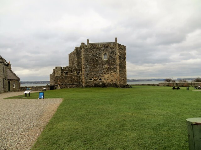
Blackness Bay is steeped in history, as it is situated near the historic village of Blackness. The bay is overlooked by the imposing Blackness Castle, a 15th-century fortress that stands as a testament to Scotland's rich heritage. The castle, often referred to as "the ship that never sailed" due to its distinctive shape, attracts history buffs from all over the world.

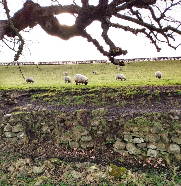
Nature enthusiasts will appreciate the bay's diverse wildlife, as Blackness Bay is a designated Site of Special Scientific Interest (SSSI). The area is home to a variety of bird species, including oystercatchers, sandpipers, and curlews, making it an ideal spot for birdwatching.

Overall, Blackness Bay offers a perfect blend of natural beauty, historical charm, and recreational opportunities, making it a must-visit destination in West Lothian for anyone seeking a peaceful coastal retreat.

If you have any feedback on the listing, please let us know in the comments section below.

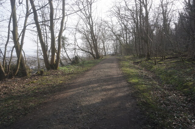
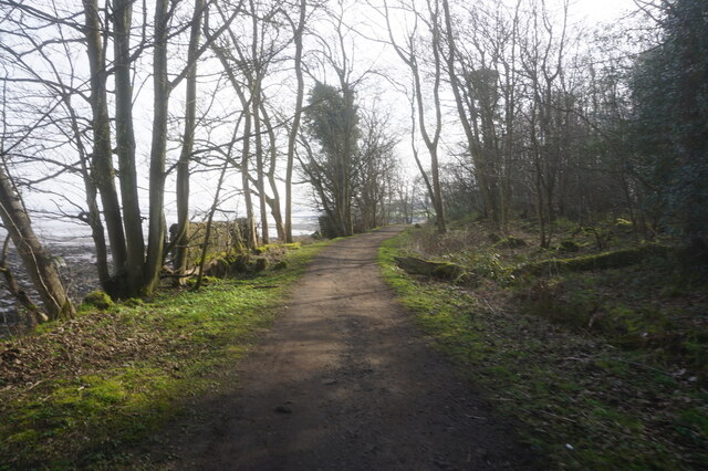
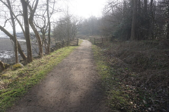
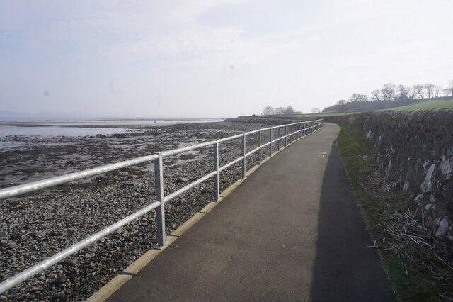
Blackness Bay Images

Images are sourced within 2km of 56.005381/-3.5223563 or Grid Reference NT0580. Thanks to Geograph Open Source API. All images are credited.

John Muir Way, west of Blackness
Blackness Castle from John Muir Trail
Shoreline on east side of Blackness Castle
Calm Waters: Blackness Looking to Blackness Castle
Calm Waters: Blackness
Looking to Blackness Castle
Blackness Beach Deserted on a February afternoon
Blackness Beach
Deserted on a February afternoon
Blackness village centre This pub formerly the Blackness Inn was re-opened after 11 years as The Lobster Pot
Blackness village centre
This pub formerly the Blackness Inn was re-opened after 11 years as The Lobster Pot
Blackness Boat Club At low tide
Blackness Boat Club
At low tide
Sheep near Blackness In field beside coast path
Sheep near Blackness
In field beside coast path
Low tide on River Forth Snow covered Ochils merging with clouds
Low tide on River Forth
Snow covered Ochils merging with clouds
Double gates Stone wall on right is field boundary, beyond gates it's in field
Double gates
Stone wall on right is field boundary, beyond gates it's in field
Blackness Castle
Blackness Castle
Blackness Castle, overlooking The Firth of Forth
John Muir Way towards Blackness
Show me another place!

Blackness Bay is located at Grid Ref: NT0580 (Lat: 56.005381, Lng: -3.5223563)

Unitary Authority: Falkirk

Police Authority: Forth Valley

What 3 Words

///cushy.hairspray.select. Near Limekilns, Fife

Related Wikis

Blackness, Falkirk

Blackness is a small village and harbour at Blackness Bay, an inlet of the Firth of Forth in Scotland. It lies 3.4 mi (5.5 km) east-southeast of Bo'ness...

Blackness Castle

Blackness Castle is a 15th-century fortress, near the village of Blackness, Scotland, on the south shore of the Firth of Forth. It was built, probably...

House of the Binns

The House of the Binns, or simply the Binns, is a historic house in West Lothian, Scotland, the seat of the Dalyell family (pronounced dee el). It dates...

Champany, Falkirk

Champany is a hamlet in Falkirk, on the junctions of the A904 and A803 roads near Linlithgow, West Lothian, Scotland. == See also == Champany Inn ��2...
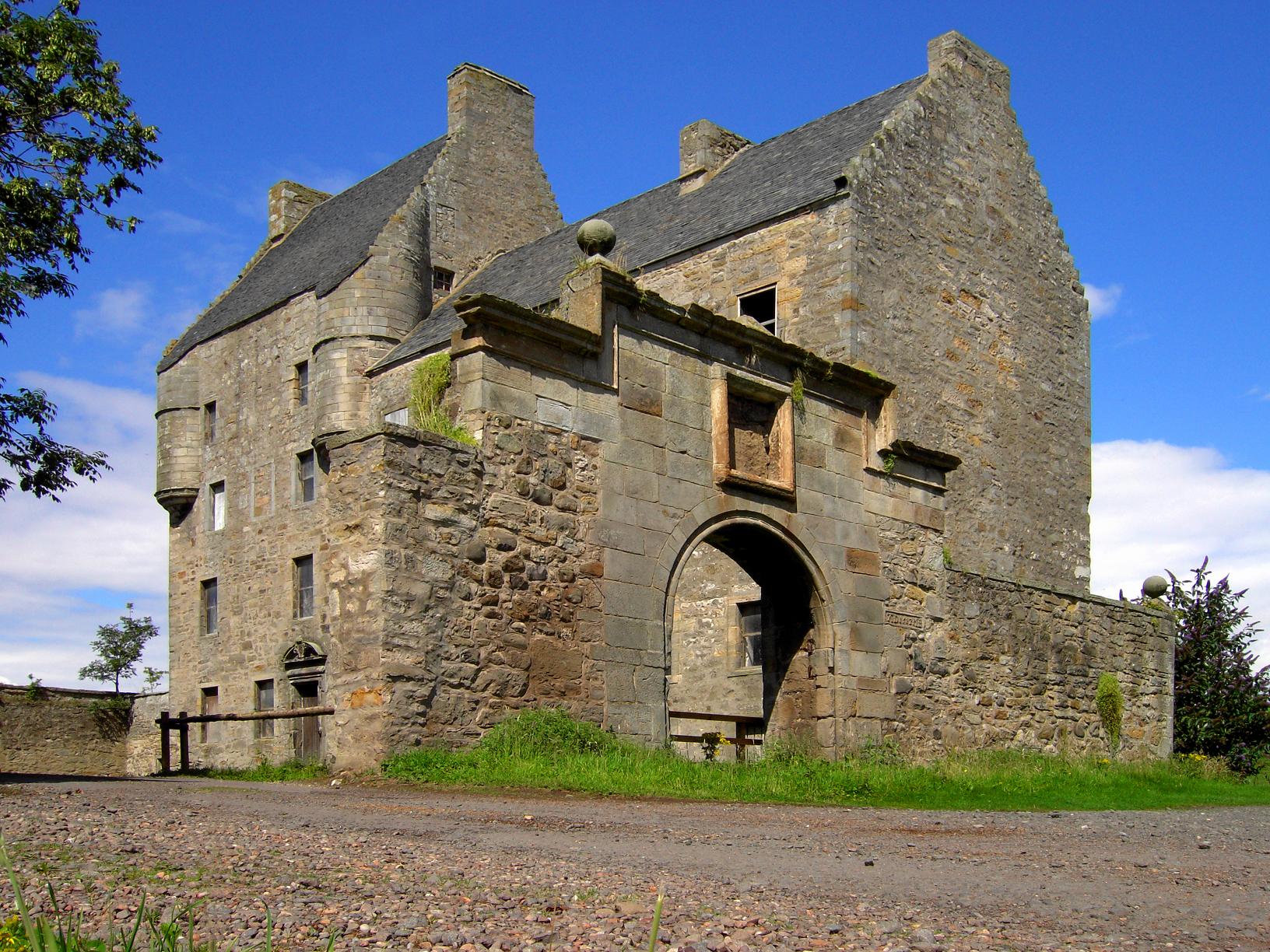
Midhope Castle

Midhope Castle is a 15th-century tower house in Scotland. It is situated in the hamlet of Abercorn on the Hopetoun estate, About 4 kilometres (2.5 mi)...

Carriden House

Carriden House is a 14,041 square feet (1,304.5 m2) mansion in the parish of Bo'ness and Carriden, in the Falkirk council area, east central Scotland....
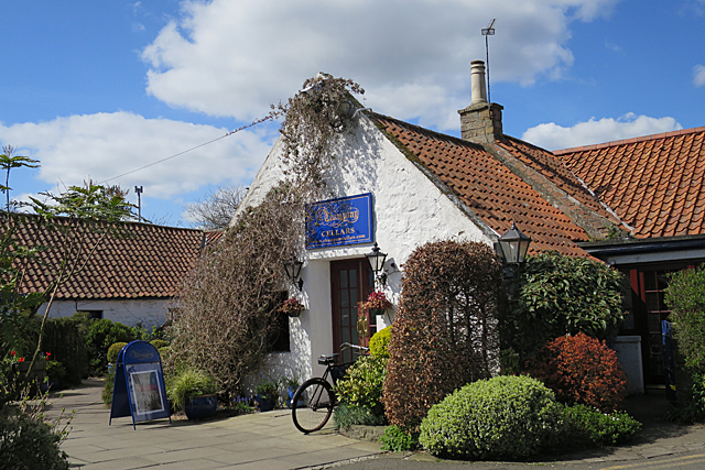
Champany Inn

The Champany Inn is a restaurant and guesthouse in Champany, a hamlet on the junctions of the A904 and A803 roads near Linlithgow, West Lothian, Scotland...

Philpstoun railway station

Philpstoun railway station was a railway station in the village of Philpstoun, to the east of Linlithgow in West Lothian, Scotland. It was located on the...

Nearby Amenities

Located within 500m of 56.005381,-3.5223563
Blackness
Name En: Blackness
Name Gd: An t-Sròn Dhubh
Place: village
Source: npe
Wikidata: Q4923190
Wikipedia: en:Blackness, Falkirk
Lat/Long: 56.0037326/-3.5221681
Barrier: block
Bicycle: yes
Foot: yes
Material: stone
Maxwidth: 1
Lat/Long: 56.0040606/-3.5255046
Blackness Bay
Natural: bay
Lat/Long: 56.0057185/-3.5218803
Traffic Calming: bump
Lat/Long: 56.0048013/-3.5181214
Bicycle Parking
Capacity: 2
Lat/Long: 56.0053438/-3.5168047
Barrier: swing_gate
Locked: yes
Locked Conditional: yes
Opening Hours: Apr-Sep: Mo-Su 10:00-17:00, Oct-Mar: Mo-Su 10:00-16:00
Lat/Long: 56.0042345/-3.5194161
Board Type: history
Information: board
Tourism: information
Lat/Long: 56.005634/-3.5168695
Tourism: picnic_site
Lat/Long: 56.005388/-3.5164297
Tourism: picnic_site
Lat/Long: 56.00546/-3.5168374
Tourism: information
Lat/Long: 56.005556/-3.5162365
Tourism: information
Lat/Long: 56.0067298/-3.5157566
Tourism: picnic_site
Lat/Long: 56.005616/-3.5161078
Tourism: picnic_site
Lat/Long: 56.0056819/-3.5158288
Tourism: picnic_site
Lat/Long: 56.0058539/-3.5159711
Bench
Lat/Long: 56.0061018/-3.5152602
Tourism: picnic_site
Lat/Long: 56.0062338/-3.5155714
Bench
Check Date: 2021-01-04
Lat/Long: 56.0058319/-3.5161078
Bench
Lat/Long: 56.0059579/-3.5158932
Bench
Lat/Long: 56.0060719/-3.515743
Toilets
Lat/Long: 56.005328/-3.516891
Tourism: information
Lat/Long: 56.0044642/-3.5167408
Board Type: wildlife
Information: board
Tourism: information
Lat/Long: 56.0040083/-3.5165262
Bench
Backrest: yes
Check Date: 2021-01-04
Lat/Long: 56.0041703/-3.5189509
Tourism: picnic_site
Lat/Long: 56.0023046/-3.51717
Tourism: picnic_site
Lat/Long: 56.0023946/-3.5171378
Blackness War Memorial
Historic: memorial
Memorial: war_memorial
Lat/Long: 56.0031888/-3.5218772
Bus Stop
Blackness, at The Square
Bus: yes
Naptan AtcoCode: 66902491002
Naptan NaptanCode: 32523464
Public Transport: platform
Shelter: no
Lat/Long: 56.0038068/-3.5222768
Barrier: kissing_gate
Lat/Long: 56.0047975/-3.5180621
Barrier: kissing_gate
Lat/Long: 56.0053072/-3.5171195
Waste Basket
Check Date: 2021-01-04
Lat/Long: 56.005446/-3.5168054
Leisure: picnic_table
Survey Date: 2021-01-04
Lat/Long: 56.0058059/-3.5164165
Barrier: door
Entrance: yes
Lat/Long: 56.0063001/-3.5156422
Barrier: door
Entrance: yes
Lat/Long: 56.0058438/-3.5161526
Barrier: door
Entrance: yes
Lat/Long: 56.0060907/-3.5160544
Barrier: door
Entrance: yes
Lat/Long: 56.0058795/-3.5162262
Postern Gate
Barrier: door
Lat/Long: 56.0063061/-3.5158087
Barrier: door
Lat/Long: 56.0060401/-3.5164311
Barrier: door
Entrance: yes
Lat/Long: 56.0059269/-3.5162697
Man Made: water_well
Lat/Long: 56.0061251/-3.5160234
Man Made: flagpole
Lat/Long: 56.0063157/-3.5156645
Barrier: door
Entrance: yes
Lat/Long: 56.0061076/-3.5160958
Blackness Area Community Council
Information: board
Tourism: information
Lat/Long: 56.0038214/-3.5228308
Hope Park
Place: isolated_dwelling
Lat/Long: 56.0021208/-3.5244075
Addr Housename: Sea Yetts
Addr Place: Blackness
Lat/Long: 56.0038104/-3.5218494
Addr Housename: Tarquinn
Addr Housenumber: 2
Addr Place: Blackness
Addr Street: The Square
Lat/Long: 56.0037288/-3.5219506
Addr Housenumber: 1
Addr Place: Blackness
Addr Street: St Ninians Way
Lat/Long: 56.0031657/-3.5214706
Addr Housenumber: 1
Addr Place: Blackness
Addr Street: The Guildry
Lat/Long: 56.0038223/-3.5225669
Addr Housenumber: 1
Addr Place: Blackness
Lat/Long: 56.0038189/-3.5247603
Addr Housenumber: 10
Addr Place: Blackness
Addr Street: St Ninians Way
Lat/Long: 56.0028009/-3.5207831
Addr Housenumber: 11
Addr Place: Blackness
Addr Street: St Ninians Way
Lat/Long: 56.0027382/-3.5206206
Addr Housenumber: 12
Addr Place: Blackness
Addr Street: St Ninians Way
Lat/Long: 56.0027285/-3.5205324
Addr Housenumber: 13
Addr Place: Blackness
Addr Street: St Ninians Way
Lat/Long: 56.0027139/-3.5204739
Addr Housenumber: 14
Addr Place: Blackness
Addr Street: St Ninians Way
Lat/Long: 56.0026756/-3.5204423
Addr Housenumber: 15
Addr Place: Blackness
Addr Street: St Ninians Way
Lat/Long: 56.0026192/-3.5202886
Addr Housenumber: 16
Addr Place: Blackness
Addr Street: St Ninians Way
Lat/Long: 56.0025976/-3.5201891
Addr Housenumber: 17
Addr Place: Blackness
Addr Street: St Ninians Way
Lat/Long: 56.002557/-3.5201442
Addr Housenumber: 18
Addr Place: Blackness
Addr Street: St Ninians Way
Lat/Long: 56.0025087/-3.5200107
Addr Housenumber: 19
Addr Place: Blackness
Addr Street: St Ninians Way
Lat/Long: 56.0024999/-3.5199863
Addr Housenumber: 2
Addr Place: Blackness
Addr Street: St Ninians Way
Lat/Long: 56.0031456/-3.5214419
Addr Housenumber: 2
Addr Place: Blackness
Addr Street: The Guildry
Lat/Long: 56.0038382/-3.5224971
Addr Housenumber: 2
Addr Place: Blackness
Lat/Long: 56.0038403/-3.5248962
Addr Housenumber: 20
Addr Place: Blackness
Addr Street: St Ninians Way
Lat/Long: 56.0024458/-3.5198367
Addr Housenumber: 21
Addr Place: Blackness
Addr Street: St Ninians Way
Lat/Long: 56.0024529/-3.5197079
Addr Housenumber: 22
Addr Place: Blackness
Addr Street: St Ninians Way
Lat/Long: 56.0024884/-3.5196623
Addr Housenumber: 23
Addr Place: Blackness
Addr Street: St Ninians Way
Lat/Long: 56.0023451/-3.5194267
Addr Housenumber: 24
Addr Place: Blackness
Addr Street: St Ninians Way
Lat/Long: 56.0023788/-3.5193833
Addr Housenumber: 3
Addr Place: Blackness
Addr Street: St Ninians Way
Lat/Long: 56.003082/-3.5213508
Addr Housenumber: 3
Addr Place: Blackness
Lat/Long: 56.003864/-3.5250466
Addr Housenumber: 3-4
Addr Place: Blackness
Addr Street: The Guildry
Lat/Long: 56.0038541/-3.5224274
Addr Housenumber: 4
Addr Place: Blackness
Addr Street: St Ninians Way
Lat/Long: 56.0030659/-3.5213278
Addr Housenumber: 4
Addr Place: Blackness
Lat/Long: 56.0038889/-3.5252051
Addr Housenumber: 5
Addr Place: Blackness
Addr Street: St Ninians Way
Lat/Long: 56.002968/-3.5212163
Addr Housenumber: 5
Addr Place: Blackness
Addr Street: The Guildry
Lat/Long: 56.0038607/-3.5222401
Addr Housenumber: 6
Addr Place: Blackness
Addr Street: St Ninians Way
Lat/Long: 56.0029093/-3.5210917
Addr Housenumber: 6-7
Addr Place: Blackness
Addr Street: The Guildry
Lat/Long: 56.0038824/-3.5221451
Addr Housenumber: 7
Addr Place: Blackness
Addr Street: Nossirom Terrace
Lat/Long: 56.0039052/-3.5214915
Addr Housenumber: 7
Addr Place: Blackness
Addr Street: St Ninians Way
Lat/Long: 56.0028937/-3.5210585
Addr Housenumber: 8
Addr Place: Blackness
Addr Street: St Ninians Way
Lat/Long: 56.0028425/-3.5209496
Addr Housenumber: 8
Addr Place: Blackness
Addr Street: The Guildry
Lat/Long: 56.003904/-3.5220501
Addr Housenumber: 9
Addr Place: Blackness
Addr Street: St Ninians Way
Lat/Long: 56.0028337/-3.5208118
The Village Shop
Shop: convenience
Lat/Long: 56.0034759/-3.5220212
Material: wood
Power: pole
Lat/Long: 56.002556/-3.516653
Give Way
Direction: forward
Lat/Long: 56.0032604/-3.5217765
Post Box
Collection Times: Mo-Fr 12:00; Sa 10:45
Operator: Royal Mail
Post Box Type: wall
Ref: EH49 11
Royal Cypher: GR
Royal Cypher Wikidata: Q33102273
Lat/Long: 56.0035689/-3.5218944
Barrier: swing_gate
Bicycle: yes
Foot: yes
Lat/Long: 56.0037863/-3.5231889
Leisure: slipway
Lat/Long: 56.0043634/-3.5216056
Defibrillator
Defibrillator Location: outside wall of Blackness Boat Club building
Emergency: defibrillator
Opening Hours: 24/7
Lat/Long: 56.0041463/-3.5219104
Information: board
Survey Date: 2021-01-04
Tourism: information
Lat/Long: 56.0057932/-3.516593
Information: board
Survey Date: 2021-01-04
Tourism: information
Lat/Long: 56.0021313/-3.5193773
Blackness Playground
Leisure: playground
Lat/Long: 56.0018764/-3.5189266
The data included in this document is from www.openstreetmap.org. The data is made available under ODbL.

Have you been to Blackness Bay?

Leave your review of Blackness Bay below (or comments, questions and feedback).