Saltom Bay

Bay in Cumberland South Lakeland

England

Saltom Bay

Gate and fishing boat On the Coast Path.
Gate and fishing boat Credit: David Medcalf

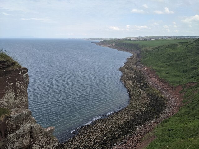
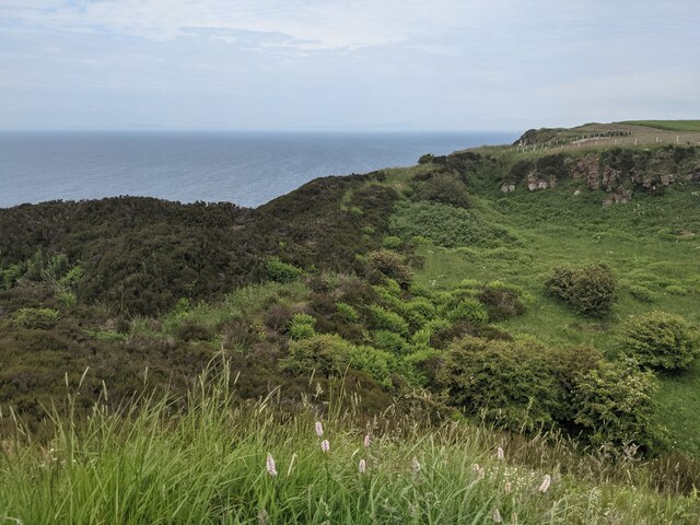
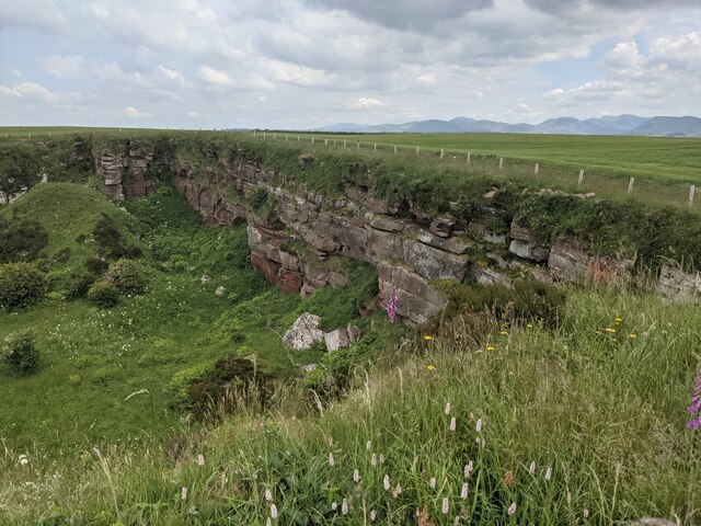
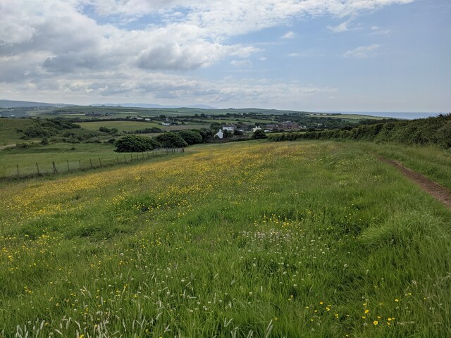
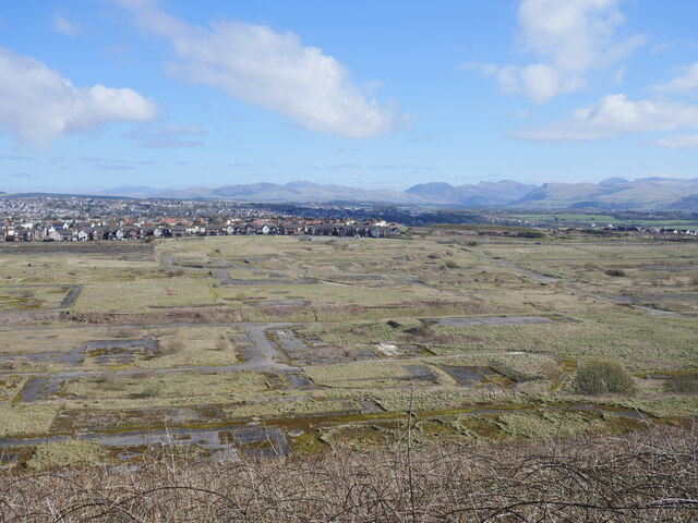
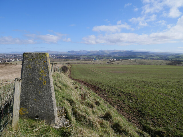
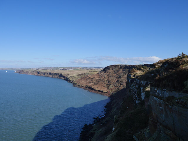
Saltom Bay is a scenic coastal inlet located in the county of Cumberland, England. Situated on the western coast of the country, it is part of the Solway Firth and lies just south of the town of Silloth. The bay stretches approximately 4 kilometers in length, offering breathtaking views of the surrounding landscape and the Irish Sea.

The bay is characterized by its sandy beaches, which attract visitors from near and far. The wide expanse of sand provides ample space for recreational activities such as beach sports, picnicking, and sunbathing. The shallow waters are also ideal for swimming, making it a popular destination for families.

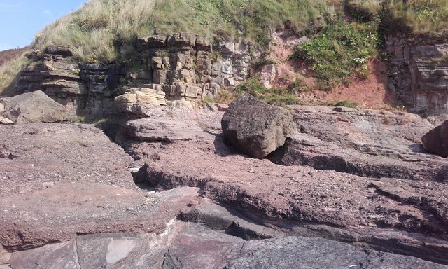
Saltom Bay is known for its stunning natural beauty and diverse wildlife. The area is home to a variety of bird species, including waders, gulls, and terns, making it a haven for birdwatchers. The bay is also a designated Site of Special Scientific Interest, as it supports a range of unique plant and animal species.

In addition to its natural attractions, Saltom Bay offers a range of amenities for visitors. There are several cafes, restaurants, and shops in the nearby town of Silloth, providing opportunities for dining and shopping. The bay is easily accessible by road and has ample parking facilities.

Overall, Saltom Bay in Cumberland is a picturesque coastal destination that combines natural beauty with recreational opportunities, making it a popular choice for locals and tourists alike.

If you have any feedback on the listing, please let us know in the comments section below.

Saltom Bay Images

Images are sourced within 2km of 54.530101/-3.6202123 or Grid Reference NX9516. Thanks to Geograph Open Source API. All images are credited.

Gate and fishing boat On the Coast Path.
Gate and fishing boat
On the Coast Path.
Ground slump field? I think the land has dropped seawards here, creating a convenient small field.
Ground slump field?
I think the land has dropped seawards here, creating a convenient small field.
Coastline at St Bees Head
Hannahmoor Lane
Hannahmoor Lane
Birkhams Quarry Now run by Marshalls who call it St Bees Quarry.
Birkhams Quarry
Now run by Marshalls who call it St Bees Quarry.
A great example of sandstone bedding At Birkhams/St Bees Quarry.
A great example of sandstone bedding
At Birkhams/St Bees Quarry.
A boulder beach near St Bees Head
The entrance to St Bees Quarry Formerly known as Birkham's Quarry.  See: <span class="nowrap"><a title="https://www.lakesguides.co.uk/html/lgaz/lk17309.htm" rel="nofollow ugc noopener" href="https://www.lakesguides.co.uk/html/lgaz/lk17309.htm">Link</a><img style="margin-left:2px;" alt="External link" title="External link - shift click to open in new window" src="https://s1.geograph.org.uk/img/external.png" width="10" height="10"/></span>
The entrance to St Bees Quarry
Formerly known as Birkham's Quarry. See: LinkExternal link
Disused quarry by the Coast Path
The back wall of the disused quarry
Wildflower field above Sandwith village
The site of the former Whitehaven chemical works The site of the former Marchon, latterly Huntsman chemical works on the outskirts of Whitehaven.  The works was operational from 1943 to 2005 with the site finally being cleared about a decade ago.

This photograph was taken during the Coronavirus (COVID-19) pandemic of 2020/21/22.
The site of the former Whitehaven chemical works
The site of the former Marchon, latterly Huntsman chemical works on the outskirts of Whitehaven. The works was operational from 1943 to 2005 with the site finally being cleared about a decade ago. This photograph was taken during the Coronavirus (COVID-19) pandemic of 2020/21/22.
Barrowmouth Wood triangulation pillar A fine view from this spot, 130 metres above sea level.  In this view, the former Whitehaven chemical works site and the distant Lake District fells can be noted.

This photograph was taken during the Coronavirus (COVID-19) pandemic of 2020/21/22.
Barrowmouth Wood triangulation pillar
A fine view from this spot, 130 metres above sea level. In this view, the former Whitehaven chemical works site and the distant Lake District fells can be noted. This photograph was taken during the Coronavirus (COVID-19) pandemic of 2020/21/22.
Along the coast to Whitehaven The rugged Cumbrian coast near Whitehaven.

This photograph was taken during the Coronavirus (COVID-19) pandemic of 2020/21/22.
Along the coast to Whitehaven
The rugged Cumbrian coast near Whitehaven. This photograph was taken during the Coronavirus (COVID-19) pandemic of 2020/21/22.
Dramatic coastline by the Cumbria Coastal Way Whitehaven is in the distance: time to glimpse back en route to St Bees Head.

This photograph was taken during the Coronavirus (COVID-19) pandemic of 2020/21/22.
Dramatic coastline by the Cumbria Coastal Way
Whitehaven is in the distance: time to glimpse back en route to St Bees Head. This photograph was taken during the Coronavirus (COVID-19) pandemic of 2020/21/22.
On the Cumbria Coastal Way near North Head An easy section of the Way with spectacular views.

This photograph was taken during the Coronavirus (COVID-19) pandemic of 2020/21/22.
On the Cumbria Coastal Way near North Head
An easy section of the Way with spectacular views. This photograph was taken during the Coronavirus (COVID-19) pandemic of 2020/21/22.
Stratigraphy at Saltom Bay This is part of the Geological Conversation Review (GCR) Barrowmouth beach section site. The basal Permian stratigraphy dips around 05 degrees to the SW.
The oldest rocks are oxidised Whitehaven sandstones which are Upper Carboniferous in age. An unconformity, representing an erosional surface and depositional hiatus (around 60 million years), can be seen above these sandstones. The Early Permian Brockram Breccia is a polygenetic breccia-conglomerate formed during the deposition of subaerial alluvial fan bodies in arid to semi-arid climatic conditions.

Above this is a dolomite, or magnesian limestone, identified as the Saltom dolomite. This limestone represents the remains of a carbonate platform formerly active on the eastern edge of the Bakevellia Sea.
Stratigraphy at Saltom Bay
This is part of the Geological Conversation Review (GCR) Barrowmouth beach section site. The basal Permian stratigraphy dips around 05 degrees to the SW. The oldest rocks are oxidised Whitehaven sandstones which are Upper Carboniferous in age. An unconformity, representing an erosional surface and depositional hiatus (around 60 million years), can be seen above these sandstones. The Early Permian Brockram Breccia is a polygenetic breccia-conglomerate formed during the deposition of subaerial alluvial fan bodies in arid to semi-arid climatic conditions. Above this is a dolomite, or magnesian limestone, identified as the Saltom dolomite. This limestone represents the remains of a carbonate platform formerly active on the eastern edge of the Bakevellia Sea.
Former Inn in Sandwith The whitewashed building is the former Lowther Arms public house. 
It is a fine example of an 18thC vernacular building.
Former Inn in Sandwith
The whitewashed building is the former Lowther Arms public house. It is a fine example of an 18thC vernacular building.
Show me another place!

Saltom Bay is located at Grid Ref: NX9516 (Lat: 54.530101, Lng: -3.6202123)

Administrative County: Cumbria

District: South Lakeland

Police Authority: Cumbria

What 3 Words

///warrior.defectors.manliness. Near Whitehaven, Cumbria

Nearby Locations

Saltom Bay

Related Wikis

Woodhouse Colliery

Woodhouse Colliery, also known as Whitehaven coal mine, is a proposed coal mine near to Whitehaven in Cumbria, England. The proposal is for the first deep...

Sandwith, Cumbria

Sandwith is a settlement and former civil parish in Cumbria, England, about 7 miles from Workington and near St Bees. It lies in the parish of Whitehaven...

Kells, Whitehaven

Kells is an area of Whitehaven in Cumbria, England, elevated on a cliff to the south of the town centre, overlooking the Irish sea. The population of this...

Haig Colliery Mining Museum

Haig Colliery Mining Museum was a visitor attraction in Kells, on the site of Cumbria's last deep coal mine on the cliffs above Whitehaven in Cumbria,...

Haig Colliery

Haig Colliery was a coal mine in Whitehaven, Cumbria, in north-west England. The mine was in operation for almost 70 years and produced anthracitic coal...
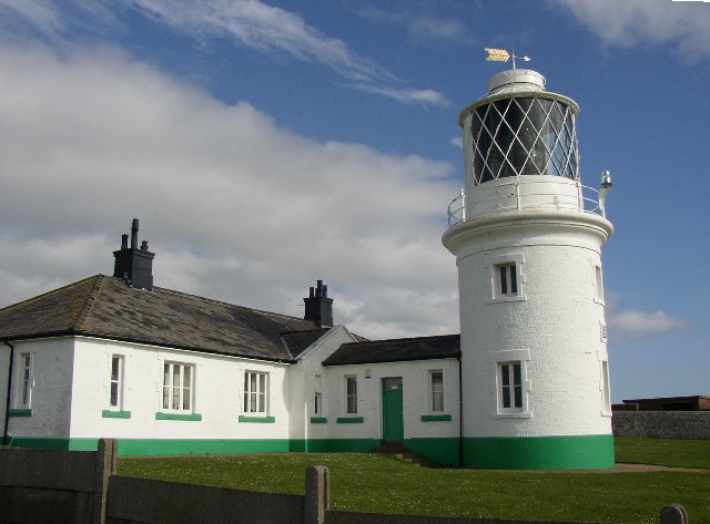
St Bees Lighthouse

St Bees Lighthouse is a lighthouse located on St Bees Head near the village of St Bees in Cumbria, England. The cliff-top light is the highest in England...

Preston Street railway station

Preston Street railway station (also known as Newtown) was a railway station in Whitehaven, Cumbria, England. Opened in July 1849 the station was the original...

Mirehouse, Copeland

Mirehouse is an area and ward in the English county of Cumbria and within the boundaries of the historic county of Cumberland. Mirehouse is 1.5 miles...

Have you been to Saltom Bay?

Leave your review of Saltom Bay below (or comments, questions and feedback).