Bay of Swordly

Bay in Sutherland

Scotland

Bay of Swordly

Kirtomy Bay
Kirtomy Bay Credit: Peter Moore

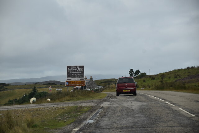
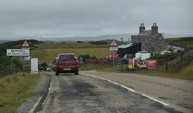
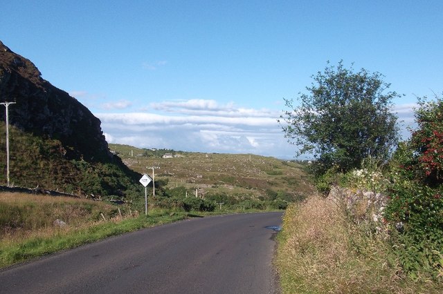
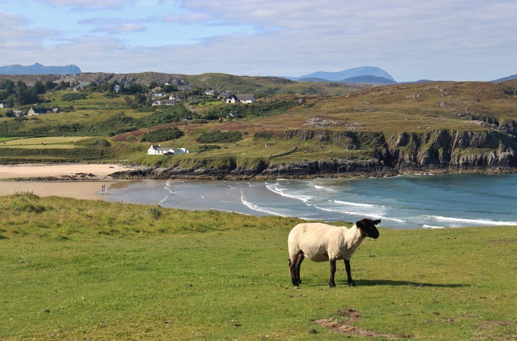
The Bay of Swordly, located in Sutherland, Scotland, is a picturesque coastal area renowned for its natural beauty and historical significance. Situated on the northwestern coast of Scotland, the bay is nestled between the villages of Durness and Tongue.

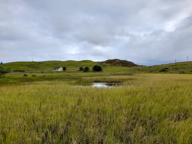
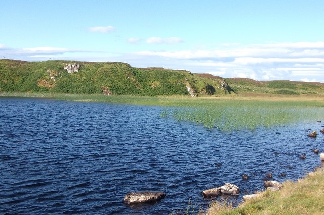
The bay boasts stunning panoramic views of the rugged coastline, with its pristine sandy beaches stretching for miles, offering visitors a tranquil and serene setting. The crystal-clear waters of the bay are ideal for swimming, kayaking, and other water activities. The beach is also known for its unique rock formations, including sea stacks and caves, which add to its scenic appeal.

In addition to its natural wonders, the Bay of Swordly holds historical significance as well. It was once a vital hub for trade and fishing during the 18th and 19th centuries. The remnants of old fishing huts and harbors can still be seen along the bay, serving as a reminder of its maritime past.

The surrounding area is home to diverse wildlife, including seals, dolphins, and a variety of bird species, making it a haven for nature enthusiasts and birdwatchers. The bay is also a popular spot for fishing, with salmon and trout being abundant in its waters.

The Bay of Swordly offers a peaceful and idyllic escape from the bustling city life, allowing visitors to immerse themselves in the beauty of Scotland's rugged coastline and rich history. Whether one seeks relaxation, adventure, or a glimpse into the region's heritage, the bay is a must-visit destination.

If you have any feedback on the listing, please let us know in the comments section below.

Bay of Swordly Images

Images are sourced within 2km of 58.543166/-4.1762494 or Grid Reference NC7363. Thanks to Geograph Open Source API. All images are credited.

Kirtomy Bay
Kirtomy Bay
Phone Box at Kirtomy
Loch Salachaidh - 1978 Loch Salachaidh, A836.
Loch Salachaidh - 1978
Loch Salachaidh, A836.
The road to Swordly and Kirtomy
Loch Salachaidh colours the moor
House near Swordly Burn For sale and being slowly engulfed by bracken at the time I was there in 1994.
House near Swordly Burn
For sale and being slowly engulfed by bracken at the time I was there in 1994.
Entering Bettyhill The A836 runs 122 miles from Dornoch Bridge to John O' Groats <a href="https://www.geograph.org.uk/photo/7086916">ND3872 : A836, John O' Groats</a>. Much of it is still single track.
<span class="nowrap"><a title="https://www.sabre-roads.org.uk/wiki/index.php?title=A836" rel="nofollow ugc noopener" href="https://www.sabre-roads.org.uk/wiki/index.php?title=A836">Link</a><img style="margin-left:2px;" alt="External link" title="External link - shift click to open in new window" src="https://s1.geograph.org.uk/img/external.png" width="10" height="10"/></span>
Entering Bettyhill
The A836 runs 122 miles from Dornoch Bridge to John O' Groats ND3872 : A836, John O' Groats. Much of it is still single track. LinkExternal link
Loch Salachaidh By the A836.
Loch Salachaidh
By the A836.
Swordly Loch
Swordly Loch
Loch Salachaidh Shallow loch near the Bettyhill viewpoint
Loch Salachaidh
Shallow loch near the Bettyhill viewpoint
Cnoc Swordly Summit cairn and purple heather.
Cnoc Swordly
Summit cairn and purple heather.
Creag a' Bhodaich Small crag to the south of the A836.
Creag a' Bhodaich
Small crag to the south of the A836.
A836 A single track section, east of Bettyhill.
A836
A single track section, east of Bettyhill.
Conifer wood near Bettyhill A small plantation south of the coast road.
Conifer wood near Bettyhill
A small plantation south of the coast road.
Loch Salachaidh A small loch beside the A836 east of Bettyhill.
Loch Salachaidh
A small loch beside the A836 east of Bettyhill.
Loch Salachaidh The shallow west end of the loch.
Loch Salachaidh
The shallow west end of the loch.
Crags above the Swordly Burn
Show me another place!

Bay of Swordly is located at Grid Ref: NC7363 (Lat: 58.543166, Lng: -4.1762494)

Unitary Authority: Highland

Police Authority: Highlands and Islands

What 3 Words

///wedge.bank.clogging. Near Reay, Highland

Related Wikis

Swordly

Swordly (Scottish Gaelic: Suardailigh) is an extremely remote hamlet, located on the Bay of Swordly, on the north coastline of Scotland in Sutherland...

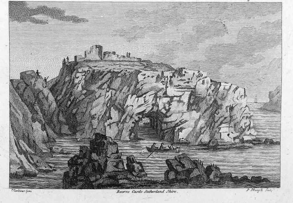
Borve Castle, Sutherland

Borve Castle in Sutherland, Scottish Highlands is now a ruin. Formerly called the House of Burro. It was built in Kirtomy Bay near the hamlet of Farr....

Farr, Sutherland

Farr (Scottish Gaelic: Fàrr) is a parish in the county of Sutherland in the Scottish council area of Highland. The parish also includes a small hamlet...

Crask

Crask is a small remote hamlet, situated on Farr Bay in the Scottish Highlands, on the shore of northern Sutherland in the Scottish council area of Highland...

Nearby Amenities

Located within 500m of 58.543166,-4.1762494
Source: PGS
Lat/Long: 58.5449317/-4.1686001
Source: PGS
Lat/Long: 58.5452735/-4.1701875
Source: PGS
Lat/Long: 58.5445454/-4.170158
Source: PGS
Lat/Long: 58.5445504/-4.171093
Source: PGS
Lat/Long: 58.5446162/-4.171667
Source: PGS
Lat/Long: 58.5446509/-4.172285
Source: PGS
Lat/Long: 58.5448925/-4.1734238
Created By: almien_coastlines
Source: PGS
Lat/Long: 58.544398/-4.174791
Source: PGS
Lat/Long: 58.5441605/-4.1748658
Source: PGS
Lat/Long: 58.5442369/-4.1749752
Source: PGS
Lat/Long: 58.544275/-4.1751126
Source: PGS
Lat/Long: 58.5429326/-4.1740552
Source: PGS
Lat/Long: 58.5427106/-4.1738616
Source: PGS
Lat/Long: 58.5427062/-4.1737253
Source: PGS
Lat/Long: 58.542317/-4.1755063
Source: PGS
Lat/Long: 58.5422347/-4.1760079
Source: PGS
Lat/Long: 58.5423834/-4.1769134
Source: PGS
Lat/Long: 58.5425119/-4.1781038
Source: PGS
Lat/Long: 58.5430051/-4.1781617
Source: PGS
Lat/Long: 58.5431854/-4.1789052
Source: PGS
Lat/Long: 58.5431532/-4.1791107
Source: PGS
Lat/Long: 58.5429371/-4.1805966
Source: PGS
Lat/Long: 58.5438203/-4.1803407
Source: PGS
Lat/Long: 58.543656/-4.1813755
Source: PGS
Lat/Long: 58.5434696/-4.1818095
Source: PGS
Lat/Long: 58.5433203/-4.1821163
Source: PGS
Lat/Long: 58.5435689/-4.1823492
Source: PGS
Lat/Long: 58.5437408/-4.1826168
Source: PGS
Lat/Long: 58.5439922/-4.1827746
Source: PGS
Lat/Long: 58.5452203/-4.1819581
Source: PGS
Lat/Long: 58.5454691/-4.1824302
Source: PGS
Lat/Long: 58.5453034/-4.1829832
Rubha Dearg
Place: locality
Lat/Long: 58.5450148/-4.1751367
Bay of Swordly
Natural: bay
Lat/Long: 58.5439897/-4.1781123
Clais Mhor
Place: locality
Source: OSODSV
Lat/Long: 58.5417451/-4.169504
The data included in this document is from www.openstreetmap.org. The data is made available under ODbL.

Have you been to Bay of Swordly?

Leave your review of Bay of Swordly below (or comments, questions and feedback).