Aber y Pysgodyn-du
Bay in Merionethshire
Wales
Aber y Pysgodyn-du
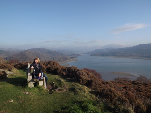
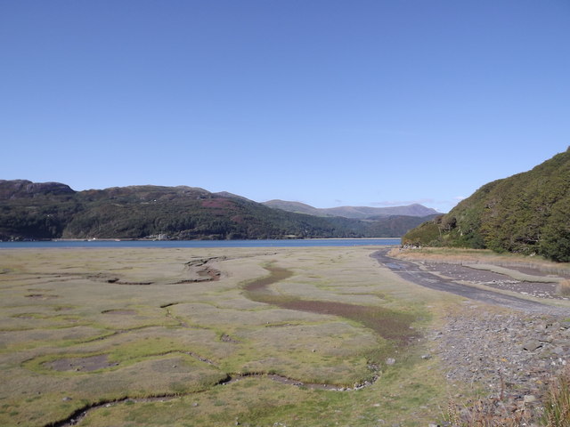
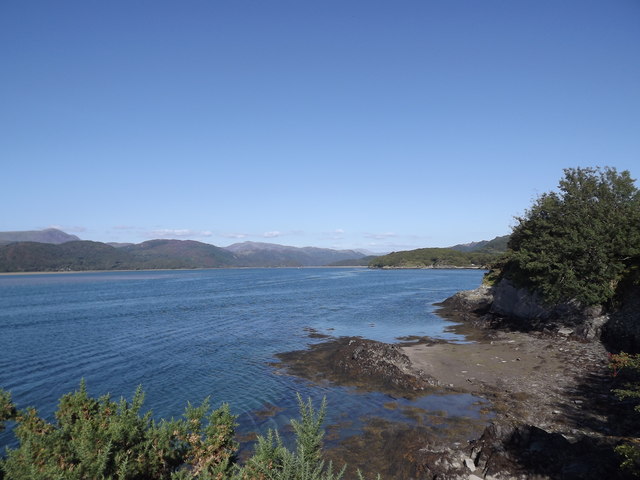
Aber y Pysgodyn-du, located in Merionethshire, is a picturesque bay situated along the Welsh coastline. The bay is renowned for its stunning natural beauty and rich history.
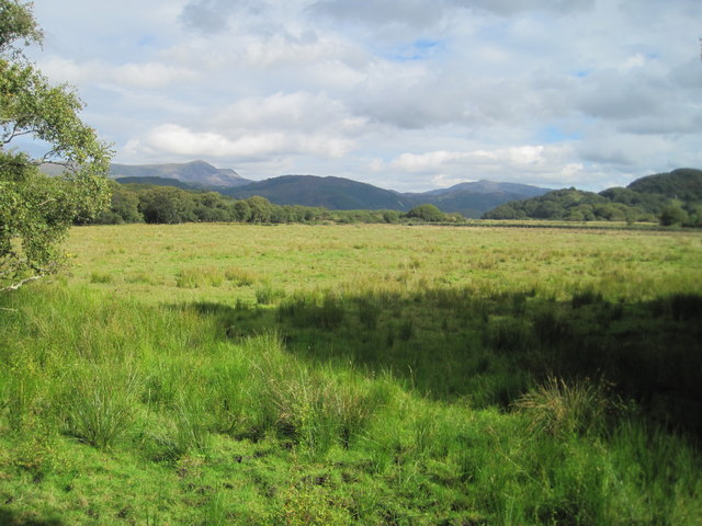
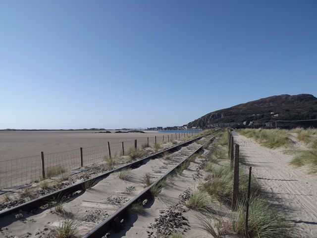
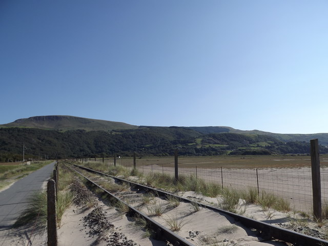
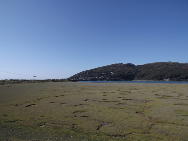
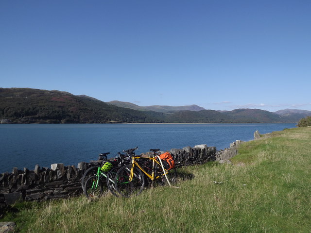
With its idyllic setting, Aber y Pysgodyn-du offers visitors a peaceful and tranquil escape. Surrounded by rolling hills and lush greenery, the bay provides a breathtaking panorama of the Irish Sea. The golden sandy beach stretches for miles, perfect for long walks and relaxation. The crystal clear waters are ideal for swimming, surfing, and various water sports activities.
The bay is not only a haven for nature lovers but also a place of historical significance. It was once a bustling fishing port, where locals relied on the sea for their livelihoods. The remnants of the old fishing village can still be seen, adding a touch of nostalgia to the area. Visitors can explore the quaint houses, now converted into charming cottages, and learn about the rich maritime heritage of the region.
Aber y Pysgodyn-du is also home to a diverse range of wildlife. Birdwatchers can spot numerous species of seabirds, including gulls, cormorants, and sandpipers. The bay is also a popular spot for seals, which can often be seen basking on the rocks or swimming in the waters.
In conclusion, Aber y Pysgodyn-du is a true gem on the Welsh coast, offering a unique blend of natural beauty and historical charm. Whether it's exploring the old fishing village, enjoying the sandy beach, or simply taking in the breathtaking views, this bay provides an unforgettable experience for all who visit.
If you have any feedback on the listing, please let us know in the comments section below.
Aber y Pysgodyn-du Images
Images are sourced within 2km of 52.722163/-4.0345864 or Grid Reference SH6215. Thanks to Geograph Open Source API. All images are credited.

Aber y Pysgodyn-du is located at Grid Ref: SH6215 (Lat: 52.722163, Lng: -4.0345864)
Unitary Authority: Gwynedd
Police Authority: North Wales
What 3 Words
///scrub.liability.thumbnail. Near Barmouth, Gwynedd
Nearby Locations
Related Wikis

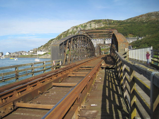
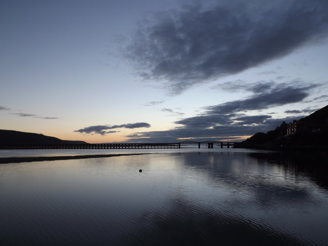
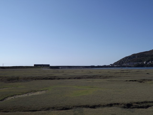
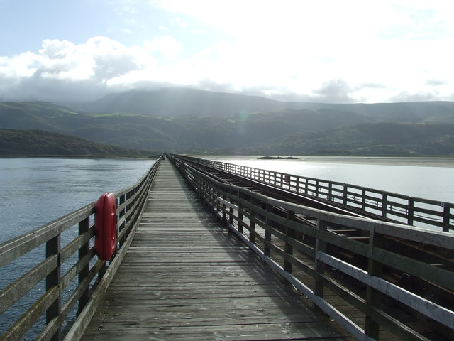
Barmouth Bridge
Barmouth Bridge (Welsh: Pont Abermaw), or Barmouth Viaduct is a Grade II* listed single-track wooden railway viaduct across the estuary of the River Mawddach...
St David's Church, Barmouth
St David's Church is a Church in Wales church by the harbour of Barmouth, Gwynedd, west Wales. It is part of the Bro Ardudwy Ministry Area. == History... ==
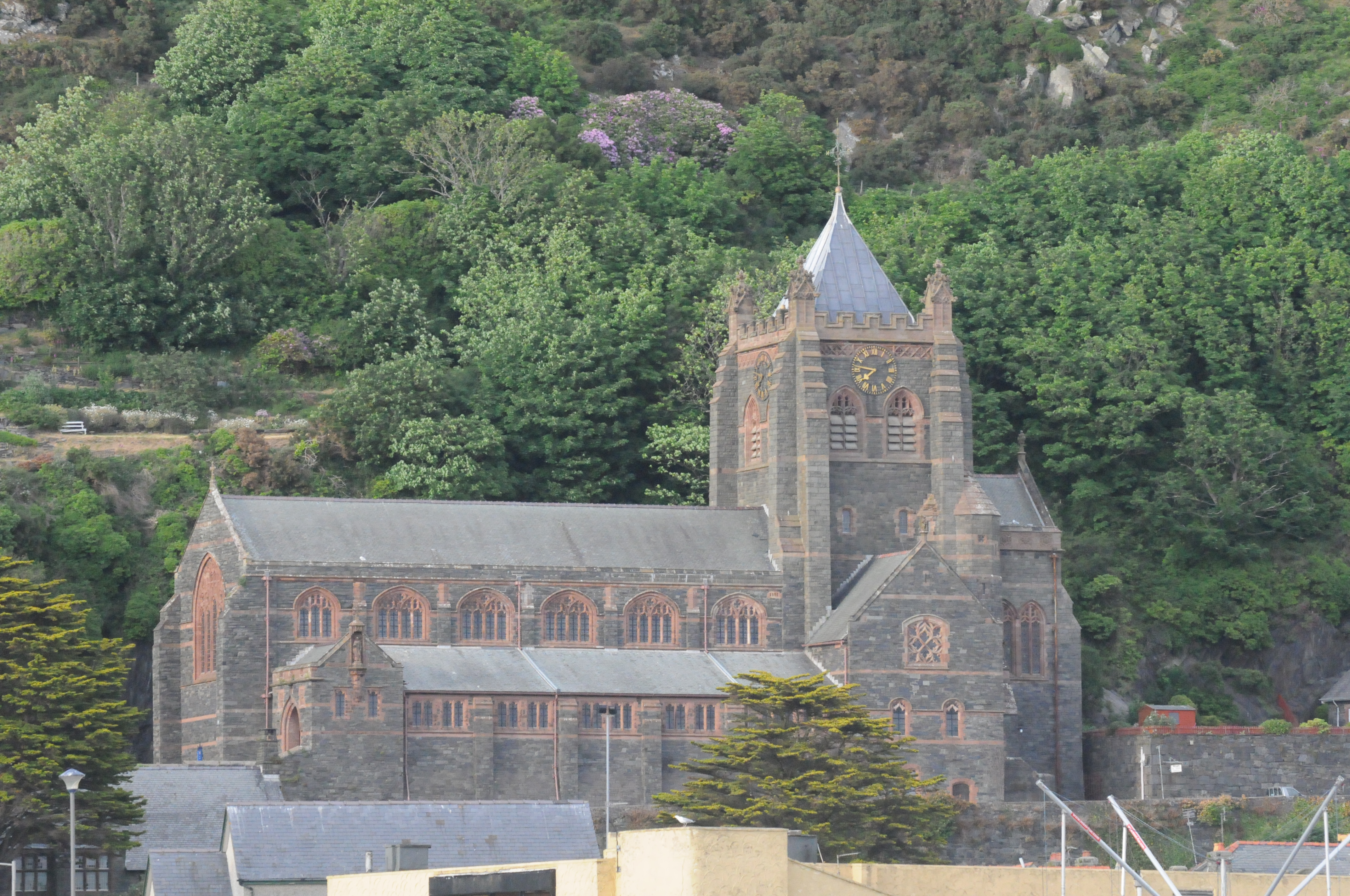
St John's Church, Barmouth
St John's Church, Barmouth, Gwynedd, Wales was built between 1889 and 1895 and designed by the Chester architects Douglas and Fordham. The foundation stone...

Barmouth
Barmouth (Welsh: Abermaw (formal); Y Bermo (colloquial)) is a seaside town and community in the county of Gwynedd, north-west Wales; it lies on the estuary...

Barmouth Lifeboat Station
Barmouth Lifeboat Station, based in Barmouth, Gwynedd, Wales, was established in the 1820s and the first lifeboat station was constructed in 1828 at a...

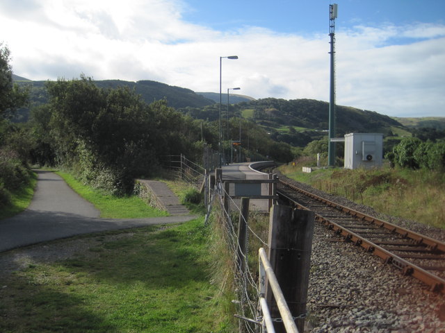
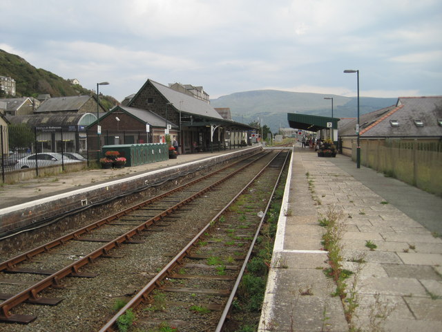
Barmouth railway station
Barmouth railway station serves the seaside town of Barmouth in Gwynedd, Wales. The station is on the Cambrian Coast Railway with passenger services to...

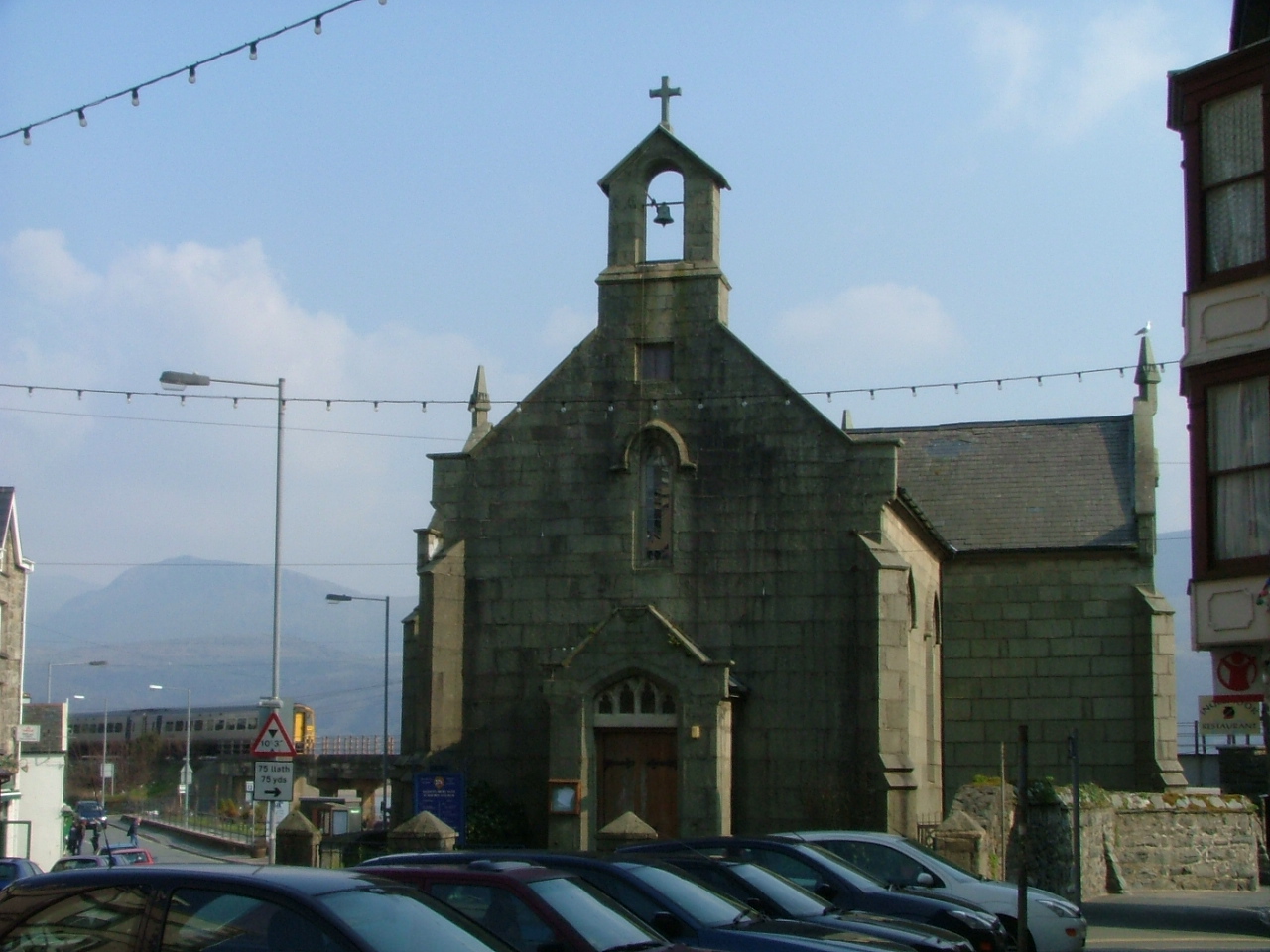
St Tudwal's Church, Barmouth
St Tudwal's Church is a Roman Catholic parish church in Barmouth, Gwynedd. It is situated on the King Edward Road leading from Barmouth to Llanaber. It...

Morfa Mawddach railway station
Morfa Mawddach railway station (formerly Barmouth Junction) is an unstaffed station located on the outskirts of the village of Arthog in Gwynedd, Wales...
Nearby Amenities
Located within 500m of 52.722163,-4.0345864Have you been to Aber y Pysgodyn-du?
Leave your review of Aber y Pysgodyn-du below (or comments, questions and feedback).