Porth Moelfre

Bay in Anglesey

Wales

Porth Moelfre

Din Lligwy Romano-British Settlement One of the buildings in this well preserved 4th century AD defended settlement <span class="nowrap"><a title="https://www.megalithic.co.uk/article.php?sid=1494" rel="nofollow ugc noopener" href="https://www.megalithic.co.uk/article.php?sid=1494">Link</a><img style="margin-left:2px;" alt="External link" title="External link - shift click to open in new window" src="https://s1.geograph.org.uk/img/external.png" width="10" height="10"/></span>
Din Lligwy Romano-British Settlement Credit: Sandy Gerrard

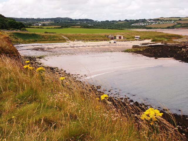
Porth Moelfre is a picturesque bay located on the east coast of the Isle of Anglesey, Wales. Situated approximately 15 miles east of the town of Holyhead, it is a popular destination for locals and tourists alike.

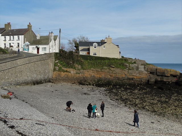
The bay is known for its stunning natural beauty, with its clear blue waters, sandy beach, and rugged cliffs. It offers breathtaking views of the Irish Sea and is surrounded by lush greenery, creating a peaceful and tranquil atmosphere.

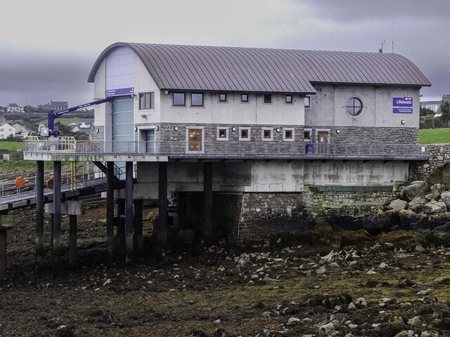
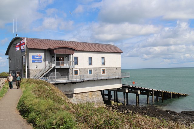
Porth Moelfre is also renowned for its rich maritime history. The Lifeboat Station, established in 1848, stands proudly overlooking the bay and serves as a reminder of the area's connection to the sea. The station has played a crucial role in several daring rescues and is a testament to the bravery of the local lifeboat crews.

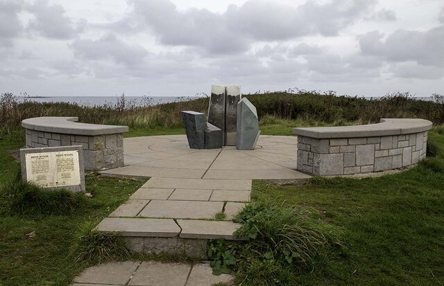
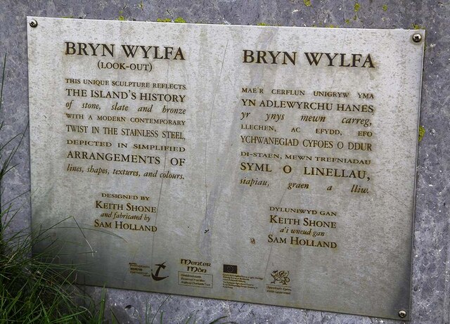
Visitors to Porth Moelfre can explore the coastal path that winds its way along the cliffs, offering panoramic views of the bay and the surrounding landscape. The area is also popular with birdwatchers, as it is home to a variety of seabirds, including puffins, gannets, and razorbills.

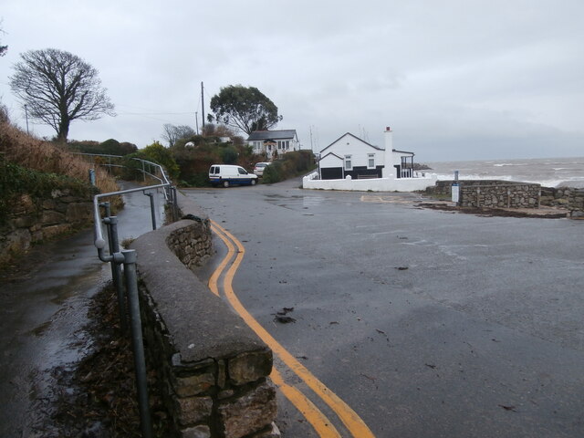
The village of Moelfre, located nearby, offers a range of amenities for visitors, including charming cafes, traditional pubs, and a museum dedicated to the maritime heritage of the area. The museum provides an insight into the history of shipwrecks and rescues, showcasing artifacts and stories from the past.

Overall, Porth Moelfre is a hidden gem on Anglesey's east coast, offering a combination of natural beauty and historical significance that draws in visitors from far and wide.

If you have any feedback on the listing, please let us know in the comments section below.

Porth Moelfre Images

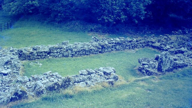
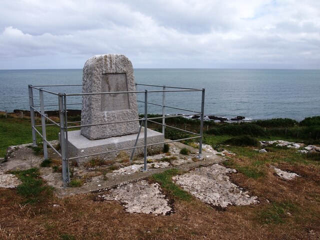
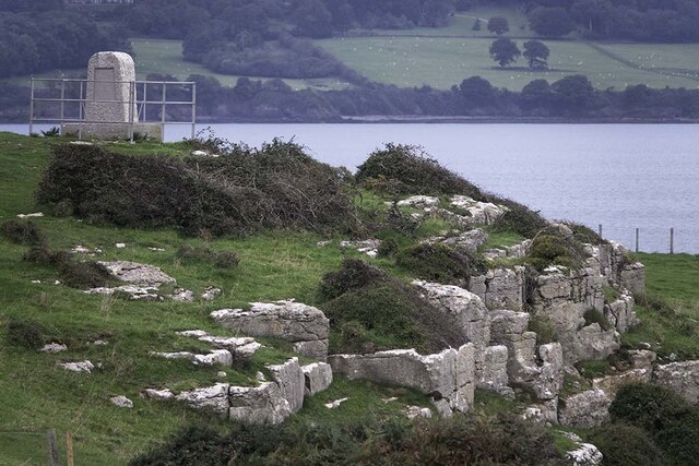
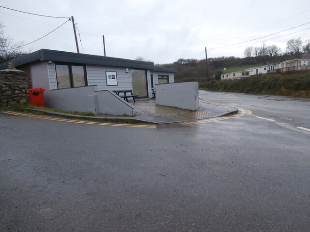
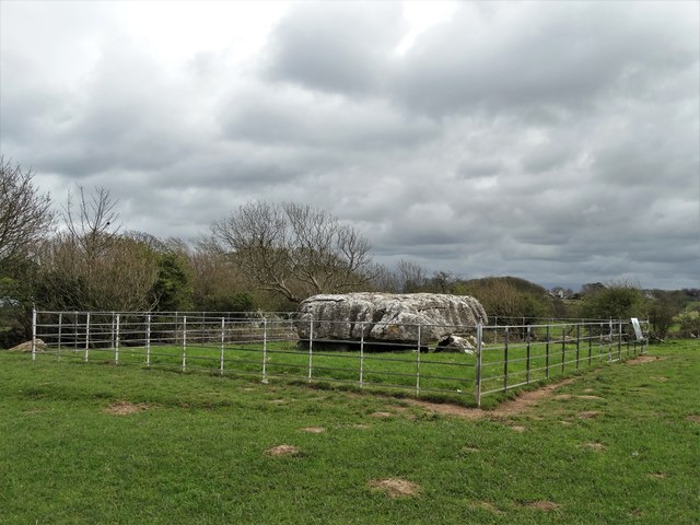
Images are sourced within 2km of 53.352455/-4.2349914 or Grid Reference SH5186. Thanks to Geograph Open Source API. All images are credited.

Din Lligwy Romano-British Settlement One of the buildings in this well preserved 4th century AD defended settlement <span class="nowrap"><a title="https://www.megalithic.co.uk/article.php?sid=1494" rel="nofollow ugc noopener" href="https://www.megalithic.co.uk/article.php?sid=1494">Link</a><img style="margin-left:2px;" alt="External link" title="External link - shift click to open in new window" src="https://s1.geograph.org.uk/img/external.png" width="10" height="10"/></span>
Din Lligwy Romano-British Settlement
One of the buildings in this well preserved 4th century AD defended settlement LinkExternal link
Din Lligwy Ancient Site in 1995 The round remains believed to be of a house
Din Lligwy Ancient Site in 1995
The round remains believed to be of a house
Din Lligwy Ancient Site in 1995 The remains of a rectangular structure believed to be for storage or workshops
Din Lligwy Ancient Site in 1995
The remains of a rectangular structure believed to be for storage or workshops
The Old Lifeboat House, Moelfre
Lifeboat Station, Moelfre
Porth Forllwyd
Porth Forllwyd
The Royal Charter Memorial
Gored, Traeth Lligwy
Memorial to the Royal Charter disaster Commemorating disaster of 1859 when the steam clipper Royal Charter, returning from Australia was wrecked during a hurricane on rocks nearby with the loss of over 400 lives.
Memorial to the Royal Charter disaster
Commemorating disaster of 1859 when the steam clipper Royal Charter, returning from Australia was wrecked during a hurricane on rocks nearby with the loss of over 400 lives.
Moelfre Lifeboat Station
Bryn Wylfa A modern sculpture reflecting the Isle of Anglesey's history of stone, slate and bronze.
Bryn Wylfa
A modern sculpture reflecting the Isle of Anglesey's history of stone, slate and bronze.
Bryn Wylfa ( Look - Out ) Plaque at site of modern sculpture in Moelfre.
Bryn Wylfa ( Look - Out )
Plaque at site of modern sculpture in Moelfre.
Lligwy Burial Chamber The capstone on this chambered tomb is huge which may explain why it is lower than usual <span class="nowrap"><a title="https://www.megalithic.co.uk/article.php?sid=1495" rel="nofollow ugc noopener" href="https://www.megalithic.co.uk/article.php?sid=1495">Link</a><img style="margin-left:2px;" alt="External link" title="External link - shift click to open in new window" src="https://s1.geograph.org.uk/img/external.png" width="10" height="10"/></span>
Lligwy Burial Chamber
The capstone on this chambered tomb is huge which may explain why it is lower than usual LinkExternal link
Traeth Bychan by the slipways The profile of the trees shows how they are put under pressure from the wind, and that was certainly happening on this Christmas Day afternoon.  The beach was presenting a very different aspect from the one seen here <span class="nowrap"><a title="https://www.thebeachguide.co.uk/north-wales/anglesey/traeth-bychan.htm" rel="nofollow ugc noopener" href="https://www.thebeachguide.co.uk/north-wales/anglesey/traeth-bychan.htm">Link</a><img style="margin-left:2px;" alt="External link" title="External link - shift click to open in new window" src="https://s1.geograph.org.uk/img/external.png" width="10" height="10"/></span> .
Traeth Bychan by the slipways
The profile of the trees shows how they are put under pressure from the wind, and that was certainly happening on this Christmas Day afternoon. The beach was presenting a very different aspect from the one seen here LinkExternal link .
Traeth Bychan beach shop and cafe Traeth Bychan beach shop seems to have been completely rebuilt since <a href="https://www.geograph.org.uk/photo/4387872">SH5185 : Traeth Bychan Beach Shop and Cafe</a>, apart from the wall outside, with a more subdued decorative palette.  Possibly this rebuilding has been done during the current winter, as the shop did not appear to have been fitted out yet.
Traeth Bychan beach shop and cafe
Traeth Bychan beach shop seems to have been completely rebuilt since SH5185 : Traeth Bychan Beach Shop and Cafe, apart from the wall outside, with a more subdued decorative palette. Possibly this rebuilding has been done during the current winter, as the shop did not appear to have been fitted out yet.
Moelfre Lifeboat Station The RNLI lifeboat station at Moelfre, Anglesey, North Wales which was opened in 2015.
Moelfre Lifeboat Station
The RNLI lifeboat station at Moelfre, Anglesey, North Wales which was opened in 2015.
Lligwy Burial Chamber Lligwy burial chamber is around 5,000 years old and dates to the Neolithic period or New Stone Age. It consists of eight low uprights supporting a massive capstone, some 5.5 metres by 4.6 metres. This great capstone is about 1.5 metres above the bottom of a natural fissure in the limestone rock, and the supporting uprights sit on the rock at the edge of the fissure or on rough stone walling.

The way the capstone, which weighs some 25 tons sits so low over a pit gives the tomb a very unusual, squat appearance.

Excavations at this tomb in 1908 revealed the bones of between 15 and 30 individuals – men, women and children. Animal bones and shells were also found, together with flint implements, a bone pin and pottery.
Lligwy Burial Chamber
Lligwy burial chamber is around 5,000 years old and dates to the Neolithic period or New Stone Age. It consists of eight low uprights supporting a massive capstone, some 5.5 metres by 4.6 metres. This great capstone is about 1.5 metres above the bottom of a natural fissure in the limestone rock, and the supporting uprights sit on the rock at the edge of the fissure or on rough stone walling. The way the capstone, which weighs some 25 tons sits so low over a pit gives the tomb a very unusual, squat appearance. Excavations at this tomb in 1908 revealed the bones of between 15 and 30 individuals – men, women and children. Animal bones and shells were also found, together with flint implements, a bone pin and pottery.
Porth Moelfre
Porth Moelfre
Show me another place!

Porth Moelfre is located at Grid Ref: SH5186 (Lat: 53.352455, Lng: -4.2349914)

Unitary Authority: Isle of Anglesey

Police Authority: North Wales

What 3 Words

///eyelashes.infants.hidden. Near Moelfre, Isle of Anglesey

Related Wikis

Moelfre, Anglesey

Moelfre ([ˈmɔɨ̯lvrɛ] ) is a village, a community and, until 2012, an electoral ward on the north-east coast of the Isle of Anglesey in Wales. The community...
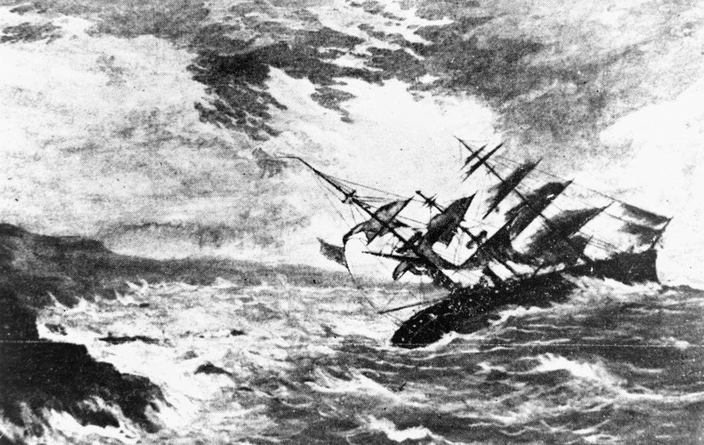
Royal Charter Storm

The Royal Charter Storm (also known as the Great storm of 1859) of 25 and 26 October 1859 was considered to be the most severe storm to hit the Irish Sea...

Moelfre Lifeboat Station

Moelfre Lifeboat Station is located in the village of Moelfre, Anglesey and is run by the Royal National Lifeboat Institution. The present boathouse became...

Ynys Moelfre

Ynys Moelfre (Welsh for 'Moelfre Island') is a small island off the coast of Anglesey, Wales. At low tide it has a maximum length of 261 metres and a maximum...

Nearby Amenities

Located within 500m of 53.352455,-4.2349914
Created By: almien_coastlines
Source: PGS
Lat/Long: 53.352507/-4.235663
Moelfre
Place: village
Lat/Long: 53.3537357/-4.2366244
Bus Stop
Bus: yes
Public Transport: platform
Lat/Long: 53.3519571/-4.2371772
Dic Evans Memorial
Historic: memorial
Wikidata: Q100707489
Lat/Long: 53.3537641/-4.2332465
Bench
Lat/Long: 53.353791/-4.2332157
Bench
Lat/Long: 53.3537021/-4.2332723
Bench
Lat/Long: 53.3532097/-4.234124
Bench
Lat/Long: 53.3505713/-4.2387797
Bench
Lat/Long: 53.3505441/-4.2362292
Bench
Lat/Long: 53.35073/-4.2362841
Bench
Lat/Long: 53.3532752/-4.2340087
Post Box
Brand: Royal Mail
Brand Wikidata: Q638098
Brand Wikipedia: en:Royal Mail
Collection Times: Mo-Fr 11:00; Sa 10:45
Operator: Royal Mail
Operator Wikidata: Q638098
Post Box Type: wall
Ref: LL72 234
Royal Cypher: GR
Royal Cypher Wikidata: Q33102273
Lat/Long: 53.3512875/-4.2376183
Source: PGS
Lat/Long: 53.3533107/-4.2334302
Porth yr Aber
Natural: bay
Lat/Long: 53.3485165/-4.2342315
Defibrillator
Emergency: defibrillator
Ref GB The Circuit: BE6CC1DE-3CB0-4173-8873-ABED0098EE27
Lat/Long: 53.3515286/-4.2371774
Defibrillator
Emergency: defibrillator
Lat/Long: 53.3547331/-4.2320934
Direction: 305
Generator Method: photovoltaic
Generator Output Electricity: yes
Generator Solar Modules: 8
Generator Source: solar
Generator Type: solar_photovoltaic_panel
Location: roof
Power: generator
Lat/Long: 53.3513919/-4.2380988
Direction: 125
Generator Method: photovoltaic
Generator Output Electricity: yes
Generator Solar Modules: 8
Generator Source: solar
Generator Type: solar_photovoltaic_panel
Location: roof
Power: generator
Lat/Long: 53.3513538/-4.2380405
Direction: S
Generator Method: photovoltaic
Generator Output Electricity: yes
Generator Solar Modules: 2
Generator Source: solar
Generator Type: solar_photovoltaic_panel
Location: roof
Power: generator
Lat/Long: 53.3565353/-4.2351926
Direction: E
Generator Method: photovoltaic
Generator Output Electricity: yes
Generator Solar Modules: 3
Generator Source: solar
Generator Type: solar_photovoltaic_panel
Location: roof
Power: generator
Lat/Long: 53.3565168/-4.2350156
Direction: SE
Generator Method: photovoltaic
Generator Output Electricity: yes
Generator Solar Modules: 10
Generator Source: solar
Generator Type: solar_photovoltaic_panel
Location: roof
Power: generator
Lat/Long: 53.3546915/-4.2368549
Direction: WNW
Generator Method: photovoltaic
Generator Output Electricity: yes
Generator Solar Modules: 4
Generator Source: solar
Generator Type: solar_photovoltaic_panel
Location: roof
Power: generator
Lat/Long: 53.3555127/-4.2347762
Direction: ESE
Generator Method: photovoltaic
Generator Output Electricity: yes
Generator Solar Modules: 12
Generator Source: solar
Generator Type: solar_photovoltaic_panel
Location: roof
Power: generator
Lat/Long: 53.3554967/-4.2347306
Direction: SSE
Generator Method: photovoltaic
Generator Output Electricity: yes
Generator Solar Modules: 15
Generator Source: solar
Generator Type: solar_photovoltaic_panel
Location: roof
Power: generator
Lat/Long: 53.3529809/-4.2362568
Direction: 190
Generator Method: photovoltaic
Generator Output Electricity: yes
Generator Solar Modules: 16
Generator Source: solar
Generator Type: solar_photovoltaic_panel
Location: roof
Power: generator
Lat/Long: 53.3550653/-4.2355292
Direction: S
Generator Method: photovoltaic
Generator Output Electricity: yes
Generator Solar Modules: 5
Generator Source: solar
Generator Type: solar_photovoltaic_panel
Location: roof
Power: generator
Lat/Long: 53.3565389/-4.2349854
Direction: S
Generator Method: photovoltaic
Generator Output Electricity: yes
Generator Solar Modules: 5
Generator Source: solar
Generator Type: solar_photovoltaic_panel
Location: roof
Power: generator
Lat/Long: 53.3565389/-4.2351249
Direction: ESE
Generator Method: photovoltaic
Generator Output Electricity: yes
Generator Solar Modules: 16
Generator Source: solar
Generator Type: solar_photovoltaic_panel
Location: roof
Power: generator
Lat/Long: 53.3558873/-4.2370614
Direction: 235
Generator Method: photovoltaic
Generator Output Electricity: yes
Generator Solar Modules: 4
Generator Source: solar
Generator Type: solar_photovoltaic_panel
Location: roof
Power: generator
Lat/Long: 53.3538182/-4.2394312
Direction: 145
Generator Method: photovoltaic
Generator Output Electricity: yes
Generator Solar Modules: 6
Generator Source: solar
Generator Type: solar_photovoltaic_panel
Location: roof
Power: generator
Lat/Long: 53.3538121/-4.2395076
[fixme] Shipwreck Memorial
Historic: memorial
Memorial: Anchor
Lat/Long: 53.3524801/-4.2362011
Moelfre War Memorial
Historic: memorial
Lat/Long: 53.3524061/-4.2364291
Direction: SSE
Generator Method: photovoltaic
Generator Output Electricity: yes
Generator Solar Modules: 12
Generator Source: solar
Generator Type: solar_photovoltaic_panel
Location: roof
Power: generator
Lat/Long: 53.3530735/-4.2384849
Historic: memorial
Lat/Long: 53.353675/-4.2334577
Entrance: yes
Lat/Long: 53.3538162/-4.2335571
Entrance: yes
Lat/Long: 53.3538677/-4.2337213
The data included in this document is from www.openstreetmap.org. The data is made available under ODbL.

Have you been to Porth Moelfre?

Leave your review of Porth Moelfre below (or comments, questions and feedback).