Arganite Bay
Bay in Devon North Devon
England
Arganite Bay
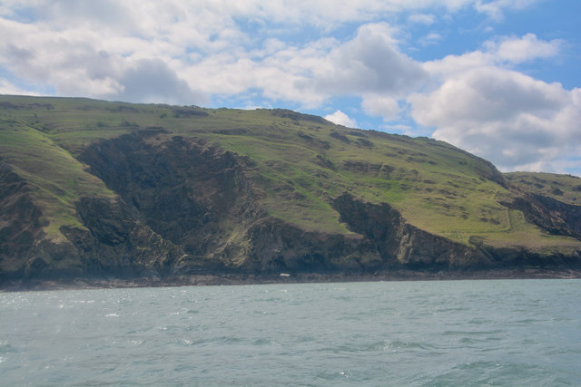
Arganite Bay is a picturesque coastal area located in the county of Devon, England. Situated on the southern coast, it offers stunning views of the English Channel and is renowned for its natural beauty and tranquility. The bay is surrounded by rolling hills and lush greenery, providing a serene and idyllic setting for visitors.
The beach at Arganite Bay is known for its golden sands and crystal-clear waters. It stretches for approximately two miles along the coastline, providing ample space for sunbathing, picnicking, and leisurely walks. The bay is also a popular spot for water sports enthusiasts, with opportunities for swimming, surfing, and paddleboarding.
Arganite Bay is home to a diverse range of marine life, making it a haven for nature lovers and wildlife enthusiasts. Seals, dolphins, and a variety of seabirds can often be spotted in the area, adding to its natural allure.
The bay is conveniently located near the charming village of Arganite, which offers a range of amenities including shops, cafes, and accommodation options. Visitors can enjoy a leisurely stroll through the village, taking in its quaint architecture and friendly atmosphere.
Arganite Bay is easily accessible by car or public transportation, with ample parking available for visitors. It is a popular destination for both locals and tourists seeking a peaceful retreat by the sea, away from the hustle and bustle of city life.
If you have any feedback on the listing, please let us know in the comments section below.
Arganite Bay Images
Images are sourced within 2km of 51.208734/-4.1317018 or Grid Reference SS5147. Thanks to Geograph Open Source API. All images are credited.


Arganite Bay is located at Grid Ref: SS5147 (Lat: 51.208734, Lng: -4.1317018)
Administrative County: Devon
District: North Devon
Police Authority: Devon and Cornwall
What 3 Words
///clinic.buzzing.mimed. Near Ilfracombe, Devon
Nearby Locations
Related Wikis
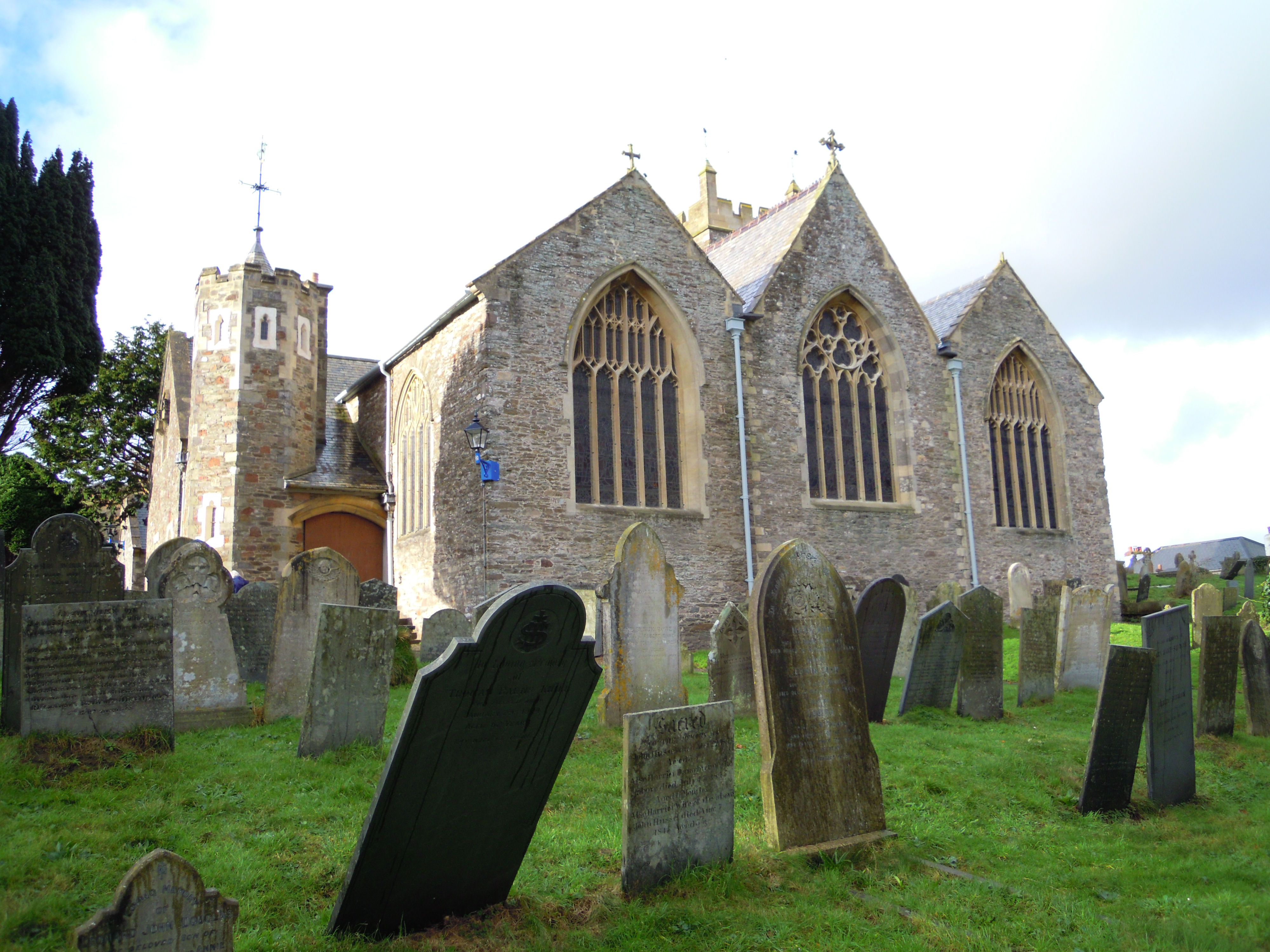
Holy Trinity Church, Ilfracombe
The Church of the Holy Trinity is the Anglican parish church for Ilfracombe in Devon. The building has been a Grade I listed building since 1951 and comes...
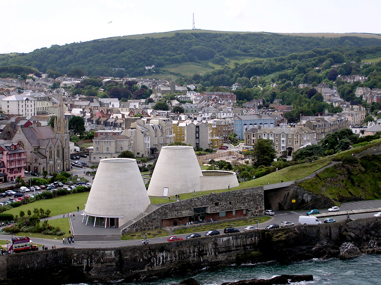
Landmark Theatre, Devon
The Landmark Theatre is a theatre in the North Devon coastal town of Ilfracombe. It has a distinctive double-conical design. It was built to replace The...

Old Town Hall, Ilfracombe
The Old Town Hall is a former municipal building in the High Street in Ilfracombe, Devon, England. The structure, which currently operates as gym, is a...

The Torrs
The Torrs are a Local Nature Reserve and one of the four main hills in the North Devon coastal town of Ilfracombe. The Park originally was designed in...
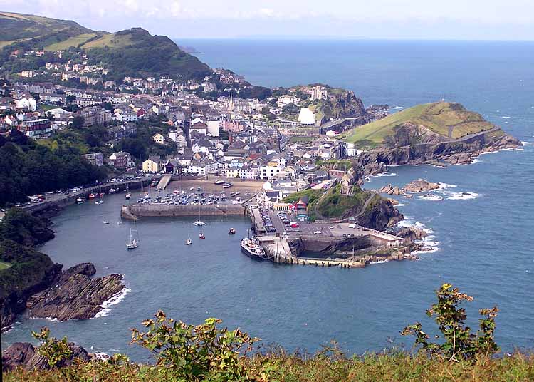
Ilfracombe
Ilfracombe ( IL-frə-koom) is a seaside resort and civil parish on the North Devon coast, England, with a small harbour surrounded by cliffs. The parish...

Ilfracombe railway station (England)
Ilfracombe railway station was the terminus of the Ilfracombe branch line in north Devon, England. The line was opened as the Barnstaple and Ilfracombe...
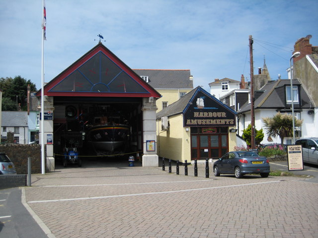
Ilfracombe Lifeboat Station
Ilfracombe Lifeboat Station is the base for Royal National Lifeboat Institution (RNLI) search and rescue operations at Ilfracombe, Devon, England. The...

Ilfracombe Cemetery
Ilfracombe Cemetery (properly the Marlborough Road Cemetery) is the burial ground for the town of Ilfracombe in Devon in the United Kingdom. The cemetery...
Nearby Amenities
Located within 500m of 51.208734,-4.1317018Have you been to Arganite Bay?
Leave your review of Arganite Bay below (or comments, questions and feedback).