Back Bay

Bay in Wigtownshire

Scotland

Back Bay

Front Bay, Monreith Viewed from the Gavin Maxwell Otter Memorial. Looking towards St Medan Golf Course.
Front Bay, Monreith Credit: Billy McCrorie

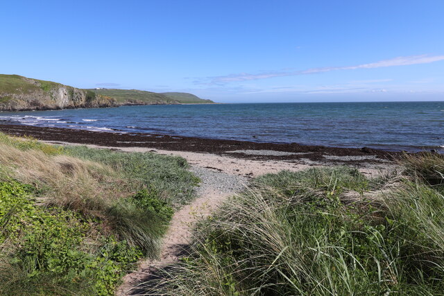
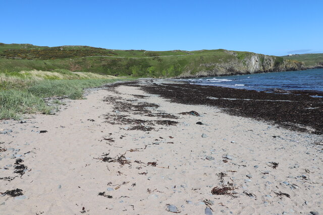
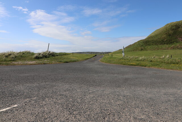
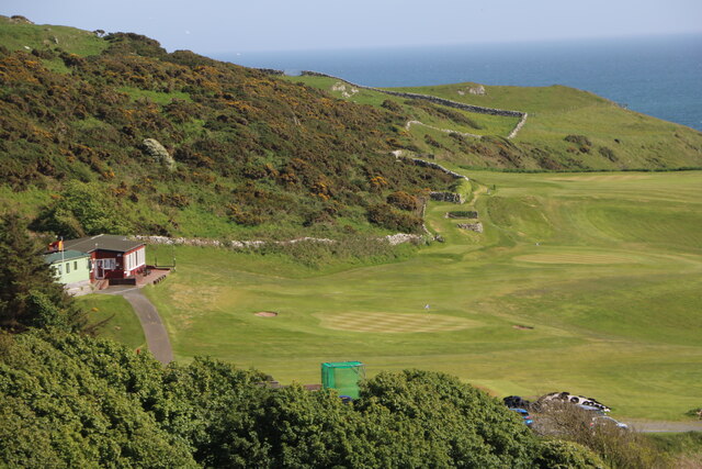
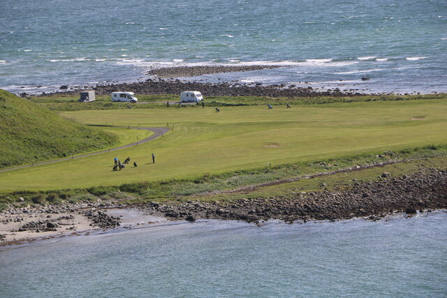
Back Bay is a small coastal village located in Wigtownshire, southwest Scotland. Situated on the eastern shore of Luce Bay, it is part of the larger parish of Kirkcolm. The village is surrounded by scenic natural beauty, with rolling hills and breathtaking views of the bay.

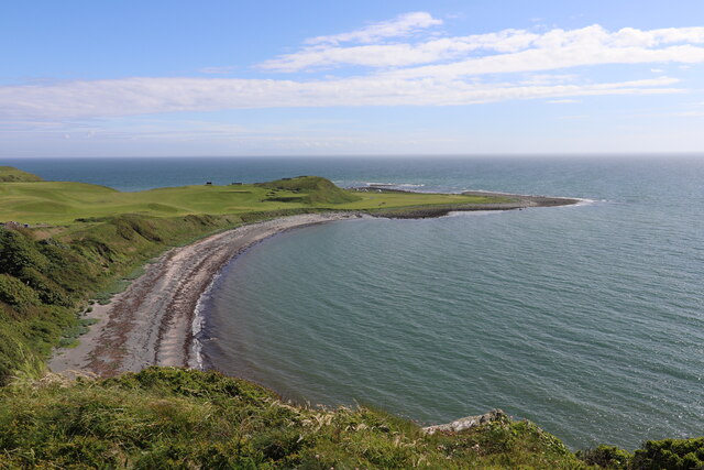
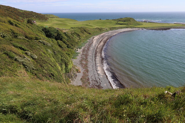
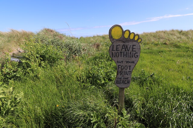
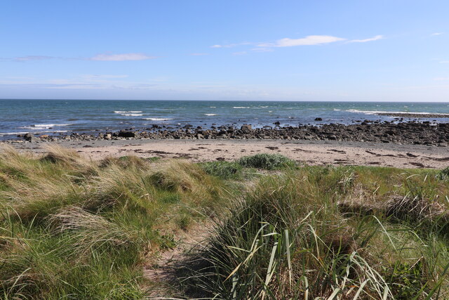
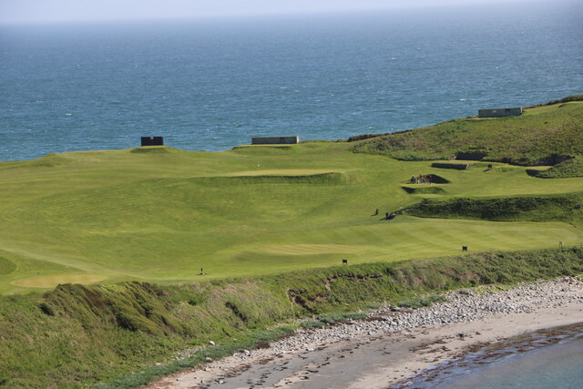
The main attraction of Back Bay is its pristine sandy beach, which stretches for approximately 2 miles along the coastline. The beach is a popular spot for locals and tourists alike, offering opportunities for sunbathing, swimming, and beachcombing. It is also a haven for wildlife enthusiasts, as the area is home to a variety of seabirds and other marine creatures.

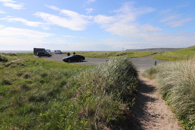
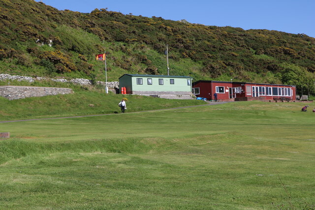
In addition to its natural attractions, Back Bay boasts a small but charming community. The village has a handful of residential properties, as well as a few local businesses, including a café and a beachside pub. These establishments provide visitors with refreshments and a chance to experience the warm hospitality of the locals.

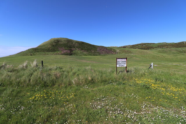
Back Bay is ideally located for those seeking outdoor activities. The surrounding area offers ample opportunities for hiking, cycling, and fishing. The nearby Galloway Forest Park provides a stunning backdrop for outdoor adventures and is known for its dark skies, making it a popular spot for stargazing.

Overall, Back Bay offers a tranquil and picturesque setting for those looking to escape the hustle and bustle of city life and immerse themselves in the beauty of Scotland's coastline.

If you have any feedback on the listing, please let us know in the comments section below.

Back Bay Images

Images are sourced within 2km of 54.722768/-4.5375069 or Grid Reference NX3639. Thanks to Geograph Open Source API. All images are credited.

Front Bay, Monreith Viewed from the Gavin Maxwell Otter Memorial. Looking towards St Medan Golf Course.
Front Bay, Monreith
Viewed from the Gavin Maxwell Otter Memorial. Looking towards St Medan Golf Course.
Shore at Front Bay, Monreith At Point of Lag looking over St Medan Golf Course. Viewed from the Gavin Maxwell Otter Memorial.
Shore at Front Bay, Monreith
At Point of Lag looking over St Medan Golf Course. Viewed from the Gavin Maxwell Otter Memorial.
Beware of Stray Golf Balls At St Medan Golf Course, viewed from Back Bay Car Park.
Beware of Stray Golf Balls
At St Medan Golf Course, viewed from Back Bay Car Park.
Car Park at Back Bay At Point of Lag, on the left is the toilet block.
Car Park at Back Bay
At Point of Lag, on the left is the toilet block.
Leave Nothing at Back Bay Sign at the car park at Point of Lag.
Leave Nothing at Back Bay
Sign at the car park at Point of Lag.
Back Bay near Monreith
Back Bay Car Park At Point of Lag near Monreith.
Back Bay Car Park
At Point of Lag near Monreith.
Shore at Back Bay Near Monreith.
Shore at Back Bay
Near Monreith.
Exit Road from Back Bay Car Park Road passes through St. Medan Golf Course.
Exit Road from Back Bay Car Park
Road passes through St. Medan Golf Course.
Rocks at Back Bay At Point of Lag near Monreith.
Rocks at Back Bay
At Point of Lag near Monreith.
St. Medan Golf Course With Clubhouse, viewed from Gavin Maxwell Otter Memorial.
St. Medan Golf Course
With Clubhouse, viewed from Gavin Maxwell Otter Memorial.
St. Medan Golf Course Near Monreith, vehicles are in a car park at Back Bay.
St. Medan Golf Course
Near Monreith, vehicles are in a car park at Back Bay.
St. Medan Golf Course Viewed from the Gavin Maxwell Otter Memorial near Monreith.
St. Medan Golf Course
Viewed from the Gavin Maxwell Otter Memorial near Monreith.
St. Medan Clubhouse Golf Course near Monreith.
St. Medan Clubhouse
Golf Course near Monreith.
St. Medan Golf Club Flag Golf Course near Monreith.
St. Medan Golf Club Flag
Golf Course near Monreith.
Rocky ground, Cairndoon A lot of land around Burrow Head is very rocky.
Rocky ground, Cairndoon
A lot of land around Burrow Head is very rocky.
View of the Scares Along with the Mull of Galloway, seen from the A747.
View of the Scares
Along with the Mull of Galloway, seen from the A747.
Rocky farmland, Garrarie
Show me another place!

Back Bay is located at Grid Ref: NX3639 (Lat: 54.722768, Lng: -4.5375069)

Unitary Authority: Dumfries and Galloway

Police Authority: Dumfries and Galloway

What 3 Words

///brightens.fail.durations. Near Whithorn, Dumfries & Galloway

Related Wikis

Monreith

Monreith ([mɒn'ri:θ] / 'mon-REETH'; Scottish Gaelic: Am Monadh Rèidh) is a small seaside village in the Machars, in the historical county of Wigtownshire...

Wren's Egg

The Wren's Egg (grid reference NX 3610 4199) is the name given to a set of late Neolithic or Bronze Age stone monuments in the parish of Glasserton, Wigtownshire...

Monreith House

Monreith House is a category A listed Georgian mansion located 1.5 kilometres (0.93 mi) east of the village of Port William in Mochrum parish in the historical...

Drumtroddan standing stones

The Drumtroddan standing stones (grid reference NX 36449 44300) are a small Neolithic or Bronze Age stone alignment in the parish of Mochrum, Wigtownshire...

Nearby Amenities

Located within 500m of 54.722768,-4.5375069
Source: PGS
Lat/Long: 54.7266937/-4.5399484
Source: PGS
Lat/Long: 54.7259378/-4.5402059
Source: PGS
Lat/Long: 54.7254545/-4.5408711
Source: PGS
Lat/Long: 54.7253182/-4.5414934
Source: PGS
Lat/Long: 54.7250084/-4.5422659
Source: PGS
Lat/Long: 54.7248102/-4.5429311
Source: PGS
Lat/Long: 54.7247358/-4.5432744
Source: PGS
Lat/Long: 54.7245004/-4.543489
Source: PGS
Lat/Long: 54.7241286/-4.54321
Source: PGS
Lat/Long: 54.7239303/-4.5426306
Source: PGS
Lat/Long: 54.7236329/-4.5420942
Source: PGS
Lat/Long: 54.7234222/-4.5418153
Source: PGS
Lat/Long: 54.7231992/-4.541429
Source: PGS
Lat/Long: 54.7230505/-4.5411286
Source: PGS
Lat/Long: 54.7230381/-4.5407209
Source: PGS
Lat/Long: 54.7231744/-4.5400557
Source: PGS
Lat/Long: 54.7232859/-4.5395193
Source: PGS
Lat/Long: 54.723447/-4.5389614
Source: PGS
Lat/Long: 54.7236949/-4.537867
Source: PGS
Lat/Long: 54.7234594/-4.5358286
Source: PGS
Lat/Long: 54.7230753/-4.5355282
Source: PGS
Lat/Long: 54.7229265/-4.5350775
Source: PGS
Lat/Long: 54.722877/-4.5343051
Source: PGS
Lat/Long: 54.722447/-4.533421
Source: PGS
Lat/Long: 54.7220715/-4.5332322
Source: PGS
Lat/Long: 54.7219723/-4.5329103
Source: PGS
Lat/Long: 54.7219475/-4.532567
Source: PGS
Lat/Long: 54.722202/-4.532526
Source: PGS
Lat/Long: 54.7223813/-4.5319018
Source: PGS
Lat/Long: 54.72209/-4.531194
Source: PGS
Lat/Long: 54.7224804/-4.5308718
Toilets
Access: yes
Fee: no
Lat/Long: 54.723616/-4.5403921
Power: pole
Lat/Long: 54.7271127/-4.5370686
Power: pole
Lat/Long: 54.726915/-4.5376244
The data included in this document is from www.openstreetmap.org. The data is made available under ODbL.

Have you been to Back Bay?

Leave your review of Back Bay below (or comments, questions and feedback).