Porth Cae-Ceffylau

Bay in Anglesey

Wales

Porth Cae-Ceffylau

Traeth Mawr
Traeth Mawr Credit: Chris Andrews

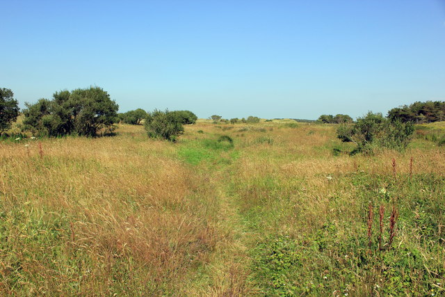
Porth Cae-Ceffylau, also known as Cae-Ceffylau Bay, is a picturesque coastal area located on the northwestern coast of the island of Anglesey in Wales, United Kingdom. This bay is nestled between the villages of Rhoscolyn and Trearddur Bay and is renowned for its stunning natural beauty and tranquil atmosphere.

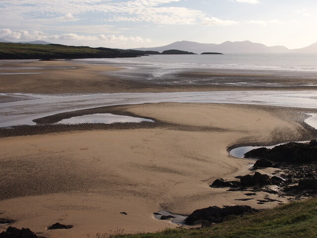
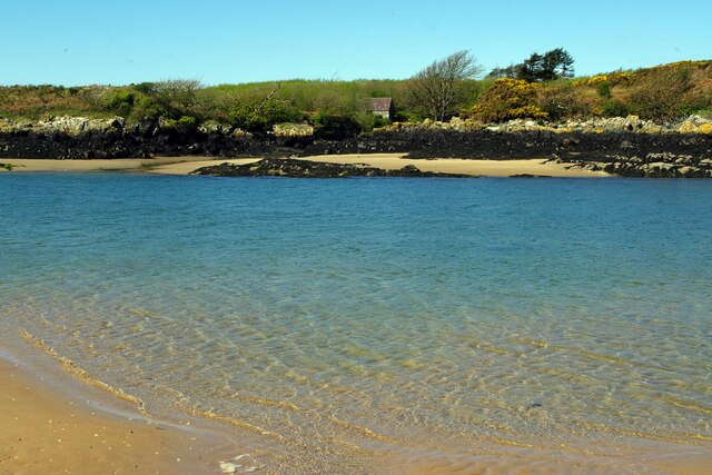
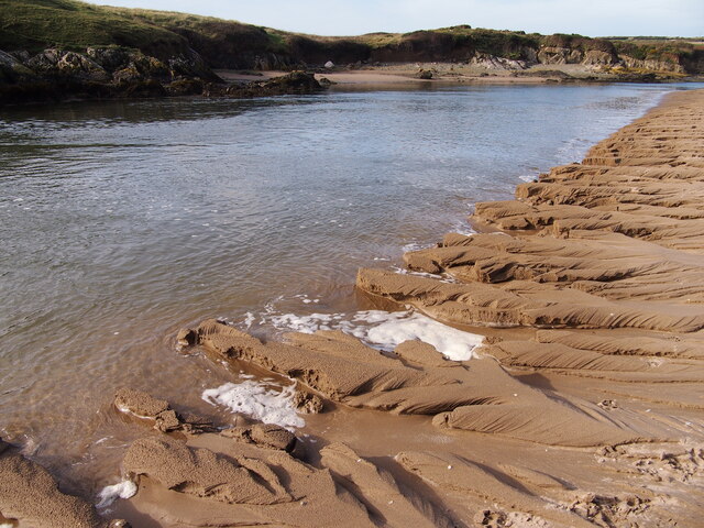
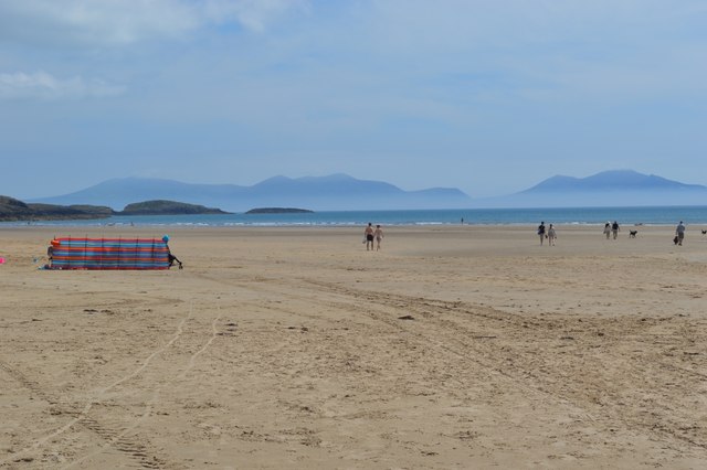
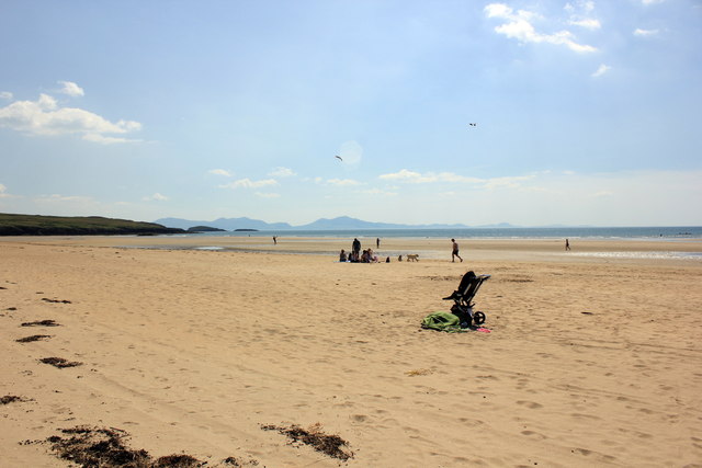
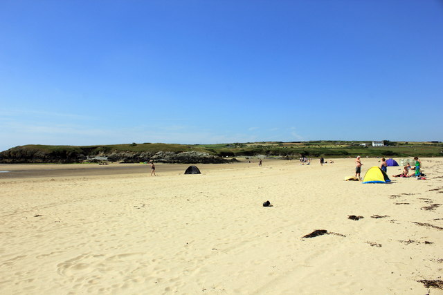
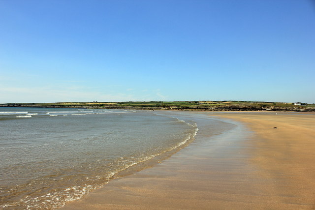
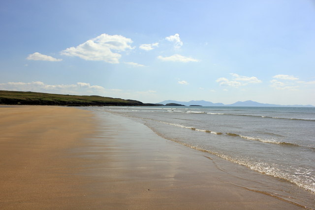
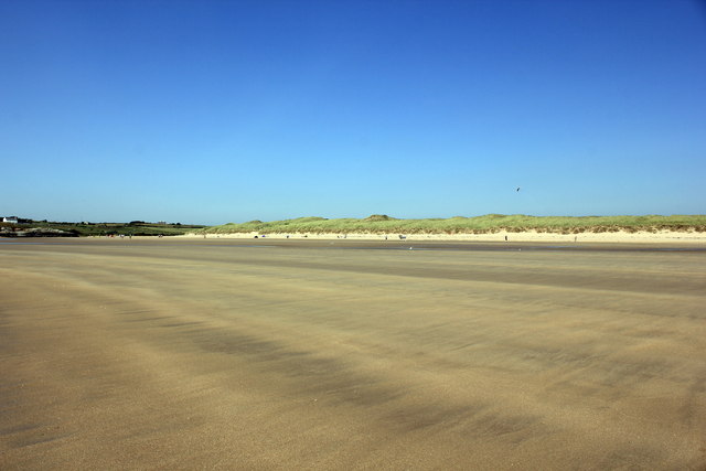
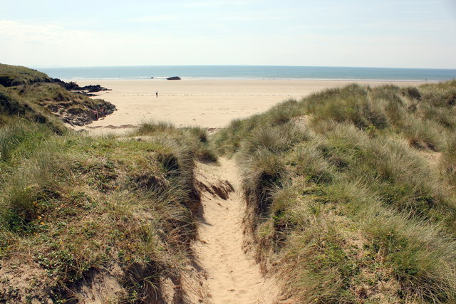
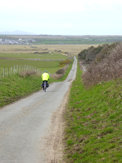
The bay is characterized by its golden sandy beach, which stretches for approximately 0.5 miles, providing ample space for visitors to relax and enjoy the surroundings. The crystal-clear turquoise waters of the bay are ideal for swimming, kayaking, and other water-based activities. The bay is also a popular spot for boating enthusiasts, with a small launching ramp available for public use.

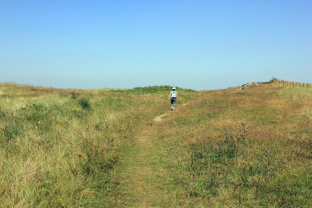
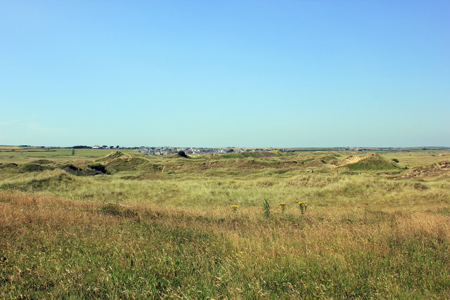
Surrounded by rugged cliffs and lush green hills, Porth Cae-Ceffylau offers breathtaking panoramic views of the Irish Sea and the distant Snowdonia mountain range. The area is a haven for wildlife, with a variety of seabirds and marine life often spotted in the bay.

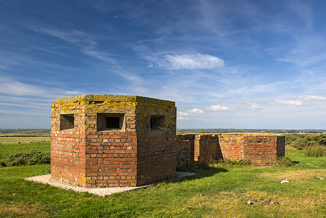
Porth Cae-Ceffylau is also steeped in history, with the ruins of St. Gwenfaen's Church visible on the headland overlooking the bay. The church dates back to the 6th century and is associated with the Welsh patron saint of horses. Visitors can explore the ruins and learn about the fascinating history of the area.

Overall, Porth Cae-Ceffylau is a hidden gem on the beautiful island of Anglesey, offering visitors a peaceful and idyllic coastal escape with its stunning beach, breathtaking scenery, and rich history.

If you have any feedback on the listing, please let us know in the comments section below.

Porth Cae-Ceffylau Images

Images are sourced within 2km of 53.16726/-4.4521123 or Grid Reference SH3666. Thanks to Geograph Open Source API. All images are credited.

Traeth Mawr
Traeth Mawr
Porth Melin Ifan Owen
The Afon Ffraw Meets The Sea
Traeth Aberffraw The trek beside the river from Aberffraw is rewarded with this fine beach with a view across to the Lleyn Peninsula.
Traeth Aberffraw
The trek beside the river from Aberffraw is rewarded with this fine beach with a view across to the Lleyn Peninsula.
Remains of Cairn, Trwyn Du A bronze age cairn, only parts of the kerb now visible.
Remains of Cairn, Trwyn Du
A bronze age cairn, only parts of the kerb now visible.
Aberffraw Sands (Traeth Mawr) Looking south along the beach at Aberffraw Sands (Traeth Mawr). The silhouette of the Snowdonia mountains on the mainland can be seen in the distance.

Wikipedia <span class="nowrap"><a title="http://en.wikipedia.org/wiki/Anglesey_Coastal_Path" rel="nofollow ugc noopener" href="http://en.wikipedia.org/wiki/Anglesey_Coastal_Path">Link</a><img style="margin-left:2px;" alt="External link" title="External link - shift click to open in new window" src="https://s1.geograph.org.uk/img/external.png" width="10" height="10"/></span>
Aberffraw Sands (Traeth Mawr)
Looking south along the beach at Aberffraw Sands (Traeth Mawr). The silhouette of the Snowdonia mountains on the mainland can be seen in the distance. Wikipedia LinkExternal link
Aberffraw Sands (Traeth Mawr) Looking north on the Anglesey Coastal Path at Aberffraw Sands (Traeth Mawr). The path continues from here through the village of Aberffraw over the Afon Ffraw and along the headland in the distance. Traeth Mawr is Welsh for big sands.

Wikipedia <span class="nowrap"><a title="http://en.wikipedia.org/wiki/Anglesey_Coastal_Path" rel="nofollow ugc noopener" href="http://en.wikipedia.org/wiki/Anglesey_Coastal_Path">Link</a><img style="margin-left:2px;" alt="External link" title="External link - shift click to open in new window" src="https://s1.geograph.org.uk/img/external.png" width="10" height="10"/></span>
Aberffraw Sands (Traeth Mawr)
Looking north on the Anglesey Coastal Path at Aberffraw Sands (Traeth Mawr). The path continues from here through the village of Aberffraw over the Afon Ffraw and along the headland in the distance. Traeth Mawr is Welsh for big sands. Wikipedia LinkExternal link
Traeth Mawr (Aberffraw Sands) Looking north on Traeth Mawr (Aberffraw Sands) towards the estuary of the Afon Ffraw at Aberffraw. Traeth Mawr is Welsh for big sands.
Traeth Mawr (Aberffraw Sands)
Looking north on Traeth Mawr (Aberffraw Sands) towards the estuary of the Afon Ffraw at Aberffraw. Traeth Mawr is Welsh for big sands.
Traeth Mawr (Aberffraw Sands) Looking south on Traeth Mawr (Aberffraw Sands) towards Dinas Trefri. The silhouette of the Snowdonia mountains on the mainland can be seen in the distance. Traeth Mawr is Welsh for big sands.
Traeth Mawr (Aberffraw Sands)
Looking south on Traeth Mawr (Aberffraw Sands) towards Dinas Trefri. The silhouette of the Snowdonia mountains on the mainland can be seen in the distance. Traeth Mawr is Welsh for big sands.
Traeth Mawr (Aberffraw Sands) Traeth Mawr (Aberffraw Sands), looking back across the beach towards the sand dunes. Traeth Mawr is Welsh for big sands.
Traeth Mawr (Aberffraw Sands)
Traeth Mawr (Aberffraw Sands), looking back across the beach towards the sand dunes. Traeth Mawr is Welsh for big sands.
The Anglesey Coastal Path at Traeth Mawr The Anglesey Coastal Path at Traeth Mawr as it heads out of the dunes and onto Traeth Mawr (Aberffraw Sands). Traeth Mawr is Welsh for big sands.

Wikipedia <span class="nowrap"><a title="http://en.wikipedia.org/wiki/Anglesey_Coastal_Path" rel="nofollow ugc noopener" href="http://en.wikipedia.org/wiki/Anglesey_Coastal_Path">Link</a><img style="margin-left:2px;" alt="External link" title="External link - shift click to open in new window" src="https://s1.geograph.org.uk/img/external.png" width="10" height="10"/></span>
The Anglesey Coastal Path at Traeth Mawr
The Anglesey Coastal Path at Traeth Mawr as it heads out of the dunes and onto Traeth Mawr (Aberffraw Sands). Traeth Mawr is Welsh for big sands. Wikipedia LinkExternal link
View from the Anglesey Coastal Path The view east from the sandunes on the Anglesey Coastal Path near Aberffraw.
View from the Anglesey Coastal Path
The view east from the sandunes on the Anglesey Coastal Path near Aberffraw.
The Anglesey Coastal Path at Aberffraw The Anglesey Coastal Path passing through the sandunes at Aberffraw.
The Anglesey Coastal Path at Aberffraw
The Anglesey Coastal Path passing through the sandunes at Aberffraw.
Tywyn Aberffraw Looking across the dunes towards Aberffraw from the Anglesey Coastal Path.
Tywyn Aberffraw
Looking across the dunes towards Aberffraw from the Anglesey Coastal Path.
Anglesey Coastal Path at Tywyn Aberffraw The Anglesey Coastal Path crossing Tywyn Aberffraw which is a nature conservation site.
Anglesey Coastal Path at Tywyn Aberffraw
The Anglesey Coastal Path crossing Tywyn Aberffraw which is a nature conservation site.
The road to Aberffraw The back road to Aberffraw from the south-east as it drops down to cross the broad band of sand dunes. The village can be seen in the distance, with Holyhead Mountain on the far horizon.
The road to Aberffraw
The back road to Aberffraw from the south-east as it drops down to cross the broad band of sand dunes. The village can be seen in the distance, with Holyhead Mountain on the far horizon.
The road to Aberffraw At Penrhyn Drytta. The houses at Llwynysgaw on the skyline.
The road to Aberffraw
At Penrhyn Drytta. The houses at Llwynysgaw on the skyline.
North Wales WWII defences: RAF Bodorgan, Anglesey - Trefri pillbox (1) -
Pillbox (unclassified): DoB ID: S0003171

On a hilltop in open countryside is a single storey, brick-faced, octagonal plan pillbox with a reinforced concrete roof, and an attached octagonal LAAMG post. Part of the former airfield defences of RAF Bodorgan.

<a href="https://www.geograph.org.uk/photo/5085758">SH3767 : North Wales WWII defences: RAF Bodorgan, Anglesey - Trefri pillbox (2)</a>
North Wales WWII defences: RAF Bodorgan, Anglesey - Trefri pillbox (1)
- Pillbox (unclassified): DoB ID: S0003171 On a hilltop in open countryside is a single storey, brick-faced, octagonal plan pillbox with a reinforced concrete roof, and an attached octagonal LAAMG post. Part of the former airfield defences of RAF Bodorgan. SH3767 : North Wales WWII defences: RAF Bodorgan, Anglesey - Trefri pillbox (2)
Show me another place!

Porth Cae-Ceffylau is located at Grid Ref: SH3666 (Lat: 53.16726, Lng: -4.4521123)

Unitary Authority: Isle of Anglesey

Police Authority: North Wales

What 3 Words

///stylist.winemaker.using. Near Rhosneigr, Isle of Anglesey

Related Wikis

Afon Ffraw

The Afon Ffraw is a short river on the Isle of Anglesey, Wales. It arises at Llyn Coron and flows southwest for two miles along the northwestern margin...

Aberffraw

Aberffraw is a village and community on the south west coast of the Isle of Anglesey (Welsh: Ynys Môn), in Wales. The village is 9 miles from the island...

St Beuno's Church, Aberffraw

St Beuno's Church, Aberffraw is a 12th-century parish church in Anglesey, north Wales. A church was established in Aberffraw in the 7th century by St Beuno...

Aberffraw (cantref)

Aberffraw was one of the three medieval cantrefs on the island of Anglesey, north Wales, in the Kingdom of Gwynedd as a cadet branch, named the House of...

RAF Bodorgan

Royal Air Force Bodorgan, or more simply RAF Bodorgan, is a former Royal Air Force satellite airfield located near to Bodorgan Hall on the Isle of Anglesey...

Bodorgan

Bodorgan is a village and community on the Isle of Anglesey, Wales, United Kingdom. According to the 2001 Census, there were 1,503 residents in the now...

St Cwyfan's Church, Llangwyfan

Eglwys Cwyfan (St Cwyfan's Church) is a Grade II*-listed medieval church in Llangadwaladr, Anglesey, Wales. Located on the small tidal island of Cribinau...

Llangadwaladr

Llangadwaladr () is a small village in south-west Anglesey, Wales, located around 2 miles east of Aberffraw and 3 miles south of Gwalchmai. It is part...

Nearby Amenities

Located within 500m of 53.16726,-4.4521123
Source: PGS
Lat/Long: 53.1708069/-4.4561468
Source: PGS
Lat/Long: 53.1703936/-4.4551263
Source: PGS
Lat/Long: 53.1704625/-4.4545788
Created By: dmgroom_coastlines
Source: PGS
Lat/Long: 53.1711103/-4.4534011
Created By: dmgroom_coastlines
Source: PGS
Lat/Long: 53.1710988/-4.4526915
Source: PGS
Lat/Long: 53.1703693/-4.4530243
Source: PGS
Lat/Long: 53.1703369/-4.4527742
Source: PGS
Lat/Long: 53.1701587/-4.4526458
Created By: dmgroom_coastlines
Source: PGS
Lat/Long: 53.169392/-4.4523956
Source: PGS
Lat/Long: 53.1689148/-4.4526188
Source: PGS
Lat/Long: 53.1684935/-4.4523619
Created By: dmgroom_coastlines
Source: PGS
Lat/Long: 53.1681913/-4.4510227
Source: PGS
Lat/Long: 53.1682018/-4.4507601
Source: PGS
Lat/Long: 53.1679019/-4.4502127
Source: PGS
Lat/Long: 53.1674887/-4.4505776
Created By: dmgroom_coastlines
Source: PGS
Lat/Long: 53.166378/-4.451157
Created By: dmgroom_coastlines
Source: PGS
Lat/Long: 53.166116/-4.451575
Created By: dmgroom_coastlines
Source: PGS
Lat/Long: 53.165599/-4.451984
Created By: dmgroom_coastlines
Source: PGS
Lat/Long: 53.165338/-4.452401
Created By: dmgroom_coastlines
Source: PGS
Lat/Long: 53.1647858/-4.4527337
Created By: dmgroom_coastlines
Source: PGS
Lat/Long: 53.1644663/-4.4530386
Created By: dmgroom_coastlines
Source: PGS
Lat/Long: 53.164295/-4.453857
Created By: dmgroom_coastlines
Source: PGS
Lat/Long: 53.16378/-4.454054
Created By: dmgroom_coastlines
Source: PGS
Lat/Long: 53.1635069/-4.4537782
Created By: dmgroom_coastlines
Source: PGS
Lat/Long: 53.1635381/-4.4533634
Created By: dmgroom_coastlines
Source: PGS
Lat/Long: 53.1638485/-4.4529432
Created By: dmgroom_coastlines
Source: PGS
Lat/Long: 53.164302/-4.4524947
Created By: dmgroom_coastlines
Source: PGS
Lat/Long: 53.1645953/-4.4518289
Source: PGS
Lat/Long: 53.1648752/-4.4511521
Source: PGS
Lat/Long: 53.1645065/-4.4497666
Source: PGS
Lat/Long: 53.1641985/-4.4495706
Source: PGS
Lat/Long: 53.163765/-4.4492124
Source: PGS
Lat/Long: 53.1635624/-4.4490028
Source: PGS
Lat/Long: 53.169401/-4.4524836
Source: PGS
Lat/Long: 53.1707714/-4.4540325
Source: PGS
Lat/Long: 53.1690242/-4.4519294
The data included in this document is from www.openstreetmap.org. The data is made available under ODbL.

Have you been to Porth Cae-Ceffylau?

Leave your review of Porth Cae-Ceffylau below (or comments, questions and feedback).