Porth Cadwaladr

Bay in Anglesey

Wales

Porth Cadwaladr

Traeth Mawr
Traeth Mawr Credit: Chris Andrews

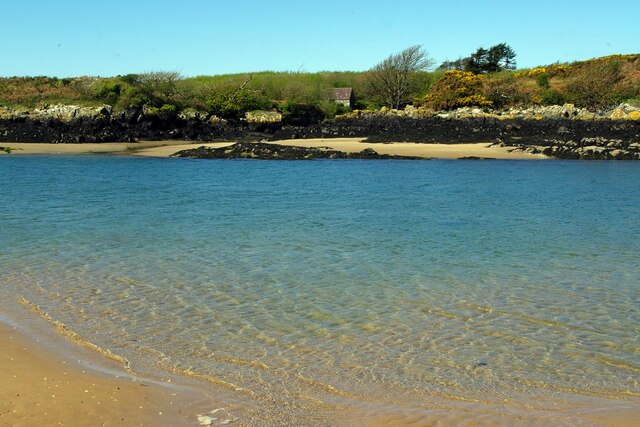
Porth Cadwaladr, also known as Cadwaladr Bay, is a picturesque coastal area located on the northern coast of Anglesey, an island off the northwest coast of Wales. The bay is situated between the popular seaside towns of Cemaes and Bull Bay, offering breathtaking views of the Irish Sea.

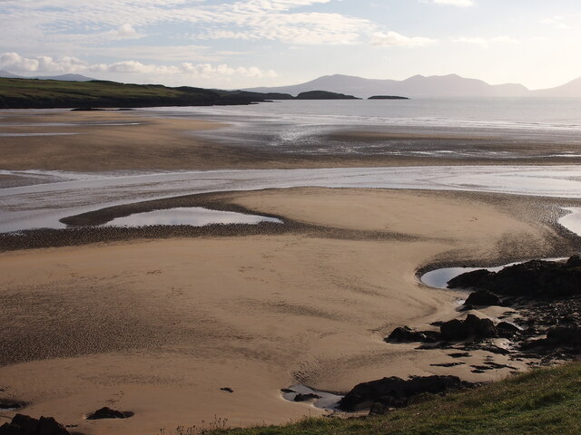
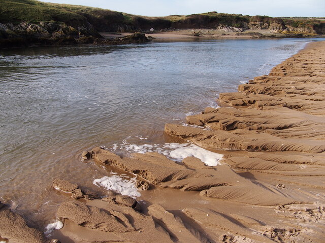
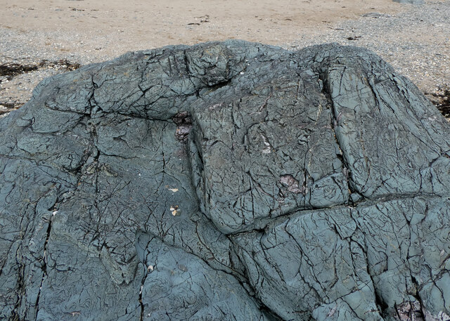
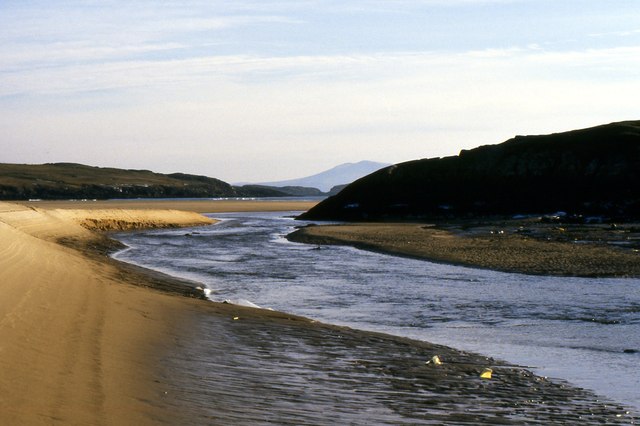
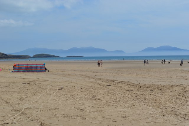
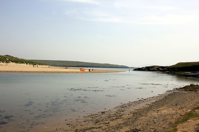
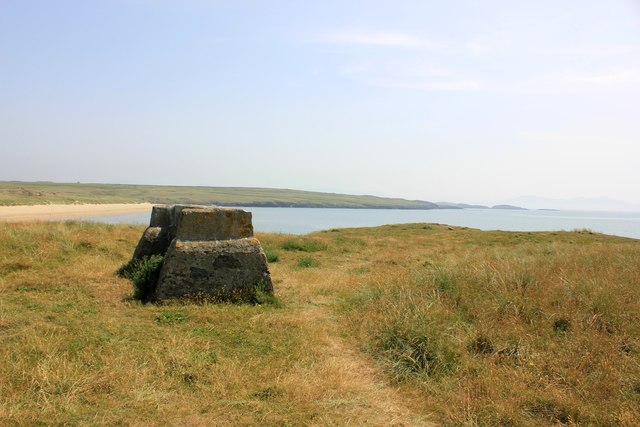
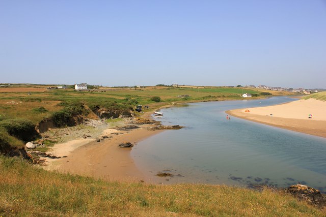
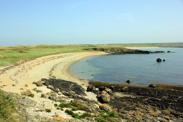
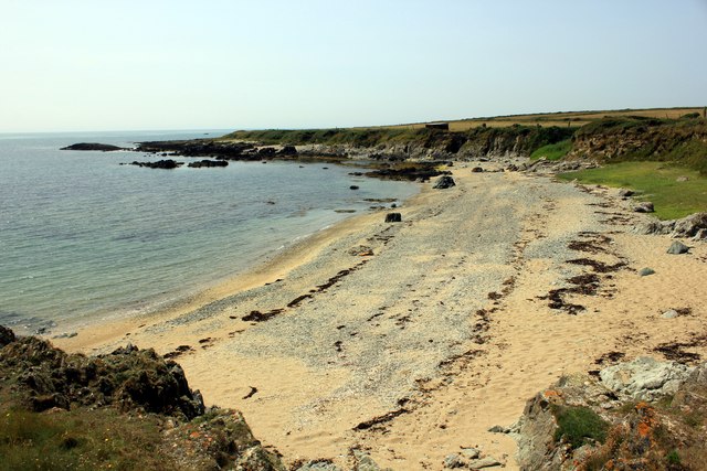
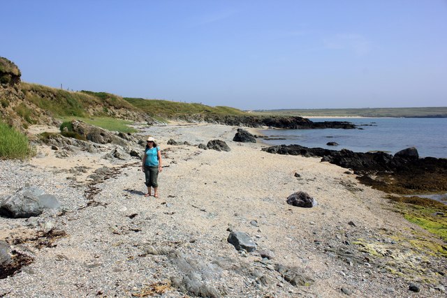
The bay is characterized by its stunning sandy beach, which stretches for approximately 1.5 kilometers. The beach is surrounded by rugged cliffs, providing a dramatic backdrop to the coastal scenery. Porth Cadwaladr is a haven for nature enthusiasts, as it is home to a diverse range of wildlife, including seals, dolphins, and a variety of seabirds.

The bay is a popular destination for outdoor activities such as swimming, sunbathing, and picnicking. The crystal-clear waters of the Irish Sea make it an ideal spot for water sports like kayaking and paddleboarding. The beach is also a fantastic spot for beachcombing, with many visitors uncovering interesting shells and fossils.

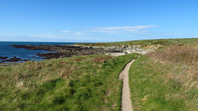
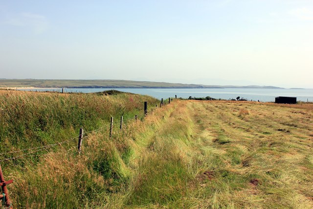
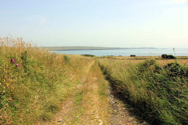
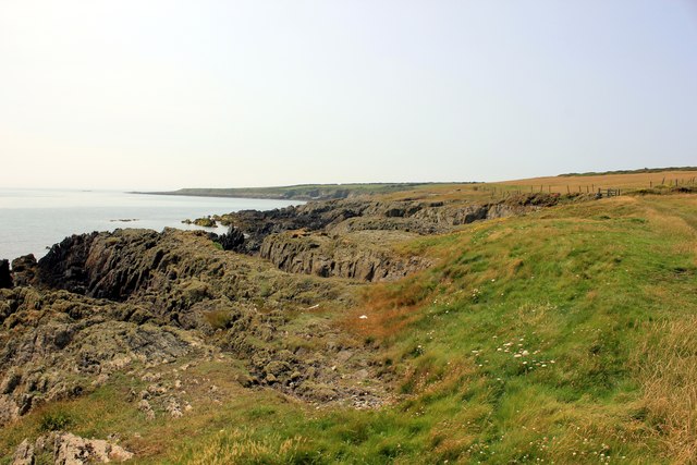
Adjacent to Porth Cadwaladr is a coastal footpath that offers stunning views of the bay and its surroundings. The footpath is a favorite among hikers and nature lovers, providing an opportunity to explore the area's natural beauty and observe the abundant marine life.

Porth Cadwaladr is a hidden gem on the Isle of Anglesey, offering a tranquil and idyllic escape for visitors seeking a peaceful coastal retreat. Its natural beauty, diverse wildlife, and range of activities make it a must-visit destination for nature enthusiasts and beach lovers alike.

If you have any feedback on the listing, please let us know in the comments section below.

Porth Cadwaladr Images

Images are sourced within 2km of 53.170426/-4.4538491 or Grid Reference SH3666. Thanks to Geograph Open Source API. All images are credited.

Traeth Mawr
Traeth Mawr
Porth Melin Ifan Owen
The mouth of the Afon Ffraw & Aberffraw Sands
Coastal path at Porth Lleidiog near Aberffraw
The Afon Ffraw Meets The Sea
Maen drawsffurfiol / A methamorphic boulder
Afon Ffraw flows into the sea
Traeth Aberffraw The trek beside the river from Aberffraw is rewarded with this fine beach with a view across to the Lleyn Peninsula.
Traeth Aberffraw
The trek beside the river from Aberffraw is rewarded with this fine beach with a view across to the Lleyn Peninsula.
Afon Ffraw Wikipedia <span class="nowrap"><a title="http://en.wikipedia.org/wiki/Aberffraw" rel="nofollow ugc noopener" href="http://en.wikipedia.org/wiki/Aberffraw">Link</a><img style="margin-left:2px;" alt="External link" title="External link - shift click to open in new window" src="https://s1.geograph.org.uk/img/external.png" width="10" height="10"/></span>
Afon Ffraw
Wikipedia LinkExternal link
Stone Seat at Aberffraw This stone seat at Aberffraw overlooks Aberffraw Bay.

Wikipedia <span class="nowrap"><a title="http://en.wikipedia.org/wiki/Aberffraw" rel="nofollow ugc noopener" href="http://en.wikipedia.org/wiki/Aberffraw">Link</a><img style="margin-left:2px;" alt="External link" title="External link - shift click to open in new window" src="https://s1.geograph.org.uk/img/external.png" width="10" height="10"/></span>
Stone Seat at Aberffraw
This stone seat at Aberffraw overlooks Aberffraw Bay. Wikipedia LinkExternal link
The Afon Ffraw at Aberffraw The Afon Ffraw looking towards Aberffraw.

Wikipedia <span class="nowrap"><a title="http://en.wikipedia.org/wiki/Aberffraw" rel="nofollow ugc noopener" href="http://en.wikipedia.org/wiki/Aberffraw">Link</a><img style="margin-left:2px;" alt="External link" title="External link - shift click to open in new window" src="https://s1.geograph.org.uk/img/external.png" width="10" height="10"/></span>
The Afon Ffraw at Aberffraw
The Afon Ffraw looking towards Aberffraw. Wikipedia LinkExternal link
The view towards Aberffraw Bay The view towards Aberffraw Bay from a path near Penrhyn.
The view towards Aberffraw Bay
The view towards Aberffraw Bay from a path near Penrhyn.
The view from Penrhyn The view towards Aberffraw Bay from Penrhyn.
The view from Penrhyn
The view towards Aberffraw Bay from Penrhyn.
View towards Aberffraw Sands Taken from the Wales Coast Path.
View towards Aberffraw Sands
Taken from the Wales Coast Path.
The beach at Porth Lleidiog The beach at Porth Lleidiog taken from the Wales Coast Path.

Wikipedia <span class="nowrap"><a title="http://en.wikipedia.org/wiki/Wales_Coast_Path" rel="nofollow ugc noopener" href="http://en.wikipedia.org/wiki/Wales_Coast_Path">Link</a><img style="margin-left:2px;" alt="External link" title="External link - shift click to open in new window" src="https://s1.geograph.org.uk/img/external.png" width="10" height="10"/></span>
The beach at Porth Lleidiog
The beach at Porth Lleidiog taken from the Wales Coast Path. Wikipedia LinkExternal link
The beach at Porth Lleidiog Parts of the Wales Coast Path lie along the beach.

Wikipedia <span class="nowrap"><a title="http://en.wikipedia.org/wiki/Wales_Coast_Path" rel="nofollow ugc noopener" href="http://en.wikipedia.org/wiki/Wales_Coast_Path">Link</a><img style="margin-left:2px;" alt="External link" title="External link - shift click to open in new window" src="https://s1.geograph.org.uk/img/external.png" width="10" height="10"/></span>
The beach at Porth Lleidiog
Parts of the Wales Coast Path lie along the beach. Wikipedia LinkExternal link
The Wales Coast Path The Wales Coast Path as it heads towards Porth Terfyn.

Wikipedia <span class="nowrap"><a title="http://en.wikipedia.org/wiki/Wales_Coast_Path" rel="nofollow ugc noopener" href="http://en.wikipedia.org/wiki/Wales_Coast_Path">Link</a><img style="margin-left:2px;" alt="External link" title="External link - shift click to open in new window" src="https://s1.geograph.org.uk/img/external.png" width="10" height="10"/></span>
The Wales Coast Path
The Wales Coast Path as it heads towards Porth Terfyn. Wikipedia LinkExternal link
Remains of Cairn, Trwyn Du A bronze age cairn, only parts of the kerb now visible.
Remains of Cairn, Trwyn Du
A bronze age cairn, only parts of the kerb now visible.
Show me another place!

Porth Cadwaladr is located at Grid Ref: SH3666 (Lat: 53.170426, Lng: -4.4538491)

Unitary Authority: Isle of Anglesey

Police Authority: North Wales

What 3 Words

///watchdogs.briskly.libraries. Near Rhosneigr, Isle of Anglesey

Related Wikis

Afon Ffraw

The Afon Ffraw is a short river on the Isle of Anglesey, Wales. It arises at Llyn Coron and flows southwest for two miles along the northwestern margin...

Aberffraw

Aberffraw is a village and community on the south west coast of the Isle of Anglesey in Wales. The village is 9 miles from the island's capital, Llangefni...

St Beuno's Church, Aberffraw

St Beuno's Church, Aberffraw is a 12th-century parish church in Anglesey, north Wales. A church was established in Aberffraw in the 7th century by St Beuno...
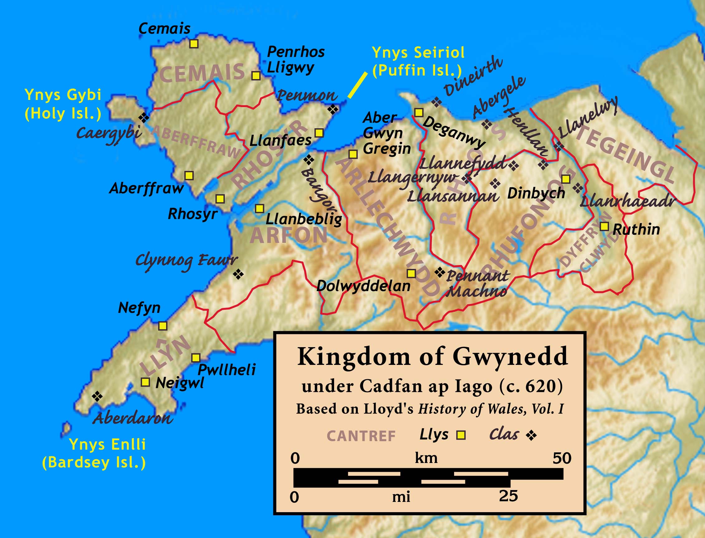
Aberffraw (cantref)

Aberffraw was one of the three medieval cantrefs on the island of Anglesey, north Wales, in the Kingdom of Gwynedd as a cadet branch, named the House of...

Nearby Amenities

Located within 500m of 53.170426,-4.4538491
Created By: dmgroom_coastlines
Source: PGS
Lat/Long: 53.1734115/-4.4570802
Created By: dmgroom_coastlines
Source: PGS
Lat/Long: 53.172713/-4.456914
Created By: dmgroom_coastlines
Source: PGS
Lat/Long: 53.1722078/-4.4566412
Created By: dmgroom_coastlines
Source: PGS
Lat/Long: 53.171824/-4.456244
Created By: dmgroom_coastlines
Source: PGS
Lat/Long: 53.171699/-4.456027
Created By: dmgroom_coastlines
Source: PGS
Lat/Long: 53.171443/-4.456018
Source: PGS
Lat/Long: 53.1710419/-4.4563023
Source: PGS
Lat/Long: 53.1708069/-4.4561468
Source: PGS
Lat/Long: 53.1703936/-4.4551263
Source: PGS
Lat/Long: 53.1704625/-4.4545788
Created By: dmgroom_coastlines
Source: PGS
Lat/Long: 53.1711103/-4.4534011
Created By: dmgroom_coastlines
Source: PGS
Lat/Long: 53.1710988/-4.4526915
Source: PGS
Lat/Long: 53.1703693/-4.4530243
Source: PGS
Lat/Long: 53.1703369/-4.4527742
Source: PGS
Lat/Long: 53.1701587/-4.4526458
Created By: dmgroom_coastlines
Source: PGS
Lat/Long: 53.169392/-4.4523956
Source: PGS
Lat/Long: 53.1689148/-4.4526188
Source: PGS
Lat/Long: 53.1684935/-4.4523619
Created By: dmgroom_coastlines
Source: PGS
Lat/Long: 53.1681913/-4.4510227
Source: PGS
Lat/Long: 53.1682018/-4.4507601
Source: PGS
Lat/Long: 53.1679019/-4.4502127
Source: PGS
Lat/Long: 53.1674887/-4.4505776
Created By: dmgroom_coastlines
Source: PGS
Lat/Long: 53.166378/-4.451157
Source: PGS
Lat/Long: 53.169401/-4.4524836
Source: PGS
Lat/Long: 53.1707714/-4.4540325
Source: PGS
Lat/Long: 53.1690242/-4.4519294
The data included in this document is from www.openstreetmap.org. The data is made available under ODbL.

Have you been to Porth Cadwaladr?

Leave your review of Porth Cadwaladr below (or comments, questions and feedback).