Port Macdonell

Bay in Inverness-shire

Scotland

Port Macdonell

Course of the Old Railway above Loch Oich (1) Now adopted by the Great Glen Way National Trail - a new lease of life for the former railway that ran between Spean Bridge and Fort Augustus
Course of the Old Railway above Loch Oich (1) Credit: Chris Heaton

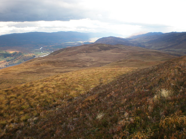
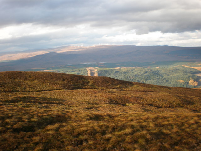
Port Macdonell is a small coastal village located in Inverness-shire, Scotland. Situated on the shores of a bay, the village is known for its picturesque views of the surrounding mountains and the clear blue waters of the bay. The village is a popular destination for tourists looking to explore the natural beauty of the Scottish Highlands.

Port Macdonell is a historic fishing village, with a long tradition of fishing and maritime activities. The village is home to a small harbor where fishing boats can be seen coming and going throughout the day. Visitors can experience the local fishing culture by visiting the harbor and watching the fishermen at work.

In addition to its fishing industry, Port Macdonell is also known for its seafood restaurants, where visitors can sample fresh seafood caught right off the coast. The village also has a number of charming bed and breakfasts, making it a popular destination for those looking to experience the peaceful charm of a Scottish coastal village.

Overall, Port Macdonell is a quaint and picturesque village with a rich history and stunning natural beauty. It is a must-visit destination for anyone exploring the Scottish Highlands.

If you have any feedback on the listing, please let us know in the comments section below.

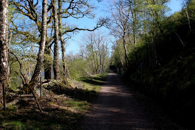
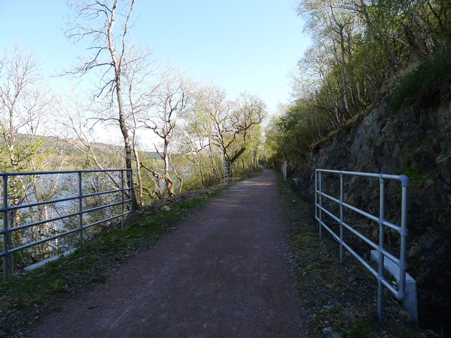
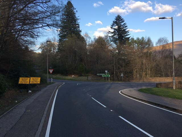
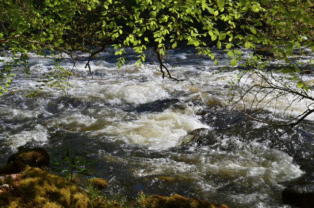
Port Macdonell Images

Images are sourced within 2km of 57.074044/-4.7679935 or Grid Reference NH3201. Thanks to Geograph Open Source API. All images are credited.

Course of the Old Railway above Loch Oich (1) Now adopted by the Great Glen Way National Trail - a new lease of life for the former railway that ran between Spean Bridge and Fort Augustus
Course of the Old Railway above Loch Oich (1)
Now adopted by the Great Glen Way National Trail - a new lease of life for the former railway that ran between Spean Bridge and Fort Augustus
'Health and Safety' gone mad? I count eleven pairs of railings visible in this picture of part of the restored trackbed of the Invergarry to Fort Augustus railway. The railings align with concrete drainage culverts. But the likelihood of injury from falling off the track at these points is surely no greater than at any other (non-railinged) part of the track.
'Health and Safety' gone mad?
I count eleven pairs of railings visible in this picture of part of the restored trackbed of the Invergarry to Fort Augustus railway. The railings align with concrete drainage culverts. But the likelihood of injury from falling off the track at these points is surely no greater than at any other (non-railinged) part of the track.
Junction of the A87 and A82 at Invergarry
A87, Invergarry The A87 runs 99 miles from Invergarry to Uig on the Isle of Skye <a href="https://www.geograph.org.uk/photo/7374675">NG3863 : End of the A87, Uig</a>.
<span class="nowrap"><a title="https://www.sabre-roads.org.uk/wiki/index.php?title=A87" rel="nofollow ugc noopener" href="https://www.sabre-roads.org.uk/wiki/index.php?title=A87">Link</a><img style="margin-left:2px;" alt="External link" title="External link - shift click to open in new window" src="https://s1.geograph.org.uk/img/external.png" width="10" height="10"/></span>
A87, Invergarry
The A87 runs 99 miles from Invergarry to Uig on the Isle of Skye NG3863 : End of the A87, Uig. LinkExternal link
A82 The A82 is a trunk road in Scotland. It is the principal route from Lowland Scotland to the western Scottish Highlands, running from Glasgow to Inverness, going by Loch Lomond, Glen Coe, Fort William and the Great Glen. It is 167 miles long.
<span class="nowrap"><a title="https://www.sabre-roads.org.uk/wiki/index.php?title=A82" rel="nofollow ugc noopener" href="https://www.sabre-roads.org.uk/wiki/index.php?title=A82">Link</a><img style="margin-left:2px;" alt="External link" title="External link - shift click to open in new window" src="https://s1.geograph.org.uk/img/external.png" width="10" height="10"/></span>
A82
The A82 is a trunk road in Scotland. It is the principal route from Lowland Scotland to the western Scottish Highlands, running from Glasgow to Inverness, going by Loch Lomond, Glen Coe, Fort William and the Great Glen. It is 167 miles long. LinkExternal link
River Garry The River Garry is one half of the River Tummel system, joining the upper Tummel to become Loch Faskally just upstream of Pitlochry.
River Garry
The River Garry is one half of the River Tummel system, joining the upper Tummel to become Loch Faskally just upstream of Pitlochry.
Path under the A82, Invergarry The path on the north bank of the River Garry.
Path under the A82, Invergarry
The path on the north bank of the River Garry.
Path by the River Garry A riverside path through woodland on the north bank.
Path by the River Garry
A riverside path through woodland on the north bank.
Turbulent water on the River Garry
Invergarry War Memorial A massive boulder surmounts the plaque listing names from both World wars.
Invergarry War Memorial
A massive boulder surmounts the plaque listing names from both World wars.
Severely damaged bridge, Invergarry No arguing with the 'road closed' sign here. Steven Brown's photograph <a href="https://www.geograph.org.uk/photo/3723730">NH3101 : Bridge and estate building at Invergarry</a> shows the bridge as it was in 2013.
Severely damaged bridge, Invergarry
No arguing with the 'road closed' sign here. Steven Brown's photograph NH3101 : Bridge and estate building at Invergarry shows the bridge as it was in 2013.
Looking North from Leitir Fhearna Grouse Moor 410m The views were extensive but due to low summer sun I could not get many photos with good camera and had to use pocket camera.
Looking North from Leitir Fhearna Grouse Moor 410m
The views were extensive but due to low summer sun I could not get many photos with good camera and had to use pocket camera.
Looking NW from Leitir Fhearna Grouse Moor 410m
A82 near Loch Oich
A82 near Loch Oich
Former Railway Tunnel, adj to Loch Oich The Invergarry and Fort Augustus Railway opened in 1903 and closed in 1943. It was intended as the first stage of a rail link between Fort William and Inverness, however the second phase was never built leaving an unprofitable spur line to Fort Augustus. The former trackbed is being surveyed by sustrans for improvement work.
Former Railway Tunnel, adj to Loch Oich
The Invergarry and Fort Augustus Railway opened in 1903 and closed in 1943. It was intended as the first stage of a rail link between Fort William and Inverness, however the second phase was never built leaving an unprofitable spur line to Fort Augustus. The former trackbed is being surveyed by sustrans for improvement work.
Invergarry Castle
Invergarry Castle
Leitirfearn
Leitirfearn
River Court, Invergarry A development of four two bedroom houses newly constructed adjacent to Invergarry Hotel.
River Court, Invergarry
A development of four two bedroom houses newly constructed adjacent to Invergarry Hotel.
Show me another place!

Port Macdonell is located at Grid Ref: NH3201 (Lat: 57.074044, Lng: -4.7679935)

Unitary Authority: Highland

Police Authority: Highlands and Islands

What 3 Words

///audible.gadgets.steepest. Near Gairlochy, Highland

Related Wikis

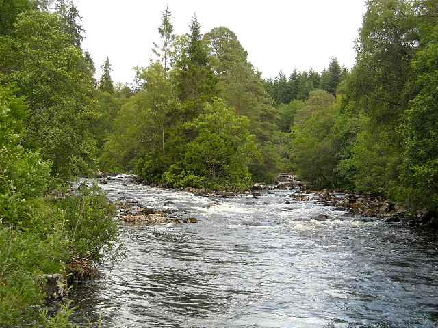
River Garry, Inverness-shire

The River Garry (Scottish Gaelic: Garadh / Abhainn Gharadh) in Inverness-shire is a Scottish river punctuated by two long Lochs, in the region of Lochaber...

Great Glen Fault

The Great Glen Fault is a strike-slip fault that runs through the Great Glen in Scotland. The fault is mostly inactive today, but occasional moderate tremors...

Invergarry Castle

Invergarry Castle in the Scottish Highlands was the seat of the Chiefs of the Clan MacDonell of Glengarry, a powerful branch of the Clan Donald. The castle...

Loch Oich

Loch Oich (; Scottish Gaelic: Loch Omhaich) is a freshwater loch in the Highlands of Scotland which forms part of the Caledonian Canal, of which it is...

Nearby Amenities

Located within 500m of 57.074044,-4.7679935
Source: Landsat photo
Lat/Long: 57.0718186/-4.7713752
Source: Landsat photo
Lat/Long: 57.0706769/-4.7700703
Source: Landsat photo
Lat/Long: 57.0704622/-4.7712422
Source: Landsat photo
Lat/Long: 57.0716859/-4.7705663
Source: Landsat photo
Lat/Long: 57.0713432/-4.770417
Source: Landsat photo
Lat/Long: 57.0711223/-4.77045
Source: Landsat photo
Lat/Long: 57.0706498/-4.7700765
Source: Landsat photo
Lat/Long: 57.0702797/-4.7721774
Source: Landsat photo
Lat/Long: 57.0703086/-4.772295
Source: Landsat photo
Lat/Long: 57.0741132/-4.7687094
Source: Landsat photo
Lat/Long: 57.076197/-4.7655148
Source: Landsat photo
Lat/Long: 57.0770576/-4.7631695
Source: Landsat photo
Lat/Long: 57.0767312/-4.7630957
Source: Landsat photo
Lat/Long: 57.0737486/-4.7685337
Source: Landsat photo
Lat/Long: 57.0759443/-4.7661726
Source: Landsat photo
Lat/Long: 57.0752976/-4.7663554
Source: Landsat photo
Lat/Long: 57.0751156/-4.7664574
Source: Landsat photo
Lat/Long: 57.0747341/-4.7674521
Source: Landsat photo
Lat/Long: 57.0746044/-4.7678302
Source: Landsat photo
Lat/Long: 57.074378/-4.7683166
Source: Landsat photo
Lat/Long: 57.0732504/-4.7685048
Source: Landsat photo
Lat/Long: 57.0728305/-4.7690016
Source: Landsat photo
Lat/Long: 57.072793/-4.769073
Source: Landsat photo
Lat/Long: 57.0720197/-4.7711192
Source: Landsat photo
Lat/Long: 57.0756542/-4.7665067
Source: Landsat photo
Lat/Long: 57.0775076/-4.7639539
Source: Landsat photo
Lat/Long: 57.0765426/-4.7648629
Power: tower
Lat/Long: 57.0731367/-4.7757696
Leitirfearn
Place: locality
Lat/Long: 57.0723865/-4.7624208
Toilets
Changing Table: no
Fee: no
Wheelchair: limited
Lat/Long: 57.0726183/-4.7620786
Power: pole
Lat/Long: 57.0726982/-4.7758769
Power: pole
Lat/Long: 57.0731425/-4.7749831
Power: pole
Lat/Long: 57.0732516/-4.7743857
Power: pole
Lat/Long: 57.0734469/-4.7732329
Power: pole
Lat/Long: 57.0736511/-4.7720606
Power: pole
Lat/Long: 57.0738733/-4.7708375
Power: pole
Lat/Long: 57.0745984/-4.7701308
Power: pole
Lat/Long: 57.0753235/-4.7691397
Power: pole
Lat/Long: 57.0758776/-4.7683881
Power: pole
Lat/Long: 57.0769265/-4.7669523
Power: pole
Lat/Long: 57.0774481/-4.766087
Power: pole
Lat/Long: 57.0778721/-4.7653998
Leitirfearn Trailblazer Rest
Backcountry: yes
Capacity Tents: 8
Fee: no
Tourism: camp_site
Lat/Long: 57.0731252/-4.7621996
Information: board
Tourism: information
Lat/Long: 57.0731847/-4.7622389
Building: yes
Note: used to tag houses that need mapping as areas
Lat/Long: 57.0721478/-4.7733102
The data included in this document is from www.openstreetmap.org. The data is made available under ODbL.

Have you been to Port Macdonell?

Leave your review of Port Macdonell below (or comments, questions and feedback).