Borth Fawr

Bay in Caernarfonshire

Wales

Borth Fawr

Abersoch Harbour
Abersoch Harbour Credit: Anthony Parkes

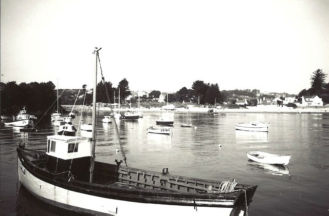
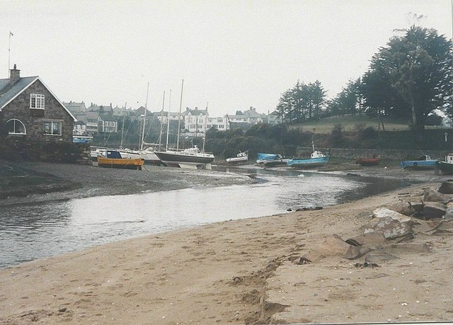
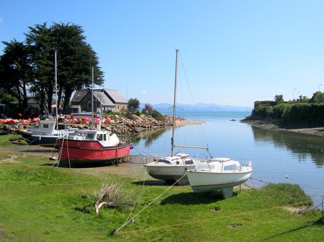
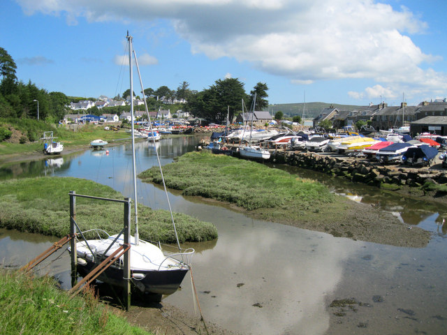
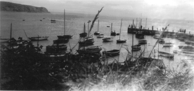
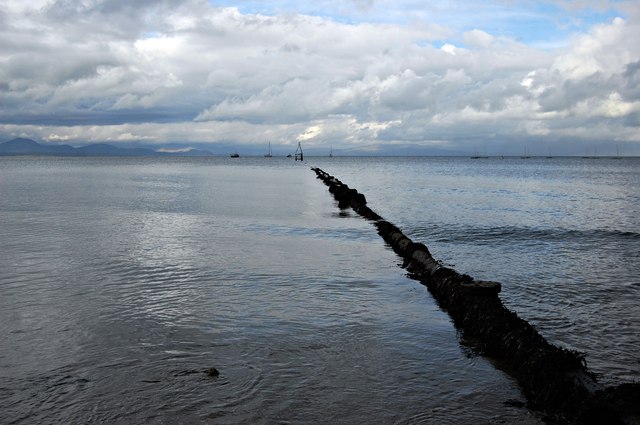
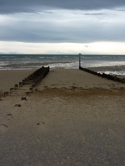
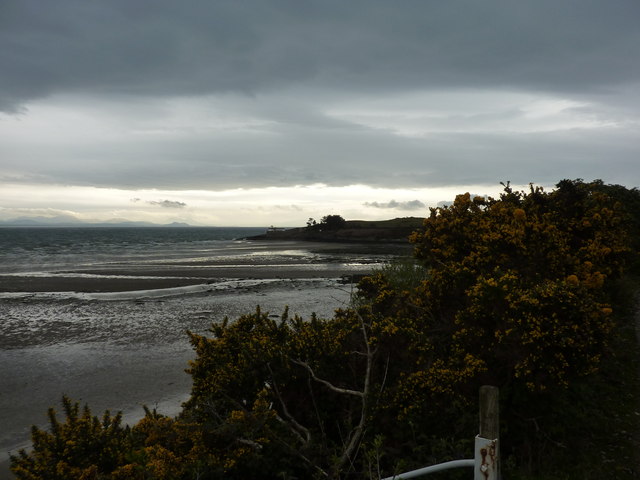
Borth Fawr, located in the county of Caernarfonshire, Wales, is a small bay renowned for its natural beauty and historical significance. Situated on the northern coast of Wales, the bay is nestled between the towns of Caernarfon and Pwllheli. Borth Fawr is bordered by the Irish Sea, offering stunning views of the expansive water and the surrounding countryside.

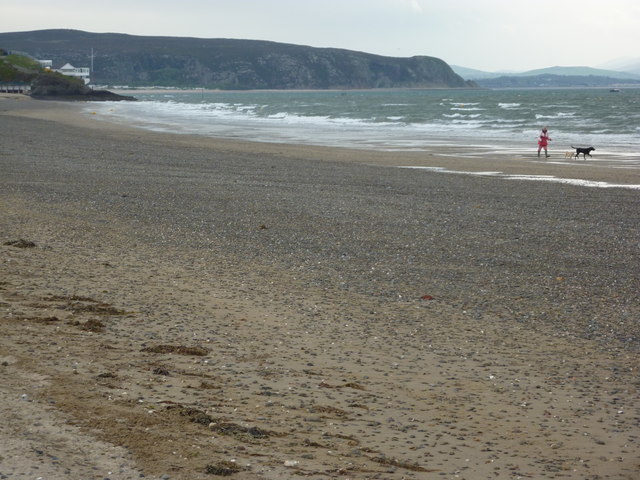
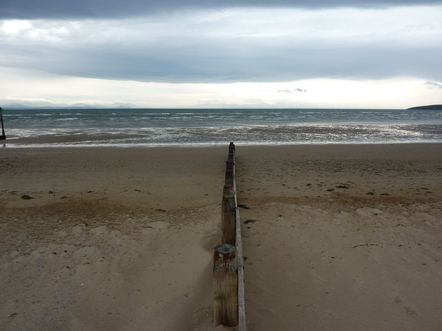
The bay is characterized by its picturesque sandy beach, which stretches for approximately 2 miles along the coast. This beach is a popular destination for locals and tourists alike, attracting visitors with its tranquil atmosphere and opportunities for recreational activities such as swimming, sunbathing, and picnicking.

Borth Fawr also holds historical significance, as it was once a thriving port during the 19th century. The bay was a hub for the slate industry, with numerous slate quarries operating in the nearby hills. The remnants of this industrial heritage can still be seen today, with old quarry buildings and structures dotting the landscape.

In addition to its natural beauty and historical importance, Borth Fawr is also home to a diverse range of flora and fauna. The bay and its surrounding areas provide habitats for various bird species, including oystercatchers, curlews, and sandpipers. The nearby marshland is filled with unique plant species, adding to the bay's ecological richness.

Overall, Borth Fawr offers visitors a combination of stunning natural landscapes, a rich history, and abundant wildlife, making it a must-visit destination for those exploring the Caernarfonshire region of Wales.

If you have any feedback on the listing, please let us know in the comments section below.

Borth Fawr Images

Images are sourced within 2km of 52.816765/-4.4948085 or Grid Reference SH3127. Thanks to Geograph Open Source API. All images are credited.

Abersoch Harbour
Abersoch Harbour
The harbour, Abersoch in 1987 The Harbour Hotel <a title="https://www.geograph.org.uk/photo/638147" href="https://www.geograph.org.uk/photo/638147">Link</a> is the white painted building in the middle of the view
The harbour, Abersoch in 1987
The Harbour Hotel Link is the white painted building in the middle of the view
Low Water Spring At Spring tides the bay empties. This picture was taken from the top Cae Du using a telephoto lens
Low Water Spring
At Spring tides the bay empties. This picture was taken from the top Cae Du using a telephoto lens
Inner harbour, Abersoch The tidal Afon Soch winds through the town of Abersoch, where various leisure craft are moored.
Inner harbour, Abersoch
The tidal Afon Soch winds through the town of Abersoch, where various leisure craft are moored.
Inner harbour, Abersoch The inner harbour, viewed from the bridge over the Afon Soch at high water.
Inner harbour, Abersoch
The inner harbour, viewed from the bridge over the Afon Soch at high water.
Abersoch harbour c1956 Abersoch harbour before commercialisation.
Abersoch harbour c1956
Abersoch harbour before commercialisation.
Outfall pipe at Abersoch Evening in Abersoch, looking along the pipe out into St Tudwal's Road, with the mountains of mid-Wales in the distance.
Outfall pipe at Abersoch
Evening in Abersoch, looking along the pipe out into St Tudwal's Road, with the mountains of mid-Wales in the distance.
Walking the dogs, at Abersoch On the beach to the south of the town.
Walking the dogs, at Abersoch
On the beach to the south of the town.
Groyne, Borth Fawr On the beach at Abersoch, Lleyn Peninsula, looking East.
Groyne, Borth Fawr
On the beach at Abersoch, Lleyn Peninsula, looking East.
Groynes, Borth Fawr On the beach at Abersoch, Lleyn Peninsula, looking east.
Groynes, Borth Fawr
On the beach at Abersoch, Lleyn Peninsula, looking east.
Beach, yachts and houses At Machroes, south of Abersoch, on the Lleyn Peninsula.
Beach, yachts and houses
At Machroes, south of Abersoch, on the Lleyn Peninsula.
Penrhyn Du Low tide on the beach at Machroes, south of Aberdaron, on the Lleyn Peninsula. Headland with old lifeboat station.
Penrhyn Du
Low tide on the beach at Machroes, south of Aberdaron, on the Lleyn Peninsula. Headland with old lifeboat station.
Penrhyn Du, the old lifeboat station Gorse in full yellow flower, and the sky clearing over the mainland, to the east.
Penrhyn Du, the old lifeboat station
Gorse in full yellow flower, and the sky clearing over the mainland, to the east.
Penrhynmawr, farmhouse South east of Machroes, on the Llyn Coastal Path.
Penrhynmawr, farmhouse
South east of Machroes, on the Llyn Coastal Path.
Cim, farmhouse south of Machroes
Stile over Welsh wall A wall of stone with earth and vegetation.
Stile over Welsh wall
A wall of stone with earth and vegetation.
Cattle, farmland and bungalow Between Sarn Bach and Bwlchtocyn, in the Lleyn Peninsula.Yellow salt bin at roadside.
Cattle, farmland and bungalow
Between Sarn Bach and Bwlchtocyn, in the Lleyn Peninsula.Yellow salt bin at roadside.
Chapel at Bwlchtocyn Dated 1796, with an extension, a porch, in 1912.A single track road leads down towards Abersoch Golf Course.
Chapel at Bwlchtocyn
Dated 1796, with an extension, a porch, in 1912.A single track road leads down towards Abersoch Golf Course.
Show me another place!

Borth Fawr is located at Grid Ref: SH3127 (Lat: 52.816765, Lng: -4.4948085)

Unitary Authority: Gwynedd

Police Authority: North Wales

What 3 Words

///places.insects.sprouting. Near Pwllheli, Gwynedd

Nearby Locations

Borth Fawr

Related Wikis

Abersoch

Abersoch is a village in the community of Llanengan in Gwynedd, Wales. It is a popular coastal seaside resort, with around 2,600 residents, on the east...

Penrhyn Du Mines

The Penrhyn Du Mines are a collection of mines situated near Llanengan on the Llŷn Peninsula. It encompasses the Penrhyn, Assheton, Western and Tan-y-Bwlch...

Afon Soch

The Afon Soch is a short river on the Llŷn peninsula, Gwynedd, Wales. It arises to the north of the village of Sarn Meyllteyrn, through which it then flows...

Porth Ceiriad

Porth Ceiriad is a south-east facing beach and bay in the parish of Llanengan, near to Abersoch, in the county of Gwynedd, North Wales. It has several...

Llanengan

Llanengan is a small village and community 1.2 mi (1.9 km) around Abersoch in Gwynedd in north-west Wales. It had a population of 2,024 at the 2001 census...

St Tudwal's Lighthouse

St Tudwal's Lighthouse on Saint Tudwal's Island West is active, but unstaffed. The site of the lighthouse, which marks the north end of Cardigan Bay, was...

Llangian

Llangian is a small village and former civil parish on the Llŷn Peninsula in the Welsh county of Gwynedd. It is located 1 mile (1.6 km) north west of...

RAF Hell's Mouth

Royal Air Force Hell's Mouth, or more simply RAF Hell's Mouth, is a former Royal Air Force air gunnery and bombing range. It was initially redeveloped...

Nearby Amenities

Located within 500m of 52.816765,-4.4948085
Source: PGS
Lat/Long: 52.8146772/-4.5013243
Source: PGS
Lat/Long: 52.8157057/-4.5015165
Created By: dmgroom_coastlines
Source: PGS
Lat/Long: 52.818318/-4.501284
Created By: dmgroom_coastlines
Source: PGS
Lat/Long: 52.819091/-4.500887
Borth Fawr
Natural: bay
Source: OS Open Names
Wikipedia: en:List of bays of Wales
Lat/Long: 52.816782/-4.4948174
The data included in this document is from www.openstreetmap.org. The data is made available under ODbL.

Have you been to Borth Fawr?

Leave your review of Borth Fawr below (or comments, questions and feedback).