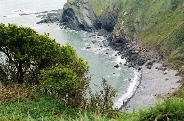
Barley Bay
Bay in Devon Torridge
England
Barley Bay

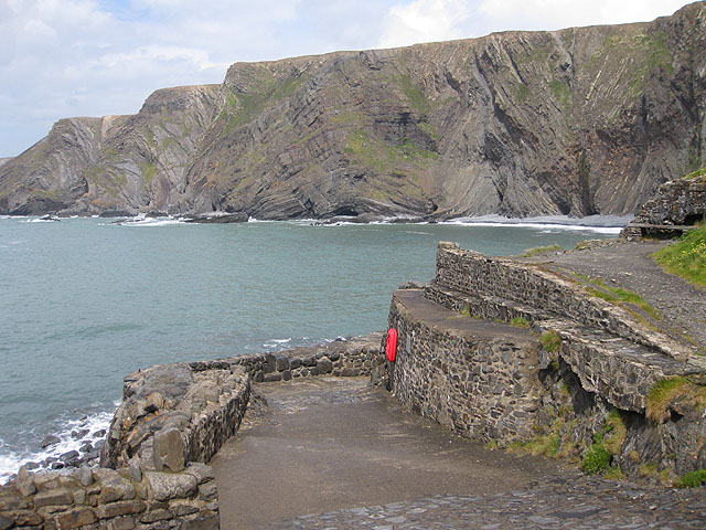
Barley Bay is a picturesque coastal village located in Devon, England. Situated on the southern coast, it offers breathtaking views of the English Channel and is known for its unspoiled natural beauty. The bay is nestled between towering cliffs and golden sandy beaches, making it a popular destination for tourists and locals alike.
The village itself is small and charming, with a population of around 500 residents. It has a rich history, dating back to the 12th century, and many of the original buildings still stand today. The quaint streets are lined with traditional cottages and local shops, giving visitors a taste of traditional English village life.
Barley Bay is renowned for its outdoor activities, particularly water sports. The crystal-clear waters are perfect for swimming, snorkeling, and even diving. The bay is also a favorite spot for sailing and fishing enthusiasts, who can often be seen enjoying the calm waters and abundant marine life.
For those who prefer to stay on land, the surrounding countryside offers plenty of opportunities for hiking and exploring. The nearby cliffs provide stunning panoramic views of the coastline, and there are several walking trails that lead to secluded coves and hidden beaches.
In terms of amenities, Barley Bay has a handful of charming pubs and restaurants, where visitors can enjoy fresh seafood and traditional British cuisine. There are also a few small shops that cater to the needs of both residents and tourists.
Overall, Barley Bay is a hidden gem on the Devon coast, offering a peaceful retreat for nature lovers and a glimpse into the idyllic English seaside village lifestyle.
If you have any feedback on the listing, please let us know in the comments section below.
Barley Bay Images
Images are sourced within 2km of 51.02148/-4.5193353 or Grid Reference SS2327. Thanks to Geograph Open Source API. All images are credited.


Barley Bay is located at Grid Ref: SS2327 (Lat: 51.02148, Lng: -4.5193353)
Administrative County: Devon
District: Torridge
Police Authority: Devon and Cornwall
What 3 Words
///mandolin.noticing.requested. Near Flexbury, Cornwall
Nearby Locations
Related Wikis
Hartland Point
Hartland Point is a 325 ft (99 m) high rocky outcrop of land on the north-western tip of the Devon coast in England. It is three miles (5 km) north-west...
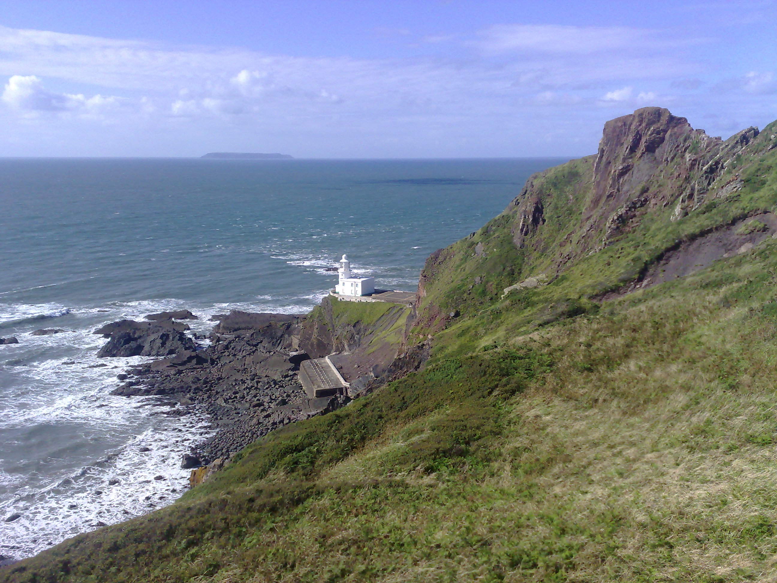
Hartland Point Lighthouse
Hartland Point Lighthouse is a Grade II listed building at Hartland Point, Devon, England. The point marks the western limit (on the English side) of the...
Embury Beacon
Embury Beacon is the site of an Iron Age promontory fort on the west of the Hartland Peninsula, north of Bude and west of Clovelly, in north Devon. The...
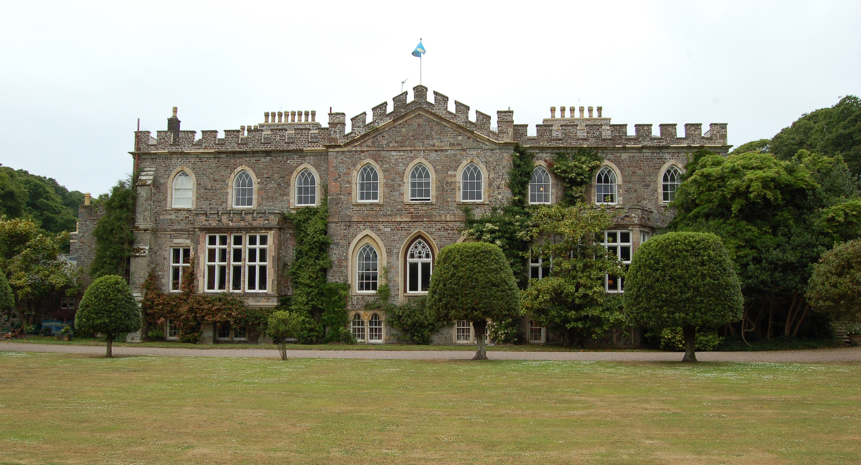
Hartland Abbey
Hartland Abbey is a former abbey and current family home to the Stucley family. It is located in Hartland, Devon. The current owner is Sir Hugh George...
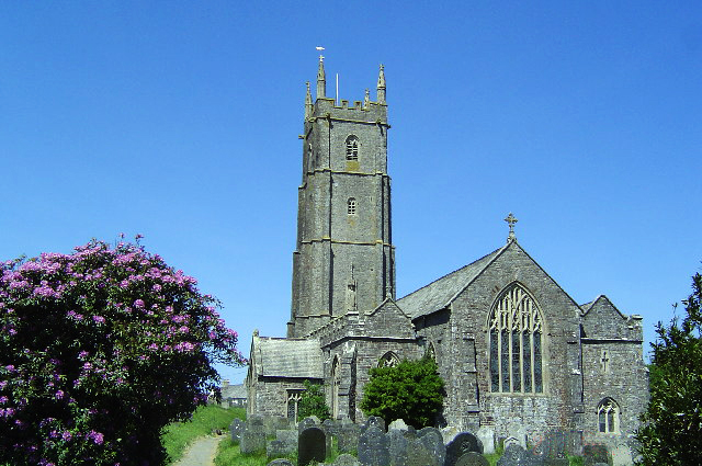
St Nectan's Church, Hartland
The Church of St Nectan is the parish church of Hartland, Devon, England. Sometimes referred to as the "Cathedral of North Devon", it is located in the...
Hartland Quay
Hartland Quay is located on the Atlantic coast of Devon, England, south of Hartland Point and north of Bude, Cornwall. It experiences some of the roughest...

Hartland, Devon
The village of Hartland, whose parish incorporates the hamlet of Stoke to the west and the village of Meddon in the south, is the most north-westerly settlement...
Our Lady and St Nectan's Church, Hartland
The Church of Our Lady and St Nectan was a Roman Catholic place of worship in the town of Hartland, Devon. It was built by local people and consecrated...
Nearby Amenities
Located within 500m of 51.02148,-4.5193353Have you been to Barley Bay?
Leave your review of Barley Bay below (or comments, questions and feedback).