Porth Dafarch

Bay in Anglesey

Wales

Porth Dafarch

Porth Dafarch Caravan Park The Anglesey Coastal Path (formally the Isle of Anglesey Coastal Path) is a 200-kilometre (124 mi) long-distance footpath around the island of Anglesey in North Wales. The route is part of the Wales Coast Path. The path logo is a flying tern. <a href="https://www.geograph.org.uk/photo/4380990">SH5186 : Anglesey Coastal Path Logo</a>
Wikipedia: <span class="nowrap"><a title="http://en.wikipedia.org/wiki/Anglesey_Coastal_Path" rel="nofollow ugc noopener" href="http://en.wikipedia.org/wiki/Anglesey_Coastal_Path">Link</a><img style="margin-left:2px;" alt="External link" title="External link - shift click to open in new window" src="https://s1.geograph.org.uk/img/external.png" width="10" height="10"/></span>
Porth Dafarch Caravan Park Credit: Mat Fascione

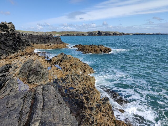
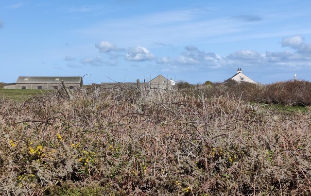
Porth Dafarch is a picturesque bay located on the Isle of Anglesey, in Wales. It is situated on the western coast of the island, approximately 2 miles southwest of the popular town of Holyhead. This bay is widely recognized for its stunning natural beauty and is a popular destination for tourists and locals alike.

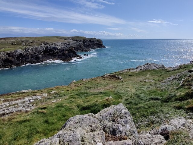
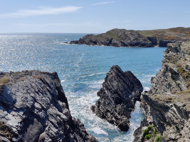
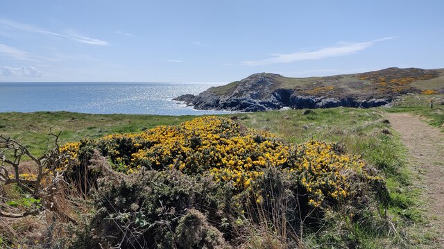
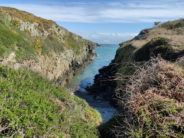
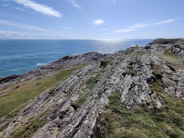
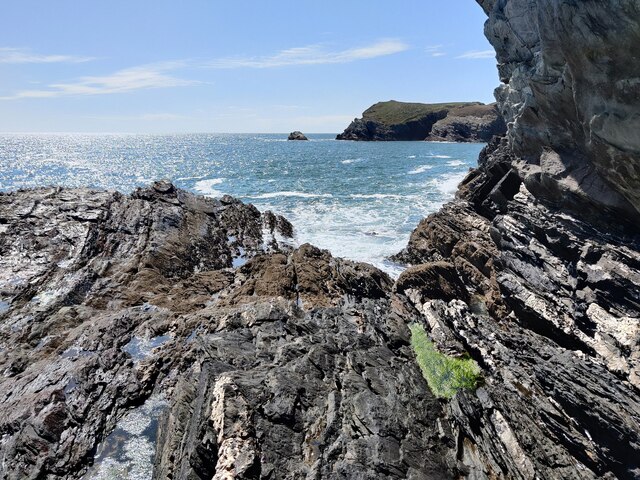
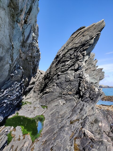
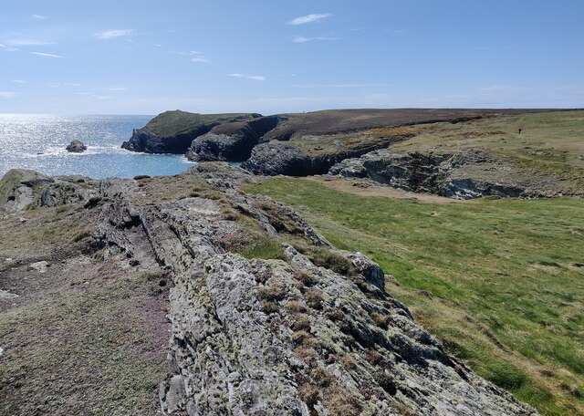
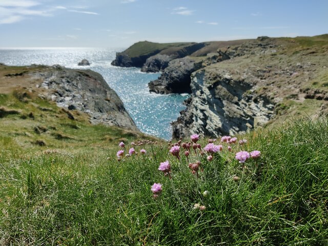
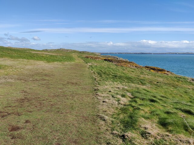
The bay is characterized by its sandy beach, which stretches over half a mile in length and is surrounded by rocky cliffs and hills. The crystal-clear waters of the bay are ideal for swimming, kayaking, and snorkeling, attracting water sports enthusiasts throughout the year. Porth Dafarch is also renowned for its exceptional wildlife, with various bird species, seals, and even dolphins frequently spotted in the area.

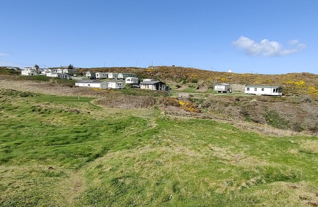
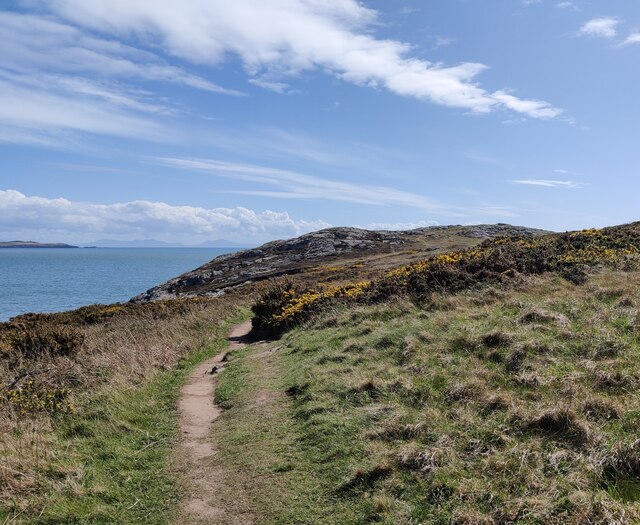
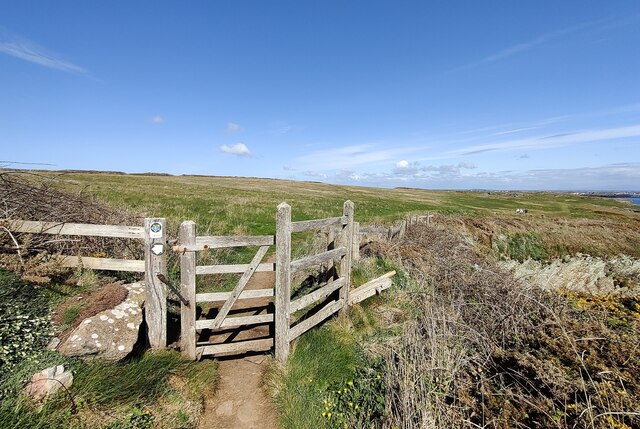
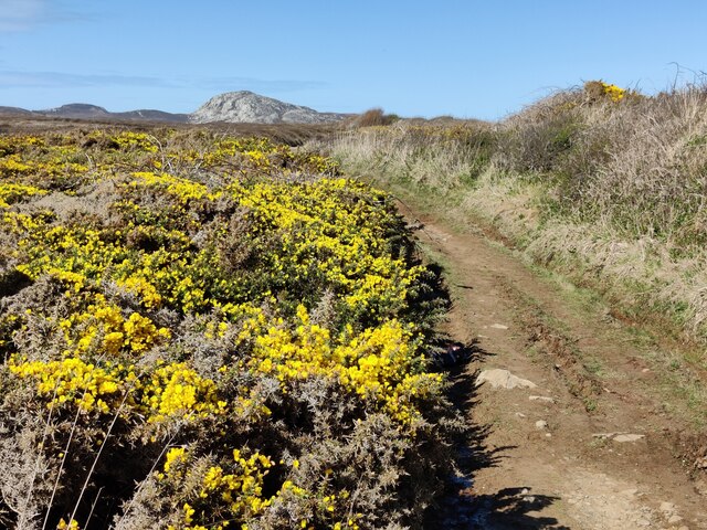
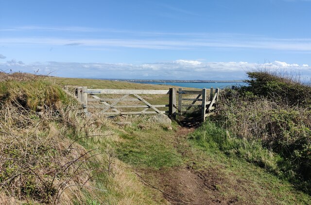
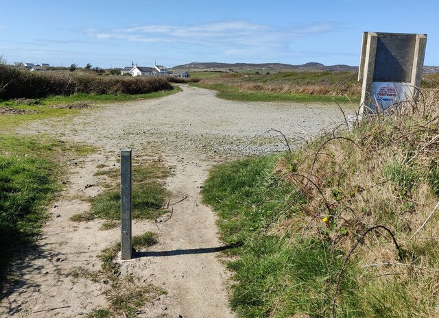
Facilities at Porth Dafarch include a car park, toilets, and a small café serving refreshments. The bay is easily accessible, with a well-maintained road leading directly to the beach. There are also several walking trails nearby, providing opportunities for scenic hikes and exploration of the surrounding coastal landscape.

Porth Dafarch is not only a place of natural beauty but also holds historical significance. It is said to have been the landing site of St. Seiriol, a renowned Welsh saint, in the 6th century. The remains of a small chapel dedicated to him can still be found nearby.

Overall, Porth Dafarch is a captivating bay that offers visitors a perfect combination of natural splendor, outdoor activities, and a touch of history.

If you have any feedback on the listing, please let us know in the comments section below.

Porth Dafarch Images

Images are sourced within 2km of 53.28545/-4.6535369 or Grid Reference SH2379. Thanks to Geograph Open Source API. All images are credited.

Porth Dafarch Caravan Park The Anglesey Coastal Path (formally the Isle of Anglesey Coastal Path) is a 200-kilometre (124 mi) long-distance footpath around the island of Anglesey in North Wales. The route is part of the Wales Coast Path. The path logo is a flying tern. <a href="https://www.geograph.org.uk/photo/4380990">SH5186 : Anglesey Coastal Path Logo</a>
Wikipedia: <span class="nowrap"><a title="http://en.wikipedia.org/wiki/Anglesey_Coastal_Path" rel="nofollow ugc noopener" href="http://en.wikipedia.org/wiki/Anglesey_Coastal_Path">Link</a><img style="margin-left:2px;" alt="External link" title="External link - shift click to open in new window" src="https://s1.geograph.org.uk/img/external.png" width="10" height="10"/></span>
Porth Dafarch Caravan Park
The Anglesey Coastal Path (formally the Isle of Anglesey Coastal Path) is a 200-kilometre (124 mi) long-distance footpath around the island of Anglesey in North Wales. The route is part of the Wales Coast Path. The path logo is a flying tern. SH5186 : Anglesey Coastal Path Logo Wikipedia: LinkExternal link
Porth Dafarch on the Holy Island coast
Ogof Iron near Porth Dafarch
Anglesey Coast Path near Graig Lŵyd The Anglesey Coastal Path (formally the Isle of Anglesey Coastal Path) is a 200-kilometre (124 mi) long-distance footpath around the island of Anglesey in North Wales. The route is part of the Wales Coast Path. The path logo is a flying tern. <a href="https://www.geograph.org.uk/photo/4380990">SH5186 : Anglesey Coastal Path Logo</a>
Wikipedia: <span class="nowrap"><a title="http://en.wikipedia.org/wiki/Anglesey_Coastal_Path" rel="nofollow ugc noopener" href="http://en.wikipedia.org/wiki/Anglesey_Coastal_Path">Link</a><img style="margin-left:2px;" alt="External link" title="External link - shift click to open in new window" src="https://s1.geograph.org.uk/img/external.png" width="10" height="10"/></span>
Anglesey Coast Path near Graig Lŵyd
The Anglesey Coastal Path (formally the Isle of Anglesey Coastal Path) is a 200-kilometre (124 mi) long-distance footpath around the island of Anglesey in North Wales. The route is part of the Wales Coast Path. The path logo is a flying tern. SH5186 : Anglesey Coastal Path Logo Wikipedia: LinkExternal link
Rocky shoreline near Porth Dafarch
Anglesey Coastal Path at Graig Lŵyd The Anglesey Coastal Path (formally the Isle of Anglesey Coastal Path) is a 200-kilometre (124 mi) long-distance footpath around the island of Anglesey in North Wales. The route is part of the Wales Coast Path. The path logo is a flying tern. <a href="https://www.geograph.org.uk/photo/4380990">SH5186 : Anglesey Coastal Path Logo</a>
Wikipedia: <span class="nowrap"><a title="http://en.wikipedia.org/wiki/Anglesey_Coastal_Path" rel="nofollow ugc noopener" href="http://en.wikipedia.org/wiki/Anglesey_Coastal_Path">Link</a><img style="margin-left:2px;" alt="External link" title="External link - shift click to open in new window" src="https://s1.geograph.org.uk/img/external.png" width="10" height="10"/></span>
Anglesey Coastal Path at Graig Lŵyd
The Anglesey Coastal Path (formally the Isle of Anglesey Coastal Path) is a 200-kilometre (124 mi) long-distance footpath around the island of Anglesey in North Wales. The route is part of the Wales Coast Path. The path logo is a flying tern. SH5186 : Anglesey Coastal Path Logo Wikipedia: LinkExternal link
Coastline at Graig Lŵyd
Rocks at Graig Lŵyd Also known as 'Mackerel Rock', a very popular spot for fishing.
Rocks at Graig Lŵyd
Also known as 'Mackerel Rock', a very popular spot for fishing.
Rocks at Graig Lŵyd Also known as 'Mackerel Rock', a very popular spot for fishing.
Rocks at Graig Lŵyd
Also known as 'Mackerel Rock', a very popular spot for fishing.
Rock formations at Graig Lŵyd
Coastline at Graig Lŵyd
Thrift at Graig Lŵyd
Anglesey Coast Path towards Graig Lŵyd The Anglesey Coastal Path (formally the Isle of Anglesey Coastal Path) is a 200-kilometre (124 mi) long-distance footpath around the island of Anglesey in North Wales. The route is part of the Wales Coast Path. The path logo is a flying tern. <a href="https://www.geograph.org.uk/photo/4380990">SH5186 : Anglesey Coastal Path Logo</a>
Wikipedia: <span class="nowrap"><a title="http://en.wikipedia.org/wiki/Anglesey_Coastal_Path" rel="nofollow ugc noopener" href="http://en.wikipedia.org/wiki/Anglesey_Coastal_Path">Link</a><img style="margin-left:2px;" alt="External link" title="External link - shift click to open in new window" src="https://s1.geograph.org.uk/img/external.png" width="10" height="10"/></span>
Anglesey Coast Path towards Graig Lŵyd
The Anglesey Coastal Path (formally the Isle of Anglesey Coastal Path) is a 200-kilometre (124 mi) long-distance footpath around the island of Anglesey in North Wales. The route is part of the Wales Coast Path. The path logo is a flying tern. SH5186 : Anglesey Coastal Path Logo Wikipedia: LinkExternal link
Gate along the Anglesey Coast Path The Anglesey Coastal Path (formally the Isle of Anglesey Coastal Path) is a 200-kilometre (124 mi) long-distance footpath around the island of Anglesey in North Wales. The route is part of the Wales Coast Path. The path logo is a flying tern. <a href="https://www.geograph.org.uk/photo/4380990">SH5186 : Anglesey Coastal Path Logo</a>
Wikipedia: <span class="nowrap"><a title="http://en.wikipedia.org/wiki/Anglesey_Coastal_Path" rel="nofollow ugc noopener" href="http://en.wikipedia.org/wiki/Anglesey_Coastal_Path">Link</a><img style="margin-left:2px;" alt="External link" title="External link - shift click to open in new window" src="https://s1.geograph.org.uk/img/external.png" width="10" height="10"/></span>
Gate along the Anglesey Coast Path
The Anglesey Coastal Path (formally the Isle of Anglesey Coastal Path) is a 200-kilometre (124 mi) long-distance footpath around the island of Anglesey in North Wales. The route is part of the Wales Coast Path. The path logo is a flying tern. SH5186 : Anglesey Coastal Path Logo Wikipedia: LinkExternal link
Gorse bushes and path at Clybyddiad Holyhead Mountain in the distance.
Gorse bushes and path at Clybyddiad
Holyhead Mountain in the distance.
Gate and path to Graig Lŵyd
Gof-du on Holy Island
Small parking area This small car park is used by anglers visiting the nearby 'Mackerel Rock'.
<a href="https://www.geograph.org.uk/photo/7159788">SH2279 : Rocks at Graig Lŵyd</a>
<a href="https://www.geograph.org.uk/photo/7159793">SH2279 : Rocks at Graig Lŵyd</a>
Small parking area
This small car park is used by anglers visiting the nearby 'Mackerel Rock'. SH2279 : Rocks at Graig Lŵyd SH2279 : Rocks at Graig Lŵyd
Show me another place!

Porth Dafarch is located at Grid Ref: SH2379 (Lat: 53.28545, Lng: -4.6535369)

Unitary Authority: Isle of Anglesey

Police Authority: North Wales

What 3 Words

///ambition.badge.forgives. Near Holyhead, Isle of Anglesey

Related Wikis

Porth Dafarch

Porth Dafarch is a small bay on the west coast of Anglesey in North Wales. The inlet is on the west side of Holy Island, Anglesey about 2 mi (3.2 km) southwest...

Penrhosfeilw

Penrhosfeilw is a village in the community of Trearddur, Anglesey, Wales, which is 140.1 miles (225.4 km) from Cardiff and 227.5 miles (366.1 km) from...

Penrhos Feilw Standing Stones

The Penrhos Feilw Standing Stones are a pair of standing stones on Holy Island west of Anglesey in north-west Wales. They are thought to date from the...

Holyhead Golf Club

Holyhead Golf Club is a golf course to the southeast of Holyhead, in Anglesey, northwestern Wales. It is a 6090-yard par-71 course, which was originally...

Nearby Amenities

Located within 500m of 53.28545,-4.6535369
Source: PGS
Lat/Long: 53.2836184/-4.6473946
Source: PGS
Lat/Long: 53.284034/-4.6466456
Source: PGS
Lat/Long: 53.2840891/-4.6467427
Source: PGS
Lat/Long: 53.2840802/-4.6477113
Source: PGS
Lat/Long: 53.2840641/-4.6477717
Source: PGS
Lat/Long: 53.2838946/-4.6483524
Source: PGS
Lat/Long: 53.2839971/-4.6490294
Source: PGS
Lat/Long: 53.2837997/-4.650635
Source: PGS
Lat/Long: 53.2840196/-4.6502989
Source: PGS
Lat/Long: 53.2845549/-4.6503112
Source: PGS
Lat/Long: 53.2845873/-4.6505054
Source: PGS
Lat/Long: 53.2845023/-4.6517551
Source: PGS
Lat/Long: 53.2846138/-4.652191
Source: PGS
Lat/Long: 53.2850975/-4.6515204
Source: PGS
Lat/Long: 53.2859468/-4.6516469
Source: PGS
Lat/Long: 53.285847/-4.6523842
Source: PGS
Lat/Long: 53.2864451/-4.6514841
Source: PGS
Lat/Long: 53.2865426/-4.6513911
Source: PGS
Lat/Long: 53.2878056/-4.651769
Source: PGS
Lat/Long: 53.28737/-4.6522658
Source: PGS
Lat/Long: 53.2872288/-4.6525392
Source: PGS
Lat/Long: 53.2870146/-4.6528835
Source: PGS
Lat/Long: 53.2867569/-4.6528801
Source: PGS
Lat/Long: 53.2864678/-4.6531621
Source: PGS
Lat/Long: 53.2860262/-4.6545157
Source: PGS
Lat/Long: 53.2863187/-4.6546632
Source: PGS
Lat/Long: 53.2861106/-4.6555531
Source: PGS
Lat/Long: 53.2860188/-4.655991
Source: PGS
Lat/Long: 53.2861712/-4.657652
Source: PGS
Lat/Long: 53.2859656/-4.65889
Source: PGS
Lat/Long: 53.2857452/-4.6604682
Source: PGS
Lat/Long: 53.2851659/-4.6603805
Source: PGS
Lat/Long: 53.2848593/-4.6600394
Source: PGS
Lat/Long: 53.2839455/-4.6599004
Source: PGS
Lat/Long: 53.2836823/-4.6602105
Source: PGS
Lat/Long: 53.283458/-4.6602123
Barrier: stile
Lat/Long: 53.2872447/-4.6535258
Barrier: kissing_gate
Lat/Long: 53.2863537/-4.6503025
Bench
Lat/Long: 53.2872932/-4.6499748
Cytiau'r Gwydellod Hut Circles
Historic: archaeological_site
Lat/Long: 53.2883282/-4.6508172
Porth Dafarch
Natural: bay
Lat/Long: 53.2861328/-4.6528253
Porth Morgan
Natural: bay
Lat/Long: 53.2857126/-4.655601
Porthyrhwydau
Natural: bay
Lat/Long: 53.2853026/-4.6598856
Ogof Iron
Natural: cave_entrance
Lat/Long: 53.2859526/-4.6548029
Leisure: picnic_table
Lat/Long: 53.2874535/-4.6499888
Leisure: picnic_table
Lat/Long: 53.2874204/-4.6499175
Historic: monument
Lat/Long: 53.2874447/-4.64993
Bench
Lat/Long: 53.2883583/-4.6515437
Power: pole
Lat/Long: 53.2891943/-4.6533061
Power: pole
Lat/Long: 53.2884208/-4.6540518
Copper Mine Creek
Natural: bay
Lat/Long: 53.286094/-4.6589021
Crossing
Lat/Long: 53.2874928/-4.6498031
Source: PGS
Lat/Long: 53.2869026/-4.6518034
Source: PGS
Lat/Long: 53.2870911/-4.6523236
Source: PGS
Lat/Long: 53.2869358/-4.6517505
The data included in this document is from www.openstreetmap.org. The data is made available under ODbL.

Have you been to Porth Dafarch?

Leave your review of Porth Dafarch below (or comments, questions and feedback).