Porthyrhwydau

Bay in Anglesey

Wales

Porthyrhwydau

Porth Dafarch Caravan Park The Anglesey Coastal Path (formally the Isle of Anglesey Coastal Path) is a 200-kilometre (124 mi) long-distance footpath around the island of Anglesey in North Wales. The route is part of the Wales Coast Path. The path logo is a flying tern. <a href="https://www.geograph.org.uk/photo/4380990">SH5186 : Anglesey Coastal Path Logo</a>
Wikipedia: <span class="nowrap"><a title="http://en.wikipedia.org/wiki/Anglesey_Coastal_Path" rel="nofollow ugc noopener" href="http://en.wikipedia.org/wiki/Anglesey_Coastal_Path">Link</a><img style="margin-left:2px;" alt="External link" title="External link - shift click to open in new window" src="https://s1.geograph.org.uk/img/external.png" width="10" height="10"/></span>
Porth Dafarch Caravan Park Credit: Mat Fascione

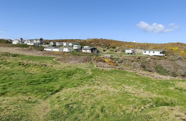
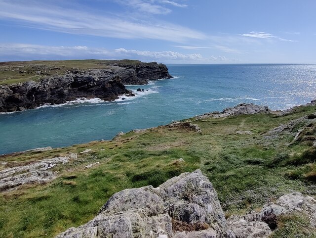
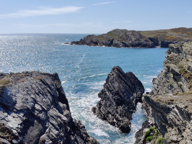
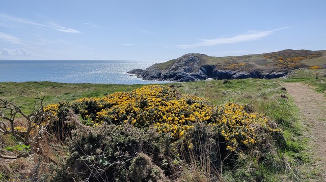
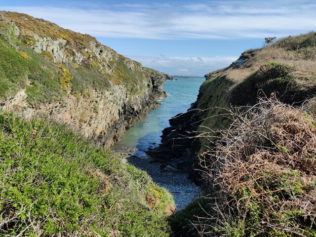
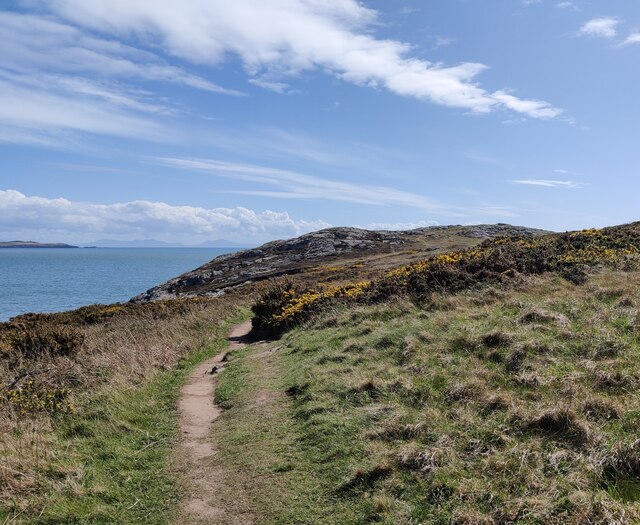
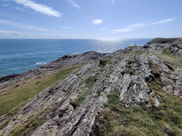
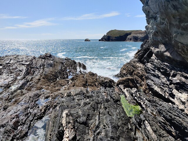
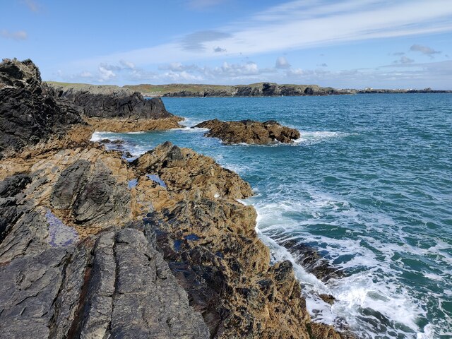
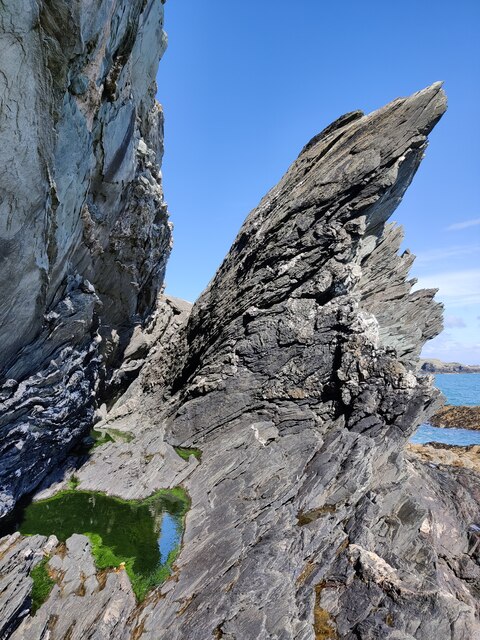
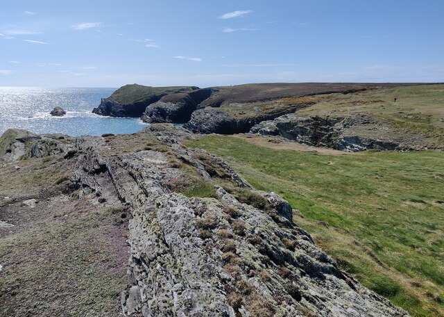
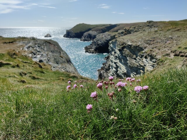
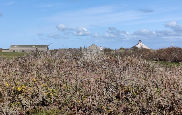
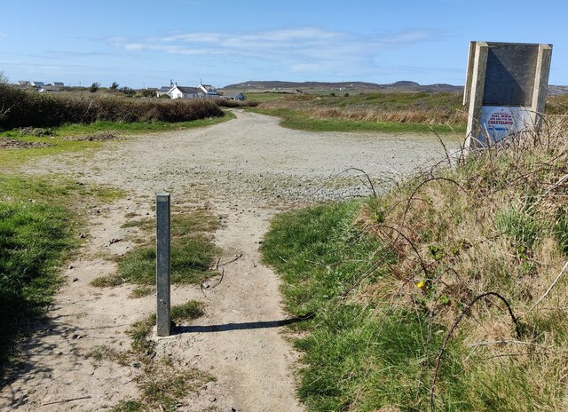
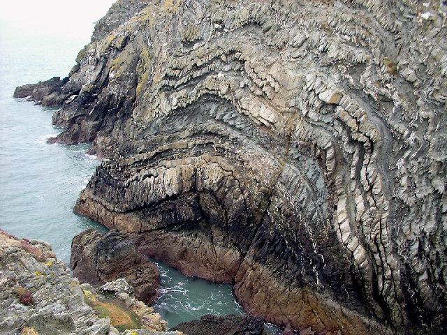
Porthyrhwydau, also known as Porth Trecastell or Cable Bay, is a picturesque beach located on the western coast of Anglesey, an island off the coast of North Wales. Situated near the village of Rhosneigr, this bay offers a stunning stretch of golden sandy beach, crystal-clear waters, and breathtaking views of the surrounding landscape.

The beach at Porthyrhwydau is popular among visitors and locals alike, attracting families, surfers, and nature enthusiasts. It is known for its clean and well-maintained facilities, including ample parking, public toilets, and lifeguard services during the summer months.

With its west-facing orientation, Porthyrhwydau is an ideal spot to enjoy beautiful sunsets over the Irish Sea. The bay is also a hotspot for water sports enthusiasts, as the strong winds and waves make it perfect for activities like surfing, windsurfing, and kiteboarding.

Nature lovers will appreciate the diverse wildlife that can be found in and around Porthyrhwydau. The bay is home to a variety of seabirds, including sandpipers, oystercatchers, and terns. The surrounding area is also known for its rich flora and fauna, with coastal plants such as sea thrift and sea campion adding to the beauty of the landscape.

Porthyrhwydau offers a peaceful and idyllic setting, making it an ideal destination for those looking to escape the hustle and bustle of city life. Whether you're seeking relaxation, adventure, or simply a place to enjoy the natural beauty of Anglesey, Porthyrhwydau is a must-visit location.

If you have any feedback on the listing, please let us know in the comments section below.

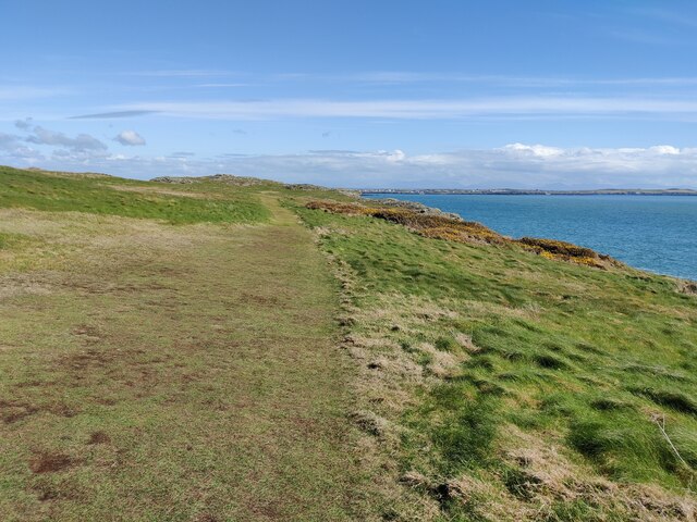
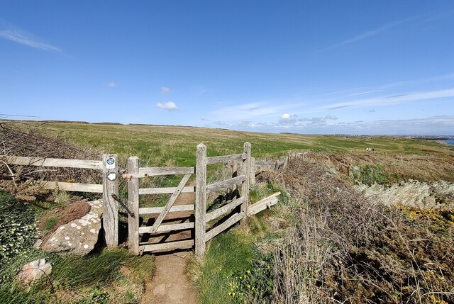
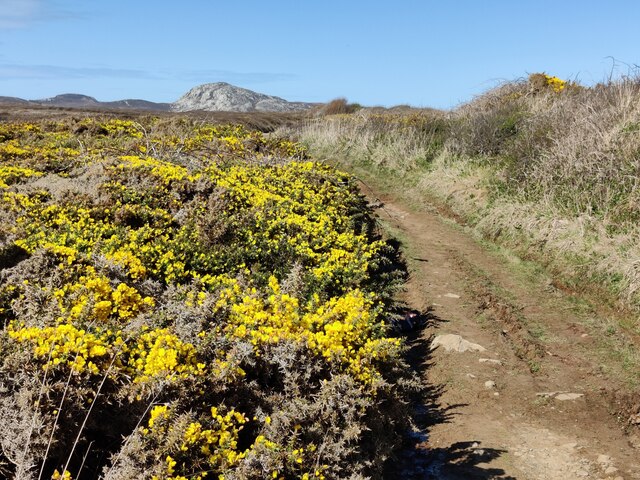
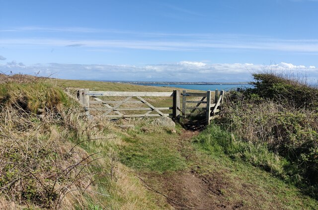
Porthyrhwydau Images

Images are sourced within 2km of 53.285168/-4.659761 or Grid Reference SH2279. Thanks to Geograph Open Source API. All images are credited.

Porth Dafarch Caravan Park The Anglesey Coastal Path (formally the Isle of Anglesey Coastal Path) is a 200-kilometre (124 mi) long-distance footpath around the island of Anglesey in North Wales. The route is part of the Wales Coast Path. The path logo is a flying tern. <a href="https://www.geograph.org.uk/photo/4380990">SH5186 : Anglesey Coastal Path Logo</a>
Wikipedia: <span class="nowrap"><a title="http://en.wikipedia.org/wiki/Anglesey_Coastal_Path" rel="nofollow ugc noopener" href="http://en.wikipedia.org/wiki/Anglesey_Coastal_Path">Link</a><img style="margin-left:2px;" alt="External link" title="External link - shift click to open in new window" src="https://s1.geograph.org.uk/img/external.png" width="10" height="10"/></span>
Porth Dafarch Caravan Park
The Anglesey Coastal Path (formally the Isle of Anglesey Coastal Path) is a 200-kilometre (124 mi) long-distance footpath around the island of Anglesey in North Wales. The route is part of the Wales Coast Path. The path logo is a flying tern. SH5186 : Anglesey Coastal Path Logo Wikipedia: LinkExternal link
Porth Dafarch on the Holy Island coast
Ogof Iron near Porth Dafarch
Anglesey Coast Path near Graig Lŵyd The Anglesey Coastal Path (formally the Isle of Anglesey Coastal Path) is a 200-kilometre (124 mi) long-distance footpath around the island of Anglesey in North Wales. The route is part of the Wales Coast Path. The path logo is a flying tern. <a href="https://www.geograph.org.uk/photo/4380990">SH5186 : Anglesey Coastal Path Logo</a>
Wikipedia: <span class="nowrap"><a title="http://en.wikipedia.org/wiki/Anglesey_Coastal_Path" rel="nofollow ugc noopener" href="http://en.wikipedia.org/wiki/Anglesey_Coastal_Path">Link</a><img style="margin-left:2px;" alt="External link" title="External link - shift click to open in new window" src="https://s1.geograph.org.uk/img/external.png" width="10" height="10"/></span>
Anglesey Coast Path near Graig Lŵyd
The Anglesey Coastal Path (formally the Isle of Anglesey Coastal Path) is a 200-kilometre (124 mi) long-distance footpath around the island of Anglesey in North Wales. The route is part of the Wales Coast Path. The path logo is a flying tern. SH5186 : Anglesey Coastal Path Logo Wikipedia: LinkExternal link
Rocky shoreline near Porth Dafarch
Anglesey Coastal Path at Graig Lŵyd The Anglesey Coastal Path (formally the Isle of Anglesey Coastal Path) is a 200-kilometre (124 mi) long-distance footpath around the island of Anglesey in North Wales. The route is part of the Wales Coast Path. The path logo is a flying tern. <a href="https://www.geograph.org.uk/photo/4380990">SH5186 : Anglesey Coastal Path Logo</a>
Wikipedia: <span class="nowrap"><a title="http://en.wikipedia.org/wiki/Anglesey_Coastal_Path" rel="nofollow ugc noopener" href="http://en.wikipedia.org/wiki/Anglesey_Coastal_Path">Link</a><img style="margin-left:2px;" alt="External link" title="External link - shift click to open in new window" src="https://s1.geograph.org.uk/img/external.png" width="10" height="10"/></span>
Anglesey Coastal Path at Graig Lŵyd
The Anglesey Coastal Path (formally the Isle of Anglesey Coastal Path) is a 200-kilometre (124 mi) long-distance footpath around the island of Anglesey in North Wales. The route is part of the Wales Coast Path. The path logo is a flying tern. SH5186 : Anglesey Coastal Path Logo Wikipedia: LinkExternal link
Coastline at Graig Lŵyd
Rocks at Graig Lŵyd Also known as 'Mackerel Rock', a very popular spot for fishing.
Rocks at Graig Lŵyd
Also known as 'Mackerel Rock', a very popular spot for fishing.
Rocks at Graig Lŵyd Also known as 'Mackerel Rock', a very popular spot for fishing.
Rocks at Graig Lŵyd
Also known as 'Mackerel Rock', a very popular spot for fishing.
Rock formations at Graig Lŵyd
Coastline at Graig Lŵyd
Thrift at Graig Lŵyd
Anglesey Coast Path towards Graig Lŵyd The Anglesey Coastal Path (formally the Isle of Anglesey Coastal Path) is a 200-kilometre (124 mi) long-distance footpath around the island of Anglesey in North Wales. The route is part of the Wales Coast Path. The path logo is a flying tern. <a href="https://www.geograph.org.uk/photo/4380990">SH5186 : Anglesey Coastal Path Logo</a>
Wikipedia: <span class="nowrap"><a title="http://en.wikipedia.org/wiki/Anglesey_Coastal_Path" rel="nofollow ugc noopener" href="http://en.wikipedia.org/wiki/Anglesey_Coastal_Path">Link</a><img style="margin-left:2px;" alt="External link" title="External link - shift click to open in new window" src="https://s1.geograph.org.uk/img/external.png" width="10" height="10"/></span>
Anglesey Coast Path towards Graig Lŵyd
The Anglesey Coastal Path (formally the Isle of Anglesey Coastal Path) is a 200-kilometre (124 mi) long-distance footpath around the island of Anglesey in North Wales. The route is part of the Wales Coast Path. The path logo is a flying tern. SH5186 : Anglesey Coastal Path Logo Wikipedia: LinkExternal link
Gate along the Anglesey Coast Path The Anglesey Coastal Path (formally the Isle of Anglesey Coastal Path) is a 200-kilometre (124 mi) long-distance footpath around the island of Anglesey in North Wales. The route is part of the Wales Coast Path. The path logo is a flying tern. <a href="https://www.geograph.org.uk/photo/4380990">SH5186 : Anglesey Coastal Path Logo</a>
Wikipedia: <span class="nowrap"><a title="http://en.wikipedia.org/wiki/Anglesey_Coastal_Path" rel="nofollow ugc noopener" href="http://en.wikipedia.org/wiki/Anglesey_Coastal_Path">Link</a><img style="margin-left:2px;" alt="External link" title="External link - shift click to open in new window" src="https://s1.geograph.org.uk/img/external.png" width="10" height="10"/></span>
Gate along the Anglesey Coast Path
The Anglesey Coastal Path (formally the Isle of Anglesey Coastal Path) is a 200-kilometre (124 mi) long-distance footpath around the island of Anglesey in North Wales. The route is part of the Wales Coast Path. The path logo is a flying tern. SH5186 : Anglesey Coastal Path Logo Wikipedia: LinkExternal link
Gorse bushes and path at Clybyddiad Holyhead Mountain in the distance.
Gorse bushes and path at Clybyddiad
Holyhead Mountain in the distance.
Gate and path to Graig Lŵyd
Gof-du on Holy Island
Small parking area This small car park is used by anglers visiting the nearby 'Mackerel Rock'.
<a href="https://www.geograph.org.uk/photo/7159788">SH2279 : Rocks at Graig Lŵyd</a>
<a href="https://www.geograph.org.uk/photo/7159793">SH2279 : Rocks at Graig Lŵyd</a>
Small parking area
This small car park is used by anglers visiting the nearby 'Mackerel Rock'. SH2279 : Rocks at Graig Lŵyd SH2279 : Rocks at Graig Lŵyd
Show me another place!

Porthyrhwydau is located at Grid Ref: SH2279 (Lat: 53.285168, Lng: -4.659761)

Unitary Authority: Isle of Anglesey

Police Authority: North Wales

What 3 Words

///arts.wishing.afterglow. Near Holyhead, Isle of Anglesey

Related Wikis

Porth Dafarch

Porth Dafarch is a small bay on the west coast of Anglesey in North Wales. The inlet is on the west side of Holy Island, Anglesey about 2 mi (3.2 km) southwest...

Penrhosfeilw

Penrhosfeilw is a village in the community of Trearddur, Anglesey, Wales, which is 140.1 miles (225.4 km) from Cardiff and 227.5 miles (366.1 km) from...

Penrhos Feilw Standing Stones

The Penrhos Feilw Standing Stones are a pair of standing stones on Holy Island west of Anglesey in north-west Wales. They are thought to date from the...

Holy Island Group

The Holy Island Group is a sequence of metasedimentary rocks of Cambro-Ordovician (Furongian to Tremadocian) age found in northern and western Anglesey...

Holyhead Golf Club

Holyhead Golf Club is a golf course to the southeast of Holyhead, in Anglesey, northwestern Wales. It is a 6090-yard par-71 course, which was originally...
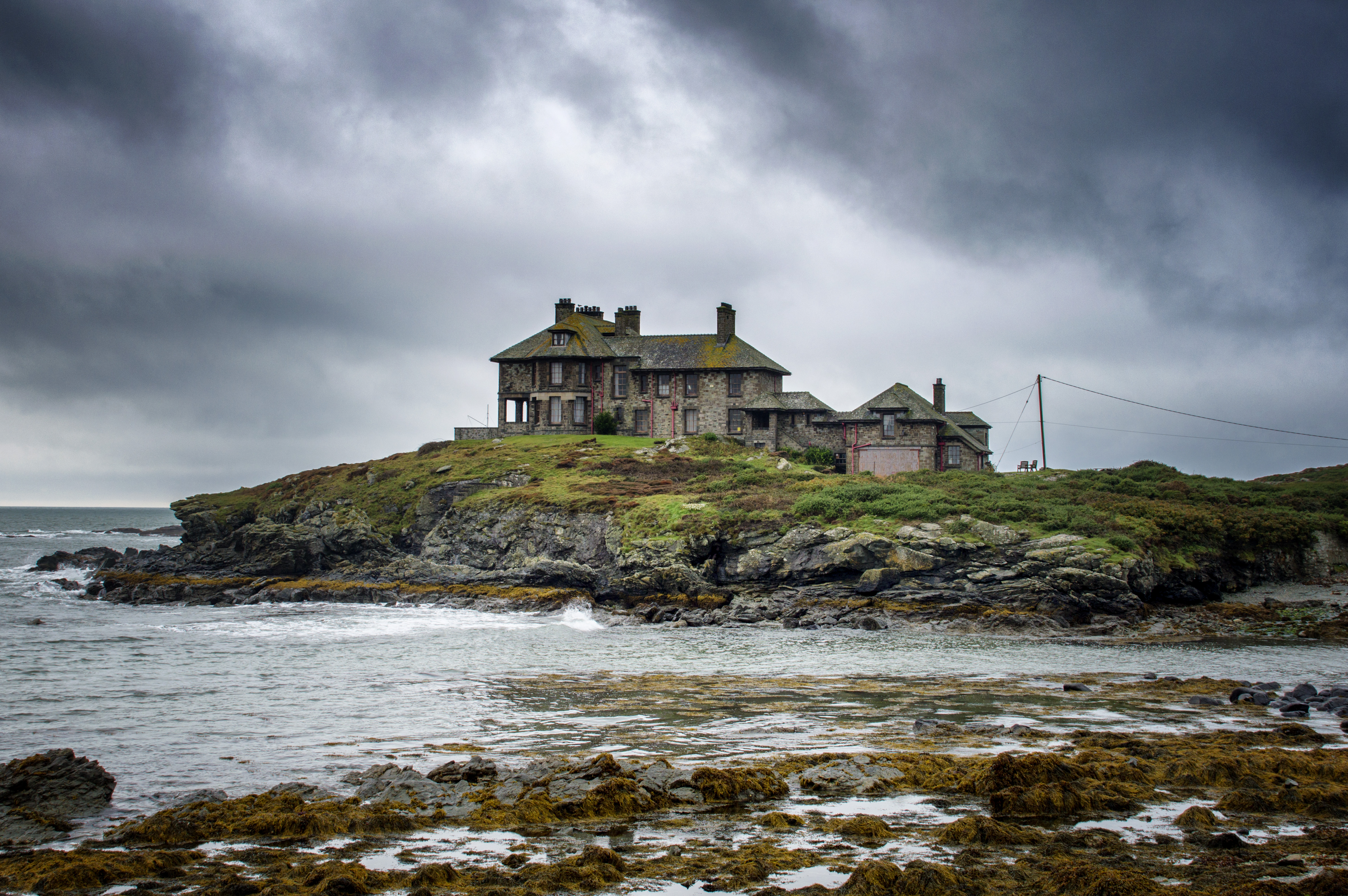
Craig y Mor

Craig y Mor is a house overlooking Treaddur Bay on Anglesey, Wales. The house dates from the early 20th century and has always been privately owned. It...

Holyhead Hotspur F.C.

Holyhead Hotspur Football Club (Welsh: Clwb Pêl-droed Hotspur Caergybi) is a football club based in Holyhead, Anglesey. They currently play in the Ardal...

Isallt Bach

Isallt Bach is a hamlet in the community of Trearddur, Anglesey, Wales, which is 138.7 miles (223.3 km) from Cardiff and 225.8 miles (363.4 km) from London...

Nearby Amenities

Located within 500m of 53.285168,-4.659761
Source: PGS
Lat/Long: 53.285847/-4.6523842
Source: PGS
Lat/Long: 53.2867569/-4.6528801
Source: PGS
Lat/Long: 53.2864678/-4.6531621
Source: PGS
Lat/Long: 53.2860262/-4.6545157
Source: PGS
Lat/Long: 53.2863187/-4.6546632
Source: PGS
Lat/Long: 53.2861106/-4.6555531
Source: PGS
Lat/Long: 53.2860188/-4.655991
Source: PGS
Lat/Long: 53.2861712/-4.657652
Source: PGS
Lat/Long: 53.2859656/-4.65889
Source: PGS
Lat/Long: 53.2857452/-4.6604682
Source: PGS
Lat/Long: 53.2851659/-4.6603805
Source: PGS
Lat/Long: 53.2848593/-4.6600394
Source: PGS
Lat/Long: 53.2839455/-4.6599004
Source: PGS
Lat/Long: 53.2836823/-4.6602105
Source: PGS
Lat/Long: 53.283458/-4.6602123
Source: PGS
Lat/Long: 53.2831269/-4.6610362
Source: PGS
Lat/Long: 53.2834606/-4.661724
Source: PGS
Lat/Long: 53.2834343/-4.6619912
Source: PGS
Lat/Long: 53.2834163/-4.6634763
Source: PGS
Lat/Long: 53.2833608/-4.6638721
Source: PGS
Lat/Long: 53.2831712/-4.6642609
Source: PGS
Lat/Long: 53.2829459/-4.6656571
Barrier: kissing_gate
Lat/Long: 53.2839837/-4.6659437
Barrier: kissing_gate
Lat/Long: 53.2861158/-4.6612259
Barrier: stile
Lat/Long: 53.2872447/-4.6535258
Porth Dafarch
Natural: bay
Lat/Long: 53.2861328/-4.6528253
Porth Morgan
Natural: bay
Lat/Long: 53.2857126/-4.655601
Porthyrhwydau
Natural: bay
Lat/Long: 53.2853026/-4.6598856
Ogof Iron
Natural: cave_entrance
Lat/Long: 53.2859526/-4.6548029
Material: wood
Power: pole
Lat/Long: 53.2871737/-4.6658383
Power: pole
Lat/Long: 53.2869689/-4.6650081
Copper Mine Creek
Natural: bay
Lat/Long: 53.286094/-4.6589021
The data included in this document is from www.openstreetmap.org. The data is made available under ODbL.

Have you been to Porthyrhwydau?

Leave your review of Porthyrhwydau below (or comments, questions and feedback).