Great Barton Strand

Bay in Cornwall

England

Great Barton Strand

Footbridge over stream and waterfall at Scrade The stream takes a sudden plunge down to the beach just beyond this point. The South West Coast Path climbs very steeply into and out of this small valley south of Chipman Point.
Footbridge over stream and waterfall at Scrade Credit: David Martin

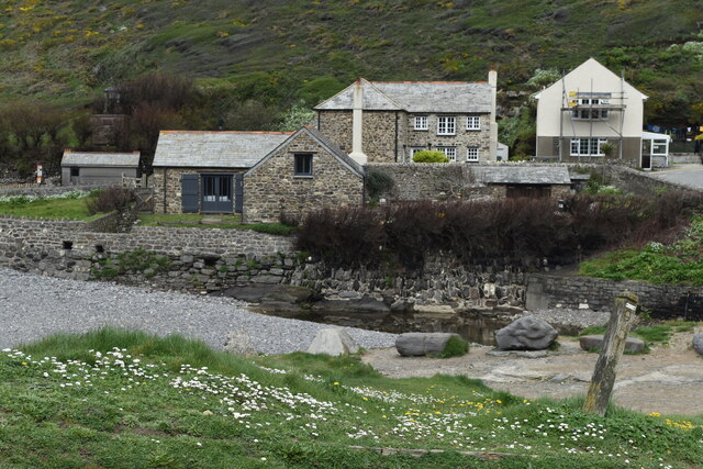
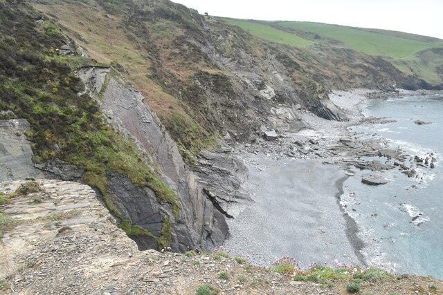
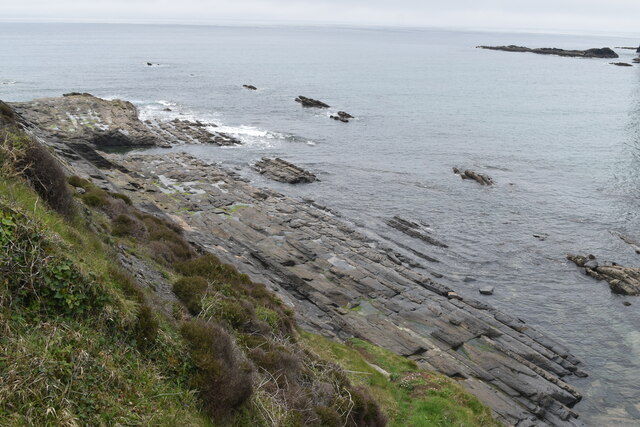
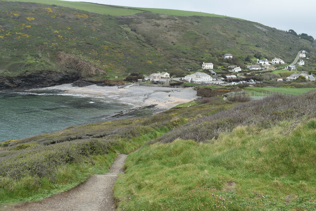
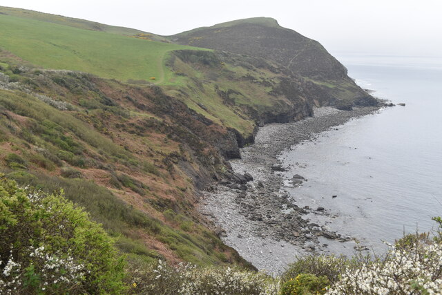
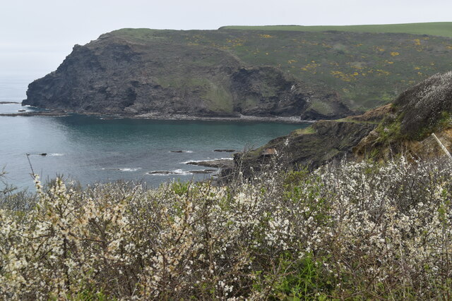
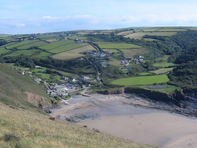
Great Barton Strand is a picturesque coastal bay located in Cornwall, England. Situated on the southern coast of the county, it is renowned for its natural beauty and pristine sandy beach. The bay is nestled between towering cliffs, providing a stunning backdrop for visitors to enjoy.

The beach at Great Barton Strand stretches for approximately one kilometer, offering ample space for sunbathing, picnicking, and beach games. The fine golden sand is soft underfoot and perfect for building sandcastles or simply relaxing in the sun. The clear blue waters are inviting for swimmers and water sports enthusiasts alike.

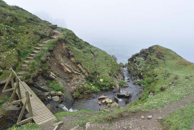
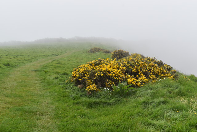
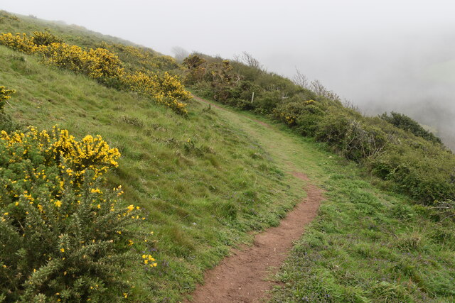
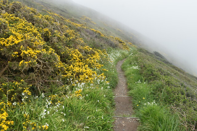
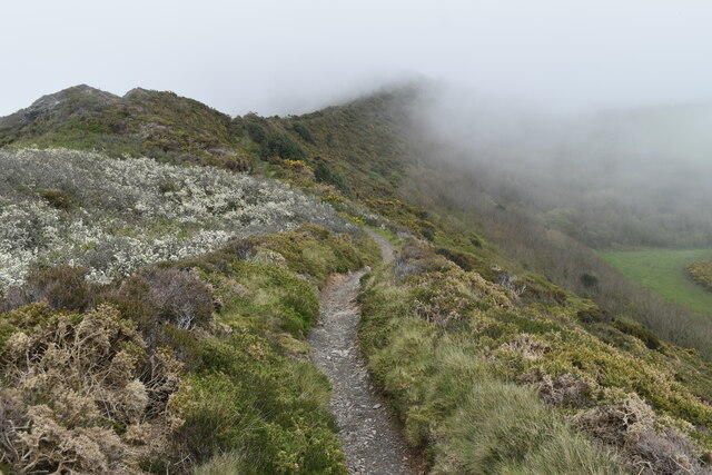
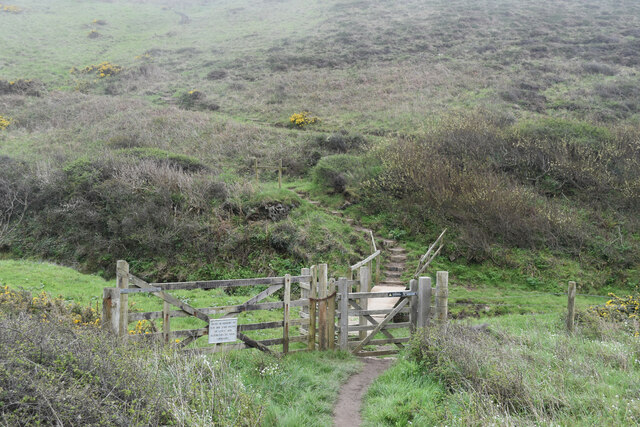
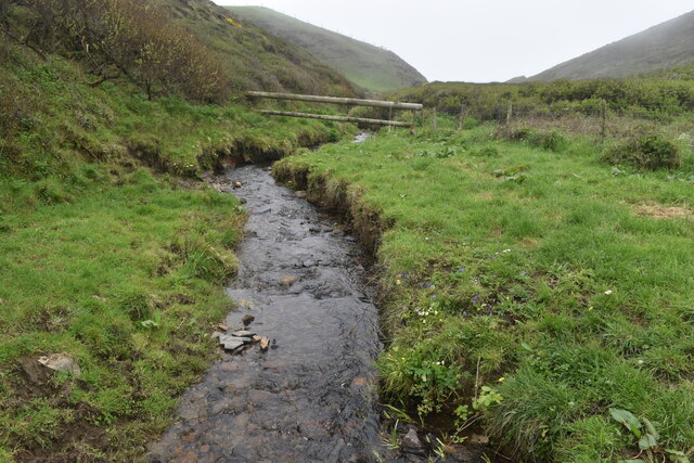
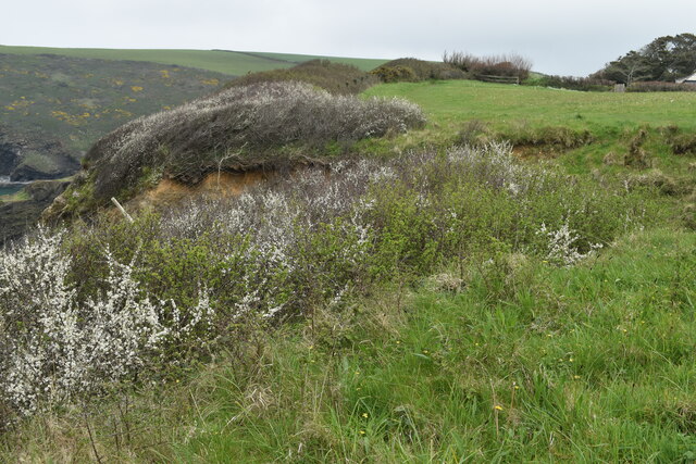
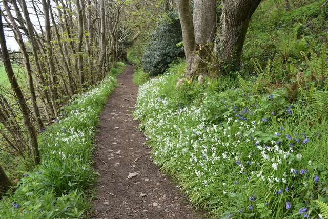
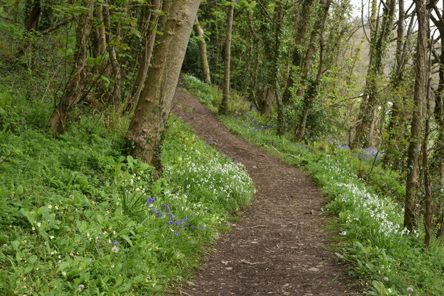
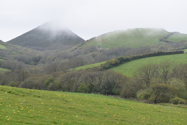
The bay is surrounded by stunning natural landscapes, with rugged cliffs and rolling hills providing a sense of tranquility and seclusion. It is a haven for wildlife, with various seabirds and marine species often spotted in the area. The coastal path that runs along the cliffs offers breathtaking views of the bay and is a popular route for hikers and nature lovers.

Great Barton Strand is also known for its excellent surfing conditions, attracting surfers of all levels. The consistent waves and relatively uncrowded nature of the beach make it an ideal spot for those looking to catch some waves.

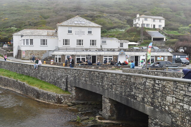
The bay is easily accessible by road, with ample parking available nearby. Facilities such as toilets, cafes, and shops can be found in the surrounding area, ensuring visitors have everything they need for a day at the beach.

Overall, Great Barton Strand is a hidden gem on Cornwall's coast, offering a perfect blend of natural beauty, recreational activities, and a peaceful ambiance.

If you have any feedback on the listing, please let us know in the comments section below.

Great Barton Strand Images

Images are sourced within 2km of 50.746224/-4.6371438 or Grid Reference SX1497. Thanks to Geograph Open Source API. All images are credited.

Footbridge over stream and waterfall at Scrade The stream takes a sudden plunge down to the beach just beyond this point. The South West Coast Path climbs very steeply into and out of this small valley south of Chipman Point.
Footbridge over stream and waterfall at Scrade
The stream takes a sudden plunge down to the beach just beyond this point. The South West Coast Path climbs very steeply into and out of this small valley south of Chipman Point.
On the coastal path at Cleave A sea fog completely obscuring the view over the cliff edge.
On the coastal path at Cleave
A sea fog completely obscuring the view over the cliff edge.
On the coastal path near Cleave The path turns briefly inland in order to descend onto the ridge leading to Castle Point.
On the coastal path near Cleave
The path turns briefly inland in order to descend onto the ridge leading to Castle Point.
On the coastal path above Crackington Haven Sea fog obscures the view of the village below.
On the coastal path above Crackington Haven
Sea fog obscures the view of the village below.
On the ridge between Castle Point and Cleave Here looking inland, away from the Castle Point summit.
On the ridge between Castle Point and Cleave
Here looking inland, away from the Castle Point summit.
Footbridge carrying coastal path over stream below Castle Point
Stream in valley south of Castle Point This stream descends over a waterfall onto Little Barton Strand.
Stream in valley south of Castle Point
This stream descends over a waterfall onto Little Barton Strand.
The Coombe Barton Inn, Crackington Haven
Houses overlooking the river mouth, Crackington Haven
Coast southwest of Bray's Point
Wave-cut platform beneath Bray's Point
Crackington Haven
Crackington Haven
Cliffs leading to Cambeak Cambeak is a prominent headland seen from many points between Bude and Boscastle.
Cliffs leading to Cambeak
Cambeak is a prominent headland seen from many points between Bude and Boscastle.
Clifftop field southwest of Crackington Haven The coast path passes through this field around a sizeable landslip which has left fenceposts dangling in mid-air.
Clifftop field southwest of Crackington Haven
The coast path passes through this field around a sizeable landslip which has left fenceposts dangling in mid-air.
Pencannow Point, seen across the mouth of Crackington Haven
Footpath in valley near Congdons Bridge
Path climbing valley side near Congdons Bridge
Sea fog rising over coastal summits near Cleave The South West Coast Path crosses most of the skyline in this image, which includes both <a href="https://www.geograph.org.uk/photo/7473489">SX1597 : On the coastal path near Cleave</a> and <a href="https://www.geograph.org.uk/photo/7473498">SX1497 : On the ridge between Castle Point and Cleave</a>. 100m cliffs drop away on the far side.
Sea fog rising over coastal summits near Cleave
The South West Coast Path crosses most of the skyline in this image, which includes both SX1597 : On the coastal path near Cleave and SX1497 : On the ridge between Castle Point and Cleave. 100m cliffs drop away on the far side.
Show me another place!

Great Barton Strand is located at Grid Ref: SX1497 (Lat: 50.746224, Lng: -4.6371438)

Unitary Authority: Cornwall

Police Authority: Devon and Cornwall

What 3 Words

///marsh.angry.skewed. Near Jacobstow, Cornwall

Related Wikis

Crackington Haven

Crackington Haven (Cornish: Porthkragen, meaning "sandstone cove") is a coastal village in Cornwall, England, United Kingdom. It is in the civil parish...

St Gennys

St Gennys (Standard Written Form: S. Gwynnas) is a coastal civil parish and small settlement in north Cornwall, England, United Kingdom. The village of...

Mineshope

Mineshope is a hamlet in the parish of St Gennys, Cornwall, England. == References ==

Dizzard

Dizzard (Cornish: Dyserth, meaning very steep) is an area, in the civil parish of St Gennys, Cornwall, containing five farms (or former farms). On the...

Related Videos

Crackington and St Gennys headland walk

late April 2021 on a calm warm sunny day.

VLOG 36 - Full week in Boscastle, Crackington Haven coastal hike, friendly lambs & angry bulls

Subscribe & Turn on Notifications for more! ❤ Camera that I filmed this video on - https://bit.ly/38bv2xP ❤ WHERE ELSE TO FIND ...

Crackington Haven Bude Cornwall

Music called "Wavelength" written by Stu Hannaford Saltash Cornwall UK copyright.

Crackington Haven Beach, Cornwall

Crackington Haven Beach is a sandy, and partly rocky, beach situated in North Cornwall, along the coast between Boscastle and ...

Nearby Amenities

Located within 500m of 50.746224,-4.6371438
Source: PGS
Lat/Long: 50.745681/-4.6397528
Source: PGS
Lat/Long: 50.74448/-4.6389616
Source: PGS
Lat/Long: 50.744423/-4.6389156
Source: PGS
Lat/Long: 50.7425426/-4.6342314
Source: PGS
Lat/Long: 50.7424379/-4.6338784
Barrier: kissing_gate
Lat/Long: 50.744658/-4.6341591
Barrier: kissing_gate
Lat/Long: 50.7447673/-4.6334795
Barrier: kissing_gate
Foot: yes
Lat/Long: 50.7472659/-4.6313934
Bench
Backrest: no
Lat/Long: 50.7434318/-4.6341152
Barrier: kissing_gate
Lat/Long: 50.744537/-4.6358868
Bench
Backrest: yes
Survey Date: 2023-02-05
Lat/Long: 50.7444698/-4.6358519
Bench
Backrest: yes
Survey Date: 2023-02-05
Lat/Long: 50.7425628/-4.6331391
Bench
Backrest: no
Survey Date: 2023-02-05
Lat/Long: 50.744571/-4.6377141
Pencannow Point
Alt Name: Penkenna Point
Tourism: viewpoint
Lat/Long: 50.7445295/-4.637692
Barrier: kissing_gate
Lat/Long: 50.7454462/-4.633214
The data included in this document is from www.openstreetmap.org. The data is made available under ODbL.

Have you been to Great Barton Strand?

Leave your review of Great Barton Strand below (or comments, questions and feedback).