Castle Point

Coastal Feature, Headland, Point in Cornwall

England

Castle Point

A sea mist on the woods below Dizzard Farm Although the sunlight was struggling through here, 750m inland, at the cliff edge the visibility was barely 100m.
A sea mist on the woods below Dizzard Farm Credit: David Martin

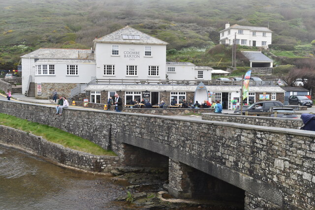
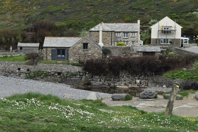
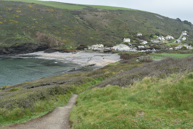
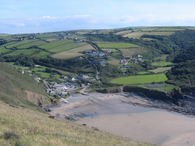
Castle Point is a prominent coastal feature located on the southwestern tip of Cornwall, England. It is a stunning headland that juts out into the Atlantic Ocean, offering breathtaking panoramic views of the surrounding area. The point is situated near the village of Port Isaac and is a popular destination for both locals and tourists alike.

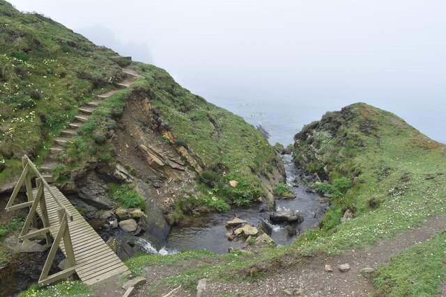
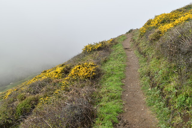
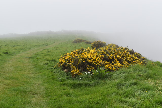
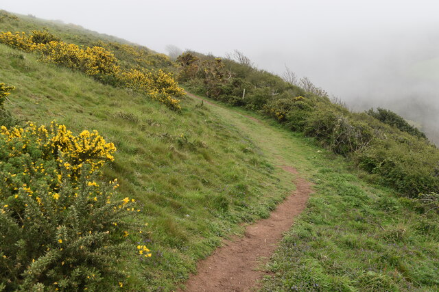
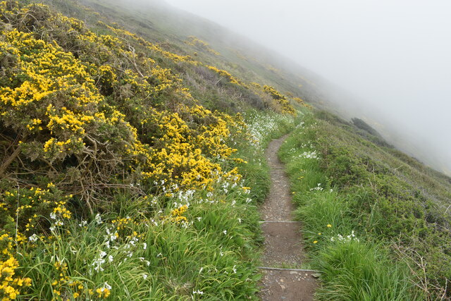
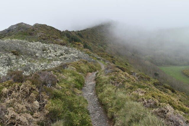
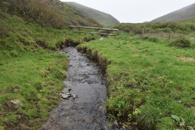
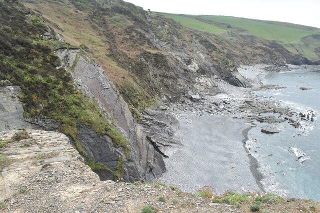
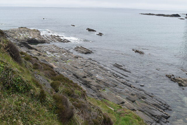
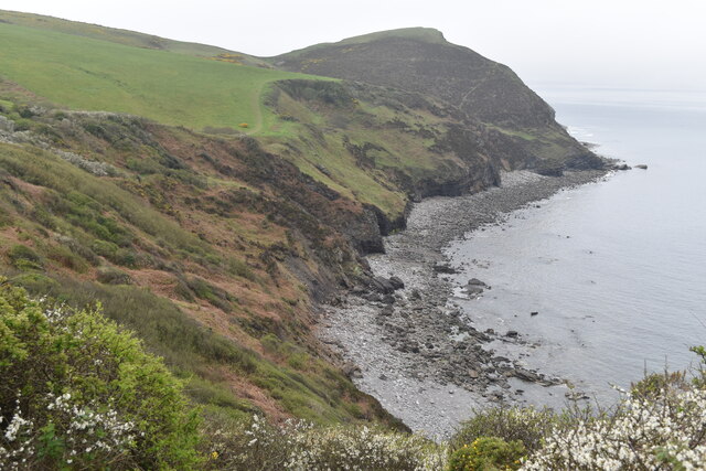
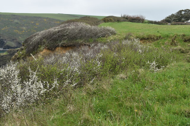
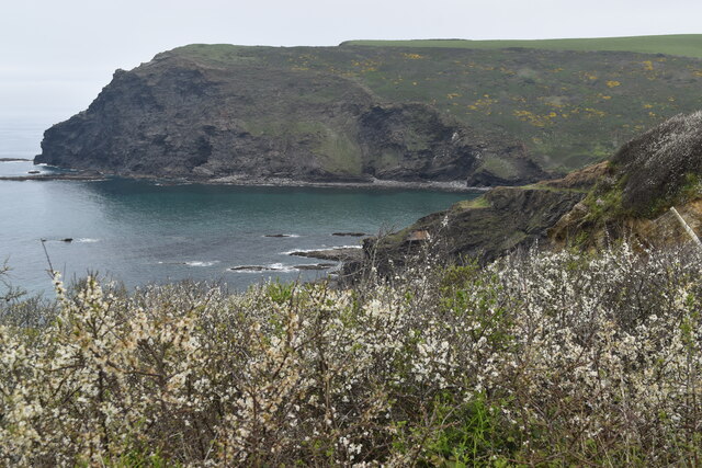
At Castle Point, visitors are treated to rugged cliffs that tower above the crashing waves below. The headland is composed of a mixture of slate and granite, giving it a distinct and visually striking appearance. The cliffs are adorned with vibrant green vegetation, adding to the natural beauty of the area.

The point derives its name from the ruins of an ancient castle that once stood atop the headland. The remains of the castle, believed to date back to the 12th century, are still visible today, adding a touch of history to the already captivating landscape.

Castle Point is a haven for wildlife enthusiasts, as it is home to a variety of seabirds, including gannets, puffins, and razorbills. The surrounding waters are also teeming with marine life, making it a popular spot for fishing and birdwatching.

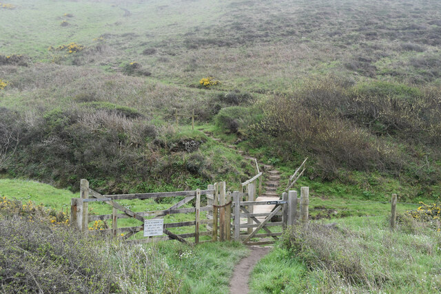
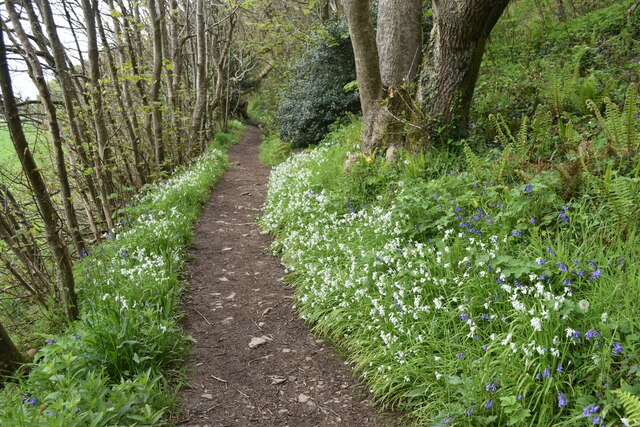
The headland is easily accessible by foot, with several coastal paths leading to its summit. This allows visitors to explore the area at their own pace and take in the breathtaking views from different vantage points.

Overall, Castle Point is a remarkable coastal feature that offers a unique blend of natural beauty, history, and wildlife. It encapsulates the essence of Cornwall's rugged coastline and provides an unforgettable experience for those who venture to its shores.

If you have any feedback on the listing, please let us know in the comments section below.

Castle Point Images

Images are sourced within 2km of 50.748874/-4.6297363 or Grid Reference SX1497. Thanks to Geograph Open Source API. All images are credited.

A sea mist on the woods below Dizzard Farm Although the sunlight was struggling through here, 750m inland, at the cliff edge the visibility was barely 100m.
A sea mist on the woods below Dizzard Farm
Although the sunlight was struggling through here, 750m inland, at the cliff edge the visibility was barely 100m.
Footbridge over stream and waterfall at Scrade The stream takes a sudden plunge down to the beach just beyond this point. The South West Coast Path climbs very steeply into and out of this small valley south of Chipman Point.
Footbridge over stream and waterfall at Scrade
The stream takes a sudden plunge down to the beach just beyond this point. The South West Coast Path climbs very steeply into and out of this small valley south of Chipman Point.
South West Coast Path in the fog, above Scrade This is the view above <a href="https://www.geograph.org.uk/photo/7473452">SX1598 : Footbridge over stream and waterfall at Scrade</a>. The coastal path descends via a series of zigzags, clearly intended to reduce erosion but also providing a much safer descent than the direct route close to the cliff edge.  The view from the edge would look something like <a href="https://www.geograph.org.uk/photo/501299">SX1598 : Coast path at Scrade Water</a>, if we could see it.
South West Coast Path in the fog, above Scrade
This is the view above SX1598 : Footbridge over stream and waterfall at Scrade. The coastal path descends via a series of zigzags, clearly intended to reduce erosion but also providing a much safer descent than the direct route close to the cliff edge. The view from the edge would look something like SX1598 : Coast path at Scrade Water, if we could see it.
On the coastal path at Cleave A sea fog completely obscuring the view over the cliff edge.
On the coastal path at Cleave
A sea fog completely obscuring the view over the cliff edge.
On the coastal path near Cleave The path turns briefly inland in order to descend onto the ridge leading to Castle Point.
On the coastal path near Cleave
The path turns briefly inland in order to descend onto the ridge leading to Castle Point.
On the coastal path above Crackington Haven Sea fog obscures the view of the village below.
On the coastal path above Crackington Haven
Sea fog obscures the view of the village below.
On the ridge between Castle Point and Cleave Here looking inland, away from the Castle Point summit.
On the ridge between Castle Point and Cleave
Here looking inland, away from the Castle Point summit.
Footbridge carrying coastal path over stream below Castle Point
Stream in valley south of Castle Point This stream descends over a waterfall onto Little Barton Strand.
Stream in valley south of Castle Point
This stream descends over a waterfall onto Little Barton Strand.
The Coombe Barton Inn, Crackington Haven
Houses overlooking the river mouth, Crackington Haven
Coast southwest of Bray's Point
Wave-cut platform beneath Bray's Point
Crackington Haven
Crackington Haven
Cliffs leading to Cambeak Cambeak is a prominent headland seen from many points between Bude and Boscastle.
Cliffs leading to Cambeak
Cambeak is a prominent headland seen from many points between Bude and Boscastle.
Clifftop field southwest of Crackington Haven The coast path passes through this field around a sizeable landslip which has left fenceposts dangling in mid-air.
Clifftop field southwest of Crackington Haven
The coast path passes through this field around a sizeable landslip which has left fenceposts dangling in mid-air.
Pencannow Point, seen across the mouth of Crackington Haven
Footpath in valley near Congdons Bridge
Show me another place!

Castle Point is located at Grid Ref: SX1497 (Lat: 50.748874, Lng: -4.6297363)

Unitary Authority: Cornwall

Police Authority: Devon and Cornwall

What 3 Words

///trifling.replays.restore. Near Jacobstow, Cornwall

Related Wikis

St Gennys

St Gennys (Standard Written Form: S. Gwynnas) is a coastal civil parish and small settlement in north Cornwall, England, United Kingdom. The village of...

Crackington Haven

Crackington Haven (Cornish: Porthkragen, meaning "sandstone cove") is a coastal village in Cornwall, England, United Kingdom. It is in the civil parish...

Dizzard

Dizzard (Cornish: Dyserth, meaning very steep) is an area, in the civil parish of St Gennys, Cornwall, containing five farms (or former farms). On the...

Coxford, Cornwall

Coxford is a hamlet in the parish of St Gennys (where the 2011 census population was included ) in north Cornwall, England. == References ==

Nearby Amenities

Located within 500m of 50.748874,-4.6297363
Barrier: kissing_gate
Foot: yes
Lat/Long: 50.7472659/-4.6313934
Barrier: kissing_gate
Lat/Long: 50.7454462/-4.633214
The data included in this document is from www.openstreetmap.org. The data is made available under ODbL.

Have you been to Castle Point?

Leave your review of Castle Point below (or comments, questions and feedback).