Slouchnamorroch Bay

Bay in Wigtownshire

Scotland

Slouchnamorroch Bay

Southbound on the Rhins of Galloway Rockhopping on the way into the mouth of Clanyard bay
Southbound on the Rhins of Galloway Credit: Tony Page

Slouchnamorroch Bay is a picturesque coastal bay located in Wigtownshire, a district in the Dumfries and Galloway region of southwestern Scotland. Situated on the western coast of the country, it is nestled between the towns of Port William and Monreith.

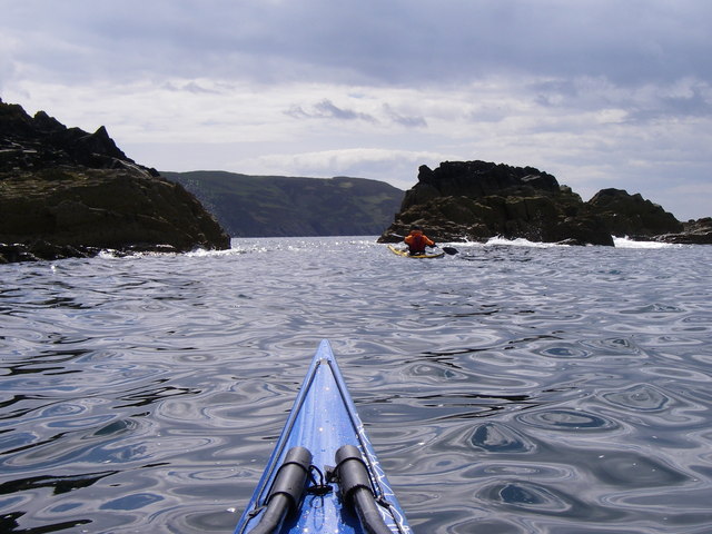
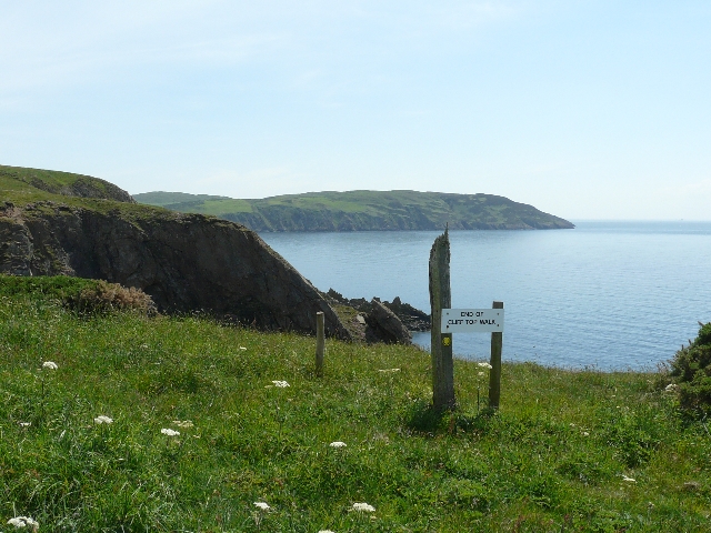
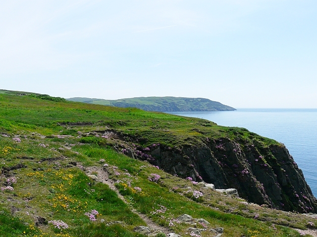
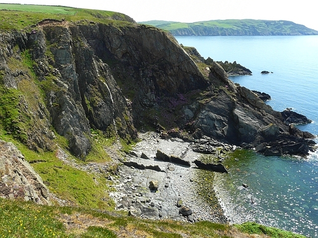
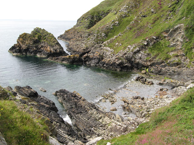
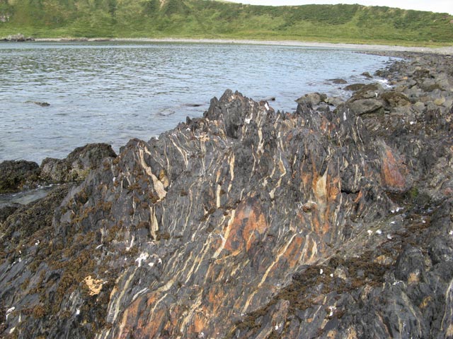
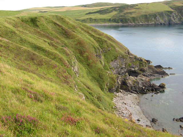
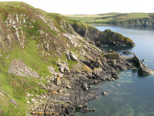
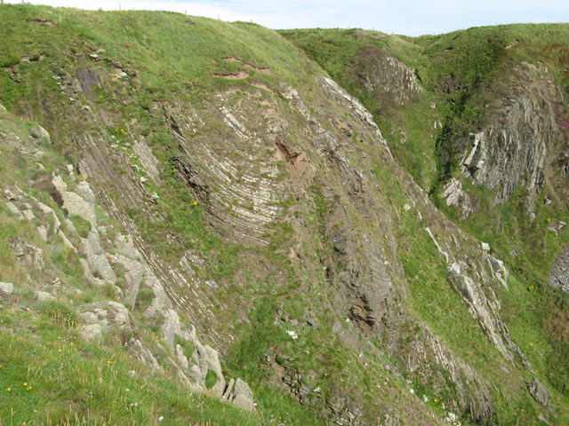
The bay stretches over an approximate length of 2 kilometers and is characterized by its sandy shores, rocky cliffs, and stunning views of the Irish Sea. The bay is a popular destination for visitors and locals alike, offering a tranquil and peaceful atmosphere for relaxation and enjoyment.

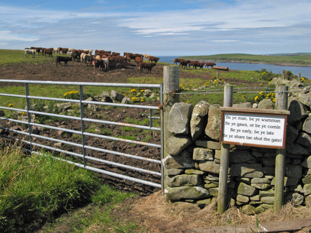
The natural beauty of Slouchnamorroch Bay is enhanced by the surrounding landscape, which features rolling hills and verdant fields. The bay is home to a diverse range of wildlife, including various species of birds, seals, and occasionally dolphins. Birdwatchers often flock to the area to catch glimpses of rare and migratory birds that visit the bay.

The bay's proximity to the nearby towns of Port William and Monreith makes it easily accessible for visitors. It also offers a range of recreational activities, such as swimming, fishing, and beachcombing. The bay is particularly renowned for its fishing opportunities, with local anglers often casting their lines in hopes of catching salmon, sea trout, and various other species.

Overall, Slouchnamorroch Bay is a picturesque and serene location that showcases the natural beauty of Scotland's western coastline. Its sandy beaches, rocky cliffs, and diverse wildlife make it a popular destination for nature lovers and those seeking a peaceful retreat.

If you have any feedback on the listing, please let us know in the comments section below.

Slouchnamorroch Bay Images

Images are sourced within 2km of 54.711843/-4.961771 or Grid Reference NX0939. Thanks to Geograph Open Source API. All images are credited.

Southbound on the Rhins of Galloway Rockhopping on the way into the mouth of Clanyard bay
Southbound on the Rhins of Galloway
Rockhopping on the way into the mouth of Clanyard bay
End of Clifftop Walk from Port Logan It is rare to see a yellow waymarker pointing straight down.  This one means 'turn back'.
There is no easy way beyond this point.
End of Clifftop Walk from Port Logan
It is rare to see a yellow waymarker pointing straight down. This one means 'turn back'. There is no easy way beyond this point.
Path from Cairnywellan Head An unofficial footpath that comes to an abrupt halt a little further south <a href="https://www.geograph.org.uk/photo/838279">NX0939 : End of Clifftop Walk from Port Logan</a> .
Path from Cairnywellan Head
An unofficial footpath that comes to an abrupt halt a little further south NX0939 : End of Clifftop Walk from Port Logan .
Cliffs overlooking Slate Heugh Bay The rock is greywacke of Early Silurian age.
Cliffs overlooking Slate Heugh Bay
The rock is greywacke of Early Silurian age.
Slate Heugh Bay The cliffs here are composed of greywacke, a sedimentary rock, laid down in the Early Silurian period. In the bay a jagged line of upstanding rock crosses the shore from the sea, and appears to continue as a white line all the way up the cliff. This is a later intrusion of hard igneous rock, and is mentioned in the British Geological Survey's excursion guide to the area <span class="nowrap"><a title="http://shop.bgs.ac.uk/Bookshop/product.cfm?p_id=GSWS" rel="nofollow ugc noopener" href="http://shop.bgs.ac.uk/Bookshop/product.cfm?p_id=GSWS">Link</a><img style="margin-left:2px;" alt="External link" title="External link - shift click to open in new window" src="https://s1.geograph.org.uk/img/external.png" width="10" height="10"/></span> as "a cross-cutting, Tertiary dolerite dyke".
Slate Heugh Bay
The cliffs here are composed of greywacke, a sedimentary rock, laid down in the Early Silurian period. In the bay a jagged line of upstanding rock crosses the shore from the sea, and appears to continue as a white line all the way up the cliff. This is a later intrusion of hard igneous rock, and is mentioned in the British Geological Survey's excursion guide to the area LinkExternal link as "a cross-cutting, Tertiary dolerite dyke".
Carlin House Bay A small bay eroded along the strike of the rather deformed rocks of the turbiditic greywackes of the Clanyard Bay Formation (Gala Group, Silurian). Much interest attaches to the deformation style and stratigraphy of this area, but I did not climb down from the grassy col between the larger and smaller bays.
Carlin House Bay
A small bay eroded along the strike of the rather deformed rocks of the turbiditic greywackes of the Clanyard Bay Formation (Gala Group, Silurian). Much interest attaches to the deformation style and stratigraphy of this area, but I did not climb down from the grassy col between the larger and smaller bays.
Farm quarry A convenient source of easily-worked stone. This band of slatey rock, part of the Silurian Gala Group of greywackes, runs across the Rhins and is worked in several places. See <a href="https://www.geograph.org.uk/photo/3141425">NX1139 : Quarry lakes</a> for another. In this image the bedding of the rocks is very clear, steep and northerly, and that is a regional trend reflecting the collision of continents in the Caledonian orogeny.
Farm quarry
A convenient source of easily-worked stone. This band of slatey rock, part of the Silurian Gala Group of greywackes, runs across the Rhins and is worked in several places. See NX1139 : Quarry lakes for another. In this image the bedding of the rocks is very clear, steep and northerly, and that is a regional trend reflecting the collision of continents in the Caledonian orogeny.
Please shut the gate An excellent reminder in colloqial Scots that closing the gate behind you is important under all circumstances. The animals that occasion the reminder are clustered on the hill overlooking Port Logan.
Please shut the gate
An excellent reminder in colloqial Scots that closing the gate behind you is important under all circumstances. The animals that occasion the reminder are clustered on the hill overlooking Port Logan.
Junction of the tracks The way-marked track from Port Logan comes in from the left here, and is signposted towards Cowans. Behind the camera stretches the route to Clanyard and Inshanks, which is the old road.
Junction of the tracks
The way-marked track from Port Logan comes in from the left here, and is signposted towards Cowans. Behind the camera stretches the route to Clanyard and Inshanks, which is the old road.
Track to Clanyard Beyond the limit of fields belonging to Cowans, the track sees little use, but it is a fine walking route. Barncorkrie Moor and Cairn Fell make the far horizon.
Track to Clanyard
Beyond the limit of fields belonging to Cowans, the track sees little use, but it is a fine walking route. Barncorkrie Moor and Cairn Fell make the far horizon.
Track to Port Logan Looking towards Port Logan on the waymarked track that is the old road from Inshanks and Clanyard. Here it just clips the corner of another square as it makes its lonely way through the fields.
Track to Port Logan
Looking towards Port Logan on the waymarked track that is the old road from Inshanks and Clanyard. Here it just clips the corner of another square as it makes its lonely way through the fields.
Deformed rocks An outcrop of highly deformed greywacke which is intruded by felsite dykes. These rugged rocks drop steeply to the sea from a pronounced feature known as Carlin House.
Deformed rocks
An outcrop of highly deformed greywacke which is intruded by felsite dykes. These rugged rocks drop steeply to the sea from a pronounced feature known as Carlin House.
Raised  beach The west coast of the Rhins only has isolated lengths of raised beach, and this is a quite spectacular section. Another fine length is at Ardwell bay, <a href="https://www.geograph.org.uk/photo/3128116">NX0745 : Raised beach</a>. The great antiquity of the formation is indicated by the prolific growth of lichen on the cobbles, which shows that it is never moved by wave action. It is distressing to see that this very special formation is being dug for hardcore and destroyed.
Raised beach
The west coast of the Rhins only has isolated lengths of raised beach, and this is a quite spectacular section. Another fine length is at Ardwell bay, NX0745 : Raised beach. The great antiquity of the formation is indicated by the prolific growth of lichen on the cobbles, which shows that it is never moved by wave action. It is distressing to see that this very special formation is being dug for hardcore and destroyed.
Moffat shales Between the major blocks of tilted strata it is common to find outcrops of the Moffat Shales, of Silurian age as are the adjoining Gala and Cairnharrow Group greywackes. It appears that these weak rocks formed detachment surfaces along which there was severe deformation and transport of kilometre-scale blocks of strata. Clanyard Bay was formed by erosion of shattered rock adjacent to one of these major faults, and the striped appearance of this shale outcrop is due to intense deformation and injection of quartz veins into fractures which run parallel to the main fault.
Moffat shales
Between the major blocks of tilted strata it is common to find outcrops of the Moffat Shales, of Silurian age as are the adjoining Gala and Cairnharrow Group greywackes. It appears that these weak rocks formed detachment surfaces along which there was severe deformation and transport of kilometre-scale blocks of strata. Clanyard Bay was formed by erosion of shattered rock adjacent to one of these major faults, and the striped appearance of this shale outcrop is due to intense deformation and injection of quartz veins into fractures which run parallel to the main fault.
Calliedown Bay Looking southwards into this unapproachable bay, with Clanyard Bay behind. Streams are eroding gullies into the soft, glacial deposits above the bedrock.
Calliedown Bay
Looking southwards into this unapproachable bay, with Clanyard Bay behind. Streams are eroding gullies into the soft, glacial deposits above the bedrock.
Heathery slope A wonderful patchwork of colours, with heather blooming among dead bracken fronds and dried grasses.
Heathery slope
A wonderful patchwork of colours, with heather blooming among dead bracken fronds and dried grasses.
Strones Bay Patches of rockfall, scree and huge boulders of probable glacial origin make a superb rocky ensemble, with Clanyard Bay to the south.
Strones Bay
Patches of rockfall, scree and huge boulders of probable glacial origin make a superb rocky ensemble, with Clanyard Bay to the south.
Folded strata Within the Silurian Gala Group greywackes there are some sections of thinly-bedded strata which show very clearly the pervasive and severe deformation experienced during the Caledonian orogeny. The cliffs here show how tight folding has resulted in detachment and faulting of these incompetent strata. Deep gullies have been eroded by streams descending from the undulating terrain above the cliffs.
Folded strata
Within the Silurian Gala Group greywackes there are some sections of thinly-bedded strata which show very clearly the pervasive and severe deformation experienced during the Caledonian orogeny. The cliffs here show how tight folding has resulted in detachment and faulting of these incompetent strata. Deep gullies have been eroded by streams descending from the undulating terrain above the cliffs.
Show me another place!

Slouchnamorroch Bay is located at Grid Ref: NX0939 (Lat: 54.711843, Lng: -4.961771)

Unitary Authority: Dumfries and Galloway

Police Authority: Dumfries and Galloway

What 3 Words

///forwarded.prefect.return. Near Drummore, Dumfries & Galloway

Related Wikis

Port Logan

Port Logan, formerly Port Nessock, is a small village in the parish of Kirkmaiden in the Rhins of Galloway in Wigtownshire. The Gaelic name is Port Neasaig...

Logan Botanic Garden

Logan Botanic Garden is a botanical garden near Port Logan on the Rhins of Galloway, at the south-western tip of Scotland. The Botanic Garden was established...

Kirkmaiden

Kirkmaiden is a parish in the Rhins of Galloway, the most southerly in Scotland; the present Church of Scotland parish has the same name as and is approximately...

Kirkmaiden (village)

Kirkmaiden (sometimes Maidenkirk; Scottish Gaelic: Cill M'Eudan) is a small settlement in Galloway, Scotland, located approximately 17 miles (27 km) south...

Drummore

Drummore (drum-ORE; (from Gaelic An Druim Mòr meaning "the great ridge") is the southernmost village in Scotland, located at the southern end of the Rhins...

Doon Castle Broch

Doon Castle Broch is an iron-age broch located in Dumfries and Galloway, Scotland (grid reference NX 06702 44683). == Location == The Broch is located...

Ardwell

Ardwell (from Gaelic Àrd Bhaile meaning "high town", pronounced as "Ardwell") is a village in the Scottish unitary council area of Dumfries and Galloway...

Clachanmore

Clachanmore is a village in the South Rhins of Galloway near Ardwell in the south west of Scotland. It has also been known as Low Ardwell.The name of the...

Nearby Amenities

Located within 500m of 54.711843,-4.961771
Source: PGS
Lat/Long: 54.7156674/-4.9648882
Source: PGS
Lat/Long: 54.7154443/-4.9641586
Source: PGS
Lat/Long: 54.7156723/-4.9635938
Source: PGS
Lat/Long: 54.7155482/-4.9633668
Source: PGS
Lat/Long: 54.7154233/-4.9631388
Source: PGS
Lat/Long: 54.7152993/-4.9629128
Source: PGS
Lat/Long: 54.7150601/-4.9629785
Source: PGS
Lat/Long: 54.7147998/-4.9638153
Source: PGS
Lat/Long: 54.7145023/-4.9636651
Source: PGS
Lat/Long: 54.7140262/-4.9624088
Source: PGS
Lat/Long: 54.7139013/-4.9621807
Source: PGS
Lat/Long: 54.7137772/-4.9619537
Source: PGS
Lat/Long: 54.7133743/-4.9626351
Source: PGS
Lat/Long: 54.7131016/-4.9620772
Source: PGS
Lat/Long: 54.712581/-4.9619485
Source: PGS
Lat/Long: 54.7124943/-4.9607469
Source: PGS
Lat/Long: 54.7117009/-4.9609185
Source: PGS
Lat/Long: 54.7108828/-4.9604465
Source: PGS
Lat/Long: 54.7099633/-4.9602208
Source: PGS
Lat/Long: 54.7095936/-4.960189
Source: PGS
Lat/Long: 54.7094076/-4.9597598
Source: PGS
Lat/Long: 54.7091969/-4.9602533
Source: PGS
Lat/Long: 54.7086018/-4.9598886
Source: PGS
Lat/Long: 54.7082299/-4.9596525
Source: PGS
Lat/Long: 54.707858/-4.9590732
The data included in this document is from www.openstreetmap.org. The data is made available under ODbL.

Have you been to Slouchnamorroch Bay?

Leave your review of Slouchnamorroch Bay below (or comments, questions and feedback).