Bàgh an t-Srathain

Bay in Sutherland

Scotland

Bàgh an t-Srathain

Inverkirkaig Beach Telephone Box & Postbox at Inverkirkaig
Inverkirkaig Beach Credit: Malcolm Jones

Bàgh an t-Srathain, also known as Loch Eriboll Bay, is a picturesque bay located in the county of Sutherland in the Scottish Highlands. It is situated on the northern coast of Scotland, approximately 10 miles southeast of Durness.

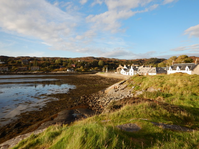
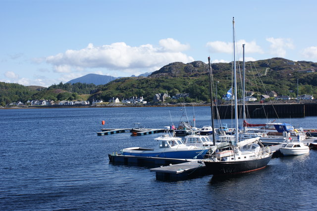
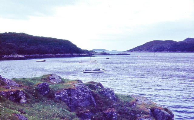
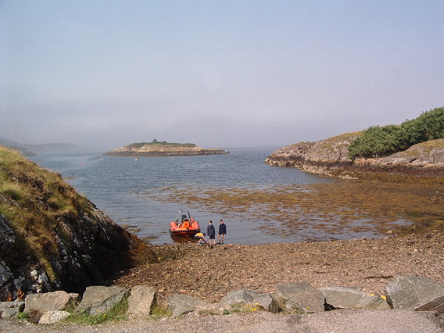
The bay is surrounded by stunning natural beauty, characterized by steep cliffs and rocky shores. The deep blue waters of the bay are a result of the Loch Eriboll, a sea loch that stretches inland for about 10 miles. The Loch Eriboll Bay is one of the largest and deepest sea lochs in Scotland.

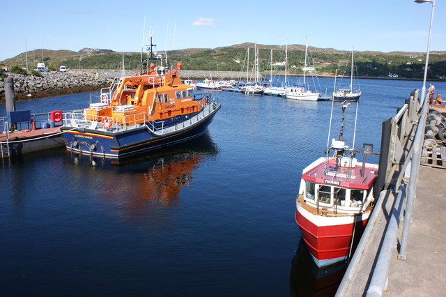
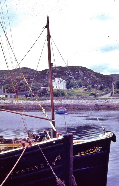
Bàgh an t-Srathain has a rich history, with its strategic location making it an important site during various conflicts. During World War II, the bay served as a safe anchorage for British naval vessels and was used as a base for submarine operations. The remnants of military structures, including coastal defenses and a wartime jetty, can still be seen in the area.

In addition to its historical significance, the bay is also an important site for wildlife. The surrounding cliffs provide nesting grounds for various seabird species, including puffins, guillemots, and razorbills. Dolphins and seals can often be spotted in the waters, adding to the area's natural charm.

Bàgh an t-Srathain is a popular destination for outdoor enthusiasts, offering opportunities for hiking, birdwatching, and photography. The bay's tranquil beauty and serene atmosphere make it a haven for those seeking a peaceful retreat in the heart of the Scottish Highlands.

If you have any feedback on the listing, please let us know in the comments section below.

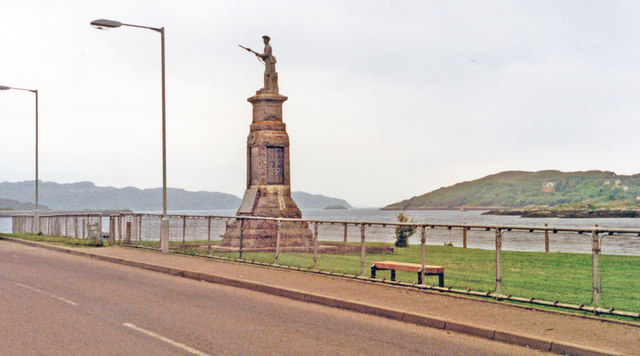
Bàgh an t-Srathain Images

Images are sourced within 2km of 58.13909/-5.2617896 or Grid Reference NC0821. Thanks to Geograph Open Source API. All images are credited.

Inverkirkaig Beach Telephone Box & Postbox at Inverkirkaig
Inverkirkaig Beach
Telephone Box & Postbox at Inverkirkaig
Mouth of the River Kirkaig Looking upstream.
Mouth of the River Kirkaig
Looking upstream.
Mouth of the River Kirkaig As it enters the sea at Loch Kirkaig.
Mouth of the River Kirkaig
As it enters the sea at Loch Kirkaig.
Head of Loch Kirkaig Seen at low tide.
Head of Loch Kirkaig
Seen at low tide.
Cottages at Inverkirkaig
The river Kirkaig
The river Kirkaig
An upstream view of the river Kirkaig What a healthy looking river! Migrating salmon have a relatively short river journey on their spawning return to Loch Kirkaig
An upstream view of the river Kirkaig
What a healthy looking river! Migrating salmon have a relatively short river journey on their spawning return to Loch Kirkaig
Rocky shore of Loch Kirkaig Rough, rolling hill country rising from the shore of the loch as seen from a trig point at an altitude of 96 metres.
The multi-topped mountain in the distance is Quinag.
Rocky shore of Loch Kirkaig
Rough, rolling hill country rising from the shore of the loch as seen from a trig point at an altitude of 96 metres. The multi-topped mountain in the distance is Quinag.
Inverkirkaig Beach The eastern shore of Loch Kirkaig
Inverkirkaig Beach
The eastern shore of Loch Kirkaig
Lochinver: War Memorial and SW towards the sea, 1994 The eponymous town, noted for its fishing, has no proper access except from the north, on the A837 from Ledmore along Loch Assynt and via Inchnadamph. The view is SW, to the sea about 2 1/2 miles away.
Lochinver: War Memorial and SW towards the sea, 1994
The eponymous town, noted for its fishing, has no proper access except from the north, on the A837 from Ledmore along Loch Assynt and via Inchnadamph. The view is SW, to the sea about 2 1/2 miles away.
Assynt meltwater channel? This sits along the same line as a series of lochs including Fionn and Veyatie. The burn flowing through the gorge is small in comparison to the loch at its head. The crags on the north side look water-worn but subsequent rock falls have covered much of the wall.
Assynt meltwater channel?
This sits along the same line as a series of lochs including Fionn and Veyatie. The burn flowing through the gorge is small in comparison to the loch at its head. The crags on the north side look water-worn but subsequent rock falls have covered much of the wall.
Loch Bad na Muirichinn, Assynt Known locally as the Children's Loch it was fairly low during this visit. There had not been any significant rain for the preceding two months. Suilven looks such an improbable hill!
Loch Bad na Muirichinn, Assynt
Known locally as the Children's Loch it was fairly low during this visit. There had not been any significant rain for the preceding two months. Suilven looks such an improbable hill!
Lochinver Coastal village on the River Inver.
Lochinver
Coastal village on the River Inver.
Yacht pontoon, Lochinver Harbour Looking northeast from the outer harbour wall with Lochinver in the background.
Yacht pontoon, Lochinver Harbour
Looking northeast from the outer harbour wall with Lochinver in the background.
The Lochinver lifeboat The lifeboat currently stationed at Lochinver is the all-weather Severn class 'Julian and Margaret Leonard'.
The Lochinver lifeboat
The lifeboat currently stationed at Lochinver is the all-weather Severn class 'Julian and Margaret Leonard'.
Looking west towards the open sea, Lochinver I am willing to accept a challenge on precise location of viewpoint
Looking west towards the open sea, Lochinver
I am willing to accept a challenge on precise location of viewpoint
Fishing vessels at Culag Pier, Lochinver
School in Loch Culag
Show me another place!

Bàgh an t-Srathain is located at Grid Ref: NC0821 (Lat: 58.13909, Lng: -5.2617896)

Unitary Authority: Highland

Police Authority: Highlands and Islands

What 3 Words

///homes.wager.elections. Near Clachtoll, Highland

Related Wikis

Badnaban

Badnaban is a remote scattered coastal village, which lies on the south shore of the sea loch, Loch Inver, in the Assynt district of the west coast of...

Strathan, Sutherland

Strathan is a remote scattered coastal village, located in Bàgh an t-strathain Bay, which lies on the south shore of the sea loch, Loch Inver, in the Assynt...

Loch Inver

Loch Inver is a 3.62-kilometre-long (1+61⁄64-nautical-mile) sea loch in Assynt, Sutherland and is on the northwest coast of Scotland. The loch meets the...

Lochinver

Lochinver (Loch an Inbhir in Gaelic) is a village that is located at the head of the sea loch Loch Inver, on the coast in the Assynt district of Sutherland...

Nearby Amenities

Located within 500m of 58.13909,-5.2617896
Source: PGS
Lat/Long: 58.1377317/-5.2606744
Source: PGS
Lat/Long: 58.1379138/-5.2611712
Source: PGS
Lat/Long: 58.1382298/-5.2620129
Passing Place
Lat/Long: 58.1359181/-5.2622228
Post Box
Operator: Royal Mail
Lat/Long: 58.1367923/-5.2604095
Lochinver Holiday Lodges
Email: lochsidehomes@btopenworld.com
Phone: +44 1571 844318
Tourism: chalet
Website: http://www.lochsidehomes.co.uk/
Lat/Long: 58.1387084/-5.2577671
Bagh an t-Srathain
Natural: bay
Lat/Long: 58.1391266/-5.2620435
Power: pole
Lat/Long: 58.1365177/-5.2683362
Power: pole
Lat/Long: 58.1363677/-5.2673083
Power: pole
Lat/Long: 58.136267/-5.2665179
Power: pole
Lat/Long: 58.1361416/-5.265747
Power: pole
Lat/Long: 58.1360286/-5.2649917
Power: pole
Lat/Long: 58.1359258/-5.2642402
Power: pole
Lat/Long: 58.1362362/-5.2634285
Power: pole
Lat/Long: 58.136379/-5.2630858
Power: pole
Lat/Long: 58.1363913/-5.261544
Power: pole
Lat/Long: 58.1363718/-5.2606446
Power: pole
Lat/Long: 58.1363677/-5.2599341
Power: pole
Lat/Long: 58.1363615/-5.2592118
Power: pole
Lat/Long: 58.1364427/-5.2586862
Power: pole
Lat/Long: 58.1366226/-5.257598
Power: pole
Lat/Long: 58.1368034/-5.2581372
Power: pole
Lat/Long: 58.1363492/-5.2567317
Power: pole
Lat/Long: 58.1360183/-5.2557174
Power: pole
Lat/Long: 58.1353688/-5.2629807
The data included in this document is from www.openstreetmap.org. The data is made available under ODbL.

Have you been to Bàgh an t-Srathain?

Leave your review of Bàgh an t-Srathain below (or comments, questions and feedback).